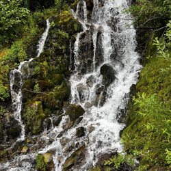
Cooper Spur Trail Photos
More like Cooper Spur Trail
Recommended Reviews - Cooper Spur Trail


More info about Cooper Spur Trail


Cooper Spur Trail - hiking - Updated July 2026
Best of Mount Hood
People found Cooper Spur Trail by searching for…
Swimming Holes in Mount Hood, Oregon
Hiking Trails in Mount Hood, Oregon
Waterfall Hike in Mount Hood, Oregon
Things to Do in Mount Hood, Oregon
Playgrounds in Mount Hood, Oregon
Secret Spots in Mount Hood, Oregon
Sunrise View in Mount Hood, Oregon
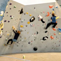
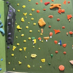
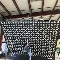
Indoor Rock Climbing in Mount Hood, Oregon
Stair Climbing in Mount Hood, Oregon
Swimming Lakes in Mount Hood, Oregon
Off Road Trails in Mount Hood, Oregon
Tent Camping in Mount Hood, Oregon
Climbing Gym in Mount Hood, Oregon
Free Campgrounds in Mount Hood, Oregon
Secluded Spots in Mount Hood, Oregon
Walking Trails in Mount Hood, Oregon
Waterfalls in Mount Hood, Oregon
Scenic Overlook in Mount Hood, Oregon
Scenic View in Mount Hood, Oregon
Dog Friendly Trails in Mount Hood, Oregon
Ropes Course in Mount Hood, Oregon
Trending Searches in Mount Hood, OR
Berry Picking near Cooper Spur Trail
Blueberry Picking near Cooper Spur Trail
Boat Rental near Cooper Spur Trail
Dog Friendly Trails near Cooper Spur Trail
Fruit Picking near Cooper Spur Trail
Jet Ski Rental near Cooper Spur Trail
Kayak Rental near Cooper Spur Trail
Off Road Trails near Cooper Spur Trail
Peach Picking near Cooper Spur Trail
Places To Swim near Cooper Spur Trail
Public Shower near Cooper Spur Trail
River Tubing near Cooper Spur Trail
Scenic Overlook near Cooper Spur Trail
Splash Pad near Cooper Spur Trail
Strawberry Picking near Cooper Spur Trail
Swimming Holes near Cooper Spur Trail
Swimming Lakes near Cooper Spur Trail
Browse Articles
Browse Nearby
Browse Brands
Related Searches in Mount Hood, OR
Best Gyms With Swimming Pools in Mount Hood, Oregon
Best Waterfalls and Swimming Holes in Mount Hood, Oregon
Check Out Off Road Trails in Mount Hood, Oregon
Discover Dog Friendly Trails to Explore in Mount Hood, Oregon
Discover Fun Kid Activities to Enjoy in Mount Hood, Oregon
Discover Gyms With Steam Room Options in Mount Hood, Oregon
Discover Kids Yoga Classes Near Mount Hood, Oregon
Discover Top Yoga Options and Studios in Mount Hood, Oregon
Enjoy Hiking Adventures in Mount Hood, Oregon
Enjoy a Beautiful Waterfall Hike in Mount Hood, Oregon
Enjoy the Best Walking Trails in Mount Hood, Oregon
Explore Boxing Gyms in Mount Hood, Oregon
Explore Fun Activities to Do in Mount Hood, Oregon
Explore High End Gyms Available in Mount Hood, Oregon
Explore Popular Scenic Views Near Mount Hood, Oregon
Explore Popular Sports Clubs in Mount Hood, Oregon
Explore Popular View Points Around Mount Hood, Oregon
Explore Summer Camps for All Ages in Mount Hood, Oregon
Explore Top Gyms in Mount Hood, Oregon Now
Explore Top Water Parks in Mount Hood, Oregon Today
Explore the Best Barre Classes Available in Mount Hood, Oregon
Find Fun Kids Activities Outdoor in Mount Hood, Oregon
Find La Fitness Center Locations in Mount Hood, Oregon
Find Top Jiu Jitsu Classes and Training in Mount Hood, Oregon
Find Top Kickboxing Options in Mount Hood, Oregon
Find Top Tai Chi Sessions in Mount Hood, Oregon
Find Top Workout Classes Available in Mount Hood, Oregon
Find the Best Boxing Training and Gyms in Mount Hood, Oregon
Find the Best Exercise Classes in Mount Hood, Oregon
Find the Best Swimming Pools in Mount Hood, Oregon Today
Fun Indoor Activities to Try in Mount Hood, Oregon
Hiking Trails With Waterfalls in Mount Hood, Oregon
Locate a Public Shower Facility in Mount Hood, Oregon
Popular Kids Activities in Mount Hood, Oregon
Popular Things to Do in Mount Hood, Oregon
Quality Fitness & Instruction Available in Mount Hood, Oregon
Safe and Fun Parks for Kids in Mount Hood, Oregon
Tennis Courts and Clubs Near Mount Hood, Oregon
Top Playgrounds for Kids to Enjoy in Mount Hood, Oregon
Top Things to Do With Kids in Mount Hood, Oregon
People who viewed Cooper Spur Trail also viewed
Munra Point Trail
2 reviews
Elowah Falls Trail
2 reviews
Nesmith Point Trail
3 reviews
Pacific Crest National Scenic Trail
4 reviews
Sherwood Campground and Day Use Area
1 review
Mosier Twin Tunnels
3 reviews
Guy W Talbot State Park
5 reviews
Tom McCall Preserve at Rowena
4 reviews
Bridal Veil Falls State Scenic Viewpoint
2 reviews
Zigzag Canyon Overlook
1 review