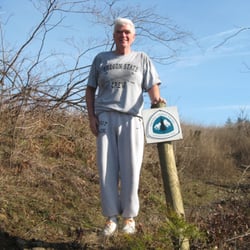
Nesmith Point Trail Photos


You might also consider
More like Nesmith Point Trail
Recommended Reviews - Nesmith Point Trail
Start your review...

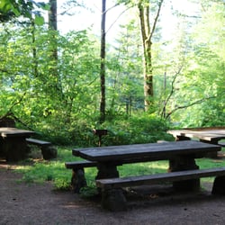
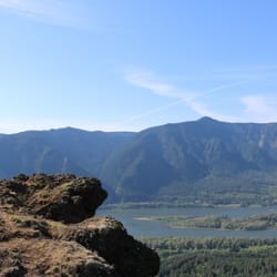
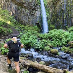
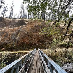
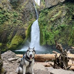
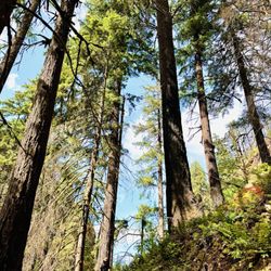
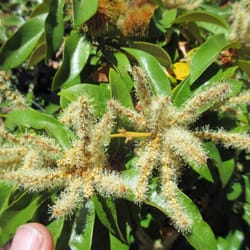
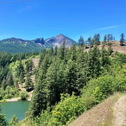
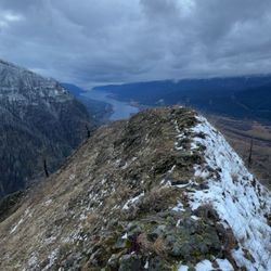
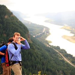
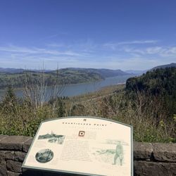
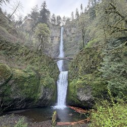
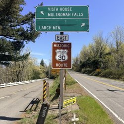
Nesmith Point hike is one of the most difficult early-season hikes available in the Columbia River Gorge. To access this hike, start at the Elowah Falls trailhead, which is on the old scenic Columbia River Gorge Hwy (30). From PDX, get off at Exit 35 and head East along the frontage road on the south side of 84 until you're almost on a freeway entrance back to 84E, which is where the Elowah Falls Trailhead is. Beware, legend has it that this is a high-theft trailhead, so don't leave any bags showing in your vehicle! Hike up the main trail about 50 feet, where the Nesmith Point trail #480(?) cuts off to the right. This hike is difficult. Don't take that lightly. The trail r/t to Nesmith point is 10 miles and 3800 vertical feet of quad-burning action. The upward grade is fairly relentless, at least in two main up sections. The first .5 to .75 mile ambles gradually up through mossy woods, then turns upward through a set of never-ending switchbacks that gets you probably 1500+ feet up along the side of the hill. Then there's a brief respite of some more gradual-up switches, that turns back in to more and more and more up. It's not until you're at probably 3000 feet before the trail begins to mellow out in to a much less ruthless grade. After the first 1,000 feet or so the trail has a lot of nice open views back down to the gorge, as well as some great stretches of old-growth including some fairly majestic trees. We did run in to a fairly aggressive grouse part way up, that seemed hell-bent on defending a stretch of the trail. We literally had to run past to avoid getting pecked, and he/she/it followed us up the trail for a while after making menacing sounds. Crazy! We heard a lot more grouse calls up top too, while on lunch. in mid-April 2013 we did encounter some snow on the upper reaches of this trail - enough to cause us to lose the trail once, and end up with some wet feet (and danger of post-holing our way to knee issues). This time of year, trekking poles would be advised, however with 3800 feet of downgrade over a relatively short 5-miles on the way down, you'd be wise to have poles for that portion of the hike regardless of season. At 4.6 or so miles you run in to the old road that linked up to the fire lookout. From there it's .2 or so miles up to a very small viewpoint at the top. It was a total white-out of clouds during our trip, so I can only imagine that the views from here are pretty awesome when clear. But it's definitely not 360-degrees of view. You get mainly a NW -facing view from the top. You can continue past the point downhill to what I'm told is an old fire lookout. We made it about 100 yards down into the trees before we opted to grab lunch and head back. Lacking views, we'd had enough "up" for the day. Water is available along the trail at lower elevations (where you don't need it) but I'd recommend a lot of water on this hike as there are few sources up top. And you. Will Sweat. I saw some pretty young, fit folks coming up the trail as we were descending and they were drenched (as we were). Also I think my calorie burn on this trail all told was close to 2,000 (I was carrying a pack with extra weight), so bring some extra cals with you. You'll be thankful. The trail at the top offers an option to loop back down to Horsetail Creek, but I have no idea how much distance that adds on. It might be an interesting way to add mileage but cut down on the miniscus-shattering descent back down Nesmith. The way back down is simply reverse of the up. It works the knees pretty hard. There's no water at the trailhead, nor are there bathrooms. So be prepared for that. Overall, this is a super solid hike. Wildflowers will surely be present in May or later, the trilliums were just busting out in mid-April, and the mix of views, old growth, moss, forest and sheer intense grade make for a challenging but beautiful hike. read more


More info about Nesmith Point Trail
Exit 35 Columbia River Gorge National Scenic Area
Cascade Locks, OR 97014
Directions
Hours
Outdoor Amenities


Nesmith Point Trail - hiking - Updated June 2026
Best of Cascade Locks
People found Nesmith Point Trail by searching for…
Lookout Points in Cascade Locks, Oregon
Scenic View in Cascade Locks, Oregon
Hiking Trails in Cascade Locks, Oregon
What to Do in Cascade Locks, Oregon
Things to Do in Cascade Locks, Oregon
Waterfalls in Cascade Locks, Oregon
Off Road Trails in Cascade Locks, Oregon
View Points in Cascade Locks, Oregon
Waterfall Hike in Cascade Locks, Oregon
Easy Hikes in Cascade Locks, Oregon
Scenic Overlook in Cascade Locks, Oregon
Swimming Holes in Cascade Locks, Oregon
Running Trails in Cascade Locks, Oregon
Trail in Cascade Locks, Oregon
Fishing Spots in Cascade Locks, Oregon
Views in Cascade Locks, Oregon
Off Leash Dog Hikes in Cascade Locks, Oregon
Picnic Areas BBQ Pits in Cascade Locks, Oregon
Lunch With a View in Cascade Locks, Oregon
Tent Camping in Cascade Locks, Oregon
To Do in Cascade Locks, Oregon
Sunset View in Cascade Locks, Oregon
Trending Searches in Cascade Locks, OR
Boat Rental near Nesmith Point Trail
Dog Friendly Beaches near Nesmith Point Trail
Dog Friendly Things To Do near Nesmith Point Trail
Fishing Spots near Nesmith Point Trail
Jet Ski Rental near Nesmith Point Trail
Kayak Rental near Nesmith Point Trail
Lakes & Ponds near Nesmith Point Trail
Outdoor Activities near Nesmith Point Trail
Parks For Picnics near Nesmith Point Trail
Pick Your Own Farms near Nesmith Point Trail
Pool Supplies near Nesmith Point Trail
Public Shower near Nesmith Point Trail
River Swimming near Nesmith Point Trail
River Tubing near Nesmith Point Trail
Rock Quarry near Nesmith Point Trail
Scenic Overlook near Nesmith Point Trail
Secluded Spots near Nesmith Point Trail
Soccer Store near Nesmith Point Trail
Splash Pad near Nesmith Point Trail
Strawberry Picking near Nesmith Point Trail
Sunrise View near Nesmith Point Trail
Swimming Holes near Nesmith Point Trail
Swimming Lakes near Nesmith Point Trail
Watch Sunset near Nesmith Point Trail
Browse Articles
Browse Nearby
BEST of Cascade Locks, Oregon Coffee near Nesmith Point Trail
BEST of Cascade Locks, Oregon Parks near Nesmith Point Trail
BEST of Cascade Locks, Oregon Restaurants near Nesmith Point Trail
BEST of Cascade Locks, Oregon Things to Do near Nesmith Point Trail
BEST of Cascade Locks, Oregon Breakfast near Nesmith Point Trail
BEST of Cascade Locks, Oregon Wineries near Nesmith Point Trail
Browse Brands
Related Searches in Cascade Locks, OR
Affordable Kayak Rental Services in Cascade Locks, Oregon
Best Fishing Locations and Guides in Cascade Locks, Oregon
Best Fun Things to Do in Cascade Locks, Oregon
Best Places for Horseback Riding in Cascade Locks, Oregon
Best Sledding Spots and Fun in Cascade Locks, Oregon
Best Waterfalls and Swimming Holes in Cascade Locks, Oregon
Discover Dog Friendly Trails to Explore in Cascade Locks, Oregon
Discover Scenic Waterfall Spots in Cascade Locks, Oregon
Discover a Hiking Trail in Cascade Locks, Oregon
Discover the Best Night Hike Trails in Cascade Locks, Oregon
Enjoy Camping Adventures Around Cascade Locks, Oregon
Enjoy Exciting Mountain Biking Adventures in Cascade Locks, Oregon
Enjoy Kayaking Adventures in Cascade Locks, Oregon
Enjoy River Tubing Adventures in Cascade Locks, Oregon
Enjoy Tent Camping Spots Around Cascade Locks, Oregon
Enjoy a Beautiful Waterfall Hike in Cascade Locks, Oregon
Enjoy the Best Family Activities in Cascade Locks, Oregon
Enjoy the Best Walking Trails in Cascade Locks, Oregon
Experience Thrilling White Water Rafting in Cascade Locks, Oregon
Explore Beautiful Parks and Green Spaces in Cascade Locks, Oregon
Explore Bike Rentals Throughout Cascade Locks, Oregon
Explore Easy Hikes Perfect for All in Cascade Locks, Oregon
Explore Family-Friendly Zoos and Wildlife in Cascade Locks, Oregon
Explore Fun Activities to Do in Cascade Locks, Oregon
Explore Popular Campgrounds Near Cascade Locks, Oregon
Explore Scenic Lakes to Visit in Cascade Locks, Oregon
Explore Secret Spots Worth Visiting in Cascade Locks, Oregon
Explore the Best Beach Spots in Cascade Locks, Oregon
Explore the Best Boating Spots in Cascade Locks, Oregon
Explore the Best Swimming Holes Around Cascade Locks, Oregon
Family Friendly Hiking With Kids in Cascade Locks, Oregon
Find Beautiful Views in Cascade Locks, Oregon
Find Popular Ziplining Spots Around Cascade Locks, Oregon
Find the Best Parks for Picnics in Cascade Locks, Oregon
Find the Best Playgrounds to Visit in Cascade Locks, Oregon
Find the Best Scenic View Locations in Cascade Locks, Oregon
Hiking Trails With Waterfalls in Cascade Locks, Oregon
Off Leash Dog Hiking Trails in Cascade Locks, Oregon
Perfect Spots to Watch Sunset in Cascade Locks, Oregon
Plan a Scenic Drive Route Near Cascade Locks, Oregon
Popular Fishing Spots to Explore in Cascade Locks, Oregon
Popular Things to Do in Cascade Locks, Oregon
Top Climbing Spots and Gyms in Cascade Locks, Oregon
Top Fishing Charter Experiences in Cascade Locks, Oregon
Top Paddleboarding Activities in Cascade Locks, Oregon
Top Playgrounds for Kids to Enjoy in Cascade Locks, Oregon
Top Running Trails to Explore in Cascade Locks, Oregon
Top Swimming Lakes to Enjoy in Cascade Locks, Oregon