Cancel

    Open app

    Search

    Conservancy Trail

    4.0 (2 reviews)

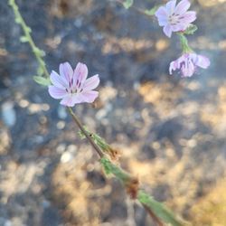
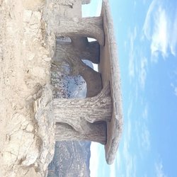
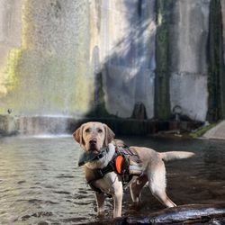
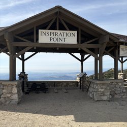
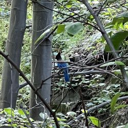
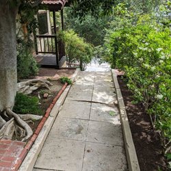
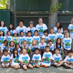
    Conservancy Trail Photos

    You might also consider

    Recommended Reviews - Conservancy Trail

    Your trust is our priority, so businesses can't pay to alter or remove their reviews. Learn more about reviews.
    Yelp app icon
    Browse more easily on the app
    Review Feed Illustration
    Photo of Seth S.
    10
    108
    4

    2 years ago

    Great views, wide trails, easy to get to..................................................

    Helpful 0
    Thanks 0
    Love this 0
    Oh no 0

    12 years ago

    Helpful 28
    Thanks 0
    Love this 30
    Oh no 1

    You might also consider

    Verify this business for free

    People searched for Hiking 13,464 times last month within 15 miles of this business.

    Verify this business

    Switzer Falls - USDA Forest Service

    Switzer Falls - USDA Forest Service

    4.4(293 reviews)
    6.1 mi

    Perfect hike for a hot day…read more I love waterfall hikes and listening to the sound of calm, running water. The added challenge on these hikes is the multiple stream crossings. I brought some hiking poles which helped with balance and probing for loose rocks and logs. If you want to get parking in the lower lot, it's best to come before 8AM. We found parking in the second lot. An Adventure Pass or Day Pass is required. Parking is enforced. A car received a ticket for being in a No Parking zone. The start of the trail is nicely shaded. The second half is a hilly, narrow, sun exposed path which routes back into the canyon toward the Lower Switzer Falls. I'm glad they had fencing on some narrow and steep parts of the trail. We encountered an active rattlesnake which headed down the mountain, so be on the lookout. Overall, the hike takes about 3 hours for 5.5 miles. The additional hike back up to the parking lot was about 1/4 of a mile. Note: if you need to use the restroom, it's best to bring your own toilet paper and to go before you start your hike. It was kind of smelly, but if you gotta go... you gotta go.

    This place is great for fully appreciating nature! The trail is around 5-5.5 miles round trip,…read moredepending on where you park. What impressed me most about this trail is that it's almost fully covered by shade. We went in the late afternoon, and I'd say probably 80-85% of it is covered. Very impressive! Here are some useful tips: 1. There are three parking lots: two are next to the highway, and one is near the hiking entrance. I'd recommend getting a parking pass if possible. 2. There are only three restrooms at the beginning of the trail, so use them when you see them. 3. If you're aiming to go to the waterfall, make sure to look for the signs. Some signs aren't very clear, so we had to stop and ask other hikers frequently. Luckily, people there are super friendly and happy to help. Just pay attention to your surroundings. 4. The trail is dog-friendly, but dogs must be on a leash. 5. Waterproof hiking boots are recommended. All in all, it's a fun trail. It's a great place for a picnic and camping, and it's very close to the stream. Great for kids, families, and pets!

    Photos
    Switzer Falls - USDA Forest Service - Lower Switzer Fall

    Lower Switzer Fall

    Switzer Falls - USDA Forest Service - The grand prize, Switzer falls.

    The grand prize, Switzer falls.

    Switzer Falls - USDA Forest Service

    See all

    Descanso Trail - Trail entrance. #BnWphoto

    Descanso Trail

    4.4(18 reviews)
    0.7 mi

    Quiet, easy hiking trail for the whole family. Baby stroller access may be a little tricky the…read morefirst 10-15 minutes. But after that it's smooth sailing. A very pleasant and peaceful walk. You may notice some freeway noise in some parts. HOW TO GET THERE: Set your GPS/Navigation to "Descanso Garden". You're going to park inside Descanso Garden anyways. Its free and its a 3 minute walk from the Trailhead. Do Not use the Yelp app's "Get Directions" on your smartphone. It'll take you to someone's house. I wish Yelp would correct this. PARKING: Don't tell anyone I told you this but I always park at Descanso Garden Parking Lot. It's free. I park my car right at the entrance to Descanso Garden so that I'm close to the entrance. There's always a gazillion empty parking spaces here. As soon as you park your car, walk back to the entrance (towards the main road, Descanso Drive) and then turn left onto the dirt sidewalk. You'll walk for a minute and find the 3 little yellow steel posts that other Yelpers described. That's your landmark for the entrance to the Trail. TRAILHEAD ACCESS: The trail begins about a 3 minute walk from the Descanso Garden parking lot. So when you exit the Descanso Garden parking lot, immediately turn left. Walk on the dirt sidewalk for less than a minute and on the left hand side you'll see 3 yellow steel posts (you know the kind that prevents people from driving over it). Walk through these 3 yellow posts and you'll find yourself walking on asphalt flanked by 8 feet tall brown colored fencing. You'll ask yourself "Am I at the right place?". Trust me, you are. Follow the signs and suddenly you'll find yourself at the trailhead. DIFFICULTY LEVEL: Easy. I went to Descanso Trail with my in-laws today. They're both in their mid-70's (very healthy) and they had no problems. The most difficult part of this trail comes about 5 minutes into the walk. You'll find yourself staring at an uphill climb consisting of several switchbacks. There's lots of loose rocks that someone can slip on. Especially small children and elderly. Climbing up is not bad. Even for my mid-70's in-laws they had no trouble. Did it without resting. Coming down these switch-backs is a little more challenging but definitely do-able for the healthy elderly. A walking/hiking stick will help. The rest of the hike is smooth sailing. Slight uphill and downhill walking here and there. Nothing challenging. The trail is made of compacted dirt, mainly about 5 feet to 10 feet wide. If you're a good hiker, if you've hiked Half Dome then this Descanso Trail hike will be a 'walk in the park'! BABY STROLLER: For about 99% of this trail, a stroller will have no problems whatsoever. However, within 5 minutes of starting this hike (read my "Difficulty Level" section above) you will find yourself at the bottom of an upward climb through some switchbacks. I think some healthy parent with a capable stroller probably could push the buggy uphill. But I believe for most parents, this will pose a challenge. You're better off holding the baby in your arms and having someone else carry the stroller uphill. Luckily, this uphill walk will take less than 5 minutes. After this, the rest of the trail is easy sailing for a stroller. Mainly compacted dirt. Keep in mind there are some gently upward and downward hills you need to navigate. CELLPHONE RECEPTION: I had 3 to 5 bars on my Verizon iPhone the whole time on the trail. No problems with reception at all.

    Hiking is a passion of mine which I truly enjoy. This is a trail that allows the flexibility of…read morebeginner to advanced workouts. For starters if you are into running, jogging or bike rides this trail is perfect. I enjoy the running aspect as I love a great workout. If you enjoy some chill time or a read this is a great spot as well. From enjoying a great sunrise or sunset this is a great spot.

    Photos
    Descanso Trail
    Descanso Trail - Beautiful pic

    Beautiful pic

    Descanso Trail - City scapes

    See all

    City scapes

    Gabrielino Trail - Playing in the dam

    Gabrielino Trail

    4.3(80 reviews)
    2.4 mi

    This is a beautiful trail that is well used by locals. You can start the trail at a parking lot by…read moreJPL. The parking lots is large so it can accommodate a lot of hikers. You should put out your adventure pass when parking at this lot. I am not sure if anybody is checking but its best to be safe, to avoid a ticket. From the parking lot to the dam its approximately 8.4 miles roundtrip. The hike has very limited elevation gain to the dam- and it follows along the river. You will have to cross the river multiple times to the dam. Some of the crossing will be on bridges while others will require to get your feet wet or hop rocks to get across. The trail is mostly cover by trees so provide some relief from the sun. The Gabrielino trail leads to many other trails and places beyond the dam- you actually start on this trail and go all the way to another waterfall- note this hike is approximately 19 miles and has over 2500 feet elevation. The trail is heavily used by bikers, hikers, walkers and horseback riders. On the weekend this trail gets very busy. If you want peace and quiet best to do this trail during the weekdays early in the morning. Currently (October 2025)- some construction is going on at the beginning of the trail. The start of the trail can be closed- so before heading out check to see if the trail is open.

    Beautiful trails. Feels like you're out of LA. Highly recommend. Dog friendly. Pretty easy parkingread more

    Photos
    Gabrielino Trail
    Gabrielino Trail
    Gabrielino Trail

    See all

    Inspiration Point via Castle Canyon

    Inspiration Point via Castle Canyon

    4.7(191 reviews)
    5.2 mi

    Updated review: I've been to Inspiration Point twice now, most recently after the great Los Angeles…read more"blizzard" of early 2023. And how super intense and cool (figuratively and literally) it was! Total about 10mi from the top of Lake - Echo Mountain - Castle Canyon trail - Inspiration Point - Sam Merrill trail - Echo Mountain and back down to Lake. DEFINITELY a strenuous hike and would highly recommend hiking poles, sunscreen, water, and snacks! The view is incredible, especially with tons of fresh snow everywhere. Hiked this early March 2023 and the Castle Canyon trail leading off from Echo Mountain (a decent hike in its own right) is pretty challenging, if not a bit brutal in some areas: slippery snow, downed trees and bushes blocking the path, and a heavy incline. Again, highly recommend poles. Once at Inspiration Point the view is phenomenal. The Pacific Ocean, Palos Verdes, Catalina Island, and even Anaheim and Irvine are all visible from the top, and downtown LA too of course. Lots of picnic benches and photo-op-worthy view finders for major Southern California sites. Gorgeous San Gabriel mountains in the background. The Sam Merrill trail leading down the backside of the mountain (and then curving back around to the south/west) is much more tame (but still a bit precarious with 2+ feet of snow) and very sun-exposed all the way back to Echo Mountain. All in all probably one of the more butt-kicking Los Angeles hike. Takes about 4-5hrs round trip depending on your pace.

    Long and difficult hike but worth the view! About 10 miles…read moreround trip from Cobb Estate. Bring a hat, lots of water, snacks, sunscreen, and BUG SPRAY. Me and my husband started around 7:30am and finished the whole hike around 1pm at a steady pace with about an hour break when we got to Inspiration Point. The hike from Cobb Estate to Echo Mountain was a breeze for us, but the hike from there to Inspiration was a whole other story. I recommend wearing long pants as the second half of the hiking path isn't as clear and pretty narrow on some parts. We took our time and treaded lightly but still got some minor scratches on our legs from all of the branches and leaves. My husband started getting irritated from walking into all of the spider webs lol. Not sure if the actual hike was 2 miles from Echo Mountain because it felt so much longer than that. We started getting really tired near the end from all the incline. We almost gave up until my husband saw the view of Inspiration Point. Once we got there, the views made it all worth it! Would we do it again? Maaaaaybe lol.

    Photos
    Inspiration Point via Castle Canyon
    Inspiration Point via Castle Canyon
    Inspiration Point via Castle Canyon

    See all

    Waterman Mt & Twin Peaks Hike - Found this tiny little spider on a beautiful yellow bloom - had to bust out my macro lens for this one! June 2025

    Waterman Mt & Twin Peaks Hike

    4.5(8 reviews)
    0.9 mi

    Such a unique and beautiful hike!!!! We even got to see some very hard snow that was almost gone,…read moredue to the rain and winds. I would highly recommend that at least 50% of the group have the trail downloaded, and you carry extra phone chargers. A few people who were with us almost got lost. It is very easy to do so if you are not paying attention. There is also one portion that becomes very steep. Take your time and bring a stick or poles if you need to. Other than that, the views are breathtaking, so enjoy! I would 1000% do this trail again, but only in a larger group with more experienced hikers. Hoping they are able to locate Monica Reza!! Please, please, please, do not leave anyone behind on their own. This is not an easy trail to guide yourself. There was a lovely man we met on the trail who hikes this consistently, and he cautioned us against losing people.

    I bagged a peak this summer!! And the Waterman Mountain loop trail has become my number one fave…read morelocal trail here in SoCal. Getting up to Waterman peak isn't terribly technical - more of a straightforward moderate hike on well marked trails with tons of biodiversity and beautiful views. I hiked it towards the end of June and there were beautiful native SoCal blooms scattered along the trail - with so many native bees! The hike is through a burn scar (from the Peak Fire in 2021 I think) - so it can be a bit barren and burned up in places but it's heartening to see how well the area is recovering. I also ran into countless Pygmy Nuthatches (a lifer for me!!), White-headed Woodpeckers, squirrels, chipmunks, and even some cute tiny spiders! But this is Black Bear and Mountain Lion country so be vigilant and carry bear spray. All in all, I hiked around 6.4 miles with around 1380+ feet elevation gain. The trails are narrow in a lot of spots and mostly consists of rocks, loose dirt, and fine gravel. The first half of the trail is through forest and burn scar. The last half after the peak and old ski resort (long closed) is very exposed fire road with no shade and minimal views. On subsequent hikes I tend to skip that part and just turn around after the peak bc I like that part of the trail better lol. The peak of Waterman Mtn sits at 8030 feet. There's a great sign at the peak made by @peakart125 (on instagram) - it's lovely and makes for a fun way to celebrate making it all the way up! There's a sort of false peak right before the actual peak so I highly recommend making sure you've downloaded the trail map on AllTrails before heading out since cell signal is minimal to nonexistent on the trail. The views from the peak are a tad obstructed by rocks and trees - but you still get nice pocket views of Twin Peaks, the valley, and Mt Wilson observatory. It's also interesting to explore the old ski resort near the peak. There's tons of equipment and a chair lift but it doesn't look like it's been opened for years probably. AllTrails also shows a bathroom up there but I didn't find one so come prepared. There's a bathroom next to the paved parking area in a campground entrance at the trailhead. There's plenty of parking - almost all paved. You'll need an adventure pass to park bc it's in the Angeles National Forest - but they accept America the Beautiful passes too! I pretty much had the trail to myself on the weekday early morning. I only ran into two people - turned out it was search and rescue looking for missing hiker Monica Reza who went missing the weekend before my hike (I think she was last seen June 22nd, 2025). I helped a bit in the search on my way out but no luck. My understanding is she's still missing (I included a photo - they're still looking for volunteers to help search if you're interested!) - be aware and keep a lookout if you do the trail! They also have Instagram and FB pages for updates.

    Photos
    Waterman Mt & Twin Peaks Hike - Precious little chipmunks kept a close eye on me while I hiked lol!

    Precious little chipmunks kept a close eye on me while I hiked lol!

    Waterman Mt & Twin Peaks Hike - Views from the trail (June 2025) #getoutsideandexplore

    Views from the trail (June 2025) #getoutsideandexplore

    Waterman Mt & Twin Peaks Hike - Lovely elderberry bloom along the trail (June 2025)

    See all

    Lovely elderberry bloom along the trail (June 2025)

    La Canada Teepee

    La Canada Teepee

    4.6(18 reviews)
    2.0 mi

    This was easily one of my favorite hikes around LA, mostly because it was such an unexpected…read moreadventure. My friend originally wanted to hike the Brown Dam hike, but last minute suggested this trail and I'm so glad she did. We parked near the Angeles Crest Highway and followed the trail up to the La Cañada Teepee. The hike itself was long but relatively easy, and we were lucky that the weather was slightly overcast that day which it made the trek much more comfortable. We knew we were close when we saw the mailbox along the trail with a chain blockading the road to the teepee. That's when we ran into two Kenyan women who gave us a quick heads-up about what was ahead: stunning lavender fields, a cool telescope (I thought it was a model of the Griffith Observatory--haha), and even a little maze hidden within the flora and bushes as you get closer to the teepee structure. The sisters also mentioned that the area is actually private property, but the owners generously allow people to visit. We didn't run into the owner's, but we were able to explore and enjoy the incredible views and the massive teepee structure at the top. It truly felt like stumbling upon a hidden gem right in Los Angeles--one of the best surprises in such a long time. Highly recommended if you are an avid hiker. Best, Lina C.

    This is a fun hiking destination! You can approach from the east or the south and you won't be…read moredisappointed.

    Photos
    La Canada Teepee
    La Canada Teepee
    La Canada Teepee

    See all

    Dawn Mine Hike

    Dawn Mine Hike

    4.4(69 reviews)
    3.8 mi

    This hike had a lot to offer. Pretty green mostly covered trails a lot of crossing water when it…read morehad rained before. About a 6-7mile hike round trip depending on your starting point we started around Altadena area by fair oaks street. Bring- a lot of water depending on how you handle hiking Adventure pass is needed to park I don't use them but some walking / trek sticks could be useful in some parts. I'm a large guy it took a lot out of me to get there it's a moderate to hard hike for me. With more exercise and a few more hikes under my belt to get back into shape I would hike it again. A lot of connecting places to hike through to as well. Echo mountain connection - inspiration point .

    One of my favorite hikes in LA. I would rate this as Moderate given the elevation change and rocky…read morepaths but it's possible for all ages and skill levels. You get to hike through many different zones including goat paths on the side of the mountain, paved roads at the beginning, and multiple creek crossings and some minor boulder climbing. Parking is at the top of where you turn left to go down toward Millard Falls and there are only 6 spaces available so that area fills up quickly. We arrived @ 7:30AM and didn't have any issues parking and didn't encounter anyone until our hike back out. It's easy to follow the path as it's marked well. The first landmark you'll see is a formerly used cabin as you descend down into the canyon and as you follow the canyon to the end you will see many old mining equipment and plumbing strewn near the creek you are walking parallel to. You have to cross the creek a few times but it's only a few inches deep and there are rocks already placed for crossing. There are portions with pools deep enough to dunk in and even a section with 3 small pools with water slides into each pool. Something worth checking out when the weather is warmer. The mine at the end is underwhelming because it's blocked off with steel bars and is very low to the ground and is flooded with water. I would say the walk to the mine is the best part not the destination. Overall a great hike with beautiful scenery and hiking with the sound of running water the whole time is a real treat.

    Photos
    Dawn Mine Hike
    Dawn Mine Hike
    Dawn Mine Hike

    See all

    Conservancy Trail - hiking - Updated May 2026

    Loading...
    Loading...
    Loading...