As part of our quest to visit all 63 U.S. national parks, we set off on a six week road trip. I…read morehave a personal rule: I only count a national park as "visited" if I actually spend time there, hike or walk through it, and truly experience it. On this trip, we visited 14 national parks, and Lassen Volcanic National Park was one of the biggest surprises.
The drive into the park was beautiful, and despite evidence of recent wildfires in parts of the forest, the landscape is recovering and remains absolutely stunning. Nature has an incredible ability to heal, and seeing young trees growing alongside older burned areas was a reminder of how volcanic landscapes are constantly changing.
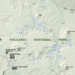
Lassen is one of the few places in the world where you can experience all four types of volcanoes: shield, composite, cinder cone, and plug dome. That alone makes it geologically fascinating, but what really impressed us was how much variety the park offers.
One moment we were standing beside steaming fumaroles and bubbling mud pots that reminded us of a smaller, quieter version of Yellowstone. The smell of sulfur, the hissing steam, and the boiling earth beneath your feet make you appreciate that this landscape is still very much alive.
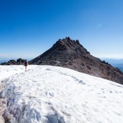
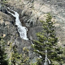
The next moment we were hiking around peaceful alpine lakes with spectacular reflections of Lassen Peak mirrored in the crystal clear water. Manzanita Lake was especially beautiful, and seeing the volcano reflected on its calm surface was one of the highlights of our visit.
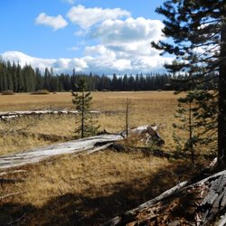
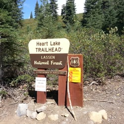
We also loved exploring quieter trails to places like Lily Pond, where we could hike for long stretches while seeing only one or two other people. There is something special about having so much natural beauty almost entirely to yourself.
For those who enjoy being on the water, the lakes are perfect for kayaking or simply sitting quietly and taking in the scenery. The combination of volcanic landscapes, mountain forests, meadows, lakes, and wildlife makes every part of the park feel different.
We stayed in the nearby town of Chester, which turned out to be a charming little base for exploring the park. It has several good restaurants, friendly people, and everything we needed after long days of hiking.
Lassen Volcanic National Park may not receive the attention of some of California's more famous parks, but it absolutely deserves it. It combines dramatic volcanic features with peaceful alpine beauty in a way that feels both exciting and calming at the same time.
If you enjoy hiking, geology, photography, or simply discovering places that are a little less crowded, Lassen Volcanic National Park is a hidden gem that should be on every national park lover's list.