1. Brokeoff Mountain Trail

    0

    Mineral, CA

    Cancel

    Open app

    Search

    Brokeoff Mountain Trail

    4.8 (4 reviews)

    Brokeoff Mountain Trail Photos

    You might also consider

    More like Brokeoff Mountain Trail

    Recommended Reviews - Brokeoff Mountain Trail

    Your trust is our priority, so businesses can't pay to alter or remove their reviews. Learn more about reviews.
    Yelp app icon
    Browse more easily on the app
    Review Feed Illustration

    2 years ago

    Helpful 4
    Thanks 0
    Love this 4
    Oh no 0

    12 years ago

    Helpful 2
    Thanks 0
    Love this 1
    Oh no 0
    Photo of Jeremy L.
    21
    40
    64

    17 years ago

    Helpful 6
    Thanks 0
    Love this 0
    Oh no 0

    14 years ago

    Helpful 2
    Thanks 0
    Love this 0
    Oh no 0

    Mill Creek Falls

    Mill Creek Falls

    5.0(1 review)
    7.8 mi

    The trail to Mill Creek Falls begins right off to the side of the new Kohm Yah-mah-nee Visitor…read moreCenter in the Southwest parking area. The trail is somewhat easy-moderate, depending how fit you are of course. It has a round trip distance of 4.6 miles with various areas of inclining slopes. The path was not smooth and in many spots there was snow blocking the way (but this was a few weeks ago and it may have melted by now). Hiking poles were very useful here. This trail isn't for those looking for an easy stroll. Keep a close eye on the trail too because it wasn't clearly marked and there are areas were you can get off the main path. With that being said, the hike and the actual falls were beautiful. Along the way there were open areas that offered lovely views of various mountain peaks, as well as areas with towering trees that loomed overhead and offered much leafy shade. There was one part of the trail that brought us to a hillside covered with bushes of yellow wildflowers, which was absolutely beautiful. The Mill Creek Falls itself was stunning. You can walk across a bridge that runs above its cascading waters and also across a second little bridge further up from the first. The bridge gives you a spectacular view of the canyon between the two hills. Be careful though because the wooden bridges do not have railings. It's hard to put into words the beauty and majesty of a natural waterfall. You just have to see it for yourself.

    Photos
    Mill Creek Falls
    Mill Creek Falls
    Mill Creek Falls

    See all

    Heart Lake in-and-back Hike - Downed trees on the trail

    Heart Lake in-and-back Hike

    4.0(3 reviews)
    6.0 mi

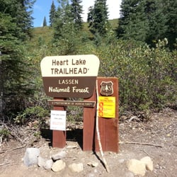
    We decided to backpack in to the lake and spend the night as our first attempt at backpacking. We…read morechose this spot because since it is in the National Forest, not the National Park, it is dog friendly, plus it's not often traveled. The road is a good gravel road. No problems for any type of vehicle. You park on the side of the road in a small turnout. No permit needed. The trailhead is well marked. The trail is all uphill, until a few hundred feet from the lake. It's listed as an easy hike, but I think it should be considered a moderate hike. The uphill hike is already on the edge of being moderate, but if you add in the dozens of downed trees, it definitely makes the hike more difficult. In a 25 lb pack, those things are really irritating. Most you can step over, but there are several you have to climb, and as of yesterday 9/14/13, 3 that have to crawled under. Almost at the lake, you cross South Digger Creek. In September this creek is a few inches high and there are lots of rocks to hop over, but I would imagine in the spring this is quite higher from the snow run off. The lake is small, but very scenic. It was heavy on the weeds and quite green though, so we were not going to swim in it. We decided to hike back to the creek so that we could use the creek water (still filtered) for drinking. We found some decent flat spots on the creek to sleep and were very comfortable. The lake, I later found out is quite full of leaches, so do not swim in it. Hang your food, I found a few piles of bear poo around the lake. You cannot make a campfire, only stove use in the summer. Please don't burn our forest down with illegal campfires. Once you see all the downed trees, you will agree this place is a disaster waiting to happen. This was a great place to try backpacking out and I recommend it for being very fun for dogs. See my pictures of the trip attached on the site.

    This is a great hike but be prepared. As of our hike (6/3/2012), the trail is in need of…read moremaintenance. There are numerous logs down across the trail and the trail is quite difficult to pick up in places. In one place, close to the lake, the trail leads right into a swamp area. If possible, have a GPS and a map. It's pretty much all up hill on the way in but the views at the lake are well worth the trip.

    Photos
    Heart Lake in-and-back Hike - Heart Lake

    Heart Lake

    Heart Lake in-and-back Hike - Trailhead

    Trailhead

    Heart Lake in-and-back Hike - South Digger Creek

    See all

    South Digger Creek

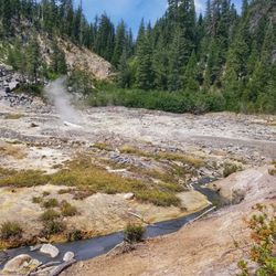
    Drakesbad Guest Ranch - Hot springs piping

    Drakesbad Guest Ranch

    3.6(41 reviews)
    12.3 mi

    Drakesbad Guest Ranch - Beautiful setting, but still room for improvement…read more Drakesbad Guest Ranch is set in a truly spectacular location, but a few operational issues prevent it from being the exceptional experience it could be. We booked a two-night stay in one of the Annex 2 cabins. About a week before arrival, I attempted to extend our reservation by an additional night. I called multiple times and left messages but never received a return call. I also sent an email and never received a response. As a result, the extra night was never added. When I arrived, I brought it up in person and was told by the property manager that I would need to return at 3:00 p.m. to see if anything was available. He explained that their communication system had been experiencing issues and that calls and emails sometimes do not come through because of limited connectivity and spotty internet service. Unfortunately, this was my first impression. Needless to say, the additional night was never added. This communication issue really needs to be addressed. If guests need to modify, confirm, or cancel reservations, they should be able to reach someone reliably. The ranch itself is located in a remote meadow valley within Lassen Volcanic National Park. It is surrounded by forest recovering from the devastating 2021 Dixie Fire. Burned trees still cover many of the hillsides, but the landscape is showing remarkable signs of recovery. The meadow is filled with tall green grass, colorful wildflowers, and deer grazing throughout the fields. Despite the fire's scars, the setting remains stunning. Upon arrival, I was surprised to find no clearly marked reception desk or office. There are no signs directing guests where to check in, so you may need to find an employee for assistance. The property manager personally checks guests in using a laptop and escorts them to their room or cabin. There is also no information provided in the rooms. No guest guide or information sheet was available, so be sure to ask questions about meals, amenities, and property operations. Since there is no cell service, I asked about Wi-Fi. The ranch uses Starlink, but during our stay the signal was only reliably available outdoors and not inside the cabins. Given today's connectivity expectations, a mesh network or Wi-Fi extenders would significantly improve the guest experience. That said, being mostly off the grid was actually refreshing. Guests should also know that the Annex cabins do not have electric lighting. Small solar-powered lanterns are provided and offer just enough light to get around after dark. In addition, power to the ranch is shut off nightly from 10:00 p.m. until 6:00 a.m., so plan accordingly and charge devices during the day. The Annex cabins appear relatively new and are in good condition. My only design criticism is the deck railing. It sits almost exactly at eye level when seated, partially blocking what should be one of the cabin's best features--the VIEW. One of the highlights of our stay was the dining experience. Breakfast, lunch, and dinner are included, and the staff were consistently friendly, welcoming, and attentive. The food exceeded expectations, and it sounded like the kitchen was happy to accommodate dietary restrictions. They also offered a nice selection of beers from local breweries, which was especially enjoyable after a long day of hiking. Unfortunately, horseback riding was unavailable during our visit. From what we were told, reservations appear to depend heavily on a single staff member. If that individual is unavailable, horseback rides may not be offered, which was disappointing. One important clarification for prospective guests: despite what some older information may suggest, Drakesbad no longer has a hot spring pool. The pool was damaged during the Dixie Fire and later destroyed by flooding. Today, all that remains is a pipe flowing hot spring water into a nearby creek. The surrounding hiking trails, including Devil's Kitchen, Boiling Springs Lake, and Terminal Geyser, were excellent and provided some of the best experiences of the trip. A few sections were heavily overgrown with thorny vegetation, so hiking pants are recommended. In some places the trail became difficult to follow because of vegetation encroachment. During the summer months, you'll also encounter hikers on the Pacific Crest Trail, which adds a unique element to the experience. Overall, we enjoyed our stay and but probably not return. The setting is undeniably beautiful, the staff are friendly, and the food is surprisingly good. However, improvements to communication, guest information, signage, Wi-Fi coverage, and activity coordination would elevate Drakesbad Guest Ranch from a pleasant stay to a truly exceptional destination.

    We spent our 45th wedding anniversary, July 2025. We love this place. Even after the fire(s), it's…read moreLassen Park! Beautiful! The guest ranch is a wonderful base camp to experience this part of the park. The ranch staff make the experience happen. We felt like family (in the good way). These folks actually care. Look closely at their website for what they offer. For us, it was like you'd think of an early 1900s, Adirondack's mountain motor lodge to be like. Rustic but regal. The staff made it regal for us.

    Photos
    Drakesbad Guest Ranch - Plenty of deer to see.

    Plenty of deer to see.

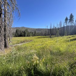
    Drakesbad Guest Ranch - Gorgeous meadow.

    Gorgeous meadow.

    Drakesbad Guest Ranch - Outdoor seating near dining room.

    See all

    Outdoor seating near dining room.

    Lassen Peak Trail - Lassen Peak Trail: trail terrain

    Lassen Peak Trail

    4.8(12 reviews)
    10.0 mi

    I did this trail this past Saturday morning 9/26/26. The guys and I got here at 8 AM. The parking…read morelot still had spots open. Bathrooms are at the parking lot. This trail stats at 8,500 feet and the summit is at 10,457 feet. Bring plenty of water and sturdy hiking boots and trekking poles. There is a fake summit but keep going until you see the huge rocks. Very windy up there do layer up. The air gets thin but if you train enough it isn't that bad. Total time to summit was 1.5 hrs. By the time finished the trail got crowded and parking lot was full. Definitely recommend starting early!

    Go Outside. Five…read moremiles, 10,457 feet of beautiful panoramic views! The Facilities: There is a huge parking lot equipped with restrooms right at the trailhead. Keep in mind that there are absolutely no bathrooms along the trail or at the summit, so plan ahead. The Wildlife Warning: Absolutely no dogs are allowed on the trail (on-leash or in a backpack). This is strictly enforced to protect the endangered Sierra Nevada red fox, one of the rarest mammals in North America. High-elevation slopes like this are their last remaining habitat. Wild foxes will pick up a domestic dog's predatory scent, feel threatened, and permanently abandon their vital hunting and denning grounds. Under safe temperature conditions, dogs are permitted to wait inside a vehicle. The Hike & Terrain: The trail is straightforward but physically demanding. It is entirely exposed to the elements with zero shade, offering a mixture of everything--starting with smoother volcanic dirt, transitioning into 43 rocky switchbacks, and ending with stone stairs, loose scree, and patches of ice. Timing & Weather: It took us two hours to power up to the top. I ran back down, navigating the steep gravel and rocky descent in a fast 30 minutes! Even in August, the high altitude makes a massive difference; the top was incredibly cold and windy, so definitely pack layers.

    Photos
    Lassen Peak Trail
    Lassen Peak Trail - That's Mount Shasta viewed from the peak.

    That's Mount Shasta viewed from the peak.

    Lassen Peak Trail - Not true

    See all

    Not true

    Kings Creek Falls down-and-back - Kings Creek Trail

    Kings Creek Falls down-and-back

    5.0(1 review)
    11.4 mi

    A gorgeous waterfall with an equally stunning hike throughout! I had originally planned to hike…read moreLassen Peak but there was still too much snow for the hike to be considered safe in condition. Decided to hike the 5 mile loop trail from Kings Creek to Bench Lake instead and it was awesome! Came here on Memorial Day Weekend around 8:30 am, and I was able to find a close spot near the trailhead. There's no actual parking lot near the Kings Creek staging area, but you can easily park along the road. By the time I finished my hike though, the cars were lined down the highway for almost a mile! Would definitely get here early to secure parking, and especially since it got HOT in the afternoon. There was still snow on the trail in late May. In fact, there was a huge pile of snow right at the beginning of the trailhead. Another lady and I realized that the trail was actually down a set of stairs that we couldn't see because snow was blocking our view. The Kings Creek Trail starts here. The hike to the falls is actually pretty easy. It's a short 2.7 miles round trip, but you can extend your hike by connecting to several other trails nearby. I hiked a 5ish mile loop to I Kings Creek, Bench Lake, and back. The trail starts off pretty mild through a shaded forest that runs alongside Kings Creek. You can hear the water from the creek flowing almost the entire time. The trail was a bit hard to follow due to all of the large snow chunks, but there were several small reg flag trail markers that helped to keep me on track. There's a small break in the trees where you'll have some of the most amazing views of the backside of Mount Lassen as well as the beautiful Shasta Valley. The views are pretty unbelievable here. A little over a mile in, you'll reach Kings Creek Falls. There wasn't anybody at the viewpoint when I arrived, and I had the beautiful view of the falls all to myself. Not too many people on this trail, so it was very enjoyable. From here, you can either go back the way you came, or you can connect to another trail. I took the loop trail to Bench Lake. After Kings Creek Falls, the trail becomes a little hard to follow again, but there are some trailhead signs to keep you on track. Bench Lake is small but very peaceful. Again, there was nobody there when I went. I took a break and had lunch here, and didn't see a soul the entire time (just the ants that really wanted my food). After Bench Lake, there's a steepish hill that you'll hike through but it's shaded. The trail continues until it loops back to the tail end of the Kings Creek trail. Some exposed spots but if you're going clockwise, the sun will be facing your back. Also, there was a ton of thick snow that I had to hike through. If you're coming in May, make sure to wear waterproof hiking boots if you don't want wet socks. The scenery throughout this hike is so amazing. Every little stop and turn affords you the most striking views. This is a hike that I would definitely do again. Kings Creek Falls is beautiful and the hike alone is worth the trek.

    Photos
    Kings Creek Falls down-and-back - Lupine

    Lupine

    Kings Creek Falls down-and-back - Devastation after the Dixie Fire

    Devastation after the Dixie Fire

    Kings Creek Falls down-and-back - Beautiful pano!

    See all

    Beautiful pano!

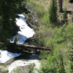
    Paradise Meadows up-and-back - How to cross the stream. Walk on this.

    Paradise Meadows up-and-back

    4.5(2 reviews)
    12.1 mi

    I hiked this trail in July 2011 when there was still several feet of snow on the ground. Very…read morelittle of the trail was visible, so I used an app on my phone to trace our way up the trail. It was pretty easy, even though we had quite a few post-holes through the snow. In a few places there was a creek under the snow that we could hear, so be very careful where you walk in snow covered conditions. We arrived at the meadow and it was breathtaking. The entire bowl was flowing water to the creek that runs through the meadow. However, there were clouds of nasty mosquitoes that could probably pick you up and carry you off. I'm serious, it was a plague. We couldn't be there more than about 5 minutes. But it was totally worthwhile to see this beautiful place.

    WOW! One of the prettiest, easiest hikes in Lassen National Park. Although the hike is listed as…read moreshort and it IS an easy distance, there is a decent climb up to the meadows but you hardly notice because of the gorgeous, cozy wooded setting. Most of the entire hike you have a beautiful view of the creek bubbling along side you and it's just gorgeous. There are wonderous amounts of wildflowers lining the trail's path: Skyrockets, Red Columbine, Larkspure, Alpine Aster and Daisies. And then the big payoff is the end of the trail where the wooded path opens up to Paradise Meadows where the still beauty is just overwhelming. On the return trip, you need to be careful of the loose rocks and sticks on the trail as you descend. This appeared to be a good hike for kids as we saw a couple of other families with children on our way out and they all seemed to be enjoying themselves immensely. Oh, and the weather can only be described as perfect. A cool breeze, beautiful sun, no bugs. I wish there were more than 5 stars to award :o)

    Photos
    Paradise Meadows up-and-back - Entrance to the trail from Hat Lake side

    Entrance to the trail from Hat Lake side

    Paradise Meadows up-and-back - Waterfall cascade

    Waterfall cascade

    Paradise Meadows up-and-back - Parking area near Hat Lake

    See all

    Parking area near Hat Lake

    Brokeoff Mountain Trail - hiking - Updated October 2026

    Loading...
    Loading...
    Loading...