Cancel

    Open app

    Search

    Brooks Memorial State Park

    4.0 (1 review)

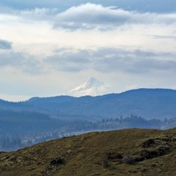
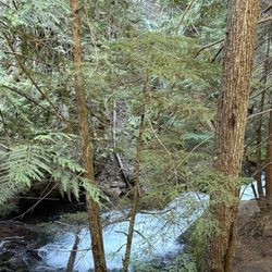
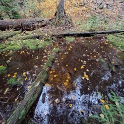
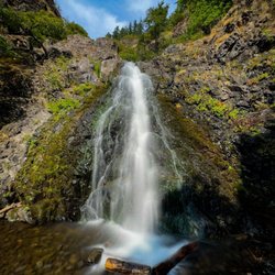
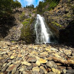
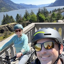
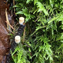
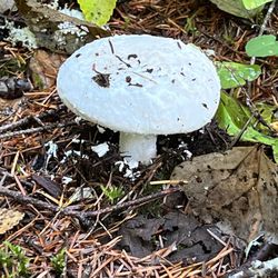
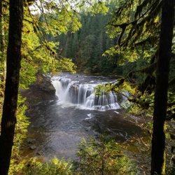
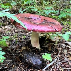
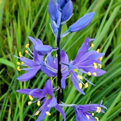
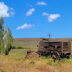
    Brooks Memorial State Park Photos

    More like Brooks Memorial State Park

    Recommended Reviews - Brooks Memorial State Park

    Your trust is our priority, so businesses can't pay to alter or remove their reviews. Learn more about reviews.
    Yelp app icon
    Browse more easily on the app
    Review Feed Illustration

    8 years ago

    Helpful 4
    Thanks 0
    Love this 0
    Oh no 0

    Verify this business for free

    Get access to customer & competitor insights.

    Verify this business

    Mosier Creek Falls - Wildflower time

    Mosier Creek Falls

    4.3(8 reviews)
    39.4 mi

    Best time for this hike is end of April and May when the wildflowers are in bloom and cover the…read morehillsides with purple widow's grass, yellow balsam root, blue lupine and lavendar bachelor buttons. It's my favorite time to be in this area! Best place to park is right before the Mosier Creek Bridge as you leave the tiny two block downtown area. As you begin the hike you come to the cemetery of the founding father's of this charming town. Continue for another 10 minutes to the falls and the swimming hole below. The falls are small, not like the 7 popular falls you see along the Old Historic Highway by Multnomah Falls, but still lovely. Continue on and up where views of the Columbia River from this vantage point are breathtaking. The river widens In this area and slight turns as it makes it's way through Mosier and onto Rowena making for a beautiful vista to take in and photo ops. Unlike at Rowena Plateau and Tom McCall Preserve, dogs are allowed on these trails.

    Pretty fun trail with a variety of sites!…read more There's a small parking area right in town just on the other side of the bridge from where the trail begins. You can make a very short hike of it and just go to the falls. Or you can continue on from there and complete the approximately 3 mile out and back with a small loop at the top...I recommend the latter. There's nice signage at the start explaining some trail details. You'll pass by a cool, tiny cemetery and venture on to the falls. Mosier Falls was a bit more substantial than I'd expected, set in a pretty canyon with an overlook for your viewing pleasure. Should you wish to continue on the trail...and you really should...you'll start up the side of the hill on switchbacks and stairs to the top. Tiny flowers popping up were blanketing the entire hillside, and I'm guessing it'll be quite a show in couple of weeks. After zigging and zagging multiple times you'll reach the top and come to an overview with spectacular views of the gorge. There's a bench there should you need a little rest or just wish to sit and take in the view for a bit. From the viewpoint you'll see the dirt trail continue on. It meanders further down to the end of the line...a short loop that offers even more gorge views. The trail is quite narrow and fairly unshaded most of the way and there are regular signs warning hikers of private property lines. We enjoyed it on a Saturday morning, along with quite a few other hikers. It's a decent workout, a pretty waterfall, and some beautiful gorge views...not too shabby!

    Photos
    Mosier Creek Falls
    Mosier Creek Falls
    Mosier Creek Falls - Mosier Creek Falls - Feb 2024

    See all

    Mosier Creek Falls - Feb 2024

    Tamanawas Falls - The river runs along the trail

    Tamanawas Falls

    4.8(37 reviews)
    52.2 mi

    Tamanawas Falls is one of my favorite waterfalls I've seen in Oregon…read more I've hiked it twice now-- once this past summer with my cousin, and more recently, last week. The hike is about three and a half miles round trip, with about 600 feet in elevation gain. Some light scrambling is necessary to get up close to the waterfall. There is a decent sized parking area at the trail head. Parking is $5 or free with a valid recreation pass. The waterfall itself is a hundred foot tall curtain. While it's only about one third the size, the shape reminds me of Vernal Fall in Yosemite. The basalt underneath the waterfall is very pretty and interesting to examine. There were lots of yellow trees (in October) including maple and Tamarack. I've read that you can go behind this waterfall, but I did not, since I'm a chicken, and like to play it safe around water. The hike was a little harder than it sounds, but still definitely doable within a couple of hours. There are a few campgrounds nearby, including Sherwood, Pollalie, and Nottingham.

    We were in the area and wanted to do a little hike. We found the Tamanawas falls hike and was…read moredescribed as an easy to moderate hike. The first mile was an easy dirt path with a modest elevation climb. When you turn away from the highway and cross the creek the trail turns a little rocky. The next mile and a half of the trail is intermittent mud and a lot of areas quite rocky. When you're about 300 yards or so from the waterfalls you'll encounter a rock slide that is one long boulder hop with some areas -that are quite treacherous. Once you get past the mudslide it's a short walk to the payoff. The waterfall is very stunning. We sat and gathered ourselves close to the base and enjoyed the beautiful scenery. The hike back seemed a lot shorter because we knew what we were encountering. The hike was described as a 4 mile hike we clocked it closer to 5 miles. Not a big deal but if you can get past the Boulder scramble the payoff is worth it. We definitely will do this hike again if in the area. There is a 5 dollar parking fee or the America the beautiful park pass we leave on the dash. There is a kiosk for the five dollar option at the trail head.

    Photos
    Tamanawas Falls
    Tamanawas Falls
    Tamanawas Falls

    See all

    Dog Creek Falls - Dog Creek Falls

    Dog Creek Falls

    4.5(2 reviews)
    42.3 mi

    My wife and I set out for an adventure from East Vancouver, heading to Dog Creek Falls, which we…read morereached in about an hour. The falls are conveniently located right off the highway, with ample parking available. In fact, we had the place to ourselves for the first 25 minutes or so. From the parking lot, it's just a short, easy walk--about 100 yards--to the falls. The waterfall is absolutely stunning, with crystal-clear water cascading into a serene, picturesque setting that feels tucked away from the world.

    A small waterfall...especially if compared to the endless supply of spectacular falls along the…read moreColumbia Gorge. There's a nice sign for Dog Creek easily seen when traveling along the 14. If you're heading west you might not see the turnoff to the parking area until you pass it. There's a decent amount of parking available, but no toilet or trash bins. Dog Creek is sweet and in a peaceful setting. The falls are easily seen from the highway, but a very short path leads from the lot to the water. A small and simple single drop falls comes down from the canyon, however we took the drone up and could see there's quite a bit more to the river and falls higher up...we did not attempt to venture up there though. There's a small pool at the base of the falls and great shade. I could see it be a nice place for families to picnic and kiddos to splash around in the summer. In an area full of fabulous hikes and sites Dog Creek Falls might not stand out, but it's a easy place to stop off the highway and quickly enjoy a falls with the fam.

    Photos
    Dog Creek Falls - Looking back at the creek from the falls.

    Looking back at the creek from the falls.

    Dog Creek Falls - Looking back towards highway 14 from the falls.

    Looking back towards highway 14 from the falls.

    Dog Creek Falls - Dog Creek Falls (wide angle)

    See all

    Dog Creek Falls (wide angle)

    Lewis River Falls - Lewis River Falls

    Lewis River Falls

    4.7(15 reviews)
    59.7 mi

    Came up here after seeing all the beautiful pictures and our experience did not disappoint. We…read moreweren't quite sure what to expect so I budgeted a whole day for the visit. We got a parking pass for the upper parking lot (just above the upper falls) and then we proceeded to hike from there all the way down to the lower falls, stopping at the upper and middle falls to check everything out. The scenery is beautiful and the falls were great. Our favorite were the lower falls, which the kids loved to play in. It's definitely a long drive from Cougar and the road has lots of twists, turns, and dips, but so glad we finally did it.

    The falls can't be beat, the forest and trails fabulous. We have been coming once a year in the…read morefall right after the campground season ends. And although we adore the area, I'm not so sure we will be returning the campground again unfortunately. Night one I awoke to the sounds of a LOT of critters scrambling up and down all sides of our van. It was funny (and of course a sound we've heard in forests before), until one found it's way in and joined me in my bed. What would be considered a cute mouse outside is not so adorable next to my face. It is the forest, it's their home...but of the many times we've stayed here the sounds of countless tiny feet scurrying all over our rig hasn't occurred. New issue at the campground? I duno. Can't deny the beauty and draw of the area though...it will always deserve 5 stars...just wanted to give a heads up to anyone else who isn't a fan of unwelcome nighttime visitors in their sleeping quarters. :)

    Photos
    Lewis River Falls
    Lewis River Falls
    Lewis River Falls - Lewis River Falls

    See all

    Lewis River Falls

    Catherine Creek Trail

    Catherine Creek Trail

    4.5(10 reviews)
    37.3 mi

    A simple yet beautiful trail that is fully paved and meanders down towards the river providing…read morevast, expansive views of the magnificent Columbia River. If you visit during wildflower season, it's even more beautiful with colorful wildflowers covering the fields. This trail is one of the few ADA accessible, which I really appreciate. While I do not use a wheelchair, I do have a disability and my legs can not handle the dirt and rock trails that are uneven. So having a paved path means that I can enjoy the gorgeous nature in this area. Wildflower season ranges from end of March to June, but every year is different based on the weather. This year (2022) was a very cold and rainy spring which delayed and prolonged the season. In April the hills were covered in yellow balsomroot and then blue lupine. End of May and heading into June, the next wave of flowers brings shades of blue from the delicate cornflowers with California poppies providing vibrant pops of orange Along the way. It's stunning! Wildflower season is my favorite season! Along the path there are many benches for those wanting to just relax and chill; some in the shade, some in the sun. There are also placards providing info on the area, the wildflowers, and the importance of pollination. The Catherine Creek paved trail is south of the parking area, which is a gravel section along Highway 8. Cross the street, the access is just past the porta potty. If you want the Catherine Creek Arch trail, it is on the same side as the parking, just head up the hill on the dirt trail. It's an easy 1.5 mile paved path that does have some declines and inclines as you make your way down, around, and then back up. If you head clockwise, you can see the creek to your left. If you decide to go off the paved path down to the creek, know there is a lot of poison oak and ticks. I stayed on the path, which is clear and well maintained. Note for wheelchair users - the path is wide and paved, but there are some areas where it slopes down and then makes it way back up. Another great thing about Catherine Creek Trail and Catherine Creek Arch Loop is that parking is free, no day pass required. The parking area is on the smaller side and on weekends, especially during wildflower time, it does get crowded. I went midweek and there was plenty of parking and I only came across two people on the path. Great for people of all ages and skills. For expert hikers, do the Catherine Arch first then finish with Catherine Creek.

    The trailhead was pretty busy Saturday afternoon, but there's a decent amount of parking along Old…read moreHwy 8 at the head. There are trails on both sides of the Hwy...according to the trail map only two above 8 and one below within Catherine Creek, but another trail leads towards Coyote Wall. We only took one uphill loop this day. The trails are quite narrow and the footing mostly uneven and rocky. The views are stunning throughout, and the flowers are emerging. As the trails wind mostly through the open ridge there is almost no shade...sunblock sunblock! It's an enjoyable spot for a hike for sure, although for me not quite AS pretty as the nearby Labyrinth Trail. We will definitely return to complete the other trails...good times.

    Photos
    Catherine Creek Trail - Such an interesting and beautiful landscape, no matter the season.

    Such an interesting and beautiful landscape, no matter the season.

    Catherine Creek Trail
    Catherine Creek Trail

    See all

    Columbia Hills Historic State Park - Old barn

    Columbia Hills Historic State Park

    3.5(6 reviews)
    27.5 mi

    One of the most beautiful spring landscapes in the PNW, the open slopes of the Dalles Mountain…read moreRanch section of the Columbia Hills Historic State Park turn yellow from the millions of arrow balsam root flowers that bloom. It is truly an incredible sight and the flowers cover thousands of acres. The balsam root are the first to appear followed by blue lupin. The next wave brings delicate blue bachelor buttons and bright orange California poppies. Since wildflower season is my favorite season, I visit often from March through June to watch the symphony of color that adorns the hills. The Dalles Mountain Ranch, was purchased from rancher Pat Bleakney in 1993. The 3,338 ranch includes Horsethief Lake and the many historic pictographs across SR-14 along the Columbia River. The open slopes of the old ranch attracts hikers in all seasons with a developed trail system with several loop options. The sweeping views of the Columbia River and Mt. Hood and Mt. Adams on a clear day are incredible! This area is so peaceful and serene. There is a dedicated parking area about 3.5 miles up the gravel drive past the old ranch and barn with vault toilets making it very convenient. Day pass is required and there is a kiosk in the parking area. This is the Gorge so it can get very windy! I've been there in the wind and have had days with no wind at all. Just be prepared for either end of the spectrum! No real shade so wear a hat and sunscreen. The trails are dirt and rock so I always brink walking sticks because I need the support. And yes, there are signs warning about rattlesnakes, part of the high dessert ecosystem so pay attention.

    There are only 5 previous reviews and mine was one. Guess cuz everybody enjoys the showy wildflower…read morehike - too busy looking at all the incredible photos to post on Yelp. I'll be short. Go to "wildflowersoregon.org" and find out when and where flowers are blooming in the Columbia River Gorge. We started the trail at Dalles Mountain Ranch and hiked 5.5 miles (elevation gain 800 feet) on a figure 8 loop carpeted with Balsamroot and lupine over the hills after hills as far as you can see. Showy wildflower display! The huge pedal Balsamroot are a bit past prime but the lupine are stellar now along with Phlox, Tretelia, Buckwheat and more. Put on a good pair of hiking shoes. Bring a smart phone or digital camera for breath-taking views. Whew! With the clouds yesterday - 5 stars *****

    Photos
    Columbia Hills Historic State Park - Horse thief Lake across SR14

    Horse thief Lake across SR14

    Columbia Hills Historic State Park
    Columbia Hills Historic State Park

    See all

    Brooks Memorial State Park - hiking - Updated May 2026

    Loading...
    Loading...
    Loading...