1. Bootleg Canyon Shuttles

0

Boulder City, NV

Cancel

Open app

Search

Bootleg Canyon Shuttles

5.0 (3 reviews)
Closed • Closed

Bootleg Canyon Shuttles Photos
You might also consider

Recommended Reviews - Bootleg Canyon Shuttles

Your trust is our priority, so businesses can't pay to alter or remove their reviews. Learn more about reviews.
Yelp app icon
Browse more easily on the app
Review Feed Illustration

2 years ago

Helpful 0
Thanks 0
Love this 0
Oh no 0

10 months ago

Helpful 0
Thanks 0
Love this 0
Oh no 0

2 years ago

Helpful 0
Thanks 0
Love this 0
Oh no 0

Ask the Community - Bootleg Canyon Shuttles

Verify this business for free

Get access to customer & competitor insights.

Verify this business

Desert Adventures - Aaah million dollar view

Desert Adventures

4.4(192 reviews)
0.8 mi

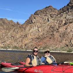
My husband and I recently went on our first kayaking tour with Desert Adventures and it was a great…read moreway to see so much! We did the day trip starting at the Hoover Dame. We arrived to the shop at 5:30 am, yes early but worth the early start especially if it is going to be hot. We were paddling down the river by 7 am. We stopped at many natural hot springs and caves along the way. Unfortunately we did the tour on a very windy day so kayaking was definitely a workout! Our guide was great and full of knowledge. He tried to provide us breaks throughout and tips for avoiding the most windy part of the river. Lunch, snacks and water were all provided and much so needed after paddling for so long against the wind. We ended our day around 3-3:30 and had roughly a 30 minute drive back to the shop. We had a great time and we will be recommending this tour to our friends visiting the Las Vegas area although our arms were SUPER sore the next day.

Desert Adventures is great! We did a self led excursion…read moredown the Colorado river but used this company to drop us off and pick us up! They provided a large trailer with ample shelves and space to put are gear onto. A safety speech was also given. This company has special authorization to enter the Hoover Dam property and take people down to launch from the entrance of the Hoover Dam. They instructed you to move quickly as there was a time limit for getting everyone/everything Into the water and away from the area. The next day, they were prompt with their pick up and helped us load our gear back onto the trailer. I would definitely use this company again and recommend them to others.

Photos
Desert Adventures - Launch at Hoover Dam

Launch at Hoover Dam

Desert Adventures
Desert Adventures - Fun day, fun times!

See all

Fun day, fun times!

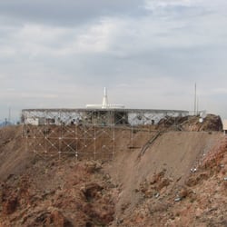
Red and Black Mountain - The antenna near the top of Red Mountain.

Red and Black Mountain

4.3(3 reviews)
0.6 mi

This is a moderately strenuous hike because of the nearly 1,200 foot elevation gain. The hike is…read moreapproximately 6.5 miles round trip if you go to both peaks. The trailhead is along US Highway 93. As you approach Boulder City, turn left the way you'd go to Hoover Dam. After you start down the hill past Industrial Road, watch for a sign on the left that says River Mountains Trail parking. It's just before the entrance to the St. Jude's Ranch for Children. There is ample parking here. From the parking area, walk behind the interpretive marker and the trail goes between the wall of an area of houses on the left and a concrete drainage ditch on the right. From there, the trail is fairly easy to follow as it's well defined. Follow the signs for the trail. There are side trails that are mountain bike trails so watch for the hiking only trail markers. The first part of the trail meanders around a bit and goes up and down until it works its way around and into a wash that comes down from the saddle between the two peaks. The saddle is the first goal. As you hike toward the saddle, the trail becomes a series of switchbacks to make getting to the top easier. Please DO NOT CUT the switchbacks. This damages the trail and when rain comes, wash outs are more likely. You'll also be trampling some native plants so stay on trail. Turn left at the saddle and keep heading up. There's still a bit more to go. After a few more switchbacks, you'll come to a road--a road you could have driven up, but that would defeat the whole purpose of hiking, no? This road is used to get to the antenna array at the top of Red Mountain. It's also used to take those who are doing the Bootleg Canyon flight lines near the launching area for the first flight. When you reach this road, you have a stunning view of Las Vegas and the Spring Mountains on the west side of the valley. You walk a short distance along the road and you'll see the trail to Red Mountain continue on your left. Follow the trail as it goes higher. It's a bit rocky and there is one spot that has some loose gravel. After a short time, you do reach the Red Mountain area and you see the antenna array you've probably seen many times driving to/from Hoover Dam. The actual peak for Red Mountain has a stake and you can go there if you want to be at the topmost point. In this area, you can see the first flight for the Bootleg Canyon Flight Lines, Lake Mead, The Eldorado Valley with its two solar plants, and of course, Las Vegas. It's a wonderful place. If you're lucky, you'll be here when a group does the flight. You can also see the mountain bike trails that make up the Bootleg Canyon trails. It's interesting to see these people riding down the steep slopes. Now for the bad news, Black Mountain is on the opposite side of the saddle. You can see the trail you need to follow from Red Mountain. If you've had enough, just return to your car. It's only about 3 miles away. If you're going to Black Mountain or your car, you need to head back the way you came passing the dirt road and looking carefully watching for when the trail to the saddle goes off the dirt road to the right. When you get back to the saddle, continue straight ahead on the trail if you're going to Black Mountain or make a right if you're going back to the car now. The trail goes about 1/2 mile to Black Mountain. It is very well defined and you hike on volcanic rock. That's what makes Black Mountain its color. At the top of Black Mountain, there's a bench and several interpretive markers explaining the geology of the Las Vegas Valley. It's a good place to have a snack and enjoy the view. Follow your tracks back to the saddle and then descend the switchbacks. They're so much nicer now that you're going downhill. Before you know it, you'll be back to your car. There is a picnic table at the parking area, so you can have an après hike lunch. We call it Guinness time! Happy hiking!

For Review 300, I wanted to spend time in a beautiful place that is as good as it gets. This is…read moreachievable when I live in a metropolitan area with access to spectacular parks. So, this past weekend's outdoor adventure was when I returned to Red & Black Mountain to climb up Red Mountain. There are two hiking routes to hike up Red & Black Mountain. Hiking Route A is from the River Mountain Trail (not the River Mountains Loop Trail).To get there from the Las Vegas area, travel on US 93 toward Hoover Dam. After turning left on US 93 to bypass downtown Boulder City, the sign for River Mountain Trail will be on your left. Hiking Route A begins in a residential subdivision, passes through a desert landscape under power lines, and then climbs up switch backs to a summit. At the top of the summit, you have the option of turning left toward Red Mountain or turning right toward Black Mountain. Hiking Route B is from the Bootleg Canyon Park Trailhead. From the Las Vegas area, drive on US 93 as if you were headed to Boulder City. After the first traffic signal, US 93 changes from a divided limited access highway to a commercial thoroughfare. Get on the left lane and turn left on Yucca Street. Taco Bell will be the landmark. From here drive on Yucca Street to it dead ends at the Bootleg Canyon Park parking lot. Once you park your car, you will hike on the River Mountains Loop Trail for a short distance. At the first junction, you will make a left on the road toward a valley. This is Bootleg Canyon. You will see restrooms and picnic tables. From this point continue on the road, which is now gravelly. It will bring you up Red Mountain. Just a note, to the right of the road is a large mountain adorned with a large "B.C." and communication towers on top. This is the mountain that you will be climbing. From my experience hiking up Red & Black Mountain, I STRONGLY suggest, hiking each mountain on two separate hikes. Two separate hikes will reward you with hours of recreation and experiences. This review is on Hiking Route B: Bootleg Canyon Park to the summit of Red Mountain. Hiking Route A: River Mountain Trail to the summit of Black Mountain will be a future review, which I will place under Yelp's River Mountain Trail Listing. From ground level to the summit, there are three types of topography to hike. From the Bootleg Canyon Park parking lot to the valley, the topography is pavement. Through the valley and up the north side of Red Mountain, the topography is a sandy and gravelly road that is used by vehicles transporting people and dirt bikes to a parking lot at the end of the road. With the exception of the gradual change in elevation, this is an easy hike. Beyond the parking lot, the topography is very rocky and gravelly for a short segment, and the trail has changed from a dirt road to a narrow trail that becomes narrow with steeper elevation gains. At this point, the hike is moderately difficult to the degree that I strongly suggest "focus on the moment "concentration and reliable hiking boots. The scenery is as good as it gets. Red Mountain (with the B.C.) is beautiful from ground level. As the dirt road travels through Bootleg Canyon northbound, then gains elevation gain eastbound, the closer up vistas of Red Mountain are captivating. Especially at dawn! As the dirt road travels through Bootleg Canyon, it treats the hiker to spectacular vistas of the River Mountains and valleys. Once the dirt road turns toward the north to travel uphill, the vistas become as good as it gets. It is at this point where the panoramas of the Las Vegas Valley featuring the Las Vegas Strip and surrounding mountain ranges overtake the landscape. It is at this point where you could look down on the top of the Stratosphere and across at French Mountain with open desert below. I said the scenery is as good as it gets? I was ahead of myself. At the parking lot where the dirt road ends, the scenery gets better! This is where you have the option of turning left and hiking to the summit of Black Mountain, or staying straight on a narrow path to the left of the gate toward the Red Mountain summit. At this point you are consumed by breathtaking scenery. To your left is the mesmerizing black Mountain and to your right hundreds of feet below you is Boulder City. I said the scenery is as good as it gets? It is almost as good as it gets! The narrow part of the trail looks over even better scenery. When you look to the right you will be able to see Black Mountain Henderson and to the left you will be able to see Lake Mead and the bridge. At the summit where people board the Bootleg Canyon Flight Lines the scenery is as good as it gets. Looking below there is Lake Mead, Boulder City, and desert. And yes, this scenery is as good as it gets and why Red & Black Mountain is 5 stars.

Photos
Red and Black Mountain - In the early part of the hike - Red Mountain on the left and Black Mountain on the right.

In the early part of the hike - Red Mountain on the left and Black Mountain on the right.

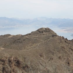
Red and Black Mountain - The view of Black Mountain from Red Mountain.  You can see the trail.

The view of Black Mountain from Red Mountain. You can see the trail.

Red and Black Mountain - Red Mountain at sundown.

See all

Red Mountain at sundown.

River Mountain Trail

River Mountain Trail

4.8(6 reviews)
0.6 mi

We have lectric bikes and boy did we take em out for a Spin!…read moreWe rode the entire 35mile loop. It took us about 5 hours with one of them Being breaks. Even with help this trail is a beautiful beast. Steep hills and a steady gradual I cline in the middle. It sure was beautiful though. Great views. Some nature. Just some chipmunks and lizards mostly.

An Earth Day 2016 Celebration Review…read more The River Mountain Trail (not River Mountains Loop Trail) is one of my most cherished hiking trails near Las Vegas. Ever since I first stepped foot on it in 2006, I have adored this charming trail. It is an adoration that led to an annual Spring hike on it. It is a tradition that has cost zero and gives back uncomplicated joy. Yesterday, I celebrated Earth Day on the River Mountain Trail. River Mountain Trail with the unsigned Black Mountain Trail is a six-mile round trip adventure that starts from a parking lot off mile marker 29.5 of the River Mountains Loop Trail (https://www.yelp.com/biz/river-mountains-loop-trail-henderson) in Boulder City then climbs from an elevation of 2,415 to 3,600 feet up to Red and Black Mountain (https://www.yelp.com/biz/red-and-black-mountain-boulder-city). This is what I consider a Disney Trail. Just like a Disneyland ride, it is clean; adorable; picturesque ; and provides a thrill minus the intimidation. Deep into the trail as it climbs the switchbacks up the Red & Black Mountain canyon it even resembles the Big Thunder Railroad. The Civilian Corps that built it in the 1930s did it with the imagination of a Disney Imagineer. The trail is a work of art that follows a sinuous course through the rolling desert where it passes through a verdant canyon of vegetation. Graffiti is relatively nonexistent. From the trailhead near St. Jude Ranch, the first impression is misleading. Following the beginning leg of the trail it borders housing walls and a concrete wash. After a slight curve, it meets the colossal spaces of the desert with Red and Black Mountain Mountain in the distance. In April, with the blooming wildflowers, the desert resembles an Arboretum more than a desolate landscape. Gradually the trail aims toward the Red & Black Mountain canyon. When the trail reaches 2,960 elevation, the switchbacks along the face of Red Mountain start rolling the ribbon of sand up sinuous and gentle curves toward the stratosphere in a place up by the clouds called the Red & Black Mountain summit. The amazing thing is how smoothly it reaches 3,300 feet. Ethereal and beautiful describe the experience of this solitary climb to the stratosphere. I compare this stretch to driving on Utah bound I-15 through endless desert then experiencing the roller coaster dips and turns of the Virgin River Gap. Here there are more rest stops. On the way there are large boulders to pause. Overhead vultures and airplanes pass over the sky. Below is a view of part of Boulder City. At the top of the saddle the trail name ends. Gone are the green and white trail signs with the River Mountain Trail - Bicycles prohibited signs. Gone is any thought of the trail ending. A left leads up to Red Mountain and straight to the Black Mountain summit. Now physically near the clouds and mentally on cloud nine, I continue straight for a. 05 to climb up a gentle 180 elevation gain to the end. On this walk near the clouds, I pass a rock that looks like an alligator. The trail concludes at the Black Mountain summit. At 3,480 feet high I rise above it all (Red Mountain is higher). This is a breathtaking panoramic view of the Las Vegas valley and Mount Charleston, Lake Mead, Boulder City, River Mountains, and desert interspersed with mountains reaching across the Hoover Dam Bridge into Arizona. Adorning the summit is a bench and informative sign on the geology. Even better than the rewarding overlook is that up to now was the laborious part of the hike. Heading back, the hike is a fun downhill descent toward the trailhead. I highly recommend hiking up the River Mountain Trail in the cooler months. In my opinion this hike is priceless. Being that this is an Earth Day review, it is appropriate to write that this is advice written from a person that is down to Earth.

Photos
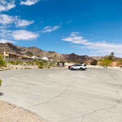
River Mountain Trail - Parking lot.

Parking lot.

River Mountain Trail - Boulder City rest area

Boulder City rest area

River Mountain Trail

See all

Bootleg Canyon Shuttles - mountainbiking - Updated October 2026
Loading...
Loading...
Loading...