Historic Railroad Trail Photos


You might also consider


More like Historic Railroad Trail
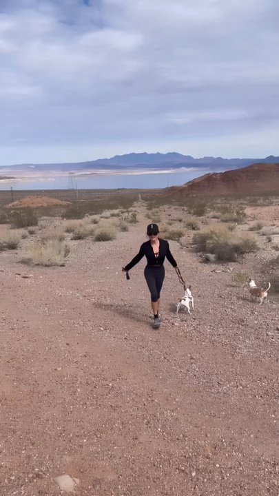
Recommended Reviews - Historic Railroad Trail
Start your review...


Reviews With Photos


What a great spot to access either direction of the trail. Easy to get to. Parking might take a moment to find a spot - but most people seem to simply take in the view and leave. Not many hikers seem to park here. The flat portion of the trail is easy. Getting to it from the parking lot can take moderate exercise as there are many loose rocks and dirt to navigate. The tunnels are refreshingly cool. There are park benches near most entrances and exits if you need a break. Views are nice! A gazebo and restroom are located opposite the tunnel entrance. Be sure to water, and wear appropriate attire!


You can choose any distance you like, but keep in mind that the return trip will be the same distance. We stopped at the halfway point, completing a hike of about 5 miles, which included walking through a few tunnels. If you're up for it, you can hike all the way to Hoover Dam, which is an 8-mile one-way distance.


On a Monday holiday, a few people hiked, biked, and ran this trail. There is not much shade besides going through the artificial tunnels. Along the hike, they have information on the history of the lake and tunnels. This hike is about 4.25 miles one way towards the Hoover Dam and 4.25 miles going back, a total of 8.5 miles. After reaching the Hoover damn, you can walk around and go to the gift shop to get a drink or something to bite on, which was nice after hiking under the hot sun. I would definitely. I recommend adding sunscreen and bringing lots of water. It's also kid- and dog-friendly. Two parking lots are available, one closer to the trail and the other to the visitor center. Lastly, go early; it gets hot. I would come back again.


I'm motivated to take more steps and do more hiking in 2024, so I'm kicking off the new year with a review for Historic Railroad Trail in Boulder City! I first hiked this trail nearly a decade ago, way before my Yelp days, and I was looking forward to coming back again. The trail has amazing views of the mountains and Lake Mead and it takes you all the way down to Hoover Dam! I did not make it all the way down there, unfortunately, because my feet were starting to cramp up and I was running out of water. I hiked 2.88 miles up to the Hoover Dam sign and 2.81 miles back to the parking lot, totaling up to almost 6 miles and nearly 13,000 steps. The weather was perfect for hiking, though I did pack a pair of gloves just in case it would get a little chilly. The beginning of the trail had an outdoor thermometer backed up by solar power, which read 67 degrees when I began the hike and then 69 degrees when I finished the hike. They also have a sign that says hiking is not permitted between the months of June and September due to the extreme heat, which is very useful. I learned during the hike that there are bats that stay put in the tunnels, but they travel south or hibernate elsewhere during the winter months and they are not out and about until between the months of May and October. Seeing bighorn sheep was a possibility during the hike, but I did not see any. This is a great trail to hike and I will recommend it to anyone looking for a new trail to try out.


We felt like we stepped back in time while exploring the Historic Railroad Tunnel Trail. This trail offers a captivating journey through time and nature, it transported us to an era when railroads played a pivotal role in shaping the American West. The trail's well-maintained path winds through rugged terrain, offering stunning views of the surrounding landscape, and stunning deserts hues. The real highlight of the hike, however, is the series of historic railroad tunnels along the way. These tunnels, originally constructed in the early 20th century, served as a crucial link for transporting materials during the construction of the Hoover Dam. Walking through them is like stepping back in time, with their weathered walls and echoes of the past whispering tales of bygone days. The engineering marvel of these tunnels is truly awe-inspiring, and provides a unique glimpse into the region's rich history. Remnants of the Hoover Dam's construction can be seen throughout this route. There are five tunnels, each 25 feet in diameter/height. Aside from the historical significance, the trail also boasts a diverse array of flora and fauna, although we didn't get a glimpse of any of them, the signs assured us they were there. The trail from beginning to end is approximately 8.5 miles there and back, it starts in Boulder City off Lakeshore Rd and ends at the Hoover Dam. It's an easy trail but long, you can turn around at any point but we did the full 8.5 miles. It is highly trafficked, and it can be walked, jogged, or biked. We had panoramic views of Lake Mead and the Boulder Basin region along the way. After passing the tunnels, elevation changes bringing new views, new hills to climb, and the final descent towards Hoover Dam. The Historic Railroad Tunnel Trail is a must-visit destination and a great way to stay active, sneak in some exercise in nature while taking in the beauty and history of the American West.


I really like this trail. I've been on it a few times with my dog. It's very pet friendly, so definitely expect a lot of dogs when you go. I went on New Year's Day so there was a ton of people, but the trail is wide enough that it accommodates crowds. I explored the trail up to the casino and there was definitely a nice view of the entire area. Make sure to take lots of water and some block because you'll be indirect light most of the time. My favorite part were the caves although beware there are a lot of bats in there.


Love love this railroad trail during the winter. We came here in January and it was perfect weather for this walk. Everytime were in vegas, we try to hit up some new trails and burn off some calories. I did some YouTube research and found this trail, which was about 30 mins off the strip. The trail is right off of Lake mead. Beautiful to see. The sign said the trail is closed for the summer months due to extreme heat. Beautiful trail!


8 miles round trip...Go early to get a good parking spot...dress accordingly. Go on foot or by bike, best to go with someone else or a group. Parents...don't force your kids to go along with you...majority of the kids we passed by were crying/whining and didn't want to be there. WATER IS ESSENTIAL...Some hikers had nothing, and some were just carrying a half empty/empty plastic 16 ounce bottle. By the end of our hike which was on a warm Easter Sunday, we each went through a half gallon of water and a couple of pieces of fruit. Fun hike and a great way to get outside and explore. ALOHA!!! SHAKA METER: \uuu/ \uuu/ \uuu/ \uuu/ \uuu/ 5
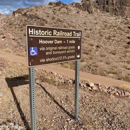

Highly recommend the Historic Railroad Trail in Boulder City! INCREDIBLE view of Lake Mead. SUPER AWESOME tunnels. A flat, easy, unpaved trail, which is great for walking, running, jogging, biking, all-terrain strollers, and is dog-friendly! Our Golden Retriever completed 7.67 miles with us beginning from the west side of the trail near The Alan Bible Visitor Center, to the east end of the trail at the Hoover Dam parking structure, and back. It was about 55 deg F and cloudy during our walk, which made for perfect hiking conditions. This is a great time to get out and enjoy this trail. From June - September, the trail is closed due to extreme heat conditions, so plan accordingly! There are a total of 5 tunnels on this trail, 300ft in length and 25ft in diameter. Tunnel 2 actually reaches 27ft high. It has a timbered framework and ceiling, which allowed trains to carry huge pipe and construction equipment to the dam site. In the 1930s, the area was a busy railroad switch yard, hauling sand, gravel, and cement over this line to a concrete plant where the Hoover Dam parking garage now stands. The trail is clearly marked and includes informational boards to learn more about the nature and history of this trail. Between May and early October, you may see Mexican free-tail bats hanging out in Tunnels 1, 2, and 3. In the fall and winter, the bats tend to fly to warmer locations to hibernate. Toilets are available at each end of the trail. Parking is free and you can either start from the Alan Bible Visitor Center or Hoover Dam Parking Structure. Poopie bags for your fur babies are also available at the start/end of trail. Bring drinking water!


Loved this trail. After days of harder hiking on rocks and near cliffs, this was a welcome change. It's an "easy" trail with only slight inclines and declines most of the way. It also is smooth enough to walk, bike, hike or whatever. It does go on and on. Yesterday we explored for a few miles. Today we walked all the way to the Hoover Dam and back (that was 8 miles round trip). Very pretty, scenic views much of the way. But the coolest part are the five tunnels. Very unique. Getting to walk on foot to the Dam was an added treat. Highly recommend this trail. It does have a warning that it is closed June - September due to heat. So plan accordingly.


Hey Yelpers! This is a super easy mostly flat hiking trail with the most beautiful views. This is the best time of the year to hike it, too. You can easily drive into the parking lot like you are heading to the visitor center, but drive past it down to the restroom parking lot close to the trail and it's perfectly marked for easy no brainer adventure. About half way or an hour in there is another restroom with a covered picnic table for a break. Then you can continue on down to the Boulder Dam. There are amazing views there as well as awesome retro restrooms , memorials, and water. There used to be a cafe. I forgot to look if they are still open. Before the dam is a parking structure. You can take the stairs or an elevator. We usually start our hikes about 8 am. The restrooms were still clean and stocked. I bring hand sanitizer. Be sure to bring water and a snack just in case. Dogs are welcome but please pick up after them and keep them on a leash. The later it gets the more busy it gets. I like to go here at least once a year. It's just so nice to get out into nature and experience Nevada. Parking is free. You can check out the visitor center while you are there. They have cool stuff. I recommend this trail. Check it out! read more

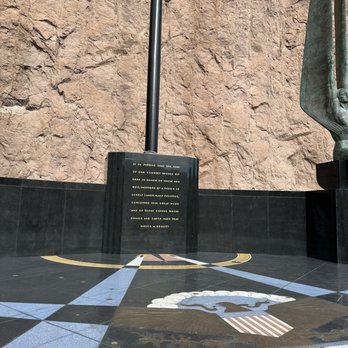

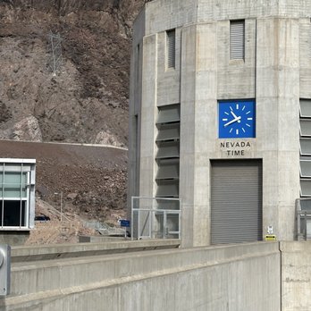

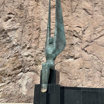

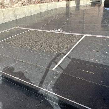
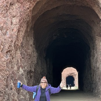


Free Parking this is the beginning 1 mile until you hit the 1st rail tunnel. You are walking basically on the removed railroad tracks where the rail cars were used to remove and bring in materials to build Hoover Dam. Walk, Jog, or bike love this spot for the beauty and the history. $25 to enter lake Meade State Park if you choose to go in if you have a pass it's free. Hoover Dam Hotel Casino and Hoover Damn are also in the area to visit to see the sights along with the small town of Boulder City which offers restaurants bars and small shops & antiques. read more





8 months ago
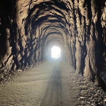
Excellent hiking trail on a cool day! On hot days, you should avoid this place! Enjoy the scenic views and always have plenty of water with you. read more




1 year ago
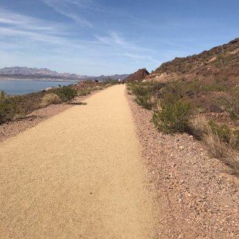
What a great spot to access either direction of the trail. Easy to get to. Parking might take a moment to find a spot - but most people seem to simply take in the view and leave. Not many hikers seem to park here. The flat portion of the trail is easy. Getting to it from the parking lot can take moderate exercise as there are many loose rocks and dirt to navigate. The tunnels are refreshingly cool. There are park benches near most entrances and exits if you need a break. Views are nice! A gazebo and restroom are located opposite the tunnel entrance. Be sure to water, and wear appropriate attire! read more


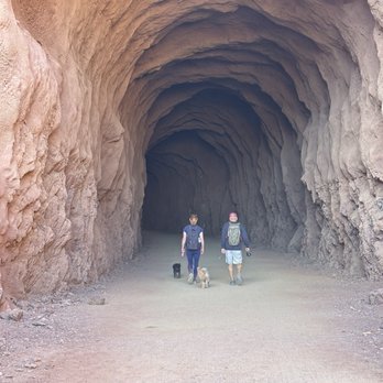


You can choose any distance you like, but keep in mind that the return trip will be the same distance. We stopped at the halfway point, completing a hike of about 5 miles, which included walking through a few tunnels. If you're up for it, you can hike all the way to Hoover Dam, which is an 8-mile one-way distance. read more


On a Monday holiday, a few people hiked, biked, and ran this trail. There is not much shade besides going through the artificial tunnels. Along the hike, they have information on the history of the lake and tunnels. This hike is about 4.25 miles one way towards the Hoover Dam and 4.25 miles going back, a total of 8.5 miles. After reaching the Hoover damn, you can walk around and go to the gift shop to get a drink or something to bite on, which was nice after hiking under the hot sun. I would definitely. I recommend adding sunscreen and bringing lots of water. It's also kid- and dog-friendly. Two parking lots are available, one closer to the trail and the other to the visitor center. Lastly, go early; it gets hot. I would come back again. read more


I'm motivated to take more steps and do more hiking in 2024, so I'm kicking off the new year with a review for Historic Railroad Trail in Boulder City! I first hiked this trail nearly a decade ago, way before my Yelp days, and I was looking forward to coming back again. The trail has amazing views of the mountains and Lake Mead and it takes you all the way down to Hoover Dam! I did not make it all the way down there, unfortunately, because my feet were starting to cramp up and I was running out of water. I hiked 2.88 miles up to the Hoover Dam sign and 2.81 miles back to the parking lot, totaling up to almost 6 miles and nearly 13,000 steps. The weather was perfect for hiking, though I did pack a pair of gloves just in case it would get a little chilly. The beginning of the trail had an outdoor thermometer backed up by solar power, which read 67 degrees when I began the hike and then 69 degrees when I finished the hike. They also have a sign that says hiking is not permitted between the months of June and September due to the extreme heat, which is very useful. I learned during the hike that there are bats that stay put in the tunnels, but they travel south or hibernate elsewhere during the winter months and they are not out and about until between the months of May and October. Seeing bighorn sheep was a possibility during the hike, but I did not see any. This is a great trail to hike and I will recommend it to anyone looking for a new trail to try out. read more


2 years ago
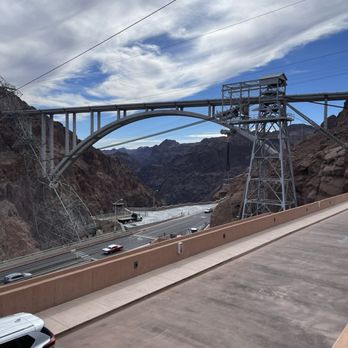
We felt like we stepped back in time while exploring the Historic Railroad Tunnel Trail. This trail offers a captivating journey through time and nature, it transported us to an era when railroads played a pivotal role in shaping the American West. The trail's well-maintained path winds through rugged terrain, offering stunning views of the surrounding landscape, and stunning deserts hues. The real highlight of the hike, however, is the series of historic railroad tunnels along the way. These tunnels, originally constructed in the early 20th century, served as a crucial link for transporting materials during the construction of the Hoover Dam. Walking through them is like stepping back in time, with their weathered walls and echoes of the past whispering tales of bygone days. The engineering marvel of these tunnels is truly awe-inspiring, and provides a unique glimpse into the region's rich history. Remnants of the Hoover Dam's construction can be seen throughout this route. There are five tunnels, each 25 feet in diameter/height. Aside from the historical significance, the trail also boasts a diverse array of flora and fauna, although we didn't get a glimpse of any of them, the signs assured us they were there. The trail from beginning to end is approximately 8.5 miles there and back, it starts in Boulder City off Lakeshore Rd and ends at the Hoover Dam. It's an easy trail but long, you can turn around at any point but we did the full 8.5 miles. It is highly trafficked, and it can be walked, jogged, or biked. We had panoramic views of Lake Mead and the Boulder Basin region along the way. After passing the tunnels, elevation changes bringing new views, new hills to climb, and the final descent towards Hoover Dam. The Historic Railroad Tunnel Trail is a must-visit destination and a great way to stay active, sneak in some exercise in nature while taking in the beauty and history of the American West. read more




11 months ago

I really like this trail. I've been on it a few times with my dog. It's very pet friendly, so definitely expect a lot of dogs when you go. I went on New Year's Day so there was a ton of people, but the trail is wide enough that it accommodates crowds. I explored the trail up to the casino and there was definitely a nice view of the entire area. Make sure to take lots of water and some block because you'll be indirect light most of the time. My favorite part were the caves although beware there are a lot of bats in there. read more


2 years ago
This trail has amazing views! It was clean, we'll taken care of, and perfect for new hikers. The trail is pretty leveled and doesn't elevate which is good for a light workout. Would recommend going around 8a before it gets busy. The trail is really active and pet friendly. read more


Love love this railroad trail during the winter. We came here in January and it was perfect weather for this walk. Everytime were in vegas, we try to hit up some new trails and burn off some calories. I did some YouTube research and found this trail, which was about 30 mins off the strip. The trail is right off of Lake mead. Beautiful to see. The sign said the trail is closed for the summer months due to extreme heat. Beautiful trail! read more


1 year ago

8 miles round trip...Go early to get a good parking spot...dress accordingly. Go on foot or by bike, best to go with someone else or a group. Parents...don't force your kids to go along with you...majority of the kids we passed by were crying/whining and didn't want to be there. WATER IS ESSENTIAL...Some hikers had nothing, and some were just carrying a half empty/empty plastic 16 ounce bottle. By the end of our hike which was on a warm Easter Sunday, we each went through a half gallon of water and a couple of pieces of fruit. Fun hike and a great way to get outside and explore. ALOHA!!! SHAKA METER: \uuu/ \uuu/ \uuu/ \uuu/ \uuu/ 5 read more


5 years ago
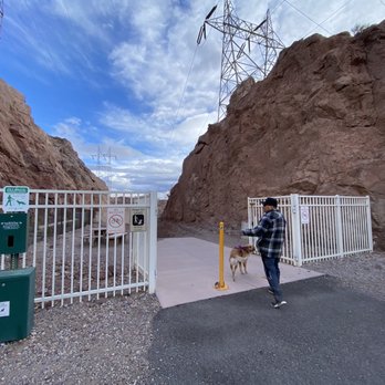
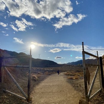
Highly recommend the Historic Railroad Trail in Boulder City! INCREDIBLE view of Lake Mead. SUPER AWESOME tunnels. A flat, easy, unpaved trail, which is great for walking, running, jogging, biking, all-terrain strollers, and is dog-friendly! Our Golden Retriever completed 7.67 miles with us beginning from the west side of the trail near The Alan Bible Visitor Center, to the east end of the trail at the Hoover Dam parking structure, and back. It was about 55 deg F and cloudy during our walk, which made for perfect hiking conditions. This is a great time to get out and enjoy this trail. From June - September, the trail is closed due to extreme heat conditions, so plan accordingly! There are a total of 5 tunnels on this trail, 300ft in length and 25ft in diameter. Tunnel 2 actually reaches 27ft high. It has a timbered framework and ceiling, which allowed trains to carry huge pipe and construction equipment to the dam site. In the 1930s, the area was a busy railroad switch yard, hauling sand, gravel, and cement over this line to a concrete plant where the Hoover Dam parking garage now stands. The trail is clearly marked and includes informational boards to learn more about the nature and history of this trail. Between May and early October, you may see Mexican free-tail bats hanging out in Tunnels 1, 2, and 3. In the fall and winter, the bats tend to fly to warmer locations to hibernate. Toilets are available at each end of the trail. Parking is free and you can either start from the Alan Bible Visitor Center or Hoover Dam Parking Structure. Poopie bags for your fur babies are also available at the start/end of trail. Bring drinking water! read more




2 years ago

Loved this trail. After days of harder hiking on rocks and near cliffs, this was a welcome change. It's an "easy" trail with only slight inclines and declines most of the way. It also is smooth enough to walk, bike, hike or whatever. It does go on and on. Yesterday we explored for a few miles. Today we walked all the way to the Hoover Dam and back (that was 8 miles round trip). Very pretty, scenic views much of the way. But the coolest part are the five tunnels. Very unique. Getting to walk on foot to the Dam was an added treat. Highly recommend this trail. It does have a warning that it is closed June - September due to heat. So plan accordingly. read more


3 years ago
Easy, enjoyable trail. Pet, kids and wheelchair friendly. Great views of the lake. It takes you all the way to the Hoover Dam. Been here many times and we always love it! read more


5 years ago
First time going kids took their bikes and we took a wagon. To be safe, we will just had to make sure they didn't ride it when there were cliffs on both sides. They rode it all the way until heading back they were tired of riding so we ended up having to carry/trying to ride their small bikes back. Took the trail from the visitors center since the other parking lot was full. Pretty views, easy hike since a path is already made, and the weather was great in November. Best part is it's clean! Second time yesterday as part of our first hike of the new year and we took the trail from the Hoover Dam Lodge. It was much faster although there is more of an incline when you head back to the Lodge. Still pretty easy hike compared to others we've been on. This time we forgot to let our kids use the bathroom before we set out on the trail so yes we had to find a spot where my boys could pee (sorry). It is a pretty easy hike but it's long for someone with a bad knee so we didn't bring my MIL along with us. However, my FIL enjoyed it. read more


3 years ago
Love to take a walk there. It's really nice and relax. Easy to walk. Dogs friendly. Parking lot available Not too far from Las Vegas read more


6 years ago
#TheThingsYouDoDuringPandemicCovid19 As of this review, the restrooms at the parking lot AND the visitor center are CLOSED. Make sure you empty your bladder before getting here otherwise you'll be peeing in a bush. I'm not a hiker and not much of an outdoor kinda gal either but this hike/trail was great. Like others have mentioned, it's all flat surface (literally a path that's laid out for you) and not much incline, if at all. You're walking on nothing but rocky dirt road so wear shoes you won't mind if they get scuffed/dusty. We went on Wed, April 1. Took us about a 30min drive and we live pretty close to The Strip. Weather was great. Got to the parking lot around 11am ish and already the lot was full...we parked on the perimeter of the parking lot. You'll see other cars doing this when the parking stalls are all taken. Just PLEASEEEE remember to leave a good amount of space between you and the cars in front/behind you so everyone can exit without scraps & nicks on the vehicle. You will walk about 1 mile before getting to the first railroad tunnel. There's five tunnels in total. Some reviews have mentioned there may be bats chillin in tunnel 3. As of early April, we didn't see any. I'm terrified of snakes and thank goodness I didn't see any. I think if you stay on the path, you won't come across any creepy crawlies. I enjoyed going through all five tunnels. Those who are photo obsessed whether if it's for your IG or photography, you can get some great photos here. I've seen people of different ranges in ages and physical shape so this hike is great for almost everyone. I even seen dogs both big, small, fit and round potato size. Not sure if there's another path to take if you want to walk allll the way to the hoover dam because as of beginning of April, there's a fence that stops you after you exit tunnel 5. This trail took us about 2 hours roundtrip. We took our time taking pictures and enjoying the beautiful view. Def come check it out....just remember social distancing. (When we went, there were others but it wasn't super crowded and everyone kept their distancing). read more
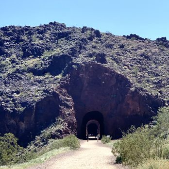


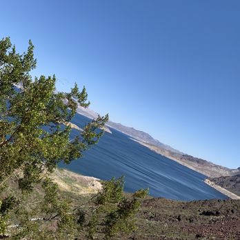


Nice hike with some awesome views of Lake Mead and Hoover Dam, if you decide to make it that far it's about 8 miles out and back.The hike starts from outside of Lake Mead, no entrance fees. You can park at either of the parking lots around the Lake Mead Visitor Center and follow the trail or people. It is a very popular hike with everyone from the old and the young there, people riding their bikes, walking their doggies, and pushing strollers. Besides the view, the hike takes you through the historic railroad tunnels. I believe there are 5 of them. There are educational information postings along the entire hike. After the tunnels there are some restrooms and shaded area to rest. A lot of people like to turn back here or continue towards the dam or bridge area. The only restrooms besides these ones are back at the start or at the dam or bridge area. Great hike. Mostly flat with a slight incline up until after the tunnels. Get there early as the parking lots do fill up. Always bring the usual necessities when outdoors. Water, sunscreen, jacket, hat, sunglasses, food, etc. read more


6 years ago
After moving here from the Bay Area, I really miss hiking or walking outdoor. While the weather cool down, I know I have to take an advantage of hiking before summer hits. Found this place online and through yelp. Thank you my fellow yelpers! This route lead to Hover Dam. Round trip I would say 7-7.5 miles. However, we didn't get to make it all the way to the dam because of the time crunch. We did enjoy the view from the distance. Might have to start earlier if we want to finished the whole thing next time. We got to the park by 8am-11am. View was amazing! overlook the water, walked inside of the caves, and surrounded by mountain. BEST hike ever. Went with a group of friends and they all enjoy it and want to come back again. Will definitely come back and try to finish the whole thing. Make sure to bring water and snacks. It is a long hike if you decided to finish the whole thing. there are some benches and picnic area with bathroom for anyone wants to take a break. read more
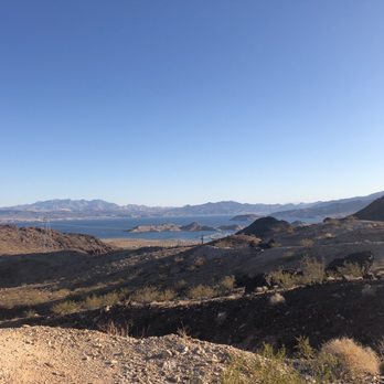


As of Nov 7, 2019. ALL 5 tunnels are open! No fee required, the trail is outside fee station! The parking lot where the trailhead starts was easy to find! It's the next parking lot on the right of Lakeshore Rd after you pass visitor center. The trail head starts on the south side of the parking lot. The trail is scenic and easy for all levels. Still tab hot for me in the middle of the afternoon around 72 degrees but cool down soon after sunset (sunset was around 4:38pm). If you decide to stay late be sure to bring jacket. It's fun passing dark tunnels but spooky at the same time especially when it's getting dark! One coyote was spotted near parking lot when I was leaving! He must had followed me the whole time since people told me they saw a coyote by the tunnel #2! Watch the video from the link below to get some info about this historical railroad trail. https://www.nps.gov/media/video/view.htm?id=482C1A4C-D0EF-9B22-4A94D5DDE5142432A read more

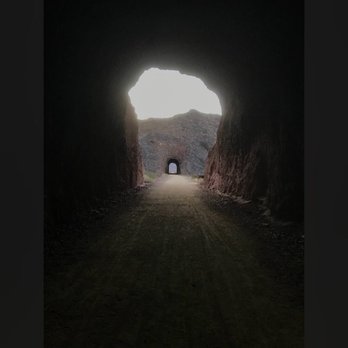


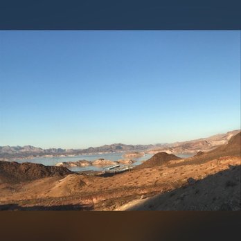

I loved this trail. It's so easy, for all levels! People come with strollers, bikes, dogs. It's a wide sand trail just be careful on the edges. Gorgeous views. Little busy and we noticed that upon arrival, parking lot was full but people parked on the side too. Bathrooms available. Tunnels are cool. We walked until the halfway bathrooms and picnic table and back which took is 1.5h. read more


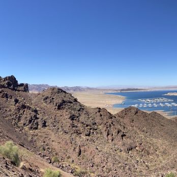


7 years ago
Beautifully maintained, easily walkable or bike-able trail. Although the trail is relatively short the views all along the trail of Lake Mead are amazing. From the trailhead to Hoover Dam is just over 3.5 miles. Although the trail is gravel and slightly uphill you could bring a stroller or wheelchair here. If you're coming in warmer months the trail may be closed due to heat. If you're coming with kids watch them near the edges there are steep drop offs with loose rocks. read more




5 years ago
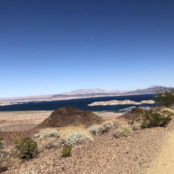
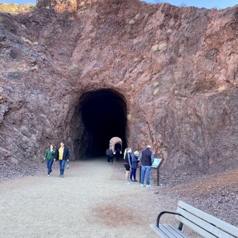
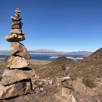
A local bucket list destination that didn't disappoint! Waiting for the right opportunity to hike this historic trail, the views and historical aspect is quite impressive! It's the old path that the train hauling supplies to the building of Hoover Dam ran along. It's impressive from the standpoint of the lack of technology back then, as well as the carving out of the mountains to allow for the train to run constantly 24 hours a day! The walk as you approach the tunnels is quite impressive with its views of Lake Mead in the distance. The tunnels themselves are impressive in their sheer size! Not a hike to do in the summer months due to the extreme weather conditions, but a hike worthy any other time of the year! read more



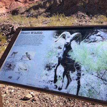
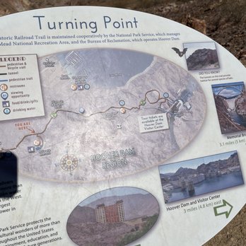
Great trail! I will definitely be doing this trail again and hopefully I'll be able to make it all the way to Hoover dam. I made it 1 mile away and had to turn around because my baby was not going to last the entire trail. It is quite the trail with spectacular views. I came during the week so there would be less people on the trail, so I would not have to wear a mask the entire time. The trail is 8 miles round-trip if you go to Hoover dam. Like all the other reviews show the trail is not paved but it is a smooth Trail so I was able to use a stroller. It is pretty flat most of the way with a little up and down hills. There is very little shade so I recommend going earlier in the day, when it's cooler. Make sure to bring tons of water, good walking shoes, and a hat. There are bathrooms at the halfway point between the start of the trail and Hoover dam. They also have garbage and recycling bins at the halfway point too. The railroad tunnels are not super long or dark so you do not need a flashlight. As I went along the trail I was able to see some lizards and bighorn sheep. I will definitely be doing the trail again and coming early in the morning. One thing to know, the trail is closed during the summer because of extreme heat. read more




7 years ago
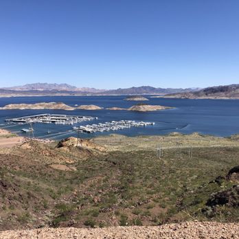
What: Easy, wide, flat trail with beautiful views of Lake Mead and the marina. Easy for non-hikers like me!! The trail goes through 5 huge historic old railroad tunnels all the way to Hoover Dam. As of 3/30/19, tunnel 3 is still closed so we just walked to a little past the 2nd tunnel then turned around (3 miles round trip took about 1.5 hours with two 11 year olds and a dog!) Ambiance: The railroad tracks are gone and the huge tunnels are cool and cavernous. Lining the trail are beautiful flowers, greenery and mountains. The trail is clean and view of lake outstanding. The path is sand/gravel so not smooth enough for me to ride a bike although people do. There is a bench every so often which was nice to take a break and sit down. Parking: Free parking in dedicated small lot past the Visitors Center lot. If that is full (come early like before 10am) then it's easy to circle back and park in Visitors Center lot. Bathrooms: Visitors Center or porta potty by parking lot. There are no restrooms on the trail so go before you go. Dog friendly: Yes! On leashes obviously. Tip: website has great historical info and helpful video to give you an idea of what the trail looks like. This has been on my to do list for almost 3 years. I'm so glad we did this. It's a lovely family outing and March is perfect weather. read more



6 years ago
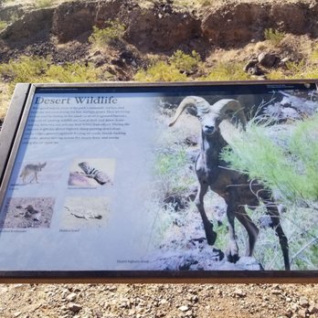
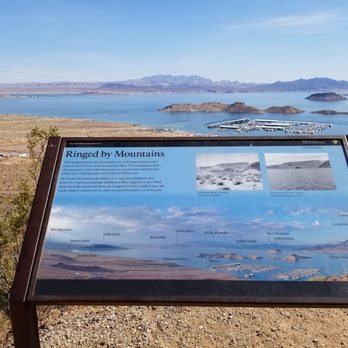
Mood- history with the + of a hike The railroad began under construction in 1931 being worked on 24 hours a day. It was built to quickly haul massive pieces that were needed to construct the Hoover Dam. Four gas locomotives and 9 steam locomotives were used to operate this system. At that time 71 people were in full operation of the tunnels. 6 companies were used to build this system. There are 5 tunnels that are built exactly the same in dimensions. 300 feet in length and 25 feet in diameter. 90 lbs rail construction comprising of Oregon fir ties along with standard gauge built these enormous rails. When the dam was completed in 1935 there was no need for the tunnels anymore. The government would occasionally use the tunnels, but eventually decided to dismantle the line in 1962. In the 1984 the area was added to the National Register of Historic Places, and a trail for a walking tour was announced. This is the only part of the trail that is intact or not underwater. In 1990 tunnel 4 was burned due to arson, tunnel 5 was met with that same demise several years previous in 1978- however was rebuilt and shot over with shotcrete in the summer of 2001. This distance roundtrip is 7.5 miles of very easy grade. This hike is hot in the summer, be mindful of your animals as it is distressing to them when the ground is very hot. Some of the tunnels have bats so if you have issues with white noise bring ear plugs as it will help to lessen the sensitivity you are experiencing. Would thoroughly recommend - pricing is free. Bring lots of water. There are many look out areas with historical interest points and benches with amazing views along the way. Location is Lake Mead/ Lake Mead visitor center parking lot - no fee read more





4 years ago
I'm someone who values living an active life and getting out to enjoy nature. For Christmas 2021, I wanted to do something different. I decided to hike thr railroad trail. It is very easy to get to this trail from Henderson. You just park near the Bible Visitor Center at Lake Mead. The trail is close by. I thought the trail was absolutely beautiful. I had a great time. The history behind the trail, being an old railroad route, was fascinating to learn about. Trains are important and I always enjoy learning more about transportation. The views of Lake Mead are stunning. You can get a great view of the Boulder Beach area. The mountainside is full of ravens who fly around and do a lot of squawking. Going through the railroad tunnels is a thrill. It is really cool how they turned the old railroad into a recreational trail. The trail is gentle and there were a lot of families and disabled people on the hike. It took like an hour to hike all the way to historic Hoover Dam. The hike was totally worth it. It felt great to get away from overcrowded life in Henderson and enjoy nature for a day. I highly recommend this trail. This is undoubtedly one of the greatest tourist attractions in the area. A good time if you like to hike and learn about trains. read more


Hiking is new to us, and this trail is perfect for beginners. We are locals, but it is located about 35 minutes from the strip. There is plenty of parking, both in the lower lot , and at the Visitor Center. It is easy to get to and well marked. There were a variety of people enjoying the trail including couples, families and even Cub Scout groups. We have gone both during the week and on the weekend. There is a trail that takes you approximately 2.5 miles through the tunnels . If you are up to it, you can go an additional 2 miles a day end up at the Hoover Dam. There are clean bathroom facilities at the start, midway through and at Hoover Dam. Bikes and Dogs are allowed on the trail , however if you choose to go on to Hoover Dam, dogs are not allowed. And you will need to park and lock your bike before descending down to the Dam area, but there are bike racks. There are also plenty of benches along the way to sit and just enjoy the scenery overlooking Lake Mead. This is a great place to go to just enjoy the great outdoors that Nevada has to offer. read more


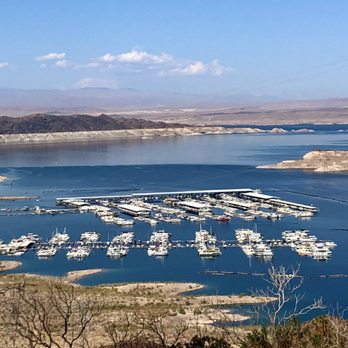
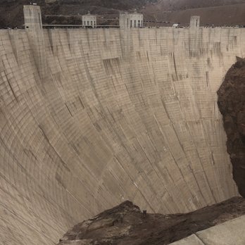

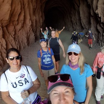


Only got to do part of the trial all the way to the last Tunnel because there was a fence. The trail it self is pretty easy because it is flat all the way The views are nice, you can see Lake mead from the teal and the tunnels are just amazing. I will be back once the teal opens up Allen the way and hike all the way to the Hoover Dam. read more


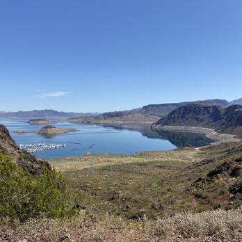


5 years ago
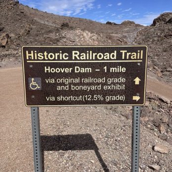
Being a history buff, hiking this trail has added meaning to a nice workout on a smooth surface and with breathtaking view on the lakeside for most of the way. Though not the fault of the trail, the speedy bikes running down the road can be threatening, the lead guy of 4 bikes shouting nasty on us taking pictures in front of Tunnel 2 is an example, very bad manner. Another con: the fork that goes right to Hoover Dam VC has no sigh! We took the "short cut" as was told from the two-bench area, but kept going passing by the boneyard and ended up back to the two-bench! Only then did we realize from Google Maps satellite view about taking the route to the right before boneyard! read more


A wonderful 4 Mile Long Trail that leads to Hoover Dam if you continue on through the Bureau of Reclamation Trail, which is a little rougher than the initial historic railroad Trail. We saw several bighorn sheep on our hike. The view of Lake Mead is astounding! A restroom is on the trail about two-thirds the way up. The five tunnels are a fun part of the walk. The trail ends on the top floor of the parking structure at the cafe. read more


Page 1 of 5
More info about Historic Railroad Trail
Boulder City, NV 89005
Directions
(702) 293-8990
Call Now
Hours
Indoor Amenities
Outdoor Amenities
Ask the Community - Historic Railroad Trail
Do they close during summer?
Although I would not be certain, I would not think they would close at any time of year. It is part of the US National Park Service, so I would think you could walk/hike/run the trail year round. There is no entry point/person to stop you from… Read more
Is the hike wheelchair accessible?
No steps. You go right from the parking lot to trail head. Mostly smooth trail. Weve seen someone with stroller on trail. Don't go on a hot summers day. Take plenty of water and a snack. Parking lot tends to fill up fast. Go earlier. You'll pass… Read more
Review Highlights - Historic Railroad Trail
You might also consider





















Why does Yelp recommend reviews?


Historic Railroad Trail - hiking - Updated May 2026
Best of Boulder City
People found Historic Railroad Trail by searching for…
Dog Friendly Things to Do in Boulder City, NV
Things to Do With Kids in Boulder City, NV
Places to Take Pictures in Boulder City, NV
Natural Hot Springs in Boulder City, NV
Dog Friendly Beaches in Boulder City, NV
Public Running Track in Boulder City, NV
Flower Fields in Boulder City, NV
Hiking Trails in Boulder City, NV
Easy Hikes in Boulder City, NV
Lakes & Ponds in Boulder City, NV
Visitor Centers in Boulder City, NV
Rock Climbing in Boulder City, NV
Cliff Jumping in Boulder City, NV
Sand Dunes in Boulder City, NV
Waterfalls and Swimming Holes in Boulder City, NV
Free Things to Do in Boulder City, NV
Stairs Workout in Boulder City, NV
Bird Sanctuary in Boulder City, NV
Trending Searches in Boulder City, NV
Boat Rental near Historic Railroad Trail
Botanical Gardens near Historic Railroad Trail
Bounce House Rentals near Historic Railroad Trail
Campgrounds near Historic Railroad Trail
Cliff Jumping near Historic Railroad Trail
Dog Friendly Things To Do near Historic Railroad Trail
Flower Fields near Historic Railroad Trail
Flower Shop near Historic Railroad Trail
Garage Sales near Historic Railroad Trail
Hair near Historic Railroad Trail
Lakes near Historic Railroad Trail
Nurseries & Gardening near Historic Railroad Trail
Outdoor Activities near Historic Railroad Trail
Outdoor Furniture Stores near Historic Railroad Trail
Party Equipment Rentals near Historic Railroad Trail
Pedicure near Historic Railroad Trail
Pick Your Own Farms near Historic Railroad Trail
Picnic Areas near Historic Railroad Trail
Places To Walk Around near Historic Railroad Trail
Rainy Day Activities near Historic Railroad Trail
Rock Quarry near Historic Railroad Trail
Running Trails near Historic Railroad Trail
Scenic Drive near Historic Railroad Trail
Secret Spots near Historic Railroad Trail
Strawberry Picking near Historic Railroad Trail
Sunrise View near Historic Railroad Trail
Swimming Holes near Historic Railroad Trail
Table And Chair Rentals near Historic Railroad Trail
Browse Articles
Browse Nearby
BEST of Boulder City, Nevada Coffee near Historic Railroad Trail
BEST of Boulder City, Nevada Restaurants near Historic Railroad Trail
BEST of Boulder City, Nevada Things to Do near Historic Railroad Trail
BEST of Boulder City, Nevada Parks near Historic Railroad Trail
BEST of Boulder City, Nevada Breakfast near Historic Railroad Trail
BEST of Boulder City, Nevada Shopping near Historic Railroad Trail
BEST of Boulder City, Nevada Hotels near Historic Railroad Trail
Browse Brands
Related Searches in Boulder City, NV
Affordable Kayak Rental Services in Boulder City, Nevada
Best Fishing Locations and Guides in Boulder City, Nevada
Best Places for Horseback Riding in Boulder City, Nevada
Best Waterfalls and Swimming Holes in Boulder City, Nevada
Check Out Off Road Trails in Boulder City, Nevada
Discover Dog Friendly Trails to Explore in Boulder City, Nevada
Discover Scenic Mountain Bike Trails Near Boulder City, Nevada
Discover Top Nature Parks to Visit in Boulder City, Nevada
Discover a Hiking Trail in Boulder City, Nevada
Discover the Best Night Hike Trails in Boulder City, Nevada
Discover the Best Running Track in Boulder City, Nevada
Dog-Friendly Hikes With Dogs in Boulder City, Nevada
Enjoy Camping Adventures Around Boulder City, Nevada
Enjoy Exciting Mountain Biking Adventures in Boulder City, Nevada
Enjoy Kayaking Adventures in Boulder City, Nevada
Enjoy Tent Camping Spots Around Boulder City, Nevada
Enjoy the Best Walking Path in Boulder City, Nevada
Enjoy the Best Walking Trails in Boulder City, Nevada
Exciting Cliff Jumping Spots in Boulder City, Nevada
Explore Beautiful Parks and Green Spaces in Boulder City, Nevada
Explore Easy Hikes Perfect for All in Boulder City, Nevada
Explore Fun Activities to Do in Boulder City, Nevada
Explore Popular Campgrounds Near Boulder City, Nevada
Explore Top Dog Parks in Boulder City, Nevada Near You
Explore the Best Beach Spots in Boulder City, Nevada
Explore the Best Boating Spots in Boulder City, Nevada
Explore the Best Trail Options in Boulder City, Nevada
Find Beautiful Views in Boulder City, Nevada
Find Cozy Camping Cabins in Boulder City, Nevada
Find Parks and Recreation Activities in Boulder City, Nevada
Find Popular Ziplining Spots Around Boulder City, Nevada
Find the Best Parks for Picnics in Boulder City, Nevada
Find the Best Scenic View Locations in Boulder City, Nevada
Great Places to Walk in Boulder City, Nevada
Hiking Trails With Waterfalls in Boulder City, Nevada
Off Leash Dog Hiking Trails in Boulder City, Nevada
Plan a Scenic Drive Route Near Boulder City, Nevada
Popular Fishing Spots to Explore in Boulder City, Nevada
Popular Outdoor Activities to Try in Boulder City, Nevada
Popular Picnic Spots to Visit in Boulder City, Nevada
Safe River Swimming Areas in Boulder City, Nevada
Safe and Fun Parks for Kids in Boulder City, Nevada
Top Climbing Spots and Gyms in Boulder City, Nevada
Top Paddleboarding Activities in Boulder City, Nevada
Top Running Trails to Explore in Boulder City, Nevada
Top Swimming Lakes to Enjoy in Boulder City, Nevada
Top Swimming Spots and Pools in Boulder City, Nevada
Top Things to Do With Kids in Boulder City, Nevada
People who viewed Historic Railroad Trail also viewed

Railroad Pass Loop
4 reviews

Wetlands Trail
8 reviews

McCullough Hills Trail
13 reviews

Black Mountain Trail
50 reviews

Park Peak Trail 403
4 reviews

Goldstrike Hot Springs
127 reviews

Lake Mead National Recreation Area -National Park Service
208 reviews

Lake Las Vegas Overlook
2 reviews

Sunrise Mountain/Frenchman Mountain
56 reviews
Sunrise

I-215 East Beltway Trail
2 reviews
Southeast