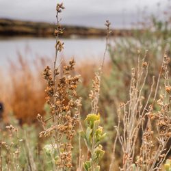
Bear Creek Mountain Photos


More like Bear Creek Mountain
Recommended Reviews - Bear Creek Mountain
Start your review...

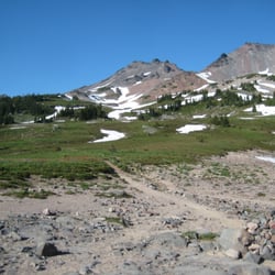
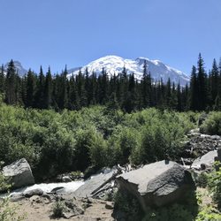
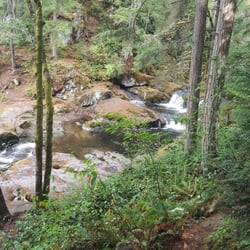
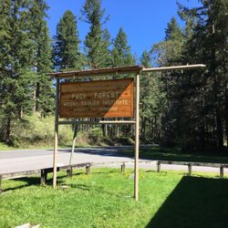
After looking at Bear Creek Mountain on my a map for the last couple years, I finally decided to hike it---two weekends in a row and by two different routes. The first time I did it was from the Section 3 TH. This was a super easy hike, a bit too easy if you're looking for a workout. But it's amazing that you can basically drive up to 6000' and then once you get up on the ridge of Bear Creek Mtn you have THE BEST VIEW of the Goat Rocks!! After this hike I wanted to do it again, but with more of a workout, so I went for the trail from Tieton Meadows. This was unique because the trail has basically been abandoned (there are no signs for this trail). But it's on topo maps. This trail (#1126) was abandoned due to limited access from a road closure due to a bridge failure on Tieton River Rd. in 2011. The road remained closed until 2018. Once I crossed the Tieton river (there's two different downed-tree bridges) so didn't get wet at all, the route-finding began. I basically followed anything I could find...mostly cut trees for access, and pathways/bridges in the bogs of this meadow. Eventually I made it from the valley floor to some pink ribbons & I assumed these were the markers for the trail upward---I roughly knew where the trail would begin up because of drainage/water sources on topo maps. This is when the fun began. You can find full details of the hike in this video: https://youtu.be/RkLSB05lv9k read more


More info about Bear Creek Mountain
404 Pinnacle Dr
Bear Creek Mountain, WA 98377
Directions
Hours
Outdoor Amenities


Bear Creek Mountain - hiking - Updated May 2026
Best of Bear Creek Mountain
Browse Brands
Browse Articles
People found Bear Creek Mountain by searching for…
Things to Do in Bear Creek Mountain, Washington
Easy Hikes in Bear Creek Mountain, Washington
Hiking Trails in Bear Creek Mountain, Washington
Off Road Trails in Bear Creek Mountain, Washington
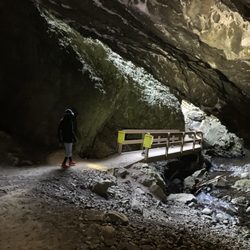
Bridge in Bear Creek Mountain, Washington
Walking Trails in Bear Creek Mountain, Washington
What to Do in Bear Creek Mountain, Washington
People who viewed Bear Creek Mountain also viewed
Grove of the Patriarchs
6 reviews
Pacific Crest Trail at Chinook Pass
3 reviews
Trailhead: South Climb
1 review
Paradise Creek Campground
7 reviews
Mount Aix Trail
1 review
Crystal Peaks Trailhead
2 reviews
Old Snowy Mountain
2 reviews
Box Canyon Overlook
3 reviews
Killen Creek Trailhead
1 review
Gifford Pinchot National Forest
1 review