Ancient Lakes Photos


More like Ancient Lakes
Recommended Reviews - Ancient Lakes
Start your review...

It's not the landscape, the wildlife, the trails or the views. It's the people. Most are perfectly fine and are out there to camp, hike, and fish for the sake of the activities. However, there is a percentage that is there because it's free and remote while still being accessible to a town where they can get their drug of choice. You'll recognize them by the ancient, filthy, motorhomes. My son was hiking with his girlfriend when they were approached by one of these "campers" who asked if they had any fentanyl to sell! Wow! Is there no where to escape this scrounge? Anywhere? read more


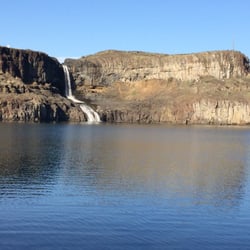
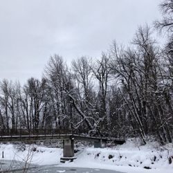
Mileage: estimated about 10 miles total (2 miles to where we set up our tents, then we hiked a loop of about 6 miles, then 2 miles back to the car the next day) Backpacked: April 16-17, 2016 This past weekend a group of us did an overnight backpack trek to Ancient Lakes. 3 first timers backpacking and it turned out to be an awesome trip! We had some problems trying to find directions out to the place, so here's directions from my personal experience. Directions: we stayed in Quincy the night before, so we took the 28 to Whitetail Road. Made a left on Whitetail from the 28, then a right on road 9 NW. follow road 9 NW and it turns into Ancient Lakes Rd NW. At the end of the road, you'll find the west parking lot. I am not sure how to get to the east parking lot. There's a lot of parking here, when we got there by 11 am, it was really crowded but we still found a spot. (When you are on Whitetail Rd, it might look like you are just driving through farms, but buried in there, there's Ancient Lakes!) There is a port-o-potty at the trail head on the west side. Trail head: is well marked, we hiked in about 2 miles and got to the lakes and the rolling grass area where you can set up tent where ever. There are some man made fire rings scattered through out the area. Hiking: After we picked a spot and set up camp, we hiked a loop around the lakes. We started towards the waterfall. It was a scramble up the side of the waterfall, like a class 4 rock scramble lol. Loose rocks, loose footing. From there, we went pass that waterfall and onto the backside where the east parking lot is. Which there's another waterfall there, and there's also camp spots there too. We looped around, it wasn't too hard. We estimated this part of the hike to be around 6 miles round trip back to our tents. Lots of people camping, we counted about 50 tents, then you estimate about 2/per tent, so like 100 people were out here! But you still are able to find solitude. We came across 3 snakes, an owl, and a marmot. Easy trek, not very hilly at all. Good for first time backpackers. The area can be explored in a day. I found this site useful: https://www.theoutbound.com/washington/backpacking/ancient-lakes-day-hike-or-backpack read more


6 years ago
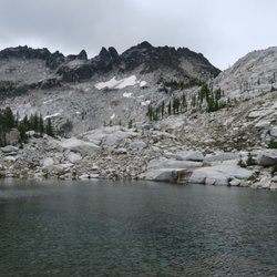
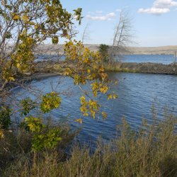
This is a great little lakeside haven in the middle of dry Eastern WA away from the crowds of Crescent Bar or Vantage. There are many different trail areas to backpack into if you are in a tent, and several areas to park campers or car camp as well. Some are right at a lake edge, others like the one we picked was above the lake. In our photos were are camping above Burke Lake and we hiked to Dusty lake. We arrived on a Friday in May and the drive in camping spots were pretty much all taken, but we found one above the lake that was very open and a pretty sunset view at night. Sometimes with free spots like this you can have other rowdy campers plop right down next to you, but this area seemed nice and quiet and plenty spread out. Of course we were camping before the prime season also. If you have kayaks or a canoe these are great lakes for paddling around or for fishing. Bring bug spray as the mosquito are pretty abundant. The hike we did was a nice easy mostly flat walk to the lake. We did encounter a rattlesnake so be on the lookout. We really liked this area and we will definitely be back! read more


10 years ago
More info about Ancient Lakes


Ancient Lakes - hiking - Updated June 2026
Best of Quincy
People found Ancient Lakes by searching for…
Campgrounds in Quincy, Washington
Things to Do in Quincy, Washington
Swimming Holes in Quincy, Washington
Hiking Trails With Waterfalls in Quincy, Washington
Photo Spots in Quincy, Washington
Camping Sites in Quincy, Washington
Watch Sunset in Quincy, Washington
Swimming Lakes in Quincy, Washington
Attractions in Quincy, Washington
Waterfalls in Quincy, Washington
Sunset View in Quincy, Washington
Beautiful Views in Quincy, Washington
Tent Camping in Quincy, Washington
Walking Trails in Quincy, Washington
Fishing Lake in Quincy, Washington
Tourist Attractions in Quincy, Washington
Things to See in Quincy, Washington
Sunrise View in Quincy, Washington
Fishing Spots in Quincy, Washington
Easy Hikes in Quincy, Washington
Trending Searches in Quincy, WA
Amusement Parks near Ancient Lakes
Boat Launch near Ancient Lakes
Boat Rental near Ancient Lakes
Cherry Picking near Ancient Lakes
Cliff Jumping near Ancient Lakes
Fishing Spots near Ancient Lakes
Jet Ski Rental near Ancient Lakes
Kayak Rental near Ancient Lakes
Pick Your Own Farms near Ancient Lakes
Picnic Areas near Ancient Lakes
Public Shower near Ancient Lakes
River Swimming near Ancient Lakes
Strawberry Picking near Ancient Lakes
Swimming Holes near Ancient Lakes
Swimming Lakes near Ancient Lakes
Swimming Pools near Ancient Lakes
Volleyball Courts near Ancient Lakes
Watch Sunset near Ancient Lakes
Browse Articles
Browse Brands
Related Searches in Quincy, WA
Affordable Jet Ski Rental Options in Quincy, Washington
Affordable Long Term RV Parking in Quincy, Washington
Best Boat Launch Spots in Quincy, Washington
Best Fishing Locations and Guides in Quincy, Washington
Best Off Leash Dog Parks in Quincy, Washington
Best Places for Horseback Riding in Quincy, Washington
Best Sledding Spots and Fun in Quincy, Washington
Discover Fun Activities to Do in Quincy, Washington
Discover Fun Recreation Activities in Quincy, Washington
Discover Popular Photo Spots in Quincy, Washington
Discover Top Boat Tours in Quincy, Washington for All Ages
Discover the Best Beaches in Quincy, Washington
Discover the Best Fishing Lake in Quincy, Washington
Dog-Friendly Hikes With Dogs in Quincy, Washington
Enjoy Camping Adventures Around Quincy, Washington
Enjoy Exciting Mountain Biking Adventures in Quincy, Washington
Enjoy Tent Camping Spots Around Quincy, Washington
Enjoy the Best Family Activities in Quincy, Washington
Enjoy the Best Night View Spots in Quincy, Washington
Enjoy the Best Tubing Experiences in Quincy, Washington
Experience Stunning Sunset Views in Quincy, Washington
Experience Thrilling White Water Rafting in Quincy, Washington
Explore Beautiful Parks and Green Spaces in Quincy, Washington
Explore Bike Rentals Throughout Quincy, Washington
Explore Free Things to Do Around Quincy, Washington
Explore Popular Boat Charters Near Quincy, Washington
Explore Popular Campgrounds Near Quincy, Washington
Explore Popular RV Parks Around Quincy, Washington
Explore Popular View Points Around Quincy, Washington
Explore Scenic Lakes to Visit in Quincy, Washington
Explore Top Water Parks in Quincy, Washington Today
Explore Volleyball Courts Available in Quincy, Washington
Explore the Best Boating Spots in Quincy, Washington
Explore the Best Swimming Holes Around Quincy, Washington
Family Friendly Hiking With Kids in Quincy, Washington
Find Beautiful Views in Quincy, Washington
Find Fun Things to Do With Kids in Quincy, Washington
Find Top Dog Swimming Spots in Quincy, Washington
Find the Best Scenic View Locations in Quincy, Washington
Find the Best Swimming Pools in Quincy, Washington Today
Great Places to Swim in Quincy, Washington
Hiking Trails With Waterfalls in Quincy, Washington
Must-See Tourist Attractions Around Quincy, Washington
Perfect Spots to Watch Sunset in Quincy, Washington
Popular Fishing Spots to Explore in Quincy, Washington
Popular Kids Activities in Quincy, Washington
Popular Picnic Spots to Visit in Quincy, Washington
Popular Things to Do in Quincy, Washington
People who viewed Ancient Lakes also viewed
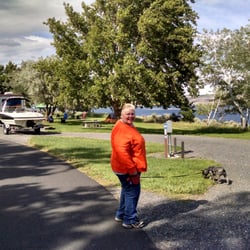
Wenatchee Confluence State Park
28 reviews
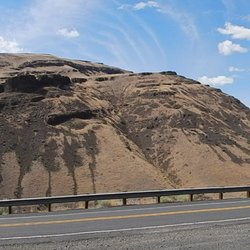
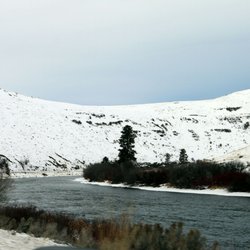
Yakima Canyon
3 reviews
Wells Dam Reservoir Recreation
3 reviews
Ginkgo Interpretive Trails
5 reviews
Ellensburg Angler
14 reviews
Vantage Boat Launch
1 review
Olmstead Place State Park
3 reviews
Kinship Trail Rides
4 reviews
City Of Vantage
2 reviews
Oasis Rv Park & Golf
20 reviews