Arrow Canyon Photos


You might also consider
More like Arrow Canyon
Recommended Reviews - Arrow Canyon
Start your review...

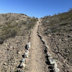
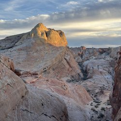
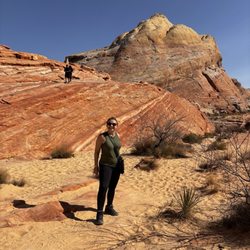
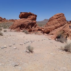
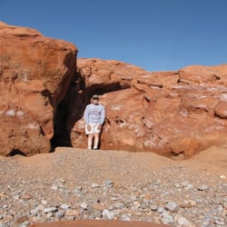
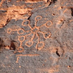
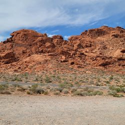
It has been 15 years since the first time I hiked Arrow Canyon and I didn't remember how hard it is on the feet. First off, follow April's directions. They are spot on. At one time there was a dispute about the right of way to get to the canyon. The owner of the house attempted to block people from using the road around his house. It is a public road because it goes to a community well. Stay on the dirt road and don't go on any of the red dirt that are his two driveways. Just before the well house, the access road makes a right and goes down a short grade. Beyond here is the low clearance parking. Don't go further unless you have a high clearance vehicle. 4 wheel drive is not needed. As you start the hike from the trailhead, you'll notice that there's a lot of gravel and some large rocks. For the first part of the hike to the slot canyon, there are use trails on thje higher ground where there are brown weeds. Use these trails--your feet will thank you. When you get to the slot canyon, you have to walk on the rocks. After entering the rock canyon, look to your right and you'll see some Indian petroglyphs but also a lot of names scratched into the rocks by people who have hiked the canyon. The genuine rock art is generally lighter in definition because of repatination. The lighter figures and drawings are newer and are not genuine Indian rock art. The hike continues and you come to an area where a side canyon enters the main one. Don't turn left--keep going straight around the large mound of large rocks washed there in flash flooding. You'll soon come to what's known as Swamp Cave, a climbing destination. The rock face has a lot of bolts and carabiners into which the climbers string their ropes. About a mile from the cave, you get to the halfway point when you reach the check dam built by the CCC in the 1930s. This is the end of the hike for most people although there's a rope and a fixed bolt on the rock for those who want to get to the top of the dam. I do not recommend that. You never know the age or condition of the rope. Take the time for a snack at the dam. Then head back to your car. The hike is listed as 5 miles. The two of us each had 5.9 miles on our wrist measuring devices. Arrow Canyon is an historical place and a good hike. Treat the history well. Also, wear hiking boots. Don't try to hike this in sneakers unless you want very sore feet. Happy hiking! read more


We have done this hike at least once a year for the last 3 years, the first time we used a car so the hike was much further but if you use a high clearance vehicle you can get to the actual trailhead. If coming from Vegas, take 15 North to the Glendale exit near Moapa, take Route 168 about 11 miles until you see a house alone on the left with a gate to a dirt road. The dirt road will take you around the house to the road you will need a high clearance vehicle for, it's windy and rocky so be careful but it takes you to the trailhead, you can't drive any further. We've been the only people out here hiking at times so make sure your prepared for anything. The hike round trip is about 5 miles, pretty much no elevation change. There is a slot canyon section with petroglyphs so keep your eyes open as not to miss a thing. The turn around point is a dam, if you're a rock climber you can probably go further but we have our dog with us and never have. It can get muddy since it's basically a wash but the majority of the trail is rock. It's a fun and interesting hike...I can't believe it's not on here, I want to keep it to myself but I want you to experience it as well! read more


More info about Arrow Canyon
Moapa, NV 89025
Directions
Hours
Outdoor Amenities


Arrow Canyon - hiking - Updated July 2026
Best of Moapa
People found Arrow Canyon by searching for…
Hiking Trails in Moapa, Nevada
Off Road Trails in Moapa, Nevada
Walking Trails in Moapa, Nevada
Hiking Groups in Moapa, Nevada
Beautiful Views in Moapa, Nevada
Fishing Spots in Moapa, Nevada
Swimming Lakes in Moapa, Nevada
Places to Visit in Moapa, Nevada
Places to Walk at Night in Moapa, Nevada