Cancel

Open app

Search

Mesquite Regional Park Trailhead

3.0 (1 review)

Mesquite Regional Park Trailhead Photos
You might also consider

More like Mesquite Regional Park Trailhead

Recommended Reviews - Mesquite Regional Park Trailhead

Your trust is our priority, so businesses can't pay to alter or remove their reviews. Learn more about reviews.
Yelp app icon
Browse more easily on the app
Review Feed Illustration

8 months ago

Helpful 0
Thanks 0
Love this 0
Oh no 0

You might also consider

Verify this business for free

Get access to customer & competitor insights.

Verify this business

Paria Canyon-Vermilion Cliffs Wilderness - Wire Pass slot

Paria Canyon-Vermilion Cliffs Wilderness

5.0(1 review)
58.6 km

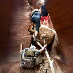
Paria Canyon-Vermillion Cliffs is a designated wilderness area within the Vermillion Cliffs…read moreNational Monument, which straddles the border between Utah and Arizona and is approximately 40 miles East of Kanab, UT. This wilderness area wraps around the northern side of the monument and encompasses the Paria River canyon and other smaller, connected canyons. It is also the site of the famous landmark known as "The Wave," though that area (called 'Coyote Buttes North') is only accessible via permit; and such a permit can only obtained via a lottery system. But if, like us, you don't win that lottery, this beautiful area still has plenty to offer, namely: stunning slot canyon hiking. PCVC wilderness area is accessible via three trail-heads on two different roads off Hwy 89. We chose the Wire Pass trail-head off House Rock Road, which involved just over 20 miles of driving on a winding, sandy (and sometimes rutted) dirt road off the highway. (Note: this road is not passable after heavy rain). Our destination was the Paria River canyon itself, which can be reached from the the trail-head by passing through Wire Pass. Long story short, our hike was beautiful. Wire Pass itself narrowed from a wide 'wash' to a narrow slot canyon about 50 ft high, and we could feel the temperature drop about 10 degrees as we entered the latter. There was at least one semi-treacherous spot where a steep, blind climb-down over a large rock was required (I was glad to have long legs). The canyon opened up a bit at the confluence with Paria River canyon, before transforming again into a wider but much deeper slot canyon downstream. But due to the dangers of flooding in this narrow space, we ended up turning back before our planned turnaround point, since we sighted (and heard) some big thunderheads about 20 miles or so upstream. (We agreed not to die of stupidity). But we still had a great day. Other things you should know before visiting Paria Canyon-Vermillion Cliff Wilderness: -- A permit is needed for backpacking overnight in Paria Canyon -- Don't think you can just sneak over to 'The Wave' without a permit. It is patrolled daily; and fines range from $1k to $10k. They've even been known to impound vehicles -- If hiking a long distance in Paria canyon, you will get wet; wading through some deep pools may be required (so bring water shoes and hiking poles) -- All poop must be packed out (You heard me) -- Local monsoon season is June - Sept; best avoided for flash flooding

Photos
Paria Canyon-Vermilion Cliffs Wilderness - Obstacle in Wire Pass

Obstacle in Wire Pass

Paria Canyon-Vermilion Cliffs Wilderness - Paria Canyon slot

Paria Canyon slot

Paria Canyon-Vermilion Cliffs Wilderness - @conjunction of Wire Pass and Paria River

See all

@conjunction of Wire Pass and Paria River

Valley of Fire State Park - Desert Beauty

Valley of Fire State Park

4.8(757 reviews)
54.3 km

I stayed here for 3 nights at Arch Rock Campground. There are other campgrounds Atlatl Rock…read moreCampground and group camping areas. Arch Rock Campground is well kept and clean. There are vault bathrooms (no flush). No showers available, you need to drive over to Atlatl Campground. Each campground had water source which is great, and shade structure! Very important since most of the area is exposed to the sun. Beautiful state park, the scenery is breath taking! Definitely worth a trip out here to visit. There are many different hiking trials, all within driving distance. A few of our favorites are the Elephant Rock Loop, White Domes Loop Trail, & Fire Wave! You can book a campground through the Nevada state website; it also has other resources available such as entrance fees, weather, tips, etc.

VOF state park is DEF one of the cooler state parks in not just Nevada, but the US! The landscapes…read moreare beautiful, and very unique. I've not been to the wave but I have been to other slot canyons/antelope canyon, and the ring of fire trail leading to the scenic view of the fire wave is reminiscent of it!! There was also a pink sand slot canyon along that trail if you do the full loop (called the Pastel (pink) canyon trail). It's super cute and very unique, I did not see any other landforms quite like it on my road trip through Utah! Another short trail I enjoyed was the rainbow view trail - it's not long at all and is just a generally pretty, pink sand trail to a nice viewpoint. And the iconic valley of fire road view actually is just past this trailhead on your way back toward the main road (driving away from ring of fire trail). DO BE AWARE it gets hotter THAN out here. They have signs up at several trailheads that essentially say "drink water, you could die." I went on a day in April and it wasn't too bad, but it was still hot enough I was sweating a bit by the time I returned to my car, and it got VERY hot inside the car as well and took a hot minute to cool down. Overall though: this is one state park that is so unique it is absolutely worth traveling off the beaten path and the $10 entry fee to visit. The visitor center is also super nice and has lots of fun learning exhibits!

Photos
Valley of Fire State Park - A ram right off the side of the road

A ram right off the side of the road

Valley of Fire State Park - "Beehives"

"Beehives"

Valley of Fire State Park - Beautiful visitor center

See all

Beautiful visitor center

Little Finland - More petroglyphs

Little Finland

5.0(2 reviews)
39.9 km

I originally found out about this place from a site I follow on Facebook, Roadtrippers (awesome…read moresite, by the way) and I had one of those, "what the" moments finding out this place is a quick 90-120 minutes away from where I live. A quick drive up I-15N and exit #112, Bunkerville (this is just south of Mesquite), and follow the signs to Whitney Pockets. You will the infamous Bundy Ranch area. The road is paved until you hit the Whitney Pockets area, then a HCV vehicle is needed. I did see a passenger car attempting to drive thru here, I guess it could be done, but it's not a place I would want to get stuck. Once you hit the trailhead area, you'll see a large red sandstone wall in the middle of nowhere. This is where you park. There are some really cool, preserved petroglyphs on the wall here. Make sure you look up to see them, they're kind of high up. From there it's a walk on a dirt road and dry wash to the area. There aren't any marking or cairns for the turnoffs to hit the trail to Little Finland, so it's best to go with someone who has been before, or do your research. The area is pretty darn cool. The sandstone rock formations get the name from wind and erosion that has made the made the rock appear to have fins. The area is really delicate, so be careful not to ruin what nature and time has created. Once you're in Litle Finland, there are more petroglyphs as well as some running water through the area. The minerals in the water made the water and rock turn colors, the entire area made me think I was on Mars. If you've ever been to Goblin Valley State Park, this is a miniature version of it. It's a pretty cool day trip.

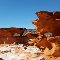
Little Finland (aka Hobgoblin's Playground and Devil's Fire) is a magical place where wind and…read morewater have sculpted red sandstone rock into fantastical shapes. I just explored this unique area with my boyfriend and a group of hikers today. Located in a remote portion of the remote Gold Butte region of southeastern Nevada ( south of Mesquite), Little Finland was a challenge to get to...about an hour on bumpy unpaved road but well worth the effort. The rocks there are very ornate and delicate, so please becareful. If you are driving north on I-15 from Las Vegas, exit at #112 (Riverside / Bunkerville), turn right and go 3 miles to cross the Virgin River. Make a right turn at the next road (Gold Butte Road), drive twenty miles on loud bumpy pavement, becareful of the free range cows, the hit the graded dirt road for four more miles. Finally, turn right at the sign that indicates Red Bluff Springs and drive four more miles on a sandy uneven dirt road that requires a high clearance vehicle. This is your day long adventure, make sure you go prepared. Bring warm clothing, gloves, hat, lots of water, a snack or lunch, sturdy boots and most of all bring your camera! The most fascinating thing about this place is the fantasyland of shapes--almost every rock appears to be an animal, face, or mythical creature. It is mixed in with the intricate red rock sculptures are fields of virtually white sandstone with sinuous waves, remnants of ancient sand dunes. In other places, the rock is covered with a thin white crust--salt that has crystallized out of groundwater running through the rock. Go see it to believe it!

Photos
Little Finland
Little Finland
Little Finland - Petroglyphs (I made it black and white, the sun was blurring the pictures)

See all

Petroglyphs (I made it black and white, the sun was blurring the pictures)

White Domes - Majestic views

White Domes

4.5(28 reviews)
50.0 km

A truly fantastic hike with changing scenic views along the way. The trail is also ever changing,…read morefrom sand, to packed dirt, to rocky/gravel, and steep stone steps. I personally recommend doing this trail counterclockwise. We're in our 30s, but my husband has bad knees and I get lower back pain; we find that the steep stone steps are far easier to go up than down. Having a walking stick while climbing the steps is also helpful. You will see some incredible things while hiking this trail. The texture on the rocks, the multitude of colors, windows, slot canyons, a portion of an old movie set, and some grand majestic views. Being an avid hiker and having hiked 80% of the trails within Valley of Fire, I'd consider this to be a moderate hiking trail. Note: There is a small covered picnic area with 4 tables as well as 4 gender neutral vault toilets near the start of this trail and next to the parking lot.
Amazing hike with beautiful scenery and moderate level…read more Starting out into the hike you have to walk through some sand which doesn't sound hard but it's actually strenuous on your body. Follow that down through some rocky man-made type rock stairs past an old movie set where you feel like you're in Star Wars Then follow that to the slot canyon. The slot Canyon is my favorite part of the hike. Very beautiful and unique. We just took our time going through the hike as we had some friends with us who were inexperienced hikers and we wanted to make sure everyone got through safely. I could've gone onto a few more hikes that day, but they were pretty tired. I will definitely go back here again. This was my second or third time here.

Photos
White Domes
White Domes
White Domes - Slot canyon

See all

Slot canyon

Red Reef Trail

Red Reef Trail

4.9(11 reviews)
79.9 km

You can use your national park pass to avoid the fee here. You just have to display it on your…read moredash. Maps took us like 2 miles north, then back track to the tunnel to get in. Not sure if that was the best way or not. The parking lot is not huge, and you can't park in the designated camping area spots. There are plenty of picnic tables, probably more than parking spaces. There are at least 20 tables there. There are a few trails to choose from. Very close the parking and campsites is a short 1/4 hike (or shorter) to the dinosaur prints. There is a hike in the other direction to the mini waterfall and pond. Probably about a mile or a little over a mile (1direction). We also found an old almost petrified bristlecone tree (that was neat). We got lucky with the weather for Dec, it was probably about 60 degrees and very nice. I saw that in the summer it can be over 110 so I am glad that we got the nice weather. The red /orange scenery is spectacular and representative of the area, like it is at zion, bryce, snow canyon, pioneer park, etc. We enjoyed a picnic lunch there, and we had a blue bird, a scrub jay, come join us and beg for food. Check out my photos.

+++++++++++++++++++++++++++++ DO NOT FOLLOW THE YELP…read moreDIRECTIONAL MAP TO GET HERE! +++++++++++++++++++++++++++++++ To reach the Red Reef trailhead, take Exit 23 off Interstate 15 S and head east on Red Cliffs Campground Road. The trailhead is located at the campground, which is about 5 miles down the paved road. GPS Coordinates: 37.224794, -113.406300 It is $5 to park your car here in the parking lot, follow directions to the trail. It is a beautiful and easy hike - until the very end. it meanders along a path - then at the end you need to climb some pretty big rocks to see the payoff of the beautiful canyon. We loved this hike. (but were thrown off by the Yelp directions that sent us in an alternate direction.

Photos
Red Reef Trail
Red Reef Trail
Red Reef Trail

See all

Moapa Valley National Wildlife Refuge

Moapa Valley National Wildlife Refuge

4.5(6 reviews)
52.3 km

The refuge is administered by the US Fish and Wildlife Service. Since this is a remote area, there…read moreis no visitor center nor rangers as one sees in other refuges or national parks and recreation areas. Instead, it is "staffed" by volunteers for US Fish and Wildlife. The area once had a number of resorts because of the warm spring waters. At one time, much of the area was owned by Howard Hughes. Supposedly he bought the land after seeing it from a plane flying over the area. This is home to a wonderful display about the endangered Moapa dace, a small fish with two fins on the bottom of the stomach. There is an area where there is warm spring water from above that flows through a specially constructed exhibit that allows the fish to live in the stream but also allows visitors to see the fish through the glass. After seeing the two dace that were in the one section (pointed out to us by one of the volunteers), we started a walk around the refuge. It is enjoyable to see how creatively they used the terrain to create this refuge and to protect the dace. We did not hike to the viewpoint at the top of the hill, but saved that for another visit when the need to visit a riparian area beckons us. This is out of the way for most people to bother with, but it's a super way to leave Las Vegas and enjoy the rural setting and the water.

The refuge is a very quiet and peaceful place, seemingly away from the hustle and bustle of Las…read moreVegas and any loud noises or crowds of people. It is not open in the summer months past May (I can see why as that area gets hot!). It is much smaller than other refuges located within a few hours of Vegas, but still nice to visit. I recommend bringing a lunch and sitting on top of the hill and taking in the nice views from there. One draw of this refuge is the moapa dace, a fish on the brink of extinction and unique to this area. There is a viewing water tank where you can see these in their natural habitat and it is so fascinating and neat to see! There are restrooms here and volunteer rangers; the rangers we saw were both very nice and informative. Great escape from the city for an afternoon!

Photos
Moapa Valley National Wildlife Refuge

See all

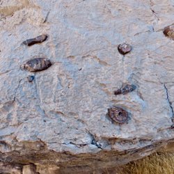
Arrow Canyon - Sponge fossils in the rock.

Arrow Canyon

5.0(2 reviews)
42.5 km

It has been 15 years since the first time I hiked Arrow Canyon and I didn't remember how hard it is…read moreon the feet. First off, follow April's directions. They are spot on. At one time there was a dispute about the right of way to get to the canyon. The owner of the house attempted to block people from using the road around his house. It is a public road because it goes to a community well. Stay on the dirt road and don't go on any of the red dirt that are his two driveways. Just before the well house, the access road makes a right and goes down a short grade. Beyond here is the low clearance parking. Don't go further unless you have a high clearance vehicle. 4 wheel drive is not needed. As you start the hike from the trailhead, you'll notice that there's a lot of gravel and some large rocks. For the first part of the hike to the slot canyon, there are use trails on thje higher ground where there are brown weeds. Use these trails--your feet will thank you. When you get to the slot canyon, you have to walk on the rocks. After entering the rock canyon, look to your right and you'll see some Indian petroglyphs but also a lot of names scratched into the rocks by people who have hiked the canyon. The genuine rock art is generally lighter in definition because of repatination. The lighter figures and drawings are newer and are not genuine Indian rock art. The hike continues and you come to an area where a side canyon enters the main one. Don't turn left--keep going straight around the large mound of large rocks washed there in flash flooding. You'll soon come to what's known as Swamp Cave, a climbing destination. The rock face has a lot of bolts and carabiners into which the climbers string their ropes. About a mile from the cave, you get to the halfway point when you reach the check dam built by the CCC in the 1930s. This is the end of the hike for most people although there's a rope and a fixed bolt on the rock for those who want to get to the top of the dam. I do not recommend that. You never know the age or condition of the rope. Take the time for a snack at the dam. Then head back to your car. The hike is listed as 5 miles. The two of us each had 5.9 miles on our wrist measuring devices. Arrow Canyon is an historical place and a good hike. Treat the history well. Also, wear hiking boots. Don't try to hike this in sneakers unless you want very sore feet. Happy hiking!

We have done this hike at least once a year for the last 3 years, the first time we used a car so…read morethe hike was much further but if you use a high clearance vehicle you can get to the actual trailhead. If coming from Vegas, take 15 North to the Glendale exit near Moapa, take Route 168 about 11 miles until you see a house alone on the left with a gate to a dirt road. The dirt road will take you around the house to the road you will need a high clearance vehicle for, it's windy and rocky so be careful but it takes you to the trailhead, you can't drive any further. We've been the only people out here hiking at times so make sure your prepared for anything. The hike round trip is about 5 miles, pretty much no elevation change. There is a slot canyon section with petroglyphs so keep your eyes open as not to miss a thing. The turn around point is a dam, if you're a rock climber you can probably go further but we have our dog with us and never have. It can get muddy since it's basically a wash but the majority of the trail is rock. It's a fun and interesting hike...I can't believe it's not on here, I want to keep it to myself but I want you to experience it as well!

Photos
Arrow Canyon - The slot canyon

The slot canyon

Arrow Canyon - Some cairns put up by someone with a sense of humor.

Some cairns put up by someone with a sense of humor.

Arrow Canyon - The wrong way!

See all

The wrong way!

Mesquite Regional Park Trailhead - hiking - Updated May 2026

Loading...
Loading...
Loading...