West Warwick Greenway Photos


More like West Warwick Greenway
Recommended Reviews - West Warwick Greenway
Start your review...

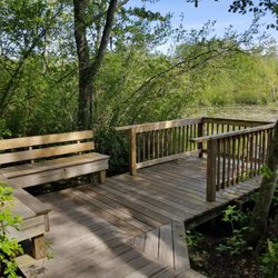
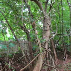
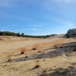
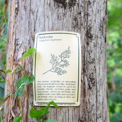
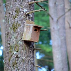
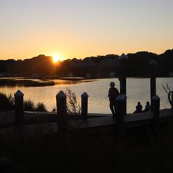
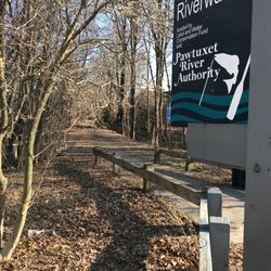
The West Warwick Greenway is part of the RI Rail Trail/Trestle Trail, the Washington Secondary Bike Path and the East Coast Greenway. All at the same time. Parking to enter the trail at this location is behind Horgan Elementary School, near the public tennis courts and skate park. There is also a red caboose to the east of the parking lot that you can explore. A homage to the Hartford, Providence and Fishkill Railroad that once ran along this pathway. Walking or riding to the south and west, the trail leads toward the Coventry Greenway which is often tree covered, passes a couple of ponds, crosses bridges, runs near two historic homes you can tour, at least two cemeteries and a conservation area. This trail ends about six miles before the CT State line in Coventry, RI. Heading to the north and east, leads to downtown West Warwick and offers a more urban excursion. The path often follows the road in this area, crosses some busy streets and is a nice way to access downtown businesses and government offices. Ultimately the north/east direction will lead you into Cranston and further on into downtown Providence. The entire pathway is paved making it an excellent outing for wheelchairs (motorized or otherwise), strollers, walkers, bikes and pedestrians alike. Walk on the left, ride on the right. If you bring your pup, keep it on a leash and take home any 'gifts' they make. There are normally no facilities along the route, but from time to time you will find a port-a-john in a parking area or stop in one of the businesses to buy an ice cream or pop and use their restroom. There are benches placed along the route at uneven intervals and from time to time you'll see old train tracks, a platform, switches and telegraph poles still visible next to the trail. The trails are well maintained with fence repair work and rain mitigation ongoing. The pathways are not cleared of snow and ice and may be closed if the weather has been inclement. read more

More info about West Warwick Greenway


Why does Yelp recommend reviews?
1 review that is not currently recommended
The reviews below are not factored into the business's overall star rating.
2 years ago
West Warwick Greenway - hiking - Updated July 2026
Best of West Warwick
People found West Warwick Greenway by searching for…
Playgrounds in West Warwick, RI
Running Trails in West Warwick, RI
Walking Trails in West Warwick, RI
Things to Do in West Warwick, RI
Hiking Trails in West Warwick, RI
Places to Take Pictures in West Warwick, RI
Things to Do on a Rainy Day in West Warwick, RI
Lakes & Ponds in West Warwick, RI
Urban Exploration in West Warwick, RI
Fun Things to Do at Night in West Warwick, RI
Swimming Lakes in West Warwick, RI
Scenic View in West Warwick, RI
Attractions in West Warwick, RI
Secluded Spots in West Warwick, RI
Stroller Walk in West Warwick, RI
Bike Paths in West Warwick, RI
Parking Lot in West Warwick, RI
Waterfalls in West Warwick, RI
Browse Nearby
BEST of West Warwick, Rhode Island Restaurants near West Warwick Greenway
BEST of West Warwick, Rhode Island Coffee near West Warwick Greenway
BEST of West Warwick, Rhode Island Things to Do near West Warwick Greenway
BEST of West Warwick, Rhode Island Parks near West Warwick Greenway
BEST of West Warwick, Rhode Island Breakfast near West Warwick Greenway
BEST of West Warwick, Rhode Island Shopping near West Warwick Greenway


