
Flat Top Park Photos


You might also consider
More like Flat Top Park
Recommended Reviews - Flat Top Park
Start your review...

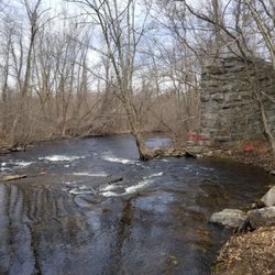
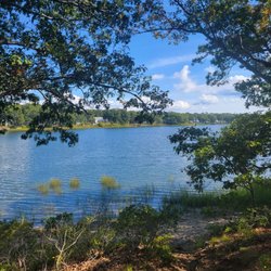
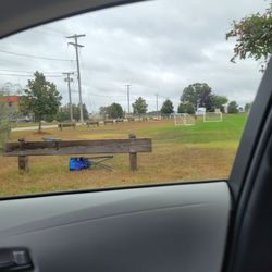
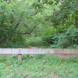
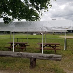
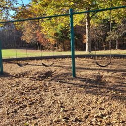
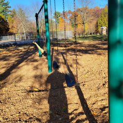
Looking for a walking path closer to home (gas prices!) I stumbled upon this little park close enough to walk from our home. I've driven by plenty of times, but thought it was just a ball field. An old play set has been removed, leaving just the benches, a picnic table and some concrete supports on the ground. (Wonder if they plan to replace it.) The ball field is in good shape and looks like it could be used for little league. The grass is mowed and a port-a-potty is located by the park entrance. We had a bit of trouble finding the path, which is right off the parking lot! It is marked with a blue blaze and includes some planked areas that are low and wet. The path is pretty well cleared, but some area need additional clearing, and even though the park signs say 'no dogs', there is dog feces all along the trail, so do watch your step. This is a rugged path, with lots of roots sticking up, plenty of wet areas to walk around and a few limbs to watch out for. At about .25 miles, it's a quick jaunt, or take the walk around the ball field first, and get in a half mile. Walking down from my house will give me a good couple of miles. There are sidewalks along New London Turnpike to keep you out of traffic. read more


More info about Flat Top Park
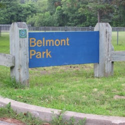
1891 New London Turnpike
West Warwick, RI 02893
Directions
Hours
Outdoor Amenities


Flat Top Park - hiking - Updated July 2026
Best of West Warwick
People found Flat Top Park by searching for…
Walking Trails in West Warwick, RI
Hiking Trails in West Warwick, RI
Little League Baseball in West Warwick, RI
Things to Do in West Warwick, RI
Places to Take Pictures in West Warwick, RI
Picnic Areas in West Warwick, RI
Dog Swimming in West Warwick, RI
Running Trails in West Warwick, RI
Picnic Tables in West Warwick, RI
Watch Sunset in West Warwick, RI
Photo Spots in West Warwick, RI
Easy Hikes in West Warwick, RI
Dog Friendly Trails in West Warwick, RI
Night Hike in West Warwick, RI
Amateur Sports Teams in West Warwick, RI
Bike Paths in West Warwick, RI
Dog Walking Areas in West Warwick, RI
Playgrounds in West Warwick, RI
Lakes & Ponds in West Warwick, RI
Waterfalls in West Warwick, RI
Browse Nearby
BEST of West Warwick, Rhode Island Restaurants near Flat Top Park
BEST of West Warwick, Rhode Island Coffee near Flat Top Park
BEST of West Warwick, Rhode Island Things to Do near Flat Top Park
BEST of West Warwick, Rhode Island Parks near Flat Top Park
BEST of West Warwick, Rhode Island Breakfast near Flat Top Park
BEST of West Warwick, Rhode Island Lakes near Flat Top Park
BEST of West Warwick, Rhode Island Campgrounds near Flat Top Park
BEST of West Warwick, Rhode Island Taxis near Flat Top Park
BEST of West Warwick, Rhode Island Day Trips near Flat Top Park


