Trott-Perry Land Preserve Photos


You might also consider
More like Trott-Perry Land Preserve
Recommended Reviews - Trott-Perry Land Preserve
Start your review...

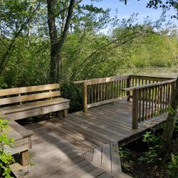
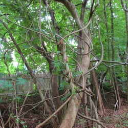
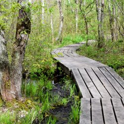
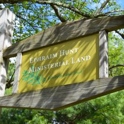
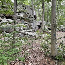
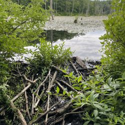
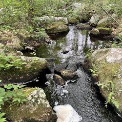
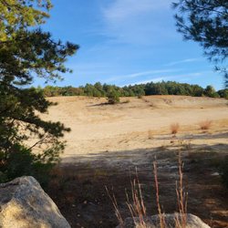
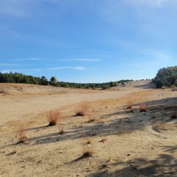
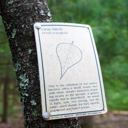
At the north end of Hope Village lies the Trott-Perry Land Preserve, a beautiful greenspace open to the public. Managed by Hope Associates, Inc., this land includes nature trails, access to the Pawtuxet River, and a baseball field. The parcel was acquired in the 1990s by Drs. Raymond H. Trott and Thomas Perry. Look carefully as you drive through town and you will find North Doctor's Lane. There is a large parking area for Doctor's Field where the trailhead begins. I was pleasantly surprised by the beauty of the rolling landscape. At approximately 3/4 of a mile, the red-blazed trail packs a punch with groves of oak, maple, cedar, pine, birch, sassafras and so much more! I saw a number of white-tailed deer and birds during my time here. There is a rope swing set up at the eastern bank of the Pawtuxet. A peaceful jaunt through the woods. Worth checking out if you are in the area! read more


More info about Trott-Perry Land Preserve
60 S Doctors Ln
Hope, RI 02831
Directions
Hours
Outdoor Amenities
You might also consider


Trott-Perry Land Preserve - hiking - Updated May 2026
Best of Hope
People found Trott-Perry Land Preserve by searching for…
Rope Swing in Hope, Rhode Island
Hiking Trails in Hope, Rhode Island
Playgrounds in Hope, Rhode Island
Walking Trails in Hope, Rhode Island
Things to Do in Hope, Rhode Island
Running Trails in Hope, Rhode Island
Waterfalls in Hope, Rhode Island
Scenic Views in Hope, Rhode Island
Jogging Trails in Hope, Rhode Island
Off Road Trails in Hope, Rhode Island
Bike Paths in Hope, Rhode Island
Stuff to Do in Hope, Rhode Island
Stroller Friendly Hikes in Hope, Rhode Island
Off Leash Dog Hikes in Hope, Rhode Island
Fall Foliage in Hope, Rhode Island
Watch Sunset in Hope, Rhode Island
Places to Take Pictures in Hope, Rhode Island
Sunset View in Hope, Rhode Island
Camping & Campsites in Hope, Rhode Island
Browse Nearby
BEST of Hope, Rhode Island Restaurants near Trott-Perry Land Preserve
BEST of Hope, Rhode Island Coffee near Trott-Perry Land Preserve
BEST of Hope, Rhode Island Things to Do near Trott-Perry Land Preserve
BEST of Hope, Rhode Island Breakfast near Trott-Perry Land Preserve
BEST of Hope, Rhode Island Botanical Gardens near Trott-Perry Land Preserve
BEST of Hope, Rhode Island Hotels near Trott-Perry Land Preserve
BEST of Hope, Rhode Island Wineries near Trott-Perry Land Preserve
Browse Brands
Browse Articles
People who viewed Trott-Perry Land Preserve also viewed
Briggs Boesch Farm
8 reviews
Yawgoo Pond Trail
2 reviews
Queen's River Nature Preserve
2 reviews
Snake Den State Park
8 reviews
Martin Wildlife Refuge
1 review
Wolf Hill Forest Preserve
21 reviews
Mowry Conservation Area
7 reviews
West Warwick Greenway
1 review
Mount Tom Trail
6 reviews
Weetamoo Woods & Pardon Gray Preserve
10 reviews