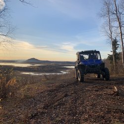
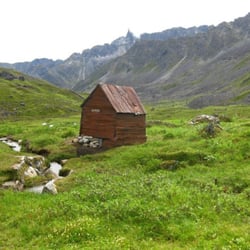
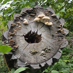
West Butte Trail Photos


You might also consider
More like West Butte Trail
Recommended Reviews - West Butte Trail

More info about West Butte Trail
15702 Mothershead Ln
Palmer, AK 99645
Directions
Visit Website
http://www.matsugov.us
Hours
Outdoor Amenities

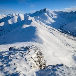


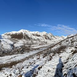


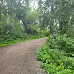
West Butte Trail - hiking - Updated July 2026
Best of Palmer
People found West Butte Trail by searching for…
Trending Searches in Palmer, AK
Boat Rental near West Butte Trail
Day Trips near West Butte Trail
Dog Friendly Trails near West Butte Trail
Kayak Rental near West Butte Trail
Off Road Trails near West Butte Trail
Public Pools near West Butte Trail
Public Shower near West Butte Trail
River Swimming near West Butte Trail
Running Trails near West Butte Trail
Scenic Overlook near West Butte Trail
Soccer Store near West Butte Trail
Swimming Holes near West Butte Trail
Swimming Lakes near West Butte Trail
Browse Articles
Browse Nearby
Browse Brands
Related Searches in Palmer, AK
Affordable Kayak Rental Services in Palmer, Alaska
Best Fishing Locations and Guides in Palmer, Alaska
Best Fun Things to Do in Palmer, Alaska
Best Places for Horseback Riding in Palmer, Alaska
Best Sledding Spots and Fun in Palmer, Alaska
Check Out Off Road Trails in Palmer, Alaska
Discover Dog Friendly Trails to Explore in Palmer, Alaska
Discover Popular Photo Spots in Palmer, Alaska
Discover Top Boat Tours in Palmer, Alaska for All Ages
Discover a Hiking Trail in Palmer, Alaska
Discover the Best Night Hike Trails in Palmer, Alaska
Dog-Friendly Hikes With Dogs in Palmer, Alaska
Enjoy Exciting Mountain Biking Adventures in Palmer, Alaska
Enjoy Kayaking Adventures in Palmer, Alaska
Enjoy the Best Walking Trails in Palmer, Alaska
Explore Beautiful Parks and Green Spaces in Palmer, Alaska
Explore Bike Rentals Throughout Palmer, Alaska
Explore Easy Hikes Perfect for All in Palmer, Alaska
Explore Free Things to Do Around Palmer, Alaska
Explore Fun Activities to Do in Palmer, Alaska
Explore Popular Campgrounds Near Palmer, Alaska
Explore Popular RV Parks Around Palmer, Alaska
Explore Popular Scenic Overlook Points in Palmer, Alaska
Explore Scenic Lakes to Visit in Palmer, Alaska
Explore Secret Spots Worth Visiting in Palmer, Alaska
Explore Top Dog Parks in Palmer, Alaska Near You
Explore Top Water Parks in Palmer, Alaska Today
Explore the Best Boating Spots in Palmer, Alaska
Family Friendly Hiking With Kids in Palmer, Alaska
Find Beautiful Views in Palmer, Alaska
Find the Best Playgrounds to Visit in Palmer, Alaska
Find the Best Scenic View Locations in Palmer, Alaska
Great Places to Swim in Palmer, Alaska
Must-See Tourist Attractions Around Palmer, Alaska
Popular Kids Activities in Palmer, Alaska
Popular Outdoor Activities to Try in Palmer, Alaska
Popular Places to Take Pictures in Palmer, Alaska
Popular Things to Do in Palmer, Alaska
Relax at Natural Hot Springs Near Palmer, Alaska
Safe and Fun Parks for Kids in Palmer, Alaska
See Top Fireworks Events in Palmer, Alaska
Top Climbing Spots and Gyms in Palmer, Alaska
Top Fishing Charter Experiences in Palmer, Alaska
Top Paddleboarding Activities in Palmer, Alaska
Top Playgrounds for Kids to Enjoy in Palmer, Alaska
Top Running Trails to Explore in Palmer, Alaska
Top Swimming Lakes to Enjoy in Palmer, Alaska
Top Things to Do With Kids in Palmer, Alaska
People who viewed West Butte Trail also viewed
Bodenburg Butte
9 reviews
Lazy Mountain Trail Head
4 reviews
Alaska Horse Adventures
27 reviews
Alaska Zipline Adventure Park
7 reviews
Hatcher Pass State Recreation Area
18 reviews
Archangel Nordic
1 review
MICA Guides
90 reviews
Craig Fellin Outfitters & Big Hole Lodge
1 review
Grouse Ridge Shooting Grounds
4 reviews
Palmer Golf Course
5 reviews