Cancel

    Open app

    Search

    Welch Dickey Trailhead

    3.0 (2 reviews)

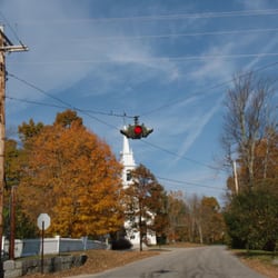
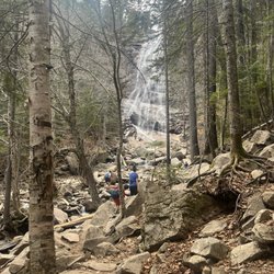
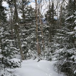
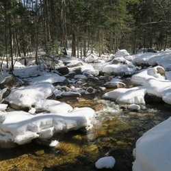
    Welch Dickey Trailhead Photos

    You might also consider

    More like Welch Dickey Trailhead

    Recommended Reviews - Welch Dickey Trailhead

    Your trust is our priority, so businesses can't pay to alter or remove their reviews. Learn more about reviews.
    Yelp app icon
    Browse more easily on the app
    Review Feed Illustration

    6 years ago

    Helpful 0
    Thanks 0
    Love this 0
    Oh no 0
    Photo of K M.
    0
    1
    0

    6 years ago

    Helpful 0
    Thanks 0
    Love this 0
    Oh no 0

    Verify this business for free

    People searched for Hiking 213 times last month within 15 miles of this business.

    Verify this business

    Bald Knob - View of Lake Winni from near the top!

    Bald Knob

    4.3(4 reviews)
    19.1 mi

    Steep. ?Private. Rocky. Good exercise. Great views of Lake Winnipesaukee. More to come . . .read more

    Also known as Bald Peak (and lending it's name to the nearby Bald Peak Colony Club) this little…read moremountain is a decent size to get in a half-day hike, depending on your ability, a picnic lunch, and some incredible views. It's a popular trek. There are also several hiking paths nearby which are maintained by the Castle Preservation Society, as well as Castle in the Clouds itself, and hiking trails at Mt. Shaw (I believe) nearby. I recommend sticking to the path along the eastern side (right-hand side as you approach the base) of the mountain. There are several very interesting places to explore just off the path, however they can get steep. The path travels up around the back of the rocky area. As you approach the outcropping, you will have an impressive view of Lake Winnipesaukee. When I was last there, there was a picnic table and camp fire as well. There are horse trails from the summit that travel west to Castle in the Clouds, but it's a long haul to get over there! (These trails are free and open to the public, but the Castle charges admission.) I believe I read that there are some geocaching spots up there as well. Parking is along the road right at the Tuftonboro/Moultonboro border by the town sign honoring local Olympians Hannah Hardaway and Wolfgang Moser.

    Photos
    Bald Knob - Cute little Eastern ribbon snake sunning itself.

    Cute little Eastern ribbon snake sunning itself.

    Bald Knob - Solomon's Plume

    Solomon's Plume

    Bald Knob - Sign at the trailhead.

    See all

    Sign at the trailhead.

    Mount Osceola - Some easy footing between main and East (a teaser!)

    Mount Osceola

    4.7(3 reviews)
    6.4 mi

    Great view. Trailhead on Tripoli Road. Parking lot fee it…read more$5. You can go to both Mount Osceola and East Osceola. Total 8.2 miles, 2871 feet elevation gain. View is great from MOunt Osceola. This mountain valley is a place of clouds hanging, so the view is kind of dramatic. East peak was in the clouds and I couldn't see the view, but when I was there in winter there was a view (East peak itself doesn't have a view but there is a view point a bit beyond the summit).

    Heave, ho and hoist! What a climb! Ascending Osceola (and East Osceola) via the Osceola Trail was…read morea moderate climb. Most peak-baggers choose to snatch up both Osceola's main peak (4,315 feet) as well as nearby East Osceola (4,156 feet); though you can approach from either the South or the East, I would recommend the Southern trail head off of Tripoli Rd as your base (roundtrip distance: 7.4 miles); 3$ to park at the base. The lower half of the trail was rocky (though I found this quaint on my way up, loose footing on the descent was rather frustrating) and several spots where the trail runs over large slabs of diagonal stone. About 3/4 of the way up to peak 1 there are fantastic views of Mt Tecumseh to the South (a serious temptation and a fabulous motivator to continue on up up UP!). The view from the top is phenomenal; the slab spreads out and reveals the valley far below - the morning of my hike the clouds played kaleidoscope with the sun, skittering shadows on the Earthen treescape *and I'm in love with hiking all over again* Traveling on to the East peak seemed like a cinch, only one mile away over rocky trodden trail. There is a very difficult craig called "the Chimney" as you descent to the col; about fifty-feet of tricky rocky tetris hard-footing. There IS a round-about/"cheaters" route which is considerably less difficult which I would recommend for descent, but I challenged myself on the return (I was VERY thankful to be in a caravan at that point!). East peak is a bit of a let down after the grande sweeping views of the previous summit (just a pile of rocks really, I walked past this "marker" before I had even realized what it identified). There are a couple of peekaboo viewpoints Northeast along this short trail which are quite nice, and made returning to the peak all that more enjoyable. It is easy to understand why this is one of the most popular hikes in the Whites. I passed all typed on my trek: singles, couples, friends, and families - it is a moderate hike with fantastic visual rewards!

    Photos
    Mount Osceola - The dreaded Chimney (tough footing and a lot of pushing and pulling to get up!)

    The dreaded Chimney (tough footing and a lot of pushing and pulling to get up!)

    Mount Osceola - Exposed rock trail on Osceola Trail

    Exposed rock trail on Osceola Trail

    Mount Osceola - Approaching the summit!

    See all

    Approaching the summit!

    Lonesome Lake Trail - Lonesome Lake

    Lonesome Lake Trail

    4.1(7 reviews)
    17.3 mi

    Lonesome Lake is a MUST. Our server at dinner suggested this hike and I am so glad that she did…read more.. always pays to ask a local expert! There is a small parking lot at the base (park next to the Lafayette Campground). My suggestion is to arrive early because it fills up. Plus it's always better to battle an uphill hike early anyways. Most of the hike is shaded, but be warned that it's pretty steep. You'll need to climb uphill for at least two miles before you reach the lake. Luckily the payoff is beautiful and you get to hike downhill the entire way back. #WORTHIT Once at the top you'll immediately have beautiful views of the lake, but make sure that you keep walking for another 10-15 minutes up the narrow trail. That will eventually lead you to a wider boardwalk area where you can lay out some towels, enjoy snacks and drinks and jump right into the lake. I'm glad we packed towels and beers because after the long steep hike I was more than happy to chill out with a drink. I honestly could've stayed all day and been content. Definitely add this hike to your list if you are in the area!

    How I have I not gushed about Lonesome Lake yet?! This was by far the best hike of our trip. The…read moreuphill hike is steep and a bit tough, but the payoff at the top is so worth it. We were visiting Littleton beginning of November and spent our whole Saturday on different trails. We got to Lonesome Lake a little later in the afternoon. The parking lot was nearly full when we got there but the trails really didn't seem that crowded at all. The entire hike up is all uphill, but not too challenging. But once you see the lake at the top?? So incredibly worth the sore legs. It seriously feels unreal or from a photograph when you first see it. It was partly covered in ice but we were so heated up from the uphill trek. This lake must be pretty wonderful in the summer months when you are just drenched from the hike up and can cool off by jumping in the lake. Little tip, be sure to wander a little further once you get to the lake. You'll see a trail with wooden planks. We basically made our own little outcove off of the trail by the water so I am not sure what is alllll the way farther down that trail. We got there on the late side and didn't want to make the hike down in the dark so we only stayed for about an hour, but I honestly could have spent the whole day there. Bring snack, drinks, anything to make a supremely cozy stay at the top. If you are looking for the perfect hike, ya found it.

    Photos
    Lonesome Lake Trail - The hike up

    The hike up

    Lonesome Lake Trail
    Lonesome Lake Trail

    See all

    Mount Tecumseh - Parking in Lot 1 at Waterville Valley

    Mount Tecumseh

    3.5(2 reviews)
    4.5 mi

    What better place to write my 500th review about (whoohoo!) than somewhere I love so much... the…read moreWhite Mountains in New Hampshire. My quest to hike the forty-eight 4000-footers in NH brought me to Mount Tecumseh this past weekend (#7 out of 48 for me). Having had knee surgery in January, I was excited to put my hard work and training to the test in the mountains. Not wanting to overdo it... Mount Tecumseh, the shortest official 4000 footer on the Appalachian Mountain Club's list, fell into my sights. This is a great mountain for easing back into alpine hiking... or to ease into it for you newcomers! A short hike distance-wise when it comes to the mountains (5.2 miles round trip), the Mount Tecumseh/Sosman Trail that delivers you to the summit is devoid of anything considered to be very steep and drives a consistent and moderate grade up to the top. The trail is well-maintained and offers a few sights along the way. Three stream crossings early on put you at the bottom of what used to be an old logging road (hence the straight-shot upwards with few switchbacks to the top). At the halfway mark up the mountain, you get your first glimpse of the beauty that is Waterville Valley. There is a sign directing you to "View" and about 30 feet off the trail you reach one of the ski trails from the Waterville Valley Resort that resides on this mountain (this view is pictured in the photo of me sitting on a rock with my purple backpack). Soak in this view because it is the last you will see before reaching the summit. The trek up after this point is a bit monotonous. Just lots of climbing in a relatively straight line. As you get closer to the top there are less random rocky outcroppings and more established "stairs" to scramble up. This trail meets up with the Sosman and its not long before you reach the summit. There is a cairn at the top to mark the peak with a decent view of the Osceola's, the Tripyramids, and Washington way off in the distance. Parking for the trailhead can be found in the Waterville Valley Resort, Lot 1. The actual trailhead can be found just across the street from the lot. It is very difficult to see from the road, just park in lot 1 and look across. You will see the very small sign for the trailhead there.

    You've heard "The Song that Never Ends", well this is the HIKE that never ends. The trail up…read moreTecumseh winds around and up up UP (up the backside of the ski resort). Rocky footing and few glimpses of the landscape also make this trek particularly less gratifying considering the 5.1 mile roundtrip. The trail base is at the base of the ski resort. The head is difficult to find along the side of the road, you have to go off to the side and there is a weeeee little sign pointing into the woods. It is an easy start over relatively level ground, switchbacks and loops around, crossing water and then spitting you out at the base of a rocky scramble up the route to the top (this was exhausting and I was glad to have boots with ankle support). The ridge just kept climbing upwards (on and on) until you meet a fork which loops up to the 4,003 foot summit and back around. The peak offers a thin view from a narrow slab.....and then you turn around. A necessary trail to tackle in order to bag all 48 400-footers....but it's a long, drawn out rummage that should be approached in the sunshine (otherwise you'll have no view at all).

    Photos
    Mount Tecumseh - Summit Sign

    Summit Sign

    Mount Tecumseh - Viewpoint

    Viewpoint

    Mount Tecumseh - Summit View

    See all

    Summit View

    Welch Dickey Trailhead - hiking - Updated May 2026

    Loading...
    Loading...
    Loading...