Wallula Gap Photos


More like Wallula Gap
Recommended Reviews - Wallula Gap
Start your review...

10 years ago
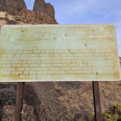
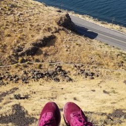
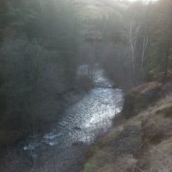
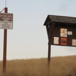
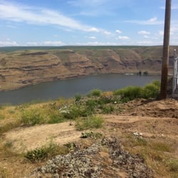
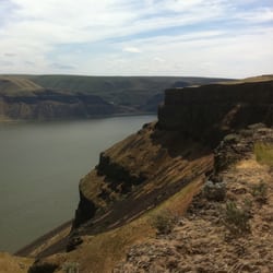
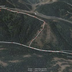
A great place to Wander. Tip#1: If you're using Google Maps to find this place, simply put in "Yellepit", and it will get you there. On the sunny Saturday that I visited, sleepy tumbleweeds lined Ayers Road, the gravel stretch that ultimately leads to the trailhead. Admittedly, it was alarming to come over a hill to see an armed man standing in the road facing me, but he, his rifle, and the other men, were there for some shooting fun. Not too far past them, was the end of the road - or rather, a closed, barbed wire gate. There's only space for about 2 parked cars to the right of the road, by the fence. I was the third, so just parked as far on the side as I could. Tip #2: Climb (carefully) OVER the barbed wire fence. Just to the left of the opening, is a good place to do this. Do not (as I did), try to open the gate. It's easy to open - it nearly literally flies open -- the barbed wire and wooden planks eager to return to their at-ease positions, and is notably much less easy to close/reassemble. I felt very, very, "city" when this happened, and I struggled for a few minutes to amend the situation. Tip #3: See Tip #2 for the following 2 barbed-wire fences you'll encounter. I crossed paths with very few people along the way, and none seemed to have a true plan of action. A couple gentlemen I encountered had been out, wandering the cow trails, and told me to just carve my own path, be wary of the drop-offs. Tip #4: Be comfortable with unclear directions, unmarked pathways, and changes-in-plan. Or perhaps, don't do this hike. I ended up on cow-trails myself, learning a bit about their dexterity along the narrow stretches. I was impressed! In any case, I missed whatever direction would have led me to the Mound Pond Overlook, which had been my goal, but still discovered worthy vistas and a very peaceful area to spend the afternoon. At one point, I was startled to happen upon two cars, on a bluff, that appeared to have fallen from a cliff above - perhaps in the 70s/80s(?). It's not really something you expect to encounter when wandering cow trails high above the Columbia. It was a gorgeous afternoon - and once I got far enough away from the makeshift gun range, it was also peaceful. This is a great hiking area if you are: 1. Comfortable with general wandering 2. Not afraid of armed people shooting nearby 3. Directionally sound enough to find your way back to your car, once you've been wandering around 4. Love and appreciate views of the Columbia River 5. Comfortable with wandering cows Final Tip: Check out the wta.org site for more trail info. This ultimately *still* didn't get me to where I wanted to be, but was helpful, nevertheless. read more


More info about Wallula Gap


Wallula Gap - hiking - Updated June 2026
Best of Wallula Gap
People found Wallula Gap by searching for…
Parks in Wallula Gap, Washington
Things to Do in Wallula Gap, Washington
Hiking Trails in Wallula Gap, Washington
View Points in Wallula Gap, Washington
Off Road Trails in Wallula Gap, Washington
Playgrounds in Wallula Gap, Washington
Walking Trails in Wallula Gap, Washington
Beautiful Views in Wallula Gap, Washington
Places to Take Pictures in Wallula Gap, Washington
Running Trails in Wallula Gap, Washington
Tent Camping in Wallula Gap, Washington
Photo Spots in Wallula Gap, Washington
Sunrise View in Wallula Gap, Washington
Night View in Wallula Gap, Washington
Bonfire in Wallula Gap, Washington
River Swimming in Wallula Gap, Washington
Swimming in Wallula Gap, Washington
Lakes & Ponds in Wallula Gap, Washington
Picnic Areas in Wallula Gap, Washington
Hiking Trails Kid Friendly in Wallula Gap, Washington
Attractions in Wallula Gap, Washington
Bike Paths in Wallula Gap, Washington