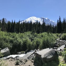
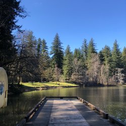
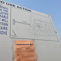
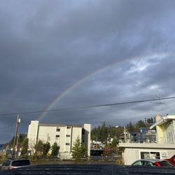
Victor Falls Photos


You might also consider
More like Victor Falls
Recommended Reviews - Victor Falls
Start your review...

Reviews With Photos

I love going on walking paths and I'm about to "graduate" and hit the walking and bike paths in King, Thurston, Snohomish and maybe eventually Whatcom counties. I thought there may have been such a path... a brief one here at Victor Falls but there wasn't. It's actually a pretty small park and there may be a picnic table or two, a small parking lot and the falls themselves. Despite the smallness of the park the waterfall is actually very pleasant to see and is beautiful. Kind of a nice place to go for a quick pic nic lunch or to gaze at the falls for a little while.

Enjoy coming here to spend some alone time and do some blunt rollin. Not to crowded here when it gets closer to dusk and that's when it's enjoyable. They have a porter potty and they have cameras as well to over look the parking lot( which is gravel). Not to many trails and can be very difficult trying to reach the bottom so would recommend going with a group if you tend to venture towards the falls. Overall hope to see you smokers out there with me lighting it up baby!


5 months ago


10 months ago
1 year ago
I love going on walking paths and I'm about to "graduate" and hit the walking and bike paths in King, Thurston, Snohomish and maybe eventually Whatcom counties. I thought there may have been such a path... a brief one here at Victor Falls but there wasn't. It's actually a pretty small park and there may be a picnic table or two, a small parking lot and the falls themselves. Despite the smallness of the park the waterfall is actually very pleasant to see and is beautiful. Kind of a nice place to go for a quick pic nic lunch or to gaze at the falls for a little while. read more

3 years ago
8 years ago
Enjoy coming here to spend some alone time and do some blunt rollin. Not to crowded here when it gets closer to dusk and that's when it's enjoyable. They have a porter potty and they have cameras as well to over look the parking lot( which is gravel). Not to many trails and can be very difficult trying to reach the bottom so would recommend going with a group if you tend to venture towards the falls. Overall hope to see you smokers out there with me lighting it up baby! read more

5 years ago
This park is a joke. It's more like an abandoned construction site full of graffiti tags and unkempt grounds. The waterfall itself is beautiful which is what makes this location even more depressing. read more


6 years ago
Beautiful, but wish I knew a way to get to the bottom of the waterfall. But this is one of my favorite waterfalls Just cause it's so easy to get to no difficult hike or anything! read more

6 years ago
An unexpected large waterfall! Easy parking and short walk to cliffs edge beautiful view. Secure barrier to keep you safe. A few picnic tables available where you can still hear the rush of the creek. read more

Gravel parking, one porta potty and a bench to rest. Beautiful waterfall. No trail to say...kinda dirt with tree roots. I would not recommend for anyone with kids. To the left- trail takes to top of waterfall. It can be dangerous and slippery. read more


8 years ago
A hidden gem! This is a great place to take a hike in the summer months, however, in order to get to the bottom you must use ropes (which are already at the site)....As a "not really athletic" person I was still able to get down to the bottom. read more


More info about Victor Falls
18212 Rhodes Lake Rd E
Bonney Lake, WA 98391
Directions
Hours
Outdoor Amenities
Ask the Community - Victor Falls
How far is the hike to the waterfall or is there a hike? Another one does it go to the top or bottom of the falls or is there a way to get to the bottom of it?
You might also consider


Why does Yelp recommend reviews?
1 review that is not currently recommended
The reviews below are not factored into the business's overall star rating.
8 years ago
Victor Falls - parks - Updated May 2026
Best of Bonney Lake
People found Victor Falls by searching for…
Things to Do in Bonney Lake, Washington
Hiking Trails With Waterfalls in Bonney Lake, Washington
Hiking in Bonney Lake, Washington
Beautiful Views in Bonney Lake, Washington
Scenic View in Bonney Lake, Washington
Places to Take Pictures in Bonney Lake, Washington
Secret Spots in Bonney Lake, Washington
Walking Trails in Bonney Lake, Washington
Scenic Drive in Bonney Lake, Washington
Cliff Jumping in Bonney Lake, Washington
Waterfalls in Bonney Lake, Washington
Park With BBQ Pits in Bonney Lake, Washington
Waterfalls and Swimming Holes in Bonney Lake, Washington
Picnic Areas in Bonney Lake, Washington
Photo Spots in Bonney Lake, Washington
Fun Things to Do With Teens in Bonney Lake, Washington
Picnic Spots in Bonney Lake, Washington
Easy Hiking Trails in Bonney Lake, Washington
Romantic Views in Bonney Lake, Washington
Running Tracks Open to the Public in Bonney Lake, Washington
Hiking Club in Bonney Lake, Washington
Must See in Bonney Lake, Washington
Trending Searches in Bonney Lake, WA
Baseball Fields near Victor Falls
Botanical Gardens near Victor Falls
Bounce House Rentals near Victor Falls
Cheap Plants near Victor Falls
Cherry Picking near Victor Falls
Cliff Jumping near Victor Falls
Garage Sales near Victor Falls
Garden Center near Victor Falls
Nurseries & Gardening near Victor Falls
Off Leash Dog Parks near Victor Falls
Outdoor Activities near Victor Falls
Outdoor Basketball Courts near Victor Falls
Outdoor Furniture Stores near Victor Falls
Parks For Parties near Victor Falls
Party Equipment Rentals near Victor Falls
Picnic Areas near Victor Falls
Places To Take Pictures For Prom near Victor Falls
Public Beaches near Victor Falls
Public Running Track near Victor Falls
Spray Tanning near Victor Falls
Swimming Holes near Victor Falls
Browse Articles
Browse Nearby
BEST of Bonney Lake, Washington Things to Do near Victor Falls
BEST of Bonney Lake, Washington Coffee near Victor Falls
BEST of Bonney Lake, Washington Restaurants near Victor Falls
BEST of Bonney Lake, Washington Playgrounds near Victor Falls
BEST of Bonney Lake, Washington Hiking near Victor Falls
BEST of Bonney Lake, Washington Breakfast near Victor Falls
BEST of Bonney Lake, Washington Campgrounds near Victor Falls
Browse Brands
Related Searches in Bonney Lake, WA
Best Off Leash Dog Parks in Bonney Lake, Washington
Best Parks for Parties and Events in Bonney Lake, Washington
Best Water Parks for Kids in Bonney Lake, Washington
Check Out Great Playgrounds in Bonney Lake, Washington
Discover Baseball Fields Around Bonney Lake, Washington
Discover Beautiful Garden Spots in Bonney Lake, Washington
Discover Fun Toddler Parks in Bonney Lake, Washington for Your Little One
Discover Lakes & Ponds to Explore in Bonney Lake, Washington
Discover Popular Photo Spots in Bonney Lake, Washington
Discover Public Beaches to Visit in Bonney Lake, Washington
Discover Soccer Fields in Bonney Lake, Washington Near You
Discover Top Nature Parks to Visit in Bonney Lake, Washington
Discover Top State Parks to Visit in Bonney Lake, Washington
Discover the Best Beaches in Bonney Lake, Washington
Discover the Best Kids Park Spots in Bonney Lake, Washington
Enjoy Scenic Places to Walk in Bonney Lake, Washington
Enjoy the Best Picnic Spots and Ideas in Bonney Lake, Washington
Enjoy the Best Walking Trails in Bonney Lake, Washington
Explore Beautiful Botanical Gardens in Bonney Lake, Washington
Explore Easy Hikes Perfect for All in Bonney Lake, Washington
Explore Family-Friendly Zoos and Wildlife in Bonney Lake, Washington
Explore Free Picnic Areas Around Bonney Lake, Washington
Explore Parks With Pull Up Bars in Bonney Lake, Washington
Explore Popular Campgrounds Near Bonney Lake, Washington
Explore Popular Picnic Areas Around Bonney Lake, Washington
Explore Popular RV Parks Around Bonney Lake, Washington
Explore Popular Recreation Centers Around Bonney Lake, Washington
Explore Scenic Lakes to Visit in Bonney Lake, Washington
Explore Top Dog Parks in Bonney Lake, Washington Near You
Explore Top Water Parks in Bonney Lake, Washington Today
Explore the Best Trail Options in Bonney Lake, Washington
Find Parks and Recreation Activities in Bonney Lake, Washington
Find Top Dog Friendly Parks to Visit in Bonney Lake, Washington
Find Top Skate Parks in Bonney Lake, Washington for All Skill Levels
Find a Park With BBQ Pits in Bonney Lake, Washington
Find the Best Parks BBQ Grills in Bonney Lake, Washington
Find the Best Parks for Picnics in Bonney Lake, Washington
Find the Best Swimming Pools in Bonney Lake, Washington Today
Have Fun at a Splash Pad in Bonney Lake, Washington
Locate Tennis Courts Around Bonney Lake, Washington
Parks With Basketball Courts for Games in Bonney Lake, Washington
Picnic Areas With BBQ Pits Available in Bonney Lake, Washington
Play at a Splash Pad Park in Bonney Lake, Washington
Popular Children Playgrounds to Visit in Bonney Lake, Washington
Popular Outdoor Activities to Try in Bonney Lake, Washington
Top Hiking Trails to Explore in Bonney Lake, Washington
Top Running Trails to Explore in Bonney Lake, Washington
Top Swimming Lakes to Enjoy in Bonney Lake, Washington
People who viewed Victor Falls also viewed
Swan Creek County Park
15 reviews
Nathan Chapman Memorial Trail
12 reviews
Riverwalk Trail
13 reviews
Grandview Chambers Bay Bike and Hike Trail
33 reviews
Thea's Park
15 reviews
Point Defiance Park
272 reviews
Dash Point State Park
125 reviews
Harry Todd Park
9 reviews
Melmont Ghost Town
4 reviews
Ward Lake Park
6 reviews