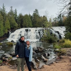
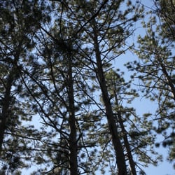
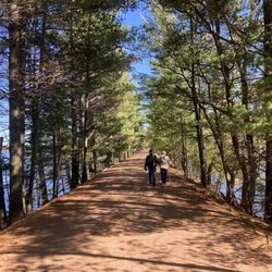
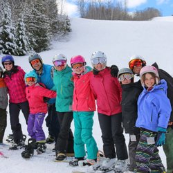
Three Eagle Trail Photos


You might also consider
More like Three Eagle Trail
Recommended Reviews - Three Eagle Trail
Start your review...

9 years ago


16 years ago
14 years ago
More info about Three Eagle Trail
Three Lakes, WI 54562
Directions
Visit Website
http://www.3eagletrail.com
Hours
Outdoor Amenities


Three Eagle Trail - hiking - Updated June 2026
Best of Three Lakes
People found Three Eagle Trail by searching for…
Things to Do in Three Lakes, Wisconsin
Parks in Three Lakes, Wisconsin
Hiking Trails in Three Lakes, Wisconsin
Fun Things to Do With Kids in Three Lakes, Wisconsin
Waterfalls in Three Lakes, Wisconsin
Family Fun in Three Lakes, Wisconsin
Walking Trails in Three Lakes, Wisconsin
Parks for Kids in Three Lakes, Wisconsin
Places to Take Pictures in Three Lakes, Wisconsin
Running Trails in Three Lakes, Wisconsin
Lakes & Ponds in Three Lakes, Wisconsin
Beautiful Views in Three Lakes, Wisconsin
Hiking With Kids in Three Lakes, Wisconsin
Trail in Three Lakes, Wisconsin
Hiking Trails Kid Friendly in Three Lakes, Wisconsin
Scenic Restaurants in Three Lakes, Wisconsin
Playground in Three Lakes, Wisconsin
Boardwalk in Three Lakes, Wisconsin
Nature Walks in Three Lakes, Wisconsin
Bridge in Three Lakes, Wisconsin
Attractions in Three Lakes, Wisconsin
Scenic Drive in Three Lakes, Wisconsin
Trending Searches in Three Lakes, WI
Bait And Tackle Shop near Three Eagle Trail
Beaches near Three Eagle Trail
Boat Rental near Three Eagle Trail
Fishing Spots near Three Eagle Trail
Jet Ski Rental near Three Eagle Trail
Kayak Rental near Three Eagle Trail
Pick Your Own Farms near Three Eagle Trail
River Tubing near Three Eagle Trail
Browse Articles
Browse Nearby
Browse Brands
Related Searches in Three Lakes, WI
Best Fishing Locations and Guides in Three Lakes, Wisconsin
Best Places for Horseback Riding in Three Lakes, Wisconsin
Best Places for Stunning Views in Three Lakes, Wisconsin
Best Sledding Spots and Fun in Three Lakes, Wisconsin
Best Waterfalls and Swimming Holes in Three Lakes, Wisconsin
Check Out Off Road Trails in Three Lakes, Wisconsin
Discover Scenic Creeks to Explore in Three Lakes, Wisconsin
Discover Top Boat Tours in Three Lakes, Wisconsin for All Ages
Discover a Hiking Trail in Three Lakes, Wisconsin
Discover the Best Fishing Lake in Three Lakes, Wisconsin
Enjoy Camping Adventures Around Three Lakes, Wisconsin
Enjoy Tent Camping Spots Around Three Lakes, Wisconsin
Enjoy the Best Tubing Experiences in Three Lakes, Wisconsin
Experience Stunning Sunset Views in Three Lakes, Wisconsin
Explore Beautiful Parks and Green Spaces in Three Lakes, Wisconsin
Explore Bike Rentals Throughout Three Lakes, Wisconsin
Explore Free Things to Do Around Three Lakes, Wisconsin
Explore Popular Boat Charters Near Three Lakes, Wisconsin
Explore Popular Campgrounds Near Three Lakes, Wisconsin
Explore Popular RV Parks Around Three Lakes, Wisconsin
Explore Scenic Lakes to Visit in Three Lakes, Wisconsin
Find Beautiful Views in Three Lakes, Wisconsin
Find Cozy Camping Cabins in Three Lakes, Wisconsin
Locate a Public Shower Facility in Three Lakes, Wisconsin
Popular Fishing Spots to Explore in Three Lakes, Wisconsin
Popular Places to Take Pictures in Three Lakes, Wisconsin
Popular Things to Do in Three Lakes, Wisconsin
Popular Things to See in Three Lakes, Wisconsin
Relax at Natural Hot Springs Near Three Lakes, Wisconsin
Safe River Swimming Areas in Three Lakes, Wisconsin
See Top Fireworks Events in Three Lakes, Wisconsin
Top Fishing Charter Experiences in Three Lakes, Wisconsin
Top Places to Visit in Three Lakes, Wisconsin for Sightseeing
Top RV Campgrounds to Visit in Three Lakes, Wisconsin