Bearskin State Trail Photos


More like Bearskin State Trail
Recommended Reviews - Bearskin State Trail
Start your review...

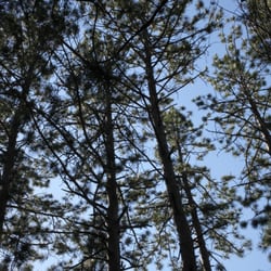
This is quite an amazing and well-maintained and a beautiful trail. I take the leg from the pink cottage road to downtown Minocqua as it exits right at the USPS. Really beautiful views and a great activity with your family and fur legged friends. read more


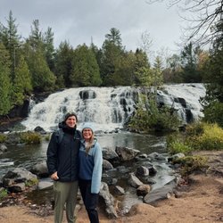
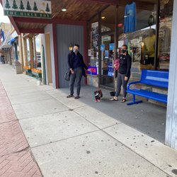
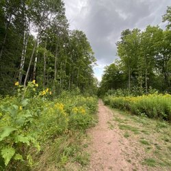
Ok, I am NOT a "trail" person. My idea of getting in touch with nature is generally looking out the window while comfortably seating in an air conditioned cabin. The Bearskin trail is amazing, you guys! Like, really really great - it's mostly flat (yes, thank you God), well maintained and easy to navigate. It's an old railway right of way and easy to access right in downtown Minocqua. The main trail is roughly 18 miles with an extension that gets you all the way to Tomahawk. The trail itself is wide, smooth and passes through beautiful forests. You'll ride over lots of bridges and beside peaceful lakes. The only sound you'll hear is the wind and the birds. As a bonus, there are several places to rest (picnic tables) and clear signage to local places to grab a bite. The Mister and I did 10 miles one way (with the help of an e-bike) and despite being a couch potato, I honestly loved it. I'd definitely come back and look to do more! read more


More info about Bearskin State Trail


Bearskin State Trail - hiking - Updated July 2026
Best of Minocqua
People found Bearskin State Trail by searching for…
Things to Do in Minocqua, Wisconsin
Hiking Trails in Minocqua, Wisconsin
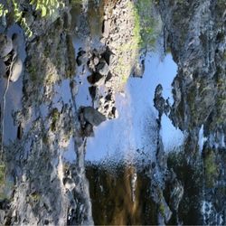
Waterfalls in Minocqua, Wisconsin
Places to Take Pictures in Minocqua, Wisconsin
Picnic Areas in Minocqua, Wisconsin
Natural Hot Springs in Minocqua, Wisconsin
Mountain Biking in Minocqua, Wisconsin
Tourist Attractions in Minocqua, Wisconsin
Attraction in Minocqua, Wisconsin
Scenic Restaurants in Minocqua, Wisconsin
Fun Things to Do With Kids in Minocqua, Wisconsin
Lakes & Ponds in Minocqua, Wisconsin
Landmarks in Minocqua, Wisconsin
Off Road Trails in Minocqua, Wisconsin
Picnic Tables in Minocqua, Wisconsin
Walking Trails in Minocqua, Wisconsin
Beautiful Views in Minocqua, Wisconsin
Scenic View in Minocqua, Wisconsin
Bike Paths in Minocqua, Wisconsin
Trending Searches in Minocqua, WI
Boat Rental near Bearskin State Trail
Day Trips near Bearskin State Trail
Fireworks near Bearskin State Trail
Jet Ski Rental near Bearskin State Trail
Kayak Rental near Bearskin State Trail
Lakes near Bearskin State Trail
Picnic Areas near Bearskin State Trail
Places To Swim near Bearskin State Trail
Public Shower near Bearskin State Trail
River Tubing near Bearskin State Trail
Swimming Holes near Bearskin State Trail
Swimming Lakes near Bearskin State Trail
Browse Articles
Browse Nearby
BEST of Minocqua, Wisconsin Things to Do near Bearskin State Trail
BEST of Minocqua, Wisconsin Restaurants near Bearskin State Trail
BEST of Minocqua, Wisconsin Coffee near Bearskin State Trail
BEST of Minocqua, Wisconsin Parks near Bearskin State Trail
BEST of Minocqua, Wisconsin Walking Trails near Bearskin State Trail
BEST of Minocqua, Wisconsin Campgrounds near Bearskin State Trail
BEST of Minocqua, Wisconsin Breakfast near Bearskin State Trail
BEST of Minocqua, Wisconsin Sledding near Bearskin State Trail
BEST of Minocqua, Wisconsin Day Trips near Bearskin State Trail
Browse Brands
Related Searches in Minocqua, WI
Affordable Kayak Rental Services in Minocqua, Wisconsin
Best Fishing Locations and Guides in Minocqua, Wisconsin
Best Fun Things to Do in Minocqua, Wisconsin
Best Places for Horseback Riding in Minocqua, Wisconsin
Best Places for Stunning Views in Minocqua, Wisconsin
Discover Top Boat Tours in Minocqua, Wisconsin for All Ages
Discover Top Nature Parks to Visit in Minocqua, Wisconsin
Discover a Hiking Trail in Minocqua, Wisconsin
Enjoy Exciting Mountain Biking Adventures in Minocqua, Wisconsin
Enjoy Kayaking Adventures in Minocqua, Wisconsin
Enjoy Tent Camping Spots Around Minocqua, Wisconsin
Enjoy Water Activities and Fun in Minocqua, Wisconsin
Enjoy the Best Family Activities in Minocqua, Wisconsin
Enjoy the Best Picnic Spots and Ideas in Minocqua, Wisconsin
Enjoy the Best Tubing Experiences in Minocqua, Wisconsin
Explore Beautiful Parks and Green Spaces in Minocqua, Wisconsin
Explore Bike Rentals Throughout Minocqua, Wisconsin
Explore Free Things to Do Around Minocqua, Wisconsin
Explore Fun Activities to Do in Minocqua, Wisconsin
Explore Jet Skis for Sale or Rent in Minocqua, Wisconsin
Explore Nature Spots Around Minocqua, Wisconsin
Explore Popular Boat Charters Near Minocqua, Wisconsin
Explore Popular Campgrounds Near Minocqua, Wisconsin
Explore Popular RV Parks Around Minocqua, Wisconsin
Explore Popular View Points Around Minocqua, Wisconsin
Explore Scenic Lakes to Visit in Minocqua, Wisconsin
Explore the Best Boating Spots in Minocqua, Wisconsin
Explore the Best Trail Options in Minocqua, Wisconsin
Family Friendly Hiking With Kids in Minocqua, Wisconsin
Find Beautiful Views in Minocqua, Wisconsin
Find Cozy Camping Cabins in Minocqua, Wisconsin
Find Fun Things to Do With Kids in Minocqua, Wisconsin
Find Parks and Recreation Activities in Minocqua, Wisconsin
Find the Best Parks for Picnics in Minocqua, Wisconsin
Find the Best Playgrounds to Visit in Minocqua, Wisconsin
Find the Best Scenic View Locations in Minocqua, Wisconsin
Must-See Tourist Attractions Around Minocqua, Wisconsin
Popular Fishing Spots to Explore in Minocqua, Wisconsin
Popular Picnic Spots to Visit in Minocqua, Wisconsin
Popular Places to Take Pictures in Minocqua, Wisconsin
Popular Things to Do in Minocqua, Wisconsin
Relax at Natural Hot Springs Near Minocqua, Wisconsin
Safe and Fun Parks for Kids in Minocqua, Wisconsin
See Top Fireworks Events in Minocqua, Wisconsin
Top Paddleboarding Activities in Minocqua, Wisconsin
Top Playgrounds for Kids to Enjoy in Minocqua, Wisconsin
Top Swimming Lakes to Enjoy in Minocqua, Wisconsin
Top Things to Do With Kids in Minocqua, Wisconsin
People who viewed Bearskin State Trail also viewed
Fern Ridge Trail
1 review
schlecht lake trail
1 review
Fallison Lake Nature Trail
1 review
Northwoods Zip Line Tours
21 reviews
Elmer's Fun Park
27 reviews
Holiday Acres Riding Academy Go Karts/Miniature Golf
20 reviews
Plum Lake Golf Club
10 reviews
Z-Best Bikes
9 reviews
$$$
Lakeland Area Dog Park
1 review
Clear Lake Inn and Resort
11 reviews