Table Rock Trail Photos


! - Hiking Near Me - North Walpole, New Hampshire")
More like Table Rock Trail
Recommended Reviews - Table Rock Trail
Start your review...

2 years ago
Anytime of the year is perfect for the rewarding view. Maybe a little tough during snow and mud season, but still doable. Table Rock faces the Bellows Falls are from New Hampshire, just across the Connecticut River. We're in our 60s and needed to stop a few times on the way up, but it was never too steep or treacherous, just a long steady hike. You want bring good hiking shoes with serious treads. No fees. Dogs allowed. read more


Phenomenal trail!! Definitely in my top 5 fave hikes - especially for the fall colors (my visit was in early October)!! And it's a killer workout too! The view from the top is breathtaking- but not for the faint of heart - I have a fear of heights and it took me a while to work up the nerve to go sit on the edge lol! AllTrails has this trail labeled as "moderate" - but it was insanely muddy and very wet when I hiked it - took me ages and totally wore me out - so in those conditions I'd call it moderate-hard. And also with the rock scrambling at the top - it can be quite difficult. Very steep and especially narrow at the top - can be dangerous if you're not careful. I did a total of 2 miles round trip - it's an out and back trail. In those 2 miles, my tracker showed an 800 foot elevation gain so it's definitely a butt burner. And along the trail there are numerous areas of rock scrambling (some are very steep) and stream crossings during the wet season - get ready to be covered in mud lol! You will definitely need decent hiking shoes - and poles would've been so helpful I think! There were quite a few other hikers around. The trails are very well marked with colorful tree badges - but in some spots between the markers, I needed my trail map bc the ground was covered in leaves and mud and it wasn't as obvious. Once you get to the top of Table Rock, the stunning view will absolutely take your breath away! It's a sweeping vista of the entire forest area with the lake and resort below to the left and the long stretch of road through the park to the right - perfect for taking in all the colorful autumn splendor!! The top is a long, very narrow and flat tableau. It seems pretty stable - but has extremely steep (and deadly!) drop offs either side and no safety rails or fencing or anything so be aware. Drones aren't allowed in the park (according to the State Park website) but someone was flying one and buzzing us closely at the top which made it very distracting and scary unfortunately. Dogs are allowed - there were many on the trail and at the top. Parking is a small dirt lot pull out on the side of the road at the trailhead - Google maps took me right to it (just put in Table Rock Trailhead). It's located in Dixville Notch State Park (you can see my review of that for more detailed info). The park doesn't have bathrooms that I could find. And I think it's free. I didn't see any fee areas and their website doesn't list it as a fee area. read more

More info about Table Rock Trail
30 Mountain View Rd
North Walpole, NH 03609
Directions
Visit Website
https://www.alltrails.com/trail/us/new-hampshire/table-rock-dixville-notch
Hours
Indoor Amenities
Outdoor Amenities


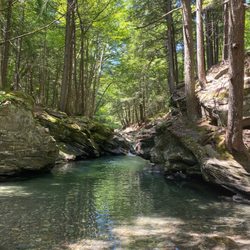
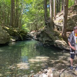


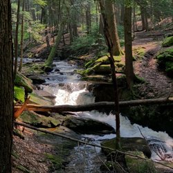


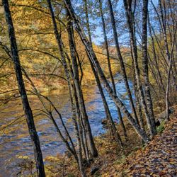


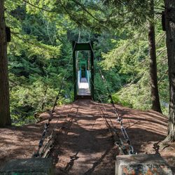

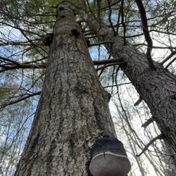


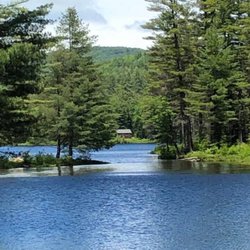
Table Rock Trail - hiking - Updated June 2026
Best of North Walpole
People found Table Rock Trail by searching for…
Things to Do in North Walpole, NH
Hiking Trails in North Walpole, NH
Beautiful Views in North Walpole, NH
Scenic Views in North Walpole, NH
Off Road Trails in North Walpole, NH
Dog Friendly Parks in North Walpole, NH
Dog Friendly Hiking Trails in North Walpole, NH
Scenic Overlook in North Walpole, NH
Walking Trails in North Walpole, NH
Waterfall Hike in North Walpole, NH
Lookout Points in North Walpole, NH
Hikes With Dogs in North Walpole, NH
View Points in North Walpole, NH
Running Trails in North Walpole, NH
Waterfalls in North Walpole, NH
Lakes & Ponds in North Walpole, NH
Dog Friendly Things to Do in North Walpole, NH
Things to Do at Night in North Walpole, NH
Easy Hikes in North Walpole, NH
Photo Spots in North Walpole, NH
River Swimming in North Walpole, NH
Trending Searches in North Walpole, NH
Amusement Parks near Table Rock Trail
Bait And Tackle Shop near Table Rock Trail
Boat Rental near Table Rock Trail
Day Trips near Table Rock Trail
Dog Swimming near Table Rock Trail
Kayak Rental near Table Rock Trail
Pick Your Own Farms near Table Rock Trail
Public Shower near Table Rock Trail
River Swimming near Table Rock Trail
Secluded Spots near Table Rock Trail
Splash Pad near Table Rock Trail
Strawberry Picking near Table Rock Trail
Swimming Holes near Table Rock Trail
Swimming Pools near Table Rock Trail
Browse Articles
Browse Nearby
BEST of North Walpole, New Hampshire Things to Do near Table Rock Trail
BEST of North Walpole, New Hampshire Restaurants near Table Rock Trail
BEST of North Walpole, New Hampshire Parks near Table Rock Trail
BEST of North Walpole, New Hampshire Coffee near Table Rock Trail
BEST of North Walpole, New Hampshire Photo Spots near Table Rock Trail
BEST of North Walpole, New Hampshire Campgrounds near Table Rock Trail
BEST of North Walpole, New Hampshire Breakfast near Table Rock Trail
BEST of North Walpole, New Hampshire Taxis near Table Rock Trail
BEST of North Walpole, New Hampshire Ski Resorts near Table Rock Trail
Browse Brands
Related Searches in North Walpole, NH
Affordable Kayak Rental Services in North Walpole, New Hampshire
Best Fishing Locations and Guides in North Walpole, New Hampshire
Best Fun Things to Do in North Walpole, New Hampshire
Best Lookout Points to Visit in North Walpole, New Hampshire
Best Places for Horseback Riding in North Walpole, New Hampshire
Check Out Off Road Trails in North Walpole, New Hampshire
Discover Baseball Fields Around North Walpole, New Hampshire
Discover Dog Friendly Trails to Explore in North Walpole, New Hampshire
Discover Popular Photo Spots in North Walpole, New Hampshire
Discover Stunning Skyline View Spots in North Walpole, New Hampshire
Discover Top Boat Tours in North Walpole, New Hampshire for All Ages
Discover a Hiking Trail in North Walpole, New Hampshire
Discover the Best Night Hike Trails in North Walpole, New Hampshire
Dog-Friendly Hikes With Dogs in North Walpole, New Hampshire
Enjoy Exciting Mountain Biking Adventures in North Walpole, New Hampshire
Enjoy Tent Camping Spots Around North Walpole, New Hampshire
Enjoy the Best Family Activities in North Walpole, New Hampshire
Enjoy the Best Walking Trails in North Walpole, New Hampshire
Experience Stunning Sunset Views in North Walpole, New Hampshire
Explore Beautiful Parks and Green Spaces in North Walpole, New Hampshire
Explore Bike Rentals Throughout North Walpole, New Hampshire
Explore Easy Hikes Perfect for All in North Walpole, New Hampshire
Explore Free Things to Do Around North Walpole, New Hampshire
Explore Jet Skis for Sale or Rent in North Walpole, New Hampshire
Explore Popular RV Parks Around North Walpole, New Hampshire
Explore Popular Scenic Overlook Points in North Walpole, New Hampshire
Explore Popular View Points Around North Walpole, New Hampshire
Explore Top Dog Parks in North Walpole, New Hampshire Near You
Explore the Best Boating Spots in North Walpole, New Hampshire
Explore the Best Swimming Holes Around North Walpole, New Hampshire
Family Friendly Hiking With Kids in North Walpole, New Hampshire
Find Top Skate Parks in North Walpole, New Hampshire for All Skill Levels
Find the Best Swimming Pools in North Walpole, New Hampshire Today
Hiking Trails With Waterfalls in North Walpole, New Hampshire
Must-See Tourist Attractions Around North Walpole, New Hampshire
Perfect Spots to Watch Sunset in North Walpole, New Hampshire
Popular Kids Activities in North Walpole, New Hampshire
Popular Picnic Spots to Visit in North Walpole, New Hampshire
Popular Places to Take Pictures in North Walpole, New Hampshire
Popular Things to Do in North Walpole, New Hampshire
Relax at Natural Hot Springs Near North Walpole, New Hampshire
Safe River Swimming Areas in North Walpole, New Hampshire
Safe and Fun Parks for Kids in North Walpole, New Hampshire
Top Climbing Spots and Gyms in North Walpole, New Hampshire
Top Playgrounds for Kids to Enjoy in North Walpole, New Hampshire
Top Running Trails to Explore in North Walpole, New Hampshire
Top Swimming Spots and Pools in North Walpole, New Hampshire
Top Things to Do With Teenagers in North Walpole, New Hampshire
Uncover the Best Secluded Spots Around North Walpole, New Hampshire
Walk Dog Friendly Hiking Trails in North Walpole, New Hampshire
People who viewed Table Rock Trail also viewed
Jamaica State Park
20 reviews
Pillsbury State Park
16 reviews
Keene Rail Trails
1 review
Railroad Square
1 review
Morningside Flight Park
22 reviews
Prospect Rock Trail
1 review
Bromley Mountain-Adventure park
23 reviews
Green Mountain National Forest
1 review
MV Mt. Sunapee II Cruise
14 reviews
Santa's Land USA
16 reviews