
Sugarloaf Mountain Photos


You might also consider


More like Sugarloaf Mountain
Recommended Reviews - Sugarloaf Mountain
Start your review...


Reviews With Photos


An excellent place for hiking less than an hour drive from DC. Not too crowded on a weekend (maybe in the summer but not in winter even when the weather is nice and warm). Some ascents and rocky terrain but since it's a small mountain not too challenging. Free entry but donation accepted. Closes at 4 pm (new regulation).


Beautiful fall Foliage, some of the trails can be really hard to trek. But we made it. Always bring lots of water and snacks to restore all your energy. Some trails are sooooo long. We got a little lost since we couldn't decide which trail but we were there for 5 hours. It was a long time before we made it out. Good thing we were there around 10 ish in the am. It was a good hike, hopefully it will stay open. Since the issue with the Frederick county /stronghold is on going. So we will see.


Such a pristine spot. The trails are clearly marked. The hiking here is mostly for beginner to intermediate levels, although there's one steep trail (red). What I like most about Sugarloaf Mountain is that getting to the top of it doesn't take forever. It's a lovely view when you do summit. This isn't for extreme climbers; rather a place for everyone. Picnic tables are available at various locations. I recommend parking in West View parking lot, the one that's highest up. I find it to be quite peaceful here. Wonderful way to spend a day or half day.


Parking was is VERY limited, but I guess that is what makes this place so great, very little people! Beautiful trails up to the top. Bring water and snacks (but please pack out your trash!!). Took the paved road down, and so happy we did. Feeling it today for sure! Lol 2 hours up (with small dog, lots of breaks), one hour down.


This was not a particularly pleasant hiking experience. The signage is extremely limited both for drivers looking for parking and for hikers looking for trails. The trails are maintained pretty well with a few spots where it appears they just... completely stop? And the views at the summits are fine but not spectacular. I would encourage you to take a little extra time and drive to Harpers Ferry instead.


The views and ambience are five star - especially during the autumn with the abundance of colors. Picnic areas. Hiking trails. And more. One star off (almost took more off) cause the speed bump to enter and the spiked hump to leave the mountain -- they are way way way high - and they tore the heck out of my wheelchair accessible van.


Sugarloaf Mountain is one of my favorite hiking places, and you can enjoy a glass of wine afterwards down the road The Sunrise Trail (orange) is the steepest rocky trail among the three trails that leads to the top; it's my favorite one to go up. It takes about 15 minutes. I would not come down on this trail, especially if you have little ones. The Monadnock Trail (red) has many stairs, so also good to go up. I like to come down on the A.M. Thomas Trail (green). I also enjoy Mountain Loop Trail (white). Looking forward to the next visit for Northern Peaks Trial (blue). :)


The drive on the way up was a little nerve-racking but there was a lot of parking when we reached the top. My group took the intermediate trail up and it had lots of stairs with a good slope incline. Once you get to the top, there are spectacular views.


Looking for an outdoor adventure? Look no further...I think we took the green trail which included over 100 steps to get the peak and it was worth it! I am not sure how busy it gets on the weekends so I would suggest getting there earlier rather than later. There were tons of kids on the trail and families having little "snacky hours" at the top so be prepared for that! It is a kid friendly and pet friendly trail but if you're looking for something more romantic, this may not be the place...


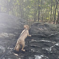
First time visitor from Arlington, VA! I set out to hike this on Thanksgiving Day, shooting to leave pretty early in case it was busy for the holiday. It's about an hour drive so I arrived around 8:30AM. There were about 5 cars at the base of the mountain, and about 5 more at the halfway point where I parked. I brought my pup, who isn't out of shape, but also isn't in great shape (love him though!). So, I opted for the sunrise trail (orange) and it was basically straight incline, short and sweet. It really didn't take long at all. Maybe like 20 minutes up with no stopping. We stopped at the top, super windy and my pup didn't like that. So we took some pics and headed back down to the picnic area, to have a picnic! The view at the summit is gorgeous, and was a great switch up to my hikes/trails in Arlington! The trail was VERY well maintained, better than some national parks I've been to. I was worried it would be muddy due to the rains over the week, but there was no problem! Next time I will bring a lo leash, since it was straight incline, coming back down meant that my dog was jumping and pulling me down. I am looking forward to coming back and trying out other trails that are a little longer!


I did an 8 mile hike here by combining the blue loop with white loop. This was a well maintained and well marked park with different loops of various lengths. There is a summit that is less than 1 mile up from the parking lot, but I missed that and instead did my loop route. There is a White Rocks overlook that I stopped at on the Blue Loop which I hear is similar in views to the actual summit so that sufficed for me. The rest of the hike though was very much the same scenery (trees, rocks, and flowers) without many views. Very shady (perfect for hot days) but also very rocky (nearly twisted my ankle a few times). Can spot an occasional deer, vulture-looking birds, snake... The hike varies from easy, flat stretches to some more rocky, steep sections. Some parts have more people than others (where people join from other loops or parking lots), but deeper into the blue loop there are less. My biggest qualm is that after driving 1.5 hours to get to Sugarloaf, we then had to spend 30 minutes circling for parking (this was around 1pm on a Sunday). I believe we arrived to the East View Parking Lot which had very few spots to begin with (around 5) and there were staff there angrily telling arriving cars to leave. When we tried to ask them for other ideas on where to park, they did not even respond and continued yelling at us to keep driving. A bunch of cars eventually started parking along a pocket in the road that was not private property (there are two mansions here), so we followed suit only to see later that the staff then let in a bunch of cars to other parking lots located in the mountain. Overall, scenic but summit/views were not as great as I thought it would be. Parking can be a bad experience. Tip: there are portable restrooms at the start of the trails. There is also a winery a few minutes from the entrance.


#Sayyestonature I'm so glad I came to do the hike on a weekday! Easy in finding parking and only saw like 5 groups of people during the whole hike. We did the blue trail with total of around 7 miles. The closest parking lot would be west view lot. It's definitely social distance approved activity and if you are comfortable, you can almost do the whole trail without a mask!


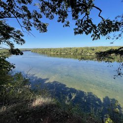
We definitely have to come back as we didn't realize the green trail leads to the top! I only realized this by reading the other reviews here haha. But we still had a great time walking around and enjoying nature, but we didn't get to see much views other than trees. I think we got a bit lost at the end and ended up at the Potomac view parking lot which had a pretty view! We parked in the west view parking lot and walked over to the east and started on the blue trail, then came down the yellow, then blue, then blue & white (see the trail map I highlighted). According to my Apple Watch it took us about 2.5 hours with a total of almost 6 miles.


This is a great day hike for those in the D.C. area, about an hour's drive from the city. Sugarloaf is owned by the Stronghold corporation, and they help maintain and improve the land using funds from a trust fund, membership dues, and gifts. It is free to hike and park, although they do have a donation box at the entrance. The highest elevation is a little over 1,280 feet. Oak trees dominate most of the mountain, but you can also see some black gum trees, black birches, and eastern hemlocks. There's a couple of parking lots, although they fill up quickly on the weekends. Try to park in either the East or West View lots. There are 4 circuit hikes: +Blue/Northern Peaks Trail: 5 miles starting from the West View lot. +Purple/Alternate route to White Rocks: 1.5 miles by itself, adds 1/2 mile to the total distance if using as an alternate to the blue trail. +White/Mountain Loop Trail: 2.5 mile loop around the summit. +Yellow/Saddleback Horse Trail: 7 mile loop around base of the mountain. There are also 3 summit area hikes: +Green/A.M. Thomas Trail: 1/4 mile trail to the summit. +Orange/Sunrise Trail: Steep 1/4 mile trek to the summit. +Red/Monadnock Trail: Leaves the blue trail for a 1/4 mile hike to the summit. Last time I was here, I started on the white trail from the East View lot and then joined up on the blue trail to hike to White Rocks. We mistakenly ended up on the yellow trail on the way down the mountain, which added a few extra miles and time. It all worked out though, and we were able to hike down to the entrance and back up to the parking lot. All in all, it took us about 4.5-5 hours to complete the hike. Wear proper shoes, especially if you're planning to hike some of the longer trails. I don't think any of the hikes are particularly difficult, but sometimes the rocks can be slippery. This is a popular hiking destination, so expect lots of people. We saw tons of groups ranging from children to older adults, as well as dogs. Since there are plenty of trails ranging in varying degrees of difficulty, you can pick and choose which trail to walk depending on your level. The view at the summit is pretty nice, although not as great as those in Shenandoah. But it is free, closer to the city, and well-maintained. Trails are generally well-marked too. We saw a family of white tailed deer here, as well as a dead snake. I've heard there's also raccoons, foxes, and rabbits around. read more


11 years ago
Elevation is all about perspective, relative distance to the ground, not an absolute concept. Getting high in some places, like Colorado, is easier to do than in, say, the District of Colombia and surrounding suburbs. But it can be done. And in fall foliage season, the sight of sweeping hardwood forests in patchwork autumn colors, well even the Rockies can't pull that off, except in bits and pieces of aspen and cottonwood separated by vast swaths of rock and pine. So Sugarloaf Mountain has an undeniable appeal; it's a beautiful place for a 3-hour long hike that takes in all the summit overlooks, starting from the West View parking area. My advice is head direct on Red Trail to the summit, savor the views, then make your way to the Blue Trail loop, which partially follows the Orange and White trails, but basically is a slender and rock-strewn ribbon winding through trees that are utterly spellbinding in October sunny splendor. Mid-70s, clear skies, leaves on trees and covering the ground, raptors soaring on thermals over the exposed rocky tops, farmland with apple cider and pumpkins for the picking, historic mansions and rolling fields and equestrian trails and the Potomac River and an Appalachian skyline; pop Mandolin Orange's "This Side of Jordan" in your music device, and bang, it's the ultimate outdoor adventure, all wrapped up in a nostalgic, seasonally-adjusted bow. Try doing that in the Sierra Nevada in October, and it just isn't the same. Monadnocks* like Sugarloaf have got serious game. And 7 miles in the woods won't do you any harm, neither. It just might make your next visit to the District all that much more wild, like it did to mine. Hard to find fault with that! (*) "A mountain or rocky mass that has resisted erosion and stands isolated in an essentially level area." read more


Great place to soak in nature for both amateur and well-seasoned hikers. Lots of different trails to pick from, some with excellent (but not exactly *impressive* viewpoints of the surrounding areas), some that are easier than others. There's a decent amount of people here on a good day, but since the area is so large, the trails are mostly empty and quiet! We couldn't find parking at the base of the mountain before the entrance, so drove up to the East lot and parked on the road since the lot was also full. We took the white/blue (and a combination of other trails), and my Fitbit averaged 15 miles and 170 floors (about 28,000 steps)! The flexibility of the different trails definitely allows you to choose the difficult of your hike. And bonus point, DOG FRIENDLY! read more


13 years ago
A wonderful hiking spot with great options for beginner to expert hikers. I spent a good 6 hours hiking here in the on a pretty Sunday in the spring 2013 and was able to get 12 miles in. The first 3 miles going up and down some pretty rocky areas, and the last 9 were spent going around the mountain on a more flat terrain (though we were lost for 2 of those miles). Unfortunately, I don't remember the color of the trails I used. It's not as gorgeous as say...Great Falls, at least when I went it was pretty brown, though there is pretty green land surrounding it. So maybe 3 stars for views & scenery, but the hike it well worth it. I would have been back more often however my east coast allergies couldn't take the outdoors thing any longer. There is a wonderful winery next door. Perfect for afterwards. read more


This is a great hike! If you can find it! Ah, but with GPS these days, what can't you find??? So once you enter, there is a long road up the mountain with twists and turns. So if you aren't an avid hiker, you can just stop at the overlooks for the views. But for the full experience! Hike! I like starting at the base, but if you get there later in the day, there is be limited parking and you will have to stalk people for a spot. Or else, just drive on in, pick up a map, which they mow have moved so they are more visible from the road. Then park in one of the overlook lots. There are a lot of different trials that intersect with each other, so study and map it out carefully. At time it can be confusing as to which path you are on. Don't forget to climb the highest point! It can be a challenge, and there are two directions to approach it. I won't tell you which approach is easier ;) and yes, I have done them both. The trails are mostly shaded with trees and as you ascend there is a breeze... so think fall with the color change :) Happy hiking! read more


17 years ago
Hiked March 20, 2010. May be different at other times of the year. Adequate hike nearby DC. Good for children, beginners, casual strolling with babies, dogs - not really a serious hike. Parking was frustrating - there's a lot when you first enter, and two secondary lots higher up, but drive THROUGH the gates. Don't drive on the side road that's outside of the gates - that goes nowhere! If you are on a gravel bumpy road with farms on the side, turn around. Scenery - below average. Nothing to write home about, you have two little overlook rocks of some houses and farms. Blah. There's no rock scrambles or anything of interest in terms hiking. Dirt ditches, dead leaves, no waterfalls or streams. Crowd - It's busy and full of people. I prefer more secluded hikes. Peeing in the woods? Forget it. Purple trail - just a longer route with no added benefit, except for horse poop and mosquitoes. read more


8 years ago
Had a really wonderful time visiting the mountain this weekend! Easy parking and very clearly marked trails. We took started by hiking to the summit on the orange trail (about 1/4 mile straight uphill) and then took the red trail down to the mountain to catch the blue trail, which was followed the whole way around. It was incredibly peaceful and not too crowded. Also very dog friendly! Would definitely recommend. read more


6 years ago

10 years ago

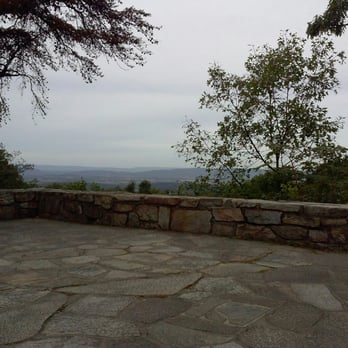
We parked at the east view parking lot and were able to catch a beautiful view before reaching the summit. We took the Orange trail up, which is a bit more of a challenge, but a 6 year old was able to make his way up. So, it's disable for mostly anyone. You need to wear proper footwear. Glad I bought Merrill shoes for this trip. The summit offers a gorgeous view which is probably best during the mid October month with changes in foliage. A great trip and right next to the winery! read more




5 years ago
Hidden Gem in on the edge of Frederick County Maryland near the Montco Border. Lived in the area for all these years and read many articles about the Sugarloaf but never gave it a second thought till the other day back. We'll impression now changed completely, this hiking wonderland is bang for buck best of the best hiking outdoorsy spot in the local area. Easy access from I-270 and near the Sugarloaf Mountain Winery (no connection) this mountain has small parking area at the entry gate with winding road up to larger parking area just a hop, skip from the top. For technical types the climb is ~ 1000' (feet) of whatever you make out of the elevation change. The parking lot at the main entrance weighs in at around 200' (feet) and its up up and away from there. If youre in any kind of reasonable shape, skip the drive up and walk.. What a concept, walking through the woods... As the local posers drive SUV's up the road, you'll enjoy the scenic woods and trail sounds and scents. The sign at the upper parking are said Bears and Slithering Critters inhabit the woods, but sticking to the main trail, ensures no sightings will be made. Thats not to say go poking around under logs, or thick brush, or off the beaten path, if so that's on the hiker. Respect the mountain is the best advice here. There are porta-potties for those that need them, and packing plenty of fluids and bug-off is well advised. There is one section of the Orange? trail that gets the heart pumping but its only when the incline steepens at the snow fence. For the most part the average hiker will be just fine. There is an abundance of hiking sticks laying around so pick one up and it will come in handy for balance and traction when the going gets tough. At the top there is plenty of scenic views, rocks to perch atop, to test balance, and rock climbing walls where roping up with climbing gear was happening. The main entrance has a spot for donations but few if any paid. Its worth noting that whomever owns and maintains the property, is doing the public a great service and most generous and patriotic. The beauty, scenic views, scents, wildlife, freedom to roam, is well worth the price of admission. If you go, use common sense, dont get in over head and enjoy. Sugarloaf is for real adventure for the suburban hiker. read more


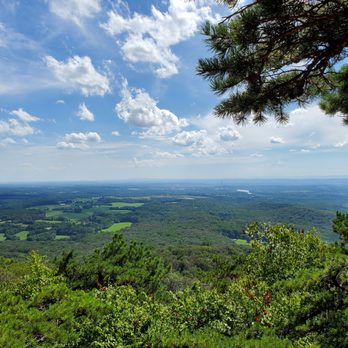


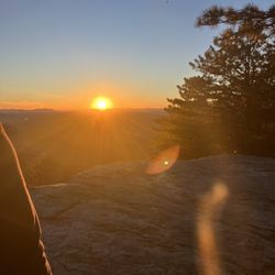
Can I say it now? Is it safe to? We hopped the fence and snuck in before the park opened trying to catch the sunrise, but we were beaten to the top by a 50y/o power walker waited who until the park opened. What slowed us down was the scenery on the way up. It's interesting that a park would not only have trails that technically go to the top, but also has a road that allows you to drive there as well. First world problems, I guess. The summit is pretty sweet, it's a scene you'd find in a Disney movie when the explorers find a pristine new land, and by "pristine" I mean to say that there's only one power plant in the valley. (It's off to the right on the river.) The parking lot at the base was just a orgy of beautifully-formed metal and plastic, minus my car, which has that dent in it serving as a constant reminder of why I can't live in NYC. In fact, it's not really a parking lot, as so much as a collision of roads, with little offshoots serving as parking spots. So I would get there early, unless you want to wait for people to pack up and go. read more


5 years ago

Great place to hike with both short and long loops options. We went in June so the trail was well shaded throughout the hike. Parts of the trail was a bit rocky and there are some climbing that you have to do, but overall it was a good hike. If you choose to do the big loop, be prepare to spend at least 4 to 4.5 hours on the hike so be sure to bring snack and water to replenish. Many thanks to the trail users that keep the trail clean by taking your trash out of the mountain. There are porter-johns and trash cans at trail heads. read more


6 years ago


15 years ago


9 years ago
I love driving to this place. Every single view is breath takingly beautiful. The significance of this place dated in the 1700's. Some historic sites here are still preserved and protected. An awesome place to go hiking or rock climbing. read more


18 years ago


12 years ago

First hike of the year took place here yesterday and I don't regret picking this hike. It's been almost 7years since I've hiked here and coming back was the best decision I could've made. We decided to park on the East View Parking even though we started our hike on the West View parking- the Blue Trail. Both parking lots are walking distance, so if you choose a lot and it's full the next one isn't too far off. The blue trail is pretty challenging but we were able to finish it within 2 1/2 hours, which in my book is excellent! It's about a 7mile hike with challenging rocky routes, that was my favorite part! The only confusion most people might encounter on the blue trail is that after you get to enjoy White Rocks, and continue on the trail towards the end you end up on a road for a millisecond. Although the that second night confused some people, because you have to pass a mini lot and stick to your left. You'll see the markers, this marker will say "towards west view parking" that's where you will want to continue. We encountered a gentleman on his own who came out of the yellow trail (I believe this is more difficult than the blue), trying to figure out where on the road will lead him to the connecting yellow trail. So it's very important you grab a map that's provided at the parking lots. It doesn't take a brainiac to figure it out but even I had a moment of concern. One thing I advise everyone now that the season is getting warmer, is to go early! My boyfriend unfortunately overslept and we didn't arrive there until noon (also if you finish early, you can beat traffic), the sun was out and it's probably the reason it took us a bit longer to finish. If you go early, you get the morning breeze and beat the scorching sun. Regardless it was a nice day out and it wasn't busy on the trails, so going hiking on a weekday is definitely a plus. There also happens to be a winery "Sugarloaf Mountain Vineyard" about a mile from there. That would be a nice treat, super cute place. read more


11 years ago
The trail maps are WILDLY inaccurate. The blue trail, which is is supposed to be 5 miles, is actually 8! There are tons of rocks on the trail so beware if your ankles roll easily. The views are beautiful, but it's not worth how badly my feet hurt from walking on jagged rocks (not to mention walking three miles more than I had anticipated!) read more


I love coming here to take in the nice views and get some good exercise. I usually take some version of the blue trail with my dog, which takes you through the the woods and has some great views at the top. The trails are kept up nicely but there are some tricky parts and some steep stairs on one downhill portion of the trail. Overall I would say it's min-mod challenge (on the blue trail), but I know there are other trails that may be easier or more difficult. I enjoy coming here to get away from the city and enjoy the outdoors. read more

More info about Sugarloaf Mountain
7901 Comus Rd
Dickerson, MD 20842
Directions
(301) 869-7846
Call Now
Visit Website
http://www.sugarloafmd.com/
Hours
Indoor Amenities
Outdoor Amenities
Sugarloaf Mountain Reviews in Other Languages
Ask the Community - Sugarloaf Mountain
Are there parking lot gates that are closed off during the off hours? What's the earliest one can start hiking up the mountain? Yelp says opens at 7am, but another site said 8am.
When I went, there were about 4 parking spaces where you could park outside the gate.
Review Highlights - Sugarloaf Mountain













Why does Yelp recommend reviews?
8 reviews that are not currently recommended
The reviews below are not factored into the business's overall star rating.

12 years ago

3 years ago

12 years ago
15 years ago

8 years ago

12 years ago
11 years ago

10 years ago


