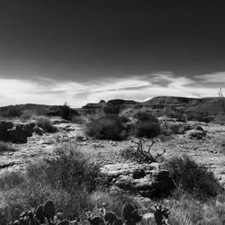
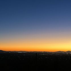
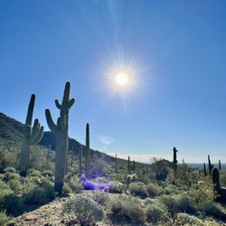
Siphon Draw Trail inc. Flatiron, Superstition Mountain Photos


More like Siphon Draw Trail inc. Flatiron, Superstition Mountain
Recommended Reviews - Siphon Draw Trail inc. Flatiron, Superstition Mountain
Start your review...

Reviews With Photos


First time making it out to this trailhead and it was slightly confusing at first after pulling in, paying the $10 fee, and attempting to navigate through the parking lot. Ironically, I was able to get in on a Sunday early morning (early bird catches the worm, right?) Trails aren't labeled that great so it's a matter of using the map they can provide you at the gate or using your hiking apps like Strava. Beautiful and stunning views with a decent workout.


When visiting Phoenix, hiking the siphon draw trail should be on your priority list. Located in the Lost Dutchman State Park this scenic trail makes for epic pictures and sweaty shirts.. It's not an easy hike and it can be crowded with other hikers, but driving out this way makes for a memorable day adventure. The hike is around 6 miles total (there and back) and it was mostly a grinding uphill trek to the top. Lots of slippery gravel in some places so wear hiking shoes. Be prepared to put in at least 5+ hours. Even if you dont think that you can finish the hike, it's still worth the attempt. $10 to park on weekends. Must see in the immediate area: - Goldfield Ghost Town (free entrance) - Driving the Apache Road (The full road is closed but it's still worth the drive to the lake and back)

Best Phoenix Hike I've found. Start at 6am, it was incredible watching the sun rise. Not nearly as challenging as I expected, but it's all relative to the shape you're in. Up took 1hr 15 min. I spent about 35-40min at the top, and the total round trip with the top rest was 3:10 (6.78 miles). It's similar to Camelback but longer, maybe 2x Camelback. The way down was not challenging like I expected given how steep it looks. Shorts are fine and preferably hiking shoes with grip. Bring a good amount of water, BRING GLOVES!!

Not easy, but super scenic and a good workout. First part of trail is east. Loose stone and gravel. Then as you ascend you will come to a big bowl area before you climb up what looks like a rock slide. Very slippery, wear good traction footwear. From there it is straight up. I would not recommend for children or dogs, although I did see both. Some people turned around at the slide. Gorgeous views.


Well if you are looking for a challenge, this is definitely it. My boyfriend has hiked this trail several times and forgot to mention to me how strenuous it is. This is NOT the trail for novice or beginners. It took us about 4 hours each way. I definitely was worried about losing my balance and falling. Once you make it to the top, the views are breathtaking. The best part of this adventure for me was having the guidance and encouragement of not only my boyfriend but complete strangers who helped me get through it! Be sure to bring plenty of fuel and water and start early. I am told avid hikers can do this between 2-3 hours one way... 6 total hours!

Super fun hike! I came here on a Wednesday morning, getting to the parking lot around 10AM. I started the hike and it was flat and hot for a while, and then it got interesting as it went into the actual mountain. There's a lot of scrambling and path-finding as the path isn't always clear, but thankfully there were always people ahead of me or coming down so I had a bit of a guide there. There weren't too many people at the top when I got there although I passed quite a few on the way up as well as when I was going back down. The views were pretty great, and I really enjoyed the hike in general! A bit rocky and hard on the knees though, that's for sure. Took about 2 hours to get up and 1.5 hours to get back down, definitely recommend it!


The hike to Flat Iron, which is a plateau more than a summit, is now officially my favorite hike just outside of the Valley. The drive to the Superstitions is well worth the gorgeous views and unique variety of terrain. After reading numerous reviews, I would be lying if I said I wasn't intimidated by this trail's reputation for being one of the toughest. My friend and I just did our first full marathon a few weekends ago, so we are still not supposed to be bouncing on our feet everywhere, but stubbornness always presides over common sense and this morning, we planned to do the hike no matter what! So it turns out, I expected the worst and the hike wasn't as tough as I envisioned. 1) Going early, like 6am early, helped greatly. The canyon was windy and shaded as we started, and being mid March, the temp at the beginning was mid 60 degrees. 2) I wore my 2L water backpack. I rarely sipped until it got warmer during the descent but at least I was ready and didn't have to hand carry a water bottle. Sadly, some peeps left empty water bottles between rocks because they didn't want to struggle carrying them. It's tough having something in your hand (camera, bottle, poles) when you are scrambling up a mountain. 3) I brought energy GUs. I had a couple protein bars too with me. All that vertical climbing wears on you - headaches form from being dehydrated and improperly fueled. 4) Take your time and make sure you spot the blue (or white dots/arrows) before ascending. If the rocks are way too slippery, as though you're causing numerous avalanches, chances are you missed the right route and must waste time going back to the "suggested" way. Trust me, I'm impatient. I learned this the hard way! On a side note, there's blue dots on the way down too! 5) I'm a dog lover, owning 2 labs myself, but did not bring them. It is a bit too challenging for them after you pass the basin of Siphon Draw. You won't enjoy the hike as much if you bring them because you will be worrying about them - if they're going to get heat exhaustion, if they'll get injured, if they have enough water, if they get in the way of people.. You catch my drift... Overall, I loved the challenge of this hike and the rewarding journey (not just the finale)! I'm definitely returning again! At approximately 5-6 miles round trip to Flat Iron and back, you get a nice little adventure. Just don't forget to have $7 cash (exactly) if you plan to go early like we did, because sometimes the pay station won't be open yet and you have to self pay.

Have I not learned a lesson from the Flagstaff Extreme yet? That was my thought when someone pulled me up and two other people pushed me up to climb up the 12 feet boulder near the top. I am not strong enough pull myself up when I am tired. Coming back down later at the same spot, I wished my legs were longer... Driving to the flatiron, when I started seeing the mountain, I was intimidated by the shape and height of this mountain. I was told we will take a little over 2 hours to the top and kept thinking how am I supposed to do that in 2 hours? This hike ended up being really fun and I enjoyed climbing rocks. Looking up, each area where I had to climb with both hands on the rocks, I kept thinking how I was supposed to be able to do that? Well I did. I was actually surprised how I was able to climb rocks like I did. Some of the part we climbed wasn't necessary if we went left. One person went right, and 10 others followed and we ended up climbing steep area. Blue dot where it supposed to help you stay on the track was difficult to spot. Some parts are really slippery. I used ski technics, going zig zag slowly so I don't slip and fall. Good hiking shoes were helpful. Gloves helped me firmly grips some sharp rocks both going up and down. I think about 80% of hikers had gloves on the day we visited. Took us 2 hours and 15 mins to the top. Felt really great to be at the top. I enjoyed beautiful rock formation while I ate my snacks at the top. Overall trip was 5 hours and from the parking lot and back was 8.5 miles. I had energy left to run the very end of the trail close to the parking. When I compare this hike to the Humphrey's peak, my knees felt so weak it was difficult to take one step after the Humphrey. I wouldn't say it was easier here but slightly being less distance and being lower altitude here, I had plenty of energy left after I was done hiking/climbing the flatiron. I consumed about 2.0l of water during my hike in November. I took 4.0l of water with me just in case. I ate one protein bar, one banana and a few piece of beef jerky. I ended up taking most of the food home. Everyone's fitness level is different. Some may need more or less. I always like to be prepared. I saw one person really hurt. I saw him climbing earlier in the morning and thought he wasn't ready but he pushed himself too much. I like to challenge a mountain but if a mountain challenges me, I walk away. Mountains will always be there.

4 months ago
This difficult 6.5 mile (5.5 according to AllTrails) heavily trafficked out and back trail is another favorite of mine out in the Superstitions. Total elevation gain is 2641' but almost all of that is in the second half, especially after siphon draw. This well-marked trail involves a lot of scrambling and vertical climbing. Lots of pretty flowers, cacti, and views along the way and at the summit. I began this one just before 11:30am when it was 55°, cloudy, and slightly windy. Ascended in 1h55min and descended in 1h37min. No water but restrooms are open at trailhead. Dogs allowed on leash (May be difficult for them past siphon draw). $7 park fee ($10 on weekends). @azfitfoodfun read more


1 year ago
2 words I'll say about hiking to the top of Flatiron... IT'S HARD. That about sums it up ;) This is a beast of a hike and should be respected. I have been saying for the past couple years that I want to do this hike. But I always find a reason not to do it. Well, I did and I accomplished my goal. And I think I'm happy to put this bad boy into the one and done category. It's hard going up, it's hard going down and the only part I enjoyed where it didn't just feel like work was being at the top. But we only spent 30 mins up there, rest of the time we were working hard. Note that the entrance fee to Lost Dutchman has recently increased. It's $20 if you have 2 or more ppl in the vehicle. We were expecting it to be $10, so just make note of that. Otherwise, great physical and mental challenge with lots of rock climbing and scrambling up the mountain. The views from the top are epic if you make it. Gloves can be helpful as well. read more


2 years ago
August in Arizona is hot! You have to get up earlier than we did to get any type of walk in. It's a beautiful spot and I would visit again. Plenty of plant and animal life despite the arid conditions. read more

3 years ago
A challenging hike not for the faint of heart. Bring lots of water and snacks as it is a 4-5 hour hike. read more


2 years ago
First time making it out to this trailhead and it was slightly confusing at first after pulling in, paying the $10 fee, and attempting to navigate through the parking lot. Ironically, I was able to get in on a Sunday early morning (early bird catches the worm, right?) Trails aren't labeled that great so it's a matter of using the map they can provide you at the gate or using your hiking apps like Strava. Beautiful and stunning views with a decent workout. read more


3 years ago
One of the most challenging, but fulfilling hikes I've done! Absolutely gorgeous views up top but this is for the experienced hikers! Bring lots of water & all your safety gear for hiking! Thanks me later! Get there early & be safe! read more


When visiting Phoenix, hiking the siphon draw trail should be on your priority list. Located in the Lost Dutchman State Park this scenic trail makes for epic pictures and sweaty shirts.. It's not an easy hike and it can be crowded with other hikers, but driving out this way makes for a memorable day adventure. The hike is around 6 miles total (there and back) and it was mostly a grinding uphill trek to the top. Lots of slippery gravel in some places so wear hiking shoes. Be prepared to put in at least 5+ hours. Even if you dont think that you can finish the hike, it's still worth the attempt. $10 to park on weekends. Must see in the immediate area: - Goldfield Ghost Town (free entrance) - Driving the Apache Road (The full road is closed but it's still worth the drive to the lake and back) read more


Best Phoenix Hike I've found. Start at 6am, it was incredible watching the sun rise. Not nearly as challenging as I expected, but it's all relative to the shape you're in. Up took 1hr 15 min. I spent about 35-40min at the top, and the total round trip with the top rest was 3:10 (6.78 miles). It's similar to Camelback but longer, maybe 2x Camelback. The way down was not challenging like I expected given how steep it looks. Shorts are fine and preferably hiking shoes with grip. Bring a good amount of water, BRING GLOVES!! read more


Not easy, but super scenic and a good workout. First part of trail is east. Loose stone and gravel. Then as you ascend you will come to a big bowl area before you climb up what looks like a rock slide. Very slippery, wear good traction footwear. From there it is straight up. I would not recommend for children or dogs, although I did see both. Some people turned around at the slide. Gorgeous views. read more


3 years ago
One of the most enjoyable hikes in the valley. It's challenging with phenomenal views. Takes a good 3 to 4 hours. Bring plenty of water and leave time to chill when you reach the top. I am looking forward to returning. read more

7 years ago
Well if you are looking for a challenge, this is definitely it. My boyfriend has hiked this trail several times and forgot to mention to me how strenuous it is. This is NOT the trail for novice or beginners. It took us about 4 hours each way. I definitely was worried about losing my balance and falling. Once you make it to the top, the views are breathtaking. The best part of this adventure for me was having the guidance and encouragement of not only my boyfriend but complete strangers who helped me get through it! Be sure to bring plenty of fuel and water and start early. I am told avid hikers can do this between 2-3 hours one way... 6 total hours! read more


Super fun hike! I came here on a Wednesday morning, getting to the parking lot around 10AM. I started the hike and it was flat and hot for a while, and then it got interesting as it went into the actual mountain. There's a lot of scrambling and path-finding as the path isn't always clear, but thankfully there were always people ahead of me or coming down so I had a bit of a guide there. There weren't too many people at the top when I got there although I passed quite a few on the way up as well as when I was going back down. The views were pretty great, and I really enjoyed the hike in general! A bit rocky and hard on the knees though, that's for sure. Took about 2 hours to get up and 1.5 hours to get back down, definitely recommend it! read more


11 years ago
The hike to Flat Iron, which is a plateau more than a summit, is now officially my favorite hike just outside of the Valley. The drive to the Superstitions is well worth the gorgeous views and unique variety of terrain. After reading numerous reviews, I would be lying if I said I wasn't intimidated by this trail's reputation for being one of the toughest. My friend and I just did our first full marathon a few weekends ago, so we are still not supposed to be bouncing on our feet everywhere, but stubbornness always presides over common sense and this morning, we planned to do the hike no matter what! So it turns out, I expected the worst and the hike wasn't as tough as I envisioned. 1) Going early, like 6am early, helped greatly. The canyon was windy and shaded as we started, and being mid March, the temp at the beginning was mid 60 degrees. 2) I wore my 2L water backpack. I rarely sipped until it got warmer during the descent but at least I was ready and didn't have to hand carry a water bottle. Sadly, some peeps left empty water bottles between rocks because they didn't want to struggle carrying them. It's tough having something in your hand (camera, bottle, poles) when you are scrambling up a mountain. 3) I brought energy GUs. I had a couple protein bars too with me. All that vertical climbing wears on you - headaches form from being dehydrated and improperly fueled. 4) Take your time and make sure you spot the blue (or white dots/arrows) before ascending. If the rocks are way too slippery, as though you're causing numerous avalanches, chances are you missed the right route and must waste time going back to the "suggested" way. Trust me, I'm impatient. I learned this the hard way! On a side note, there's blue dots on the way down too! 5) I'm a dog lover, owning 2 labs myself, but did not bring them. It is a bit too challenging for them after you pass the basin of Siphon Draw. You won't enjoy the hike as much if you bring them because you will be worrying about them - if they're going to get heat exhaustion, if they'll get injured, if they have enough water, if they get in the way of people.. You catch my drift... Overall, I loved the challenge of this hike and the rewarding journey (not just the finale)! I'm definitely returning again! At approximately 5-6 miles round trip to Flat Iron and back, you get a nice little adventure. Just don't forget to have $7 cash (exactly) if you plan to go early like we did, because sometimes the pay station won't be open yet and you have to self pay. read more


Have I not learned a lesson from the Flagstaff Extreme yet? That was my thought when someone pulled me up and two other people pushed me up to climb up the 12 feet boulder near the top. I am not strong enough pull myself up when I am tired. Coming back down later at the same spot, I wished my legs were longer... Driving to the flatiron, when I started seeing the mountain, I was intimidated by the shape and height of this mountain. I was told we will take a little over 2 hours to the top and kept thinking how am I supposed to do that in 2 hours? This hike ended up being really fun and I enjoyed climbing rocks. Looking up, each area where I had to climb with both hands on the rocks, I kept thinking how I was supposed to be able to do that? Well I did. I was actually surprised how I was able to climb rocks like I did. Some of the part we climbed wasn't necessary if we went left. One person went right, and 10 others followed and we ended up climbing steep area. Blue dot where it supposed to help you stay on the track was difficult to spot. Some parts are really slippery. I used ski technics, going zig zag slowly so I don't slip and fall. Good hiking shoes were helpful. Gloves helped me firmly grips some sharp rocks both going up and down. I think about 80% of hikers had gloves on the day we visited. Took us 2 hours and 15 mins to the top. Felt really great to be at the top. I enjoyed beautiful rock formation while I ate my snacks at the top. Overall trip was 5 hours and from the parking lot and back was 8.5 miles. I had energy left to run the very end of the trail close to the parking. When I compare this hike to the Humphrey's peak, my knees felt so weak it was difficult to take one step after the Humphrey. I wouldn't say it was easier here but slightly being less distance and being lower altitude here, I had plenty of energy left after I was done hiking/climbing the flatiron. I consumed about 2.0l of water during my hike in November. I took 4.0l of water with me just in case. I ate one protein bar, one banana and a few piece of beef jerky. I ended up taking most of the food home. Everyone's fitness level is different. Some may need more or less. I always like to be prepared. I saw one person really hurt. I saw him climbing earlier in the morning and thought he wasn't ready but he pushed himself too much. I like to challenge a mountain but if a mountain challenges me, I walk away. Mountains will always be there. read more


My favorite hike in the Valley! But trust, it will kick your you-know-what. You better come prepared for this behemoth. It's only a couple miles in total distance but that doesn't take into account the massively steep ascent to the top. The first part of the hike is a fairly gradual increase in elevation that makes you think it may not be that hard. Then you actually get to the point where you can see the flatiron and your mind changes lol. You will then meet some smooth rock that is actually easier to scale than you'd think. Once you've gone past the small waterfall and went over the slippery rocks, you have a long scrambling journey to the top. I recommend gloves especially in the winter due to the boulders getting hot by the sun. You may get second thoughts about completing the hike about halfway up. Don't. Give. Up. Continue to watch for spray-painted dots that mark the trail. Push through and you will be rewarded by one of the best views the Valley has to offer. Be sure to take a picnic up or at least some snacks because you'll definitely be hungry. If you still have any energy left, I recommend the short climb up to the mountain summit, which adds another 30 minutes to the journey. Overall, prepare to be gone about 4-5 hours. Get out there and enjoy! read more

We did siphon trail but did not go all the way up to flat iron due to time constraints. Once you hit the base of the mountain range it is such a beautiful and unique hike with lots of different sections. The part we did was very manageable (I heard the last mile is the hard part). Gorgeous views all the way up. Hoping to come back to do the whole thing eventually. read more


8 years ago
OMG. Talk about a challenge, left about 12:30 in the afternoon and barely made it back down to the vehicle by sunset. During the month of December my husband and I were looking for a hiking trail up in AZ. Superstition MT seemed like it would be a challenge------ we scrambled through rocks, we climbed, we sweat, we felt like stopping to take extra breaks, but overall we genuinely appreciated the amount that we put in to make it to the top! Worth it, give it a shot! read more


This is by far my favorite hike in the Phoenix valley area. The trail is challenging, but doable for anyone that puts forth the time and effort. I assure you that the rewards at the top are well worth it. It costs $20 to enter the Lost Dutchman state park where the trailhead is located, so come prepared for that. From the trailhead the incline starts gradually and increases until you get to the 'saddle.' The last section up to this point is flat rock, which can get slippery, so I recommend good hiking shoes that have a nice grip. From the saddle, you are about halfway, and you have a brief respite before the really challenging part starts. There's another ~1000 feet of elevation gain over a very short horizontal distance, requiring a fair amount of scrambling. The final obstacle is a 12 foot almost vertical wall you have to climb over. It's not as intimidating as it sounds, but you would do well to hike with a friend to help you navigate the foot/hand holds if you're at all nervous. Upon reaching the summit, you are treated to some of the best views in the valley. You can see CamelBack mountain as a tiny bump in the distance and have amazing views of Four Peaks to the northeast. Such a great opportunity to contemplate life and enjoy the beauty of the desert. Due to its somewhat distant location to the rest of the valley and its $20 entrance fee, the trail is never too crowded and is all the better for it. You can go at whatever pace you like and still get a great workout. Bring plenty of water (at least two liters). Also, if you're starting in the late afternoon, make sure you bring a headlamp in case you need it coming down. I consider myself a fairly experienced hiker and the fastest I've summitted was 1hr 40min. Don't spend any more time reading about it here, check out this fantastic Phoenix gem for yourself! There's nothing else like it in the valley! read more


11 years ago
I've hiked quite a bit in AZ. Humphreys was the highest. Brown's Peak (4 Peaks) has the best views from the top, Sedona has the most scenic drive, but Flatiron is the most physically enjoyable. I prefer the scrambling rather than just walking up hills. I love this so much that I do it 4 times a week, every Wednesday, Friday, and a double on Sundays. Helpful info: 1. You need to be in good (not necessarily great) physical condition to get to the top. It's all a matter of pace. If you can climb one boulder, you can theoretically climb 1000 if you have enough supplies and time. There's a short class 3 scramble at the top, but you can take a class 2 detour to the left of it if you have heights issues. 2. People often ask me how long it will take. It's like asking how long will it take to run a marathon. This mountain shouldn't be a first ever hike for you. I suggest hiking Echo Canyon side of Camelback first. Multiply your time on that trail by 2.5 to 3 to get your Flatiron time. That's all assuming you stay on trail. As far as effort level, here's a rough estimate: If your 10K race pace is 6 min or faster, this will feel like a 10 to 13 mile race. If your 10k pace is over 10 minutes, then this will feel like a marathon. 3. The trail is very easy to follow until you crest the basin. At that point, you'll see 3 distinct trails. Roughly 100 feet separate each trail. See diagram 1 below. All 3 will take you to the top, but if you take the left or middle trails, bring your machete and bushwacking skills. The right-most trail looks the most overgrown with trees at first, but that's the official trail, and is very well-kept throughout. It's mostly class 2 scrambling from here. 4. Diagram 2 shows the 2nd critical area where people tend to stray to the right. Go toward that tree and keep left. After passing this tree, follow ROUTE MARKERS! but if in doubt, stay left (before this point, better to keep right). 5. Route markers: First came the Blue spray paint that have since faded, and are too far apart to be very useful other than to give you peace of mind you're on trail. Look for newer white paint droplets that look like Seagull poop spaced 20-100 feet apart after the basin. Some are even grouped to form arrows. Always look for these, especially in wide open areas of trail. 6. Go to hikearizona's website on your smartphone and look up this hike. Download the official route. It'll prompt you to download their mobile RS app. This is a GPS route map that will guide you through the trail. It's a must-have for any novice hiker, so you can quickly see if you're going off trail or not. Load the route BEFORE starting your hike while you have reception. 7. If you have to push bushes out of your way, then you need to back track and find the trail before continuing up any longer. The further you climb off trail, the harder it will be to get back onto the right trail. 8. Bring 26oz of fluids per hour for the ascent under 85 degrees. Double that for 100 degrees. The trail faces west, so most of the climb is shaded from the sun. In summer, If you've used 70% of your fluids and you're still climbing, then it's time to descend. 9. Flatiron is not the top. The summit of Siphon Draw trail is several hundred fee higher. Instead of turning right at the top to go to flat iron, go straight/left and keep climbing. Just keep heading up and look for the cairns wherever there are any intersections. It's a much better view from the summit than from flat iron. 10. Leave your dog at home, or at least turn around at the top of the basin. Don't take your dog to the flat iron. Some boulders are too tall to climb, forcing people to carry dogs in unsafe ways. I've seen lots of bloody paws from the jagged rocks. Dogs also can't cool off like humans. Imagine wearing a plastic bag with a fur coat over it and try to hike with that. 11. Kids. If your kids can hike Echo Canyon, they can theoretically hike Siphon Draw, but ask yourself this: After your kids finish Echo Canyon, will they want to turn around and hike back up and down? And after they've done a double, will they want to do it one more time for a triple? If the answer is yes, then bring your kids on this adventure. If not, you'll have some miserable kids with you 2/3 of the way up, and all the way down. Reviewer "Bao" said a Camelback double is harder. It's all about pace. You can attack Camelback faster because it's easier terrain, achieving higher heart rate. Echo can be done without hands, but a 2-arm amputee cannot physically climb to flatiron alone. If Bao brought his Flatiron time down to 2hr instead of 3hr, he won't say 2x Camelback is harder. read more


We began our adventure at 6:00am on Saturday morning. Parking is $7 and finding the trail head was very easy. As we passed by the Welcome gate we were in awe of beautiful lush mountains and scenery that looked quite jungle like. I said to my friends, "Wow - wouldn't it be amazing if we get to that canyon and it's like a different world! With monkey's jumping around and herbivorous pterodactyl's soaring through the air, colorful exotic birds and flowers that fill the air with a beautiful sweet scent as you ascend the mountain!?" Well, they thought I was crazy and my imagination definitely didn't come to fruition - there were no exotic creatures or wildlife, BUT there was moss and plenty of Gnats! Making my first recommendation: bug spray! We were covered in gnats the entire trip so save yourself 5-6 hours of aggravation and get some. Immediately after starting we were at a consistent incline. It was then that I could tell this wasn't going to be an easy feat, especially when you look AT Flat Iron and see just how far you have to go! 4,800 feet... Straight up! Yikes! Alas, we dug deep and just took it one step at a time. We got off trail a time or two - following the white dots isn't as easy as it seems because they blend in. "I see a white dot! Oh, wait, no... that's bird poop." My best advice would be that it seemed you ought to stay to the left most times it looks like the trail splits, but that's just me. Be careful! Of course, bring water. And plenty of it! I'm 5'1", 120lbs and went through 68 ounces like it was nothing! Also, bring some wet wipes (and Ziploc baggies for the trash) if you need to do your business. My second recommendation: take gloves! I can't stress this enough. I used some old gardening gloves I had that had a little bit of grip and they worked great. We were basically mountain goats the majority of this hike so I don't know how I would have managed without. Especially, when it came to the dreaded "10 foot wall," which is actually not daunting at all and upon arrival had us all on an anticlimactic revelation as we realized the wall of terror we heard so much about was not a big feat, but in actuality had us all cawing "that's it?!?" Lame. Albeit the hike wasn't the Avatar inspired vision I had it was still gorgeous! The views throughout are awesome and climbing rocks is really fun! The view(s) at the top are even more breathtaking! There's no bar, which was disappointing, but it looks like a landscaped garden and has trees that look like something out of the Lorax. You know no one is hiking up there to trim bushes so it's awesome seeing how pretty "untouched" nature is! Some other little tips from my experience: 1. Clip your toenails short so your toes don't get sore when going downhill. You can even buy toe pads that ballerina's use for extra cushion. 2. Don't wear cotton, especially socks. I got a major blister on the ball of my right foot. 3. Eat breakfast and bring snacks for energy. When we first started I kept whining, "I don't wanna!", but I had a Power Bar and 30 minutes later I was PUMPED! 4. Watch out for critters! On our way up a girl asked us if we saw a rattlesnake that apparently was just hanging out near the trail. No thanks! 5. Zig-zagging downhill helps tremendously instead of trying to go straight down slippery rock. 6. Carb load the night before and get plenty of protein after for recovery. 7. Don't attempt this hike if you've never hiked before or are out of shape. Seriously. As mentioned before, we started this hike at 6am. Praise Jesus we were able to hike up the entire mountain in the shade, however, our descent wasn't so enjoyable. By that time (10am or so) the sun was beating down and it was pretty draining. I lathered up with some much needed sunscreen and had to sing my complaints out loud to keep myself from going crazy at how monotonous it was. If I were to do this hike again I would probably start at 5am. On our way down there was a guy in rough shape. He kept saying he didn't think he was going to make it. He was throwing up, crying, snot running down his nose - so be careful! Heat exhaustion and dehydration are NO joke. If you can't do Camelback or Piestewa with ease, you can't do this either. Overall, this hike took us 6 hours round trip from the parking lot, and covered around 7 miles. I do intermediate yoga at least twice a week and go to the gym so I would consider myself in decent shape; this mountain will kick your butt, but you will survive! Although, I have to admit, some extra inches would have come in handy. I got to a couple of big boulders and thought, "how in the hell are these little legs going to get up THAT!?" But I made like a monkey and made do! I for sure thought I was going to be in pain the day after, but in some magical way I wasn't sore AT ALL. How that's even possible? I honestly have no idea. Just get out there and do it! Flat Iron in all of its glory is waiting for you! read more


7 years ago
This is one of the greatest hikes I have been on. I am not a experienced hiker but had no troubles getting to the top. Impressive views such an accomplishment reaching the summit if you live in Arizona or visiting and would like to go on a hike "NOT IN THE SUMMER TIME" I would definitely suggest this one. Bring a lot of water with you I went through 3 liters. read more


14 years ago
I have one word for Flatiron Mountain: KILLER (but in a good way if you like to hike) Flatiron Mountain is about an hour out of Phoenix by Mesa. I had heard about this place from a long-time friend who told me it was hard. Naturally, I didn't believe him. I assumed he thought I was wimpy or something. Little did I know he was right and my legs would hate me for three days after climbing the thing. So here's the scoop in case you want to try it yourself -- because you know, misery loves company and right now I'm needing the company. The Siphon Draw Trail at Flatiron starts at Lost Dutchman State Park and it is 6 miles long - which sounds like nothing until you actually do it. This is because, the higher you climb, the harder it gets - and my friend and I also went when it was 106 degrees. Yes, it was hot. Way too hot to be climbing a mountain, but whatever. If you go, at first you are going to think I'm a wuss because the first mile of the trail is easy. It's well-maintained and marked. But keep going. The farther you walk up the trail, the more rugged the path gets. Soon the dirt path disappears and is replaced with small loose rocks and the higher you climb, the more narrow and rough the path gets. There are giant boulders to climb over and a large smooth stone basin which probably has water in it part of the year, but was completely dry when we went in September. From there, the trail (if you could call it that), leads towards Flatiron, which is the flat plateau on the top of the Superstition Mountain. I was considering to do this mountain alone, but was glad I went with a friend. The path is kind of marked (you have to look for spray painted marks on the boulders), but even with that, we got lost and made up our own route for part of the way. Then there's the climbing. This is what was challenging for me. I've hiked, but never actually had to climb and pull myself over giant rocks before. Of course, I'm wearing normal sneakers and not hiking shoes as I had no idea the climb would be so intense. In fact the mile between the smooth rock area and the top is over 1,500 feet in elevation. And then just when you think you're done and can see the top, there is a 12-foot vertical rock wall. I admit, I didn't get that far. I had to wimp out about 10 minutes before reaching the top. This is because just before giant vertical wall was a slightly smaller (yet, still too big for me) boulder area and I couldn't pull myself over it. Yes, the mountain defeated me and if they hidden cameras in the area, I would totally be on the blooper reel as I am not a graceful climber. I'm more like the people on that show "Wipe Out" with arms flailing everywhere and hanging on any which way possible. But what I really needed to make it to the top was two people: One to pull my arms and someone behind me to push my butt up from behind -- or maybe catch me as I slid back down. My friend (who went on ahead) tells me that if I would have been able to scale the 12-foot rock wall, I would have been at the top of the mountain. Sigh...so close, but not close enough. I don't have any regrets though. I was exhausted just getting to where I got to, and going down was just as hard as going up. You see, going up you can use your hands to claw and clutch your way up, but going down, there is no clutching. There is only scary sliding down on your butt and hoping your feet find a little hook in the rock to stop you. I swear, I crab-crawled my way down the mountain and was glad I had my biking gloves with me or else my hands would have been shredded. So will I do it again? Yes. But here's what I would do differently: -- Bring more water -- Start earlier and not at 11 a.m. when it's super hot -- Do more upper body training so I can make it over the rock wall read more


14 years ago
I love this trail! You get to climb to the very top of some of the tallest mountains in the Phoenix metro area! These mountains are so high up that they'll get a light dusting of snow every winter, sometimes lasting as long as 2 weeks. This place is for sure a challenge. I would recommend it for those who have mastered the Camelbacks and Piestewa Peaks and are ready for a new challenge. Here are a few reasons why I love this trail: 1. Elevation. The change is so dramatic that you'll enter different habitats along the way. From low lying shrubs and cacti at the bottom to larger trees and plants towards the top. Then on the very top (the Flatiron) you'll see what kind of plans survive on the windswept plateau. 2. Challenge I would say climbing this mountain is a feat. This mountain rises high above our deserts and everytime you look East and see this, you'll known that you stood atop the Superstition at one point in time. 3. Views From the top on a clear day you can see all the way over to the White Tank Mountains (those mountains by the west side you pass going to Cali) and looking behind you, you can see the Superstition Mountain range and beyond to the Pinal Mountains and Four Peaks. 4. Serenity If you're turned off city hiking due to crowded trails or too little parking, you'll enjoy the experience here. At least on weekends you won't be alone on this hike, but groups are much more spaced out and there is a ton of parking. You can even camp here if you wold like. I always feel like there is just enough people so you don't have to worry about people not finding your body but not too much where they get in the way. 5. Wildflowers Everybody in metro Phoenix should be out here after a good rainy season to see the flowers. This is along the Siphon Draw Trail, an easy flat walk though the park basically, but gives you some of the best wildflower views nature has to give. (SEE MY PHOTOS!) Protips: Bring plenty of water. My camelback is not enough for this place, I have to bring extra bottles! Bring a snack or sandwich to eat on top. Start early. Hella early to avoid major heat and to get done at a decent time. 6:00 am is a good time to start, just calculate the time it takes to drive here! read more


10 years ago
I read a lot of reviews before going on this hike and I'm going to just conclude the best of all of the tips in this review. Let's start with-I'm a fit 27 year old gal and workout at least 5 times per week. I love hiking but probably go only about 10 times in a year (so, not often.) I can make it up camelback in 45 minutes comfortably and mostly because who I'm with needs to take a few breaks along the way. Now that the disclaimer is out of the way here is my opinion and best tips! 1. This hike is worth the 3 hours it takes to get up because the view is incredible. 2. Go early. We left the car 8:15am and got back to the car at 1:15pm and by that time it was hot. 3. Bring sunscreen, lots of water (camelpack is ideal), snack for the top, hat, hiking gloves, and good hiking shoes. Many of the parts can be slick and you need good traction. Oh and a camera! 4. This is not for those who cannot do camelback comfortably. In distance and elevation it is literally going up camelback twice and coming down twice in one trip. It's tedious and you do a lot of scrambling up big boulders. You need steady legs to come down with. 5. Near the top there is a vertical rock before the "nature walk trail" to the summit. Go up the wall on the right, come down that same wall on the left using the sturdy tree! I am kind of afraid of heights and this was valuable info! We also camped at the campground. We were the only tent camping crew there. It was super clean, quiet, and open. It was the four seasons of camp grounds! read more


16 years ago
10 years ago
Gangster little hike! The first mile or so was the toughest (in my yelpy opinion) traversing rocky trail and stepping over railroad ties. Once you get up to the basin, the terrain gets more like rock climbing and scrambling, but still easy enough for most. A little less than a mile after this, you get to the slick rock limestone where you have to scramble up toward the top heading to flat iron. Definitely leave early, especially if you insist on doing this in the heat of summer, like I did. Bad idea, by the way. We left about 745 and it was nice walking half of this in the shade. With a breeze it was beautiful. The way back down was much warmer, as the sun had come up over the top of the mountain. Bring lots of water. I had 3L in my water pack and probably used about 1/2 to 3/4 this time, just to keep hydrated. Wear good shoes. A hat or head wrap also helps when the sun comes up. And don't forget sunscreen! If you're tent camping, as we were, the $15 fee covers entrance to the park and all the hiking trails. Facilities are incredible. Clean and very well kept. Ritz Carlton of campgrounds! Love this place. read more


10 years ago
I did the Flatiron hike for the first time on Feb 14th 2016. Boy was it tough! I have done Piestewa Peak summit trail several times and Camelback Chollo trail once. But Flatiron was by far the hardest I have done yet! It's like hiking the Piestewa peak summit trail 3 times over. It IS worth it! A very involved and fun trail with an AMAZING view waiting at the top. We got to see a Gila Monster pretty close to the trail! So keep an eye out for wildlife. We parked at Saguaro parking lot, it was not too hard to find a spot. It took us about 7 hours round trip from the parking lot, to the top of Flatiron and back. We did take a lot of breaks and my tracker said the round trip was about 10 miles. The trail it-self was pretty busy, and you kinda have to wait on other people to pass on some spots because the trail gets pretty narrow. I would not say it was hard to find and stay on the trail, but it is NOT clearly marked at all so you have to be careful to watch where you are going. My recommendation is to stay on the creek path that once used to be a river/waterfall. Hiking boots are a must, and they need to have a good grip and a sturdy bottom. There are several spots where you have to "rock climb" and crawl up with not much to grab onto, especially one spot at the top that's about 12-15 foot high. Some sort of gloves may be helpful. If the park rangers tie a rope here that would be awesome! Bring plenty of water and lots of snacks, I went through about 3L of water plus 2 bottles of Gatorade, an orange, a PB&J sandwich and couple of power bars. Go only as high as you can climb back down, if you spend all of your energy climbing up, you are stuck ;) Coming down is not an easy task either, lots of times i had to use my hands and sit and slide. Overall, the park is beautiful and the weather was perfect for the hike. Flowers are starting to bloom and there are some easier trails for nice walks. Enjoy and Be Safe! read more


11 years ago
I have hiked many trails in Arizona and this is at the top of my favorites list. I went with a few co workers of all skill levels. It took us an average a 4 and a half hours round trip. The scenery and terrain constantly changes. I would recommend this hike for anyone. However, not sure everyone can make it all the way due to the tougher rock climbing area at the very top. read more


Definitely one of the toughest hikes right outside of PHX. I would rate this one side by side with Camelback and I'll explain later. If you can do Camelback try x2! This is one of those great weekend hikes with friends. I would say it would take 5 hours total. If you aren't sure you can do this; don't do this! However, if you're a trail runner this should take at least 3 hours tops. Again, if you think you can do this; try to be positive and know you can! Okay I say it's equal to Camelback because I do trail running and going up and down Echo Canyon and Cholla Trail and back again is so much tougher! However, I would still recommend Flatiron just for the experience! - Enjoy! read more


10 years ago
My pictures show our 5-year-old climbing to the top, but don't let that fool you. This mountain is not appropriate for most kids. Don't bring kids unless you're experienced on this mountain and you know for sure you won't get lost. There are very few hikers on this trail, and even the ones you see are probably hiking it for the first time, so don't assume they're on trail. If you don't follow the not-so-obvious route markers after the basin, you have very little chance of staying on trail. See Ocean's review. Once you get to Flatiron, you have a 180 degree view below, but for a 360 panoramic, you'll need to keep climbing to the summit (Peak 5024). The trek to the summit is a very different experience. The rocks are bigger, the foliage thicker, but the scenery much, much better. You'll get to see the giant hoodoos up-close. The view of Four Peaks is stunning, especially when it's snow capped. Weaver's Needle, and the rest of the Tonto National Forest and Superstition Wilderness just opens right up from the summit. Don't wear old sneakers. You'll slip. A lot. Hiking shoes recommended, but if you don't have those, wear new shoes with lots of tread left. Hike time = Echo Canyon time x 3 read more


10 years ago
Its $ 7 per car to enter the park & the hike is 7 miles roundtrip , very demanding hike. Hiking shoe is a must and preferably starting earl would best as it takes 5 -6 hours to complete the hike. A must do for the hikers & the view from summit is worth the effort. read more

5 years ago
8 years ago
8 years ago
Page 1 of 3
More info about Siphon Draw Trail inc. Flatiron, Superstition Mountain
6109 N Apache Trl
Apache Junction, AZ 85119
Directions
Hours
Indoor Amenities
Outdoor Amenities
Ask the Community - Siphon Draw Trail inc. Flatiron, Superstition Mountain
Review Highlights - Siphon Draw Trail inc. Flatiron, Superstition Mountain


Siphon Draw Trail inc. Flatiron, Superstition Mountain - hiking - Updated June 2026
Best of Apache Junction
People found Siphon Draw Trail inc. Flatiron, Superstition Mountain by searching for…
Hiking Trails With Waterfalls in Apache Junction, Arizona
Scenic Drive in Apache Junction, Arizona
Campgrounds in Apache Junction, Arizona
Things to Do in Apache Junction, Arizona
Photo Spots in Apache Junction, Arizona
Scenic Night View in Apache Junction, Arizona
Sunrise Hike in Apache Junction, Arizona
Ghost Towns in Apache Junction, Arizona
Stairs Workout in Apache Junction, Arizona
Watch Sunset in Apache Junction, Arizona
Easy Hiking Trails in Apache Junction, Arizona
Waterfalls in Apache Junction, Arizona
Rock Climbing in Apache Junction, Arizona
Attractions in Apache Junction, Arizona
Off Road Trails in Apache Junction, Arizona
Parks in Apache Junction, Arizona
Natural Hot Springs in Apache Junction, Arizona
Places to Take Pictures in Apache Junction, Arizona
Night Hike in Apache Junction, Arizona
Dog Friendly Hiking Trails in Apache Junction, Arizona
Stair Climbing in Apache Junction, Arizona
Sunrise View in Apache Junction, Arizona
Trending Searches in Apache Junction, AZ
Black Owned Nail Salons near Siphon Draw Trail inc. Flatiron, Superstition Mountain
Boat Rental near Siphon Draw Trail inc. Flatiron, Superstition Mountain
Cliff Jumping near Siphon Draw Trail inc. Flatiron, Superstition Mountain
Creeks near Siphon Draw Trail inc. Flatiron, Superstition Mountain
Day Trips near Siphon Draw Trail inc. Flatiron, Superstition Mountain
Fishing Spots near Siphon Draw Trail inc. Flatiron, Superstition Mountain
Jet Ski Rental near Siphon Draw Trail inc. Flatiron, Superstition Mountain
Kayak Rental near Siphon Draw Trail inc. Flatiron, Superstition Mountain
Lakes & Ponds near Siphon Draw Trail inc. Flatiron, Superstition Mountain
Off Road Trails near Siphon Draw Trail inc. Flatiron, Superstition Mountain
Outdoor Activities near Siphon Draw Trail inc. Flatiron, Superstition Mountain
Places To Walk Around near Siphon Draw Trail inc. Flatiron, Superstition Mountain
Public Pools near Siphon Draw Trail inc. Flatiron, Superstition Mountain
Public Shower near Siphon Draw Trail inc. Flatiron, Superstition Mountain
River Swimming near Siphon Draw Trail inc. Flatiron, Superstition Mountain
Rock Quarry near Siphon Draw Trail inc. Flatiron, Superstition Mountain
Scenic Night View near Siphon Draw Trail inc. Flatiron, Superstition Mountain
Scenic Overlook near Siphon Draw Trail inc. Flatiron, Superstition Mountain
Secluded Spots near Siphon Draw Trail inc. Flatiron, Superstition Mountain
Soccer Store near Siphon Draw Trail inc. Flatiron, Superstition Mountain
Splash Pad near Siphon Draw Trail inc. Flatiron, Superstition Mountain
Strawberry Picking near Siphon Draw Trail inc. Flatiron, Superstition Mountain
Sunrise View near Siphon Draw Trail inc. Flatiron, Superstition Mountain
Swimming Holes near Siphon Draw Trail inc. Flatiron, Superstition Mountain
Swimming Lakes near Siphon Draw Trail inc. Flatiron, Superstition Mountain
U Pick Farms near Siphon Draw Trail inc. Flatiron, Superstition Mountain
Watch Sunset near Siphon Draw Trail inc. Flatiron, Superstition Mountain
Water Parks near Siphon Draw Trail inc. Flatiron, Superstition Mountain
Waterfalls near Siphon Draw Trail inc. Flatiron, Superstition Mountain
Browse Articles
Browse Nearby
Browse Brands
Related Searches in Apache Junction, AZ
Affordable Kayak Rental Services in Apache Junction, Arizona
Best Fishing Locations and Guides in Apache Junction, Arizona
Best Places for Horseback Riding in Apache Junction, Arizona
Best Waterfalls and Swimming Holes in Apache Junction, Arizona
Check Out Off Road Trails in Apache Junction, Arizona
Discover Dog Friendly Trails to Explore in Apache Junction, Arizona
Discover Scenic Mountain Bike Trails Near Apache Junction, Arizona
Discover Walking Parks in Apache Junction, Arizona Near You
Discover a Hiking Trail in Apache Junction, Arizona
Discover the Best Night Hike Trails in Apache Junction, Arizona
Discover the Best Running Track in Apache Junction, Arizona
Enjoy Camping Adventures Around Apache Junction, Arizona
Enjoy Exciting Mountain Biking Adventures in Apache Junction, Arizona
Enjoy Kayaking Adventures in Apache Junction, Arizona
Enjoy River Tubing Adventures in Apache Junction, Arizona
Enjoy Tent Camping Spots Around Apache Junction, Arizona
Enjoy a Beautiful Waterfall Hike in Apache Junction, Arizona
Enjoy the Best Tubing Experiences in Apache Junction, Arizona
Enjoy the Best Walking Path in Apache Junction, Arizona
Enjoy the Best Walking Trails in Apache Junction, Arizona
Experience Thrilling White Water Rafting in Apache Junction, Arizona
Explore Beautiful Parks and Green Spaces in Apache Junction, Arizona
Explore Easy Hikes Perfect for All in Apache Junction, Arizona
Explore Fun Activities to Do in Apache Junction, Arizona
Explore Popular Campgrounds Near Apache Junction, Arizona
Explore Top Dog Parks in Apache Junction, Arizona Near You
Explore the Best Beach Spots in Apache Junction, Arizona
Explore the Best Boating Spots in Apache Junction, Arizona
Explore the Best Trail Options in Apache Junction, Arizona
Family Friendly Hiking With Kids in Apache Junction, Arizona
Find Beautiful Views in Apache Junction, Arizona
Find Popular Ziplining Spots Around Apache Junction, Arizona
Find the Best Parks for Picnics in Apache Junction, Arizona
Find the Best Scenic View Locations in Apache Junction, Arizona
Great Places to Walk in Apache Junction, Arizona
Hiking Trails With Waterfalls in Apache Junction, Arizona
Off Leash Dog Hiking Trails in Apache Junction, Arizona
Plan a Scenic Drive Route Near Apache Junction, Arizona
Popular Fishing Spots to Explore in Apache Junction, Arizona
Popular Outdoor Activities to Try in Apache Junction, Arizona
Popular Picnic Spots to Visit in Apache Junction, Arizona
Safe River Swimming Areas in Apache Junction, Arizona
Safe and Fun Parks for Kids in Apache Junction, Arizona
Top Climbing Spots and Gyms in Apache Junction, Arizona
Top Places for Snorkeling in Apache Junction, Arizona
Top Running Trails to Explore in Apache Junction, Arizona
Top Swimming Lakes to Enjoy in Apache Junction, Arizona
Top Swimming Spots and Pools in Apache Junction, Arizona
Walk Dog Friendly Hiking Trails in Apache Junction, Arizona
Walk the Best Paved Walking Trails in Apache Junction, Arizona
People who viewed Siphon Draw Trail inc. Flatiron, Superstition Mountain also viewed
Peralta Trails
32 reviews
Massacre grounds Trail
8 reviews
Picketpost Trail
14 reviews
Paseo Trail
17 reviews
Tonto National Forest
12 reviews
Hawes Trail System
8 reviews
Broadway Trailhead to Broadway Cave
3 reviews
Interpretive Trail
9 reviews
Beverly Canyon Trailhead
8 reviews
Boulder Canyon Trail - Superstition Mountain
17 reviews