Massacre grounds Trail Photos


You might also consider
More like Massacre grounds Trail
Recommended Reviews - Massacre grounds Trail
Start your review...

Reviews With Photos

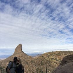
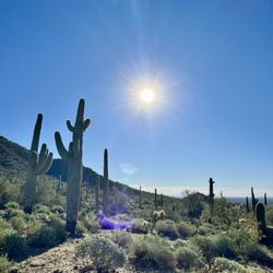
I came here to run / hike on a Saturday morning around 11:30AM, and when I arrived, the parking lot was pretty full but still had spots. The map at the head of the trail was helpful, and the hike itself was very scenic. Lots of people though, and the trail is pretty narrow and rocky at some parts. The view there and the view back were both great, and it's not very steep. The waterfall is (obviously) not there at the moment but I could see the impact it made on the rocks. Near the end there were some burn marks from the fire, clearly visible. Good trail though, unshaded as usual in AZ.

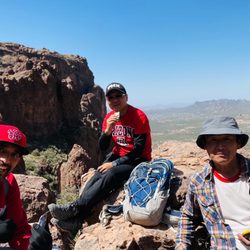
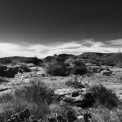
Beautiful trail! The scenery is outstanding. Took me four hours to get to the waterfall and back down with my three dogs. You have got to make sure you got plenty of water with you as you will be on the trail for a long time. There is a lot of steep gravel. I slipped many times. Good shoes is a must.

2 years ago
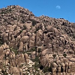
Massacre falls is awesome to visit when the waterfall is going strong. With all the recent rain it's pretty great right now. I've done this trail a few years ago. The water fall was much more impressive this time. I will say that this time it felt way harder than I remember. Overall I think we hiked about 7 miles out to the falls & back to the parking area. There is a gradual increase in elevation as you hike up to the waterfall. I don't remember all that, I thought the trail was more flat. The views are gorgeous, especially at sunset. This hiking area is next to the Lost Dutchman State Park which charges for admission. Same overall area but no fee to hike up to Massacre falls. Highly recommend it! read more


9 months ago
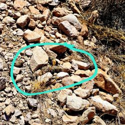
Massacre Falls's waterfalls appear only this time of the year or after rain. I think I missed the perfect timing by one week based on some pictures posted online but I still got to see some water when I visited. We had lots of snow this year and melted snow created lots of water flowing to this waterfalls. Trail is less than 6 miles round trip. Come early to avoid crowds. When we arrived around 8am, we saw less than 10 cars parked. By the time we got back around 11am, parking lot was completely full. Trail is listed moderate. I thought it was pretty easy. Lots of pretty wildflowers along the trail, trek to the Falls was enjoyable. Dogs allowed and I saw many of them. Hiking sticks not required but always helpful some slippery area. Free parking. read more


I came here to run / hike on a Saturday morning around 11:30AM, and when I arrived, the parking lot was pretty full but still had spots. The map at the head of the trail was helpful, and the hike itself was very scenic. Lots of people though, and the trail is pretty narrow and rocky at some parts. The view there and the view back were both great, and it's not very steep. The waterfall is (obviously) not there at the moment but I could see the impact it made on the rocks. Near the end there were some burn marks from the fire, clearly visible. Good trail though, unshaded as usual in AZ. read more


6 years ago
Beautiful trail! The scenery is outstanding. Took me four hours to get to the waterfall and back down with my three dogs. You have got to make sure you got plenty of water with you as you will be on the trail for a long time. There is a lot of steep gravel. I slipped many times. Good shoes is a must. read more


I loved every minute of this waterfall hike in late spring. Looking forward to more rain at some point so I can go again when the waterfall is flowing. My GPS has it about 5.5 miles round trip - nothing technical and quite easy for 5.5. Go early around sunrise and take in nature and the end you will be pleasantly rewarded. Beautiful! read more


7 years ago
4 years ago
More info about Massacre grounds Trail
1st Water Trail
Gold Canyon, AZ 85118
Directions
Hours
Indoor Amenities
Outdoor Amenities
Ask the Community - Massacre grounds Trail


Massacre grounds Trail - hiking - Updated May 2026
Best of Gold Canyon
People found Massacre grounds Trail by searching for…
Hiking Trails With Waterfalls in Gold Canyon, Arizona
Places to Take Pictures in Gold Canyon, Arizona
Things to Do in Gold Canyon, Arizona
Watch Sunset in Gold Canyon, Arizona
Waterfalls in Gold Canyon, Arizona
Photo Spots in Gold Canyon, Arizona
Easy Hikes in Gold Canyon, Arizona
Scenic View in Gold Canyon, Arizona
Dog Friendly Parks in Gold Canyon, Arizona
Sunrise Hike in Gold Canyon, Arizona
Dog Friendly Hiking Trails in Gold Canyon, Arizona
Running Trails in Gold Canyon, Arizona
Sunrise View in Gold Canyon, Arizona
Waterfalls and Swimming Holes in Gold Canyon, Arizona
Sunset View in Gold Canyon, Arizona
Night Hike in Gold Canyon, Arizona
Walking Trails in Gold Canyon, Arizona
Free Parking in Gold Canyon, Arizona
Dog Friendly Things to Do in Gold Canyon, Arizona
Places to Run in Gold Canyon, Arizona
Places to Walk at Night in Gold Canyon, Arizona
Trending Searches in Gold Canyon, AZ
Boat Rental near Massacre grounds Trail
Botanical Gardens near Massacre grounds Trail
Bounce House Rentals near Massacre grounds Trail
Campgrounds near Massacre grounds Trail
Cheap Plants near Massacre grounds Trail
Cliff Jumping near Massacre grounds Trail
Floral Designers near Massacre grounds Trail
Flower Fields near Massacre grounds Trail
Flower Shop near Massacre grounds Trail
Garage Sales near Massacre grounds Trail
Garden Center near Massacre grounds Trail
Lakes & Ponds near Massacre grounds Trail
Nurseries & Gardening near Massacre grounds Trail
Outdoor Activities near Massacre grounds Trail
Outdoor Furniture Stores near Massacre grounds Trail
Parks near Massacre grounds Trail
Party Equipment Rentals near Massacre grounds Trail
Pedicure near Massacre grounds Trail
Photo Spots near Massacre grounds Trail
Picnic Areas near Massacre grounds Trail
Places To Take Pictures near Massacre grounds Trail
Rock Quarry near Massacre grounds Trail
Running Trails near Massacre grounds Trail
Rv Rental near Massacre grounds Trail
Scenic Drive near Massacre grounds Trail
Sunrise View near Massacre grounds Trail
Swimming Holes near Massacre grounds Trail
Table And Chair Rentals near Massacre grounds Trail
Browse Articles
Browse Nearby
BEST of Gold Canyon, Arizona Coffee near Massacre grounds Trail
BEST of Gold Canyon, Arizona Restaurants near Massacre grounds Trail
BEST of Gold Canyon, Arizona Things to Do near Massacre grounds Trail
BEST of Gold Canyon, Arizona Breakfast near Massacre grounds Trail
BEST of Gold Canyon, Arizona Parks near Massacre grounds Trail
BEST of Gold Canyon, Arizona Walking Trails near Massacre grounds Trail
BEST of Gold Canyon, Arizona Campgrounds near Massacre grounds Trail
BEST of Gold Canyon, Arizona Caves near Massacre grounds Trail
BEST of Gold Canyon, Arizona Visitor Centers near Massacre grounds Trail
Browse Brands
Related Searches in Gold Canyon, AZ
Affordable Kayak Rental Services in Gold Canyon, Arizona
Best Fishing Locations and Guides in Gold Canyon, Arizona
Best Places for Horseback Riding in Gold Canyon, Arizona
Check Out Off Road Trails in Gold Canyon, Arizona
Discover Dog Friendly Trails to Explore in Gold Canyon, Arizona
Discover Kid Friendly Hiking Trails in Gold Canyon, Arizona
Discover Scenic Mountain Bike Trails Near Gold Canyon, Arizona
Discover Top Nature Parks to Visit in Gold Canyon, Arizona
Discover a Hiking Trail in Gold Canyon, Arizona
Discover the Best Night Hike Trails in Gold Canyon, Arizona
Discover the Best Running Track in Gold Canyon, Arizona
Dog-Friendly Hikes With Dogs in Gold Canyon, Arizona
Enjoy Camping Adventures Around Gold Canyon, Arizona
Enjoy Exciting Mountain Biking Adventures in Gold Canyon, Arizona
Enjoy Kayaking Adventures in Gold Canyon, Arizona
Enjoy River Tubing Adventures in Gold Canyon, Arizona
Enjoy Tent Camping Spots Around Gold Canyon, Arizona
Enjoy a Beautiful Waterfall Hike in Gold Canyon, Arizona
Enjoy the Best Walking Path in Gold Canyon, Arizona
Enjoy the Best Walking Trails in Gold Canyon, Arizona
Experience Thrilling White Water Rafting in Gold Canyon, Arizona
Explore Beautiful Parks and Green Spaces in Gold Canyon, Arizona
Explore Easy Hikes Perfect for All in Gold Canyon, Arizona
Explore Fun Activities to Do in Gold Canyon, Arizona
Explore Popular Campgrounds Near Gold Canyon, Arizona
Explore Top Dog Parks in Gold Canyon, Arizona Near You
Explore the Best Beach Spots in Gold Canyon, Arizona
Explore the Best Boating Spots in Gold Canyon, Arizona
Explore the Best Trail Options in Gold Canyon, Arizona
Family Friendly Hiking With Kids in Gold Canyon, Arizona
Find Beautiful Views in Gold Canyon, Arizona
Find the Best Parks for Picnics in Gold Canyon, Arizona
Find the Best Scenic View Locations in Gold Canyon, Arizona
Great Places to Walk in Gold Canyon, Arizona
Hiking Trails With Waterfalls in Gold Canyon, Arizona
Off Leash Dog Hiking Trails in Gold Canyon, Arizona
Picnic Areas With BBQ Pits Available in Gold Canyon, Arizona
Plan a Scenic Drive Route Near Gold Canyon, Arizona
Popular Fishing Spots to Explore in Gold Canyon, Arizona
Popular Outdoor Activities to Try in Gold Canyon, Arizona
Popular Picnic Spots to Visit in Gold Canyon, Arizona
Safe River Swimming Areas in Gold Canyon, Arizona
Safe and Fun Parks for Kids in Gold Canyon, Arizona
Top Climbing Spots and Gyms in Gold Canyon, Arizona
Top Places for Snorkeling in Gold Canyon, Arizona
Top Running Trails to Explore in Gold Canyon, Arizona
Top Swimming Lakes to Enjoy in Gold Canyon, Arizona
Top Swimming Spots and Pools in Gold Canyon, Arizona
People who viewed Massacre grounds Trail also viewed
Wave Cave
56 reviews
Wind Cave Trail
68 reviews
Hieroglyphic Trail Hoa
65 reviews
Siphon Draw
8 reviews
Spook Hill Mountain Preserve
17 reviews
Siphon Draw Trail inc. Flatiron, Superstition Mountain
89 reviews
Silly Mountain Park
28 reviews
Lost Dutchman State Park
181 reviews
Fish Creek Trail 60
1 review
Merkle Trail
1 review