Cancel

    Open app

    Search

    Seneca Caverns

    4.0 (1 review)

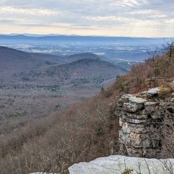
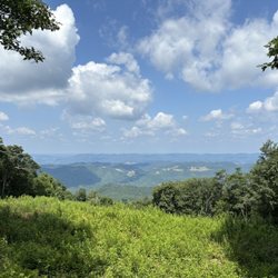
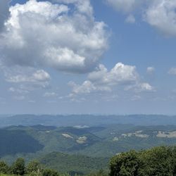
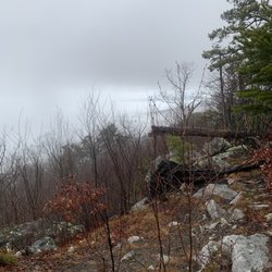
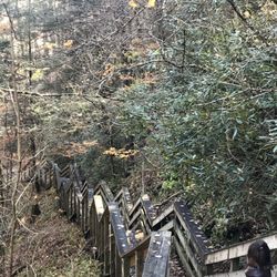
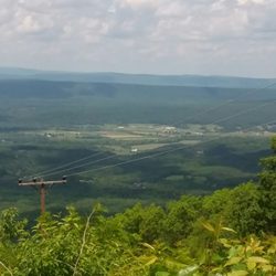
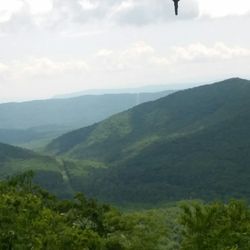
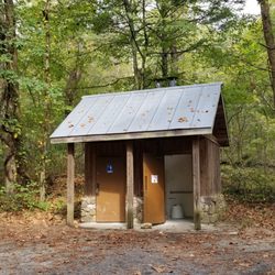
    Seneca Caverns Photos

    More like Seneca Caverns

    Recommended Reviews - Seneca Caverns

    Your trust is our priority, so businesses can't pay to alter or remove their reviews. Learn more about reviews.
    Yelp app icon
    Browse more easily on the app
    Review Feed Illustration
    Photo of Ward D.
    8
    1239
    3207

    4 years ago

    Helpful 0
    Thanks 0
    Love this 0
    Oh no 0

    Verify this business for free

    Get access to customer & competitor insights.

    Verify this business

    Spruce Knob

    Spruce Knob

    4.8(12 reviews)
    8.9 mi

    I stopped by recently for a little adventure :)…read more I've been here more times than I can count and at all times of the day and the night, but I never get tired of this place. The peace and tranquility here is off the charts. It was a beautiful day, the temperature was about 68, and the sky was perfect. Every time I leave here I go a different way out to try and get lost, but after about two hours of exploring and finding some cool new roads and places, I made it back onto US-33 off of Glady Fork Rd by The Lodge in Alpena. What a great place to relax and unwind and learn news roads in and out. I have always loved this whole area and I always will. I'll be seeing you again very soon Spruce Knob :D

    Road was super curving and some was gravel . We stopped at a overlook and even though the light…read morewas going away it was a great view. I def wish we had more time and better light to appreciate it. We saw so many deer which i loved seeing. in the end light was going too fast we made it to the lake but didn't make it to the top because sun was going down. driving those roads in low light was a bit scary. I know my husband really had wanted to be heading home much earlier and not be driving those roads in the dark. But once he realized I was wanting more exploring he went with it. I really would like to return. I wish we had spent more time in WV and skipped skyline drive. I have fell in love with WV. He kept wanting to move on to SKyline drive and down to Gatlinburg. I was wanting all WV.

    Photos
    Spruce Knob
    Spruce Knob
    Spruce Knob

    See all

    Spruce Knob - Seneca Rocks National Recreation Area

    Spruce Knob - Seneca Rocks National Recreation Area

    4.6(33 reviews)
    6.5 mi

    Seneca Rocks Trail. A number of years ago, my husband and I visited the educational Discovery…read moreCenter for the Seneca Rocks National Recreation Area, and got a great view of the Seneca Rocks from the parking lot. But, it was late in the day on a Sunday and we had a long drive ahead of us, so we decided not to attempt to hike up the trail, but we put it as yet another item on our bucket list. We returned to the area in Sept, 2025, specifically to attempt to do the hike. No concerns as to whether my husband would be able to do it, but I have to admit that I was apprehensive as to whether I could! The brochures say that it's 1.5 miles each way (up, and then back down) and you gain almost 850' in elevation. And, did I mention that I'm in my 60s, NOT a regular hiker, and with a medical condition that affects my balance? Nonetheless, my husband and I donned our hiking boots, put on some sunscreen, packed a picnic lunch, snacks, and water, and my hiking stick -- and we were on our way! The trail is wide and well-maintained and, as others have mentioned, has steep sections, especially in the switchbacks towards the top. It's a steady climb up, and my Fitbit registered some intense exercise, but my heart rate never reached its peak category. Given my balance issues, having my walking stick and an occasional hand from my husband, especially on the descent in steep areas with roots or stones, were helpful. I tried not to be discouraged by the two very fit runners who raced by us, recognizing that the majority of hikers and dogs on leash were panting at least to some degree! There are occasional benches, especially towards the bottom, and signs pointing out ecological features. There's an observation deck at the top, with gorgeous views of the valley below, as well as shaded benches to enjoy our picnic lunch. You can't see the rocks from the observation deck. However, some hikers scramble over some additional rocks for more views though signage warns that this can be dangerous. I'm happy to report that my husband and I both completed the hike, and we are now able to cross that item off of our joint bucket list. We celebrated our accomplishment by getting some ice cream at Yokum's, just down the street! Admission to the Seneca Rocks National Recreation Area and parking is free. Staff in the Discovery Center are exceptionally helpful. There are picnic tables and restrooms at the base, and the Seneca Shadows Campground is about a mile down the street.

    Literally a quick trip ( sadly), recommended by a friend, en route from Cass to Elkins…read more Absolutely beautiful and would have loved to have hiked this beauty. Hope to return one day ( Florida resident), preferably again in the fall to see the colors. Nature center sadly closed because of the government shut down.

    Photos
    Spruce Knob - Seneca Rocks National Recreation Area
    Spruce Knob - Seneca Rocks National Recreation Area - Another view of the top.

    Another view of the top.

    Spruce Knob - Seneca Rocks National Recreation Area

    See all

    Strickler's Knob

    Strickler's Knob

    4.7(3 reviews)
    43.9 mi

    Beautiful area with tons of trails to explore- rocky paths and limited parking availableread more

    I agree with most posts I read that state this is a "mini" Old Rag. It's true to the fact that if…read moreyou start at the lowest starting point, it does take all day. There is also a pretty eventful rock climb you have to work through to get to the top. (No need for harnesses..hand and foot rock climbing). I agree with the handful of posts that state, "It's easy to get lost". I even printed the map with texts on it and took it with me. We turned around a couple of times before agreeing on which path to take at an intersection. I took 4, 15 year olds with me on this (5 mile round trip hike). It ended up being 13 miles round trip. My fitbit confirmed 13 miles and over 32,000 steps! We arrived to the trail at 11:30am Sunday 9/11. We got back to the car at 6:30pm. We only sat on the rocks at the top for 30 min...we had to go before the sun set. We did have fun. The kids were troppers, let me tell you! they could have slain me out there for this trip! It was never ending AND strenuous. We were well prepared though. We each took 3 bottles of water and a couple extras. Trail mix, cheetos, peanut butter crackers, apples..we were good to go. The paths with little rocks whether going up or down would start a dirt avalanche with every step! Take it slowly and distance yourself from the person in front of you! Lots of sliding. On the boulders/big rocks, that you have to manuever over the other half of the trail, takes a lot of time and energy. Be careful. Easy to twist an ankle or fall and get seriously hurt in the middle of absolutely nowhere! And it's very solitude, which i usually like.....usually.... Follow the Markers! If you do not see a marker every 40 yards, something is wrong! The paths are marked! I will say that....but a lot of intersections and it depends on which way you came in from as to take a right or left. It was hard. The rock scramble at the top. Take your time! Look for the pink markers on the rocks.....easy to miss at times. On the way towards our final march toward the rock scramble, we did see a sign showing us an easier way back to our car. We could take this short cut 1.5 miles and come out on Crisman Hollow Rd. We did this on the way back....Once we got to the road, we still had to hike another good 1.5 if not 2 miles on the road to the car! It was exhausting! wow..... Here's what we did.... and here's an easier way to do it: We drove down rte 211 from Warrenton through Luray to take a right on Crisman Hollow Rd. (dirt road). Road goes up. See Storybook Land Trail on the right...keep going....See Massenutten Trail on the right..(That's where we parked!--UGH.....13 miles--probably 9 but we had to back track a bit). Straight down hill from the get go! landslides under your feet.... get down to the bottom at the intersection. Take a LEFT on the orange trail (do not take a right on white). On Orange..go up, go down, go across a creek...go up, up....another intersection...Go Left here! (we went right and had to back track a mile or so!) After this left, you go up again...then down adn RE-CROSS the stream...Then you'll notice you are on a long Switch back up up up another mountain that is very rocky with large boulders...keep going up!!! Forever...until the next intersection. You will see a sign. Amen! Take a right onto the orange trail. Sign will say gap trail..You'll see fire burnt trees on the left as you walk...Once it opens up and your walking on large rocks...Stop! Look to the right. You have to look on the rocks to see a pink paint mark. That's your path! (Not the clear path on the left or down hill)...The rocky boulder path on the right. Go have fun there. Follow the Pink Markers! What we should have done: Keep driving on the gravel Crismson Hollow Road PAST the Massenutten sign to the sign that says Scothorn gap Trail. (The sign was broken though)...Sign is on the left...parking on the right! There is a yellow marker on the tree! There is also a metal gate blocking the path so you can't drive up there...Park there and walk across a creek immeditely...to go up, up up a 1.5 mile hike to an intersection where you see the sign...Go Straight....You'll continue to go uphill and see the fire burnt trees on the left..yadda yadda yadda.... But that cuts like 4 or 5 miles off the enormous hike we took. I hope this helps someone. Here are some pictures of our trip. -Oh! Let me say....I'm sorry everyone...but there are a million views that are better than this one. Even the Stoney Man trail has better views...Hawksbill Trail. Spy Rock, Humpback Rock. This one did not grab me and take my breath like the others. And I've been up Old Rag Mountain....This pales in comparison with the hike and the view...

    Photos
    Strickler's Knob
    Strickler's Knob - Silly kids!

    Silly kids!

    Strickler's Knob - Nice view of Luray and the Shenandoah River from the tippy topest rock!

    See all

    Nice view of Luray and the Shenandoah River from the tippy topest rock!

    Falls at Hills Creek

    Falls at Hills Creek

    4.8(5 reviews)
    72.6 mi

    An amazing set of Falls. See the Lower falls if you can…read more This is one of the best sights along the entire drive. There are 3 different sights to see at this stop. There are upper, middle and lower falls. Let's start at the beginning. There is a parking lot for about 30 cars directly off the road. There is a set of restrooms in the parking lot across from the trailhead. The trailhead has a solid pathway of switchbacks that leads to an observation point to the upper falls viewpoint. For people that want to shortcut the windy path, there is a straighter trail that goes directly down the hill to the first viewpoint. From there, there is a boardwalk with lots of steps that leads down the a bridge that crosses the river. Then more boardwalk and a steel set of stair to two platforms to view the middle falls. More boardwalk along the river and a large wooden stair platform leads to the lower falls. If you get a chance, you should see all three as each is unique and all are beautiful as much as the walk is enjoyable. Just remember, walking down is easy and you have to walk back up to return to the parking lot. Well worth the walk. Enjoy.

    This was an unexpected find on my trip to WV. The trail was nice, if a little strenuous for this…read morefatman, and the water falls (plural) were lovely. It is a well developed trail with lots of stairs, including an actual stairwell to get you to the bottom of the falls. If you are mobile and in the area you should visit, just give yourself some time on the hike back if your a big person like myself.

    Photos
    Falls at Hills Creek - Upper Falls from boardwalk and about .3 miles from parking lot!

    Upper Falls from boardwalk and about .3 miles from parking lot!

    Falls at Hills Creek - Stairs to lower falls

    Stairs to lower falls

    Falls at Hills Creek

    See all

    Eagle Rock / Tuscarora Trail - WV to the west. Wardensville.

    Eagle Rock / Tuscarora Trail

    5.0(3 reviews)
    54.5 mi

    Absolutely beautiful landscapes and views of the valley and ridge lines. The hike is a short…read moredistance (0.8 miles) to the view point, but the change in elevation makes it a great workout.

    - Update - *Several…read morepeople have advised me that the bird that tried to attack me is a Ruffled Grouse!* Apparently, they are well known in the area and confirmed to be aggressive and make strange noises! *Don't say you haven't been warned! :-) Saturday for the Memorial Weekend, I went to Wardensville WV to hike the Eagle Rock. AKA Tuscarora Trail. It's a simple 1 hour from my house. It's part of the Great North Mountain that acts as part of a natural border of WV and VA for some miles. The total miles of the Tuscarora Trail is 252 miles. It runs through PA/MD/WV and VA. It catches some of the Appalacian Trail at the Matthew's Arm Campground area. This trail was built as an alternative route for the Appalacian Trail due to the fear of the AT being shut down from development along the areas. The Tuscarora Trailhead for this location starts on the tippy top of The Great North Mtn on US48/VA55. At this location also you are in George Washington National Forest. You honestly can't miss it. 66w to 81s. Strasburg Exit to US48/VA55 follow for about 17 miles and you crest the mountain. There is a sign at the crest on the left near the wooods saying Tuscarora Trail. You can see it from the road. It slightly catches your eye but on the right side, you will see a big brown sign that says Entering Wardensville Cooperative Wildliffe Management Area. Park at the sign. Do not block the fire gates. I started out a little upset by the amount of hiker garbage on the o/s guardrail. Tons of Ice tea and water bottles littering the entire area. Not just a couple. It's like a ground of plastic bottles here. Also a bit worrisome was the constant gunshots. Over and Over until about the 1.5 mile stretch ends. I even saw Shot gun casings on the path, but I guess the sign did say Wildlife management Area. Geeze. The first mile was strenuous. There, I passed my first and only group of people I ever saw. They seemed to be teens chaperoned by 3 adults. They were catching their breath on the first mile. It was steep. Afterward, it leveled out and you could see you were walking the ridgeline of the mountain by looking o/s the trees to the mountain next door. Same height. From here it went from breathlessly uphill to muscle scortching downhill and leveling out.. over and over.. so overall there was give and take. A lot of the path became weedy and made my legs itchy. Some times it was almost knee length weeds. and the bugs. oh... the bugs. Don't stop for too long. I was breathing in a lot of bug protien on Saturday, let me tell you I had bugs for prelunch, lunch and snack! You could hear them around your head like a beehive. It was very much more wild than SNP. You could feel the wildness out here... I swear I am surprised I didn't see a bear. It was definately Bear Country! Speaking of this, let me also tell you what scared the living heck out of me up there. (Turns out after the scare I was laughing out loud all to myself but at the the time... I thought I was going to die) I heard some leaves russling... I slowed down and made a little noise...This...This... Turkey Bird Thing races out of the woods at full turkey bird speed and is coming right at me. It puffs up it's whole body and the tail spreads out like a Turkey but it's not big like a Turkey, more of a chicken size but fatter.... anyway this thing runs to me with his body puffed out and all I could do was walk backward and shout No over and over and over.. It's amazing I didn't fall down! That bird was litterally attacking me. I guess there was a nest along the patch in the woods and I was a bit close but OMG, If it were a bear, I'd be dead. That simple. Freaking Bird. OMG.... so it went off to the right and made this sound like a beaten dog.. wimpering..it was terrible. and When I started on my way, it followed me ! It was walking in the woods making that sickening noise for a good couple yards...That whole situation made me wonder about this dumb whistle I brought with me for safety. wow. wth is this whistle going to do! I forgot it was even in my hand! and that was a bird! lol. So later at a rock outcrop I almost sit on the one snake I saw the entire time. He was identical to the rock. Identical. I looked right at him and sat next to him. (?!?) The views were nice. A good change from SNP views. I'm glad I chose to hike this mountain this summer. There's so much more of it to hike and it even meets up with the Stairway to Heaven I did a couple weeks prior. I'm interested in exploring it a bit more. I may need to invest in a bigger whistle and perhaps a nice size knife as well. In the end, I was trying to outhike the storm on the way back to the car. I almost made it. But I was dripping wet once I turned the key! It was a great day and a great hike.

    Photos
    Eagle Rock / Tuscarora Trail - Trail grass can get high and is pretty itchy.

    Trail grass can get high and is pretty itchy.

    Eagle Rock / Tuscarora Trail - More scenery

    More scenery

    Eagle Rock / Tuscarora Trail - Scenery

    See all

    Scenery

    Dolly Sods Wilderness

    Dolly Sods Wilderness

    3.7(11 reviews)
    18.3 mi

    Access to the preservation is on a narrow gravel road, with lots of uneven places. I do not…read morerecommend if you don't have AWD or have an aversion to narrow spaces and heights, one side of the road is a high drop off. I also recommend taking a map of the preservation and trails with you, as the signs posted can be confusing. That being said once you arrive and find your way to the trail you have selected, the trails are very well maintained and marked, the scenery is spectacular. I did notice signs posted that hunting is allowed Oct -Mar and hikers should wear bright clothing during this time, I think I would just prefer to avoid the area during this time. The area was also a WWII training ground, signs are posted for visitors not to touch any ordnance they may find.

    One of the premier hiking locations on the east coast. The sods are a high altitude tundra like…read moreterrain at about 4000 feet of elevation. The wilderness features many different trails and lots of primitive camping. Access is from forest road 75, a gravel and dirt road that is mostly inaccessible in winter. The trails are well marked but not blaised, which can be a problem if you intend to night hike. Water is plentiful but has high levels of iron. Some of the trails are very boggy, especially the Dobbins grade trail. You are warned,! This area is so popular that on weekends it can be very crowded. Parking is limited so go early.

    Photos
    Dolly Sods Wilderness - Creek crossing with our pup

    Creek crossing with our pup

    Dolly Sods Wilderness - Creek crossing with our pup

    Creek crossing with our pup

    Dolly Sods Wilderness

    See all

    Seneca Caverns - hiking - Updated May 2026

    Loading...
    Loading...
    Loading...