Seamon Memorial Pk Photos


You might also consider
More like Seamon Memorial Pk
Recommended Reviews - Seamon Memorial Pk
Start your review...

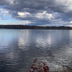
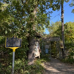
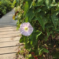
Usually outdoor/nature spaces are slam dunk 5 stars, but I'm taking one star because parking is confusing. There's a driveway that isn't for the park, then a small sign that says "parking second entrance," and the second entrance (I think?) is a walking path more than an entrance - since the "actual" parking area is dirt/stone. We drove the length of the walking path without encountering another car or person (thankfully!!!), but it's very narrow and winding. There IS a blue&yellow historical marker at the entrance to the parking area. Anyway.... The park itself is very small, but beautifully maintained, with plantings for every season, and LOTS of benches and places to sit, and truly stunning mountain views. There are also several fountains - I don't know if they're functional, because we went in early spring and it's not really fountain season quite yet, but if they are....how peaceful and lovely it must be when they're all running!! Can't wait to go back in summer to see it in full bloom, and fall for the Mum Festival - there were still lights in the huge evergreen, also! So they do that much for winter, if not more! read more


7 years ago
The park entrance came up quick and looked like a dead end by to our delight we found a hidden gem. Continue to the back that offered multiple picnic table, swings for the kids and just a nice little area to get off he road for awhile. read more


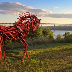
The entrance to the parking area could be better marked. It felt a bit like I was entering someone's private driveway. The gardens are lovely with many memorial benches, a gazebo, and neat statues. The playground is quite old school: mostly jungle gyms, big rocks and logs to climb. There are baby swings but no big kid swings despite a frame that looks like it housed them. My kids(4 and 8) weren't real impressed with that aspect. Picturesque views of mountains, forest, and fields with grazing deer. read more


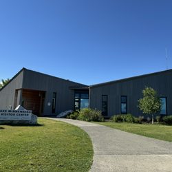
More info about Seamon Memorial Pk
5 Malden Ave
Saugerties, NY 12477
Directions
(845) 246-2919
Call Now
Hours
Outdoor Amenities


Seamon Memorial Pk - parks - Updated July 2026
Best of Saugerties
People found Seamon Memorial Pk by searching for…
Hiking in Saugerties, New York
Playgrounds in Saugerties, New York
Things to Do in Saugerties, New York
Off Road Trails in Saugerties, New York
Hiking Trails in Saugerties, New York
Playgrounds for Kids in Saugerties, New York
Picnic Areas in Saugerties, New York
Secret Spots in Saugerties, New York
Scenic Drive in Saugerties, New York
Scenic View in Saugerties, New York
Walking Trails in Saugerties, New York
Places to Take Pictures in Saugerties, New York
Photo Spots in Saugerties, New York
Secluded Spots in Saugerties, New York
Beautiful Views in Saugerties, New York
Sculpture Garden in Saugerties, New York
Things to Do at Night in Saugerties, New York
Park With BBQ Pits in Saugerties, New York
Picnic Spots in Saugerties, New York
Easy Hikes in Saugerties, New York
Fall Foliage in Saugerties, New York
Trending Searches in Saugerties, NY
4th Of July Fireworks in Saugerties, NY
Black Owned Nail Salons in Saugerties, NY
Cliff Jumping in Saugerties, NY
Dog Friendly Beaches in Saugerties, NY
Fishing Spots in Saugerties, NY
Jet Ski Rental in Saugerties, NY
Kayak Rental in Saugerties, NY
Paddle Boat Rentals in Saugerties, NY
Public Beaches in Saugerties, NY
Public Pools in Saugerties, NY
River Swimming in Saugerties, NY
Strawberry Picking in Saugerties, NY
Swimming Holes in Saugerties, NY
Swimming Lakes in Saugerties, NY
Swimming Pools in Saugerties, NY
Things To Do With Kids in Saugerties, NY
Browse Articles
Browse Nearby
BEST of Saugerties, New York Coffee near Seamon Memorial Pk
BEST of Saugerties, New York Restaurants near Seamon Memorial Pk
BEST of Saugerties, New York Things to Do near Seamon Memorial Pk
BEST of Saugerties, New York Playgrounds near Seamon Memorial Pk
BEST of Saugerties, New York Breakfast near Seamon Memorial Pk
BEST of Saugerties, New York Picnic Areas near Seamon Memorial Pk
BEST of Saugerties, New York Star Gazing near Seamon Memorial Pk
BEST of Saugerties, New York Campgrounds near Seamon Memorial Pk
Browse Brands
Related Searches in Saugerties, NY
Best Parks for Parties and Events in Saugerties, New York
Best Water Parks for Kids in Saugerties, New York
Check Out Great Playgrounds in Saugerties, New York
Discover Baseball Fields Around Saugerties, New York
Discover Free Parking Options in Saugerties, New York
Discover Lakes & Ponds to Explore in Saugerties, New York
Discover Popular Photo Spots in Saugerties, New York
Discover Top Nature Parks to Visit in Saugerties, New York
Discover the Best Beaches in Saugerties, New York
Enjoy the Best Walking Trails in Saugerties, New York
Explore Beautiful Botanical Gardens in Saugerties, New York
Explore Easy Hikes Perfect for All in Saugerties, New York
Explore Family-Friendly Zoos and Wildlife in Saugerties, New York
Explore Free Kids Activities Near Saugerties, New York
Explore Free Picnic Areas Around Saugerties, New York
Explore Fun Activities to Do in Saugerties, New York
Explore Parks With Pull Up Bars in Saugerties, New York
Explore Popular Campgrounds Near Saugerties, New York
Explore Popular Picnic Areas Around Saugerties, New York
Explore Popular RV Parks Around Saugerties, New York
Explore Popular Recreation Centers Around Saugerties, New York
Explore Scenic Lakes to Visit in Saugerties, New York
Explore Secret Spots Worth Visiting in Saugerties, New York
Explore Top Dog Parks in Saugerties, New York Near You
Explore Top Gyms in Saugerties, New York Now
Explore Top Water Parks in Saugerties, New York Today
Explore the Best Swimming Holes Around Saugerties, New York
Find Beautiful Views in Saugerties, New York
Find Top Dog Friendly Parks to Visit in Saugerties, New York
Find Top Skate Parks in Saugerties, New York for All Skill Levels
Find Top Skating Rinks in Saugerties, New York for All Ages
Find a Park With BBQ Pits in Saugerties, New York
Find the Best Parks BBQ Grills in Saugerties, New York
Find the Best Swimming Pools in Saugerties, New York Today
Great Places to Swim in Saugerties, New York
Have Fun at a Splash Pad in Saugerties, New York
Hiking Trails With Waterfalls in Saugerties, New York
Indoor Playgrounds to Explore in Saugerties, New York
Locate Tennis Courts Around Saugerties, New York
Must-See Tourist Attractions Around Saugerties, New York
Parks With Basketball Courts for Games in Saugerties, New York
Picnic Areas With BBQ Pits Available in Saugerties, New York
Popular Fishing Spots to Explore in Saugerties, New York
Popular Outdoor Activities to Try in Saugerties, New York
Popular Places to Take Pictures in Saugerties, New York
Top Hiking Trails to Explore in Saugerties, New York
Top Running Trails to Explore in Saugerties, New York
Top Swimming Lakes to Enjoy in Saugerties, New York
Top-Rated Basketball Courts to Play at in Saugerties, New York