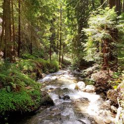
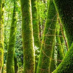
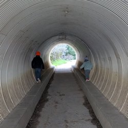
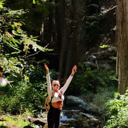
1. Salmon Creek Trail

0

,

Cancel

Open app

Search

Salmon Creek Trail

4.5 (2 reviews)

Salmon Creek Trail Photos

You might also consider

Recommended Reviews - Salmon Creek Trail

Your trust is our priority, so businesses can't pay to alter or remove their reviews. Learn more about reviews.
Yelp app icon
Browse more easily on the app
Review Feed Illustration

9 years ago

Helpful 10
Thanks 0
Love this 6
Oh no 0

5 years ago

Helpful 1
Thanks 0
Love this 0
Oh no 0

You might also consider

Verify this business for free

Get access to customer & competitor insights.

Verify this business

Partington Cove - You can get to this part of the mountain and see an uninterrupted view of the ocean

Partington Cove

4.8(54 reviews)
4.2 km

Our twelfth stop (09:42) on the Cabrillo Highway on our southbound trip through Big Sur, this dirt…read moreturn off provides unmarked parking to get clear views of the Partington Cove trail that will take you down to see the cove. We couldn't take the hike down but there were already cars parked on the side of the road to allow easy entry onto the trailhead. No cell reception in this area.

We came here 10 years ago and it was a hidden gem at the time, we drove by around 8:30am on the way…read moreto McWay Falls and there were already 2 cars there so I knew it was no longer a secret. This is by far one of our favorite Big Sur spots. The entire beginning of the hike is all downhill so you'll have an easy time going down and be panting on the way back up, you'll see it in other people's faces as you are going down. At the very bottom split I would take the time to go both directions, if you take the bridge it'll lead to a view of the ocean that narrows and then broadens. There is a nice wood tunnel you'll pass through and at the very end of the trail you can do a small rock scrambles to get an amazing view of the turquoise blue water and seaweed gently swaying in the water. If you are lucky you'll spot some sea otters diving in the kelp. If you take the other path it leads to a rocky cove with fun boulders for kids and adults to climb on, if you come in a wet season or after rain there will be a stream with many mini waterfalls on the left side. The wave splashes here are epic and it is dangerous so I would always be mindful of the water and avoid rocks that are wet when visiting.

Photos
Partington Cove - Right side trail, big waves here so be careful

Right side trail, big waves here so be careful

Partington Cove - Rock scramble at the end of the cove trail

Rock scramble at the end of the cove trail

Partington Cove - Gorgeous morning hike

See all

Gorgeous morning hike

Limekiln State Park - Best campsite at LimeKiln

Limekiln State Park

4.4(146 reviews)
4.7 km

This place is terrible, stay away (so I will have less issues trying to book for next time)…read more Joking aside, this place is gorgeous. On the RV side they have two bathrooms and a shower, and it's a short walk to the ocean where a natural stream creates a lagoon on the sand before pouring out into the ocean. I would come here every year if I could get a spot!

I love camping here. It's been years and coming back recently was as magical as always…read more I've only camped in the ocean sites due to having a VW camper van. The other sites are tent camping only. I must say, the ocean sites are very snug and limited in space. If you're looking for a spacious camping site with privacy, you're not going to get here. And not all of the sites are the same size so if you have a trailer and a truck, you're gonna have to really be choosy at which is a site to book. This is right underneath the underpass so you're going to hear road noise. But to be honest, a lot of the sound was drowned out by the nearby stream and the ocean. It was walking distance to what felt like a private beach. Since the last time I've been here it looks like they made a mini dam with the running stream creating a mini swimming cove with crystal clear water. There are no electrical hook ups but the bathroom has running water and hot showers available. The bathrooms can get freaking disgusting from the day use visitors, but they do clean it every morning. And let's not forget the beautiful drive to get here. Magical.

Photos
Limekiln State Park - Facebook.com/DavidPasillasPhoto

Facebook.com/DavidPasillasPhoto

Limekiln State Park - Da Pose

Da Pose

Limekiln State Park - Another Da Pose

See all

Another Da Pose

Mill Creek Trail

Mill Creek Trail

4.5(2 reviews)
7.7 km

Great trail with an opportunity for an epic view of the coastline…read more With many of the State Parks in the area closing down their hiking trails (Spring 2019) I was lucky to find the Mill Creek trail. This hike exceeded my expectations. The Yelp page directions were spot on and we arrived at the dirt parking lot. The trailhead is right along the road. This is a family-friendly trail, and I think I booked about 3.5 miles total. There are some small ups and downs but overall not too bad.. There was a lot of green during our hike and many tall redwoods.. Tips - My top tip is that after you've hiked just drive up the road from the parking lot for about a mile. There will be amazing views when you get to highest point facing the coastline. - Make sure you have Google maps installed on your phone (for the gps)... just in case you accidentally go off trail. - Tons of poison oak. Long pants required. - If you have kids, there will be a fork in the trail not too far from the trailhead. Right side path goes straight down the steap side of the hill. You can take this and check out the creek if you don't want to do the full hike. - Basic rule is to stay along the main creek trail until you get to a point to cross it.. This is confusing because when you reach the point that the creek is in your way there are multiple paths you can take. The few people we saw on this hike all went different directions from here. We crossed the creek and we were okay.

We decided to do this hike on our way back to the Bay Area. It was amazing and we are so glad we…read moredid. We were the only ones in the parking lot that morning and it felt like we had the whole hike to ourselves. Coming in the spring was great since everything was growing, lush, green, and the water was roaring. So serene.

Photos
Mill Creek Trail
Mill Creek Trail
Mill Creek Trail - So green..

See all

So green..

Pfeiffer Big Sur State Park

Pfeiffer Big Sur State Park

4.4(412 reviews)
32.9 km

One of California's bigger and more popular state parks, rightfully so. Not as touristy as Yosemite…read morebut this is on a bigger scale than most other Cali State Parks. I ventured here once before in my early 20s back in my school boy days and felt it was time to see it again with decades worth of a wiser perspective. And I was rewarded in spades. This park is about 30 miles or so south of Carmel on Highway 1, which in my opinion is one of the most glorious stretch of road to drive. Even though it is only 30 miles or so, it still takes almost an hour to travel from Carmel. The road winds around through many curves and undulations so you simply cannot drive freeway speeds here, nor should you want to. Enjoy the views, roll down the window and take in that coastal air, play your favorite tunes and just soak in the moment. Once at the park there are campsites, as well as cabins and even a full service lodge for those that don't want to rough it at all. You are now in mountainous terrain so lots of trees, a big creek and lots of hiking trails. I did a 3 day camp stay and loved it. They keep the park clean, maintain the restrooms and patrol the grounds frequently. Even though they have almost 200 campsites available, they spread it out nice so not everyone is in the same area. I could sometimes hear my neighbors but they were never in my direct view. That is a big plus for me when rating camp sites. People can also just get a day pass and enjoy the trails and creek without having to stay. My camping pass also got me to see a couple other California State Parks nearby on the same trip, so well worth the price of admission. Very lively with animal life which are unfortunately very used to humans. Squirrels and blue jays will not be shy to investigate what they can scavenge so do not leave any food unattended. Upon setting up camp I had a ziplock bag of trail mix on the picnic bench along with the rest of my gear. While I was setting up the tent with me somewhat close by, a stellar jay swooped in and pecked at the bag. It didn't take it but ripped a good hole in the bag. So just a big fyi to keep your food on guard/lock. The big creek runs through many of the sites. Some parts are mellow whilst other parts the water rushes pretty good. I was about 50 yards from the creek so I couldn't see it but I could hear it rolling through the valley. It was very relaxing to hear the cool water rolling downstream, whether at night or waking up at sunrise. And a myriad of birds will contribute with their morning songs, which makes for the best alarm clock. TRUST A little too big for my preference but still beautiful enough that I can revisit every other year. And just outside the park are the California coastline with Highway 1 carving through it. Some of the most breathtaking views Cali has to offer. Pfeiffer thanks for the reacquaintance and the confirmation that you are still indeed one of California's top gems.

Great Stop in Big Sur -- Beautiful Trails, Swimming Spots, & Scenic Views!…read moreThe drive along CA-1 to get here is reason enough to visit--absolutely stunning coastal views the entire way! Pfeiffer Big Sur State Park itself has a lot to offer. There are tons of trails to explore, though keep in mind that there isn't a whole lot of signage. The good news is that if you start from a central area, most paths naturally end up bringing you around in a loop at some point, so it's pretty easy to find your way back. A few takeaways from our visit: Water & Swimming: There are plenty of great spots along the rocks to dip in and swim, which is perfect on a warm day. Accommodations: Great setup whether you like roughing it or prefer comfort. Plenty of campsite options, plus the Lodge if you'd rather stay in a room. Pfeiffer Falls Trail: Honestly, this hike was pretty underwhelming. The falls were down to just a trickle when we went, but at least it was a decent walk to log some good steps! Overall, it's a lovely park with plenty to do. Just keep your expectations low for the waterfall if it hasn't rained recently, and enjoy the river, trees, and incredible coastal drive!

Photos
Pfeiffer Big Sur State Park - Family Camping September 12-14, 2025

Family Camping September 12-14, 2025

Pfeiffer Big Sur State Park - Family Camping September 12-14, 2025

Family Camping September 12-14, 2025

Pfeiffer Big Sur State Park - Family Camping September 12-14, 2025  THE JOY LUCK CLUB

See all

Family Camping September 12-14, 2025 THE JOY LUCK CLUB

McWay Falls - Tunnel that takes you underneath the highway to McWay Falls

McWay Falls

4.6(192 reviews)
18.5 km

McWay Falls is one of the most iconic and photographed landmarks along the Big Sur coast, famous…read morefor its ethereal, postcard-perfect scenery. Located within Julia Pfeiffer Burns State Park, it is one of the few waterfalls in California that empties directly into the ocean. Unique Tide Falls: The stunning 80-foot waterfall flows year-round from McWay Creek, dropping over a jagged granite cliff directly onto the pristine sands of a picturesque, turquoise cove, or into the waves at high tide. Effortless Viewpoint Trail: The falls are reached via an exceptionally short and accessible 0.5-mile round-trip trail, making it a quick and highly rewarding stop right off Highway 1. This trail was unfortunately closed during my visit, but we could still see the falls

Located within the Julia Pfeffer Burns State Park, the McWays Falls (named after an early settler…read moreof Big Sur) Vista Point was the fourteenth (09:53) and furthest south stop of our southbound scenic car tour through Big Sur. The trail down to get a close up view of the falls continues to be closed (there is no estimated reopen date). However there is a vista point off the highway that you can walk to (need to hop over a railing) from a safer parking spot, that provides a clear aerial view of the waterfall (one of the few in the world that dumps directly into the ocean...learned that those are called a tidefalls [another one in California is Alamere Falls near SF]).

Photos
McWay Falls - Parking is $10 at the trailhead across the highway

Parking is $10 at the trailhead across the highway

McWay Falls
McWay Falls

See all

Ewoldsen Trail

Ewoldsen Trail

4.7(29 reviews)
18.5 km

The hike kicked our ass, a lot to adventure and see. I think in total we had almost 15,000 steps…read moreand climbed about 109 stairs.

Come here if you want to feel like katniss, the part before she volunteered as a tribute and spent…read moremost of her days hunting in the woods. This hike is no joke. Beware of bringing noobs on this hike because Ewoldsen will work you so hard and so good. In addition to being steep as hell, the trail is also narrow af. You have to basically hug the wall of the mountain to let the opposite traffic go. Sharing is caring! But be very careful because doing that stunt gets even scarier the higher you go up. The trail starts off only one path in the beginning. Right at the beginning, it's okay to take it a little bit easy. It's very chill at this point. And then suddenly, you face this "almost vertical looking" path and you're thinking to yourself "aw shit. What did I get myself into." But it's too late to turn back. I mean, you can but you traveled so far just to conquer this monster Ewoldsen. You might as well finish it and show off what you achieved! Anyway, somewhere along the trail, a wild fork appears. Which one to take? Left or right?? Choose wisely because one leads you to a never ending path! Just kidding. (Although, you may start thinking that about the entire hike). Per advice from people in the opposite traffic, My friends and I chose left. We really should have went right so that we went counter clockwise because then we would be climbing up less. I don't know if that made sense. We went left. And we ended up going up steep hills so if we had went right, we would be actually going down those hills instead of up. It's actually a loop so technically it doesn't matter if you choose left or right. You will end up at the same fork after completing the loop. The view on the top was stunning. Although, the McWay falls trail produced a prettier picture, you will feel more accomplished once you see the small waterfall from all the way on top of the ewoldsen loop.

Photos
Ewoldsen Trail
Ewoldsen Trail
Ewoldsen Trail

See all

Prewitt Ridge - Please be careful with fire

Prewitt Ridge

3.3(18 reviews)
0.0 km

I have camped up here a number of times and always find it to be so beautiful and well worth the…read moredrive. The views are incredible. The flies can be a bummer but at some point I just ignore them. My biggest pet peeve with this place is some of the people and the way they treat this treasure. Just because you can make payments on a Toyota Forerunner with a Tepui Tent, does not qualify you as an outdoor master. Be respectful of the environment, other people and the rules. On my last trip, the 4th through 6th of July, I saw way too much toilet paper sitting around. Bring a shovel and bury your shit and toilet paper. It is gross and shows that your parents didn't raise you very well if you leave it like that. While up there I also saw a number of people having Fires when it clearly states, NO FIRES!. Don't be and entitled silicon valley ass. The rules do apply to you too! If you start a fire up there you WILL go to prison. Enjoy the view and the beauty. Be a good person!
I did an overnight motorcycle ride with a buddy, from the SF Bay Area to Prewitt Ridge and WOW! The…read moreride south along Hwy 1 heading there is spectacular, but the views from the ridge are next level! The 5+ miles of silty, rough dirt road heading up to the ridge was a little challenging on street bikes, but we managed just fine. The views from the ridge are breathtaking in every direction, and it was very pleasant to see very little trash laying about. Clearly, this is a campground area that is mainly used by seasoned, "Pack Your Trash" campers, which is awesome. Hope it stays that way. We went in mid Fall during a very brief heat wave, and the small flies were annoying, but they don't bite. We just covered our faces with buffs and slept under netting. That was literally the only drawback. PROS: Awesome Panoramic Views FREE to camp! Many flat camping areas to choose from No Trash lying around Weather is usually comfortable Many trees to find shade under CONS: Some seasons have annoying, small flies. They don't bite though TIPS: If you're heading there from the North and you need provisions, stop at the Big Sur Lodge Store. They have EVERYTHING you may need Dirt road leading up to the ridge is not maintained (much) and may be tough to navigate for novice drivers. If muddy, may need 4WD and off road tires Bring a mosquito net No water access, so you have to bring your own No bathrooms - Bury your #2! *No open campfires allowed during the warm months (but you won't need it for warmth anyway) Jet boils and contained flame are OK PACK YOUR TRASH!

Photos
Prewitt Ridge - View at sunset.

View at sunset.

Prewitt Ridge
Prewitt Ridge

See all

Jade Cove Beach - Base of Jade cove

Jade Cove Beach

4.4(28 reviews)
15.3 km

What an amazing hidden treasure. Hard to find and if you know you know. Not easy to find no markers…read moreits about 800 feet south of sand dollar beach. Hike through some poison ivy into a cool meadow over looking the beautiful cove. Now finding your way down is no joke adventurous people only. Need to find the cliff with the ropes and hold on tight as you cascade the cliff. Once at the bottom you feel amazing like you conquered a hidden secret Now climbing back up I thought would be tough however climbing back up is much easier than going down. This is not for the weak but totally worth it. Highly recommend. Jade well thats the color of the water and if thats what you're searching for I suggest diving for it.

Fun, but getting there can be tricky. I used the AllTrails app to find Jade Cove. I then opened up…read morethe Jade Cove map and looked for the blue dot (my car) going along highway 1. I pulled over at the trail marker.. It worked perfectly. The best part of this experience was the short but precarious hike down to the cove. You'll be required to use a rope to hike down to the beach and back up again. The rope is a permanent fixture. Kids seven and over could do it without any assistance. When at the beach you'll see a lot of green rocks, mostly serpentine. The rule is that you can take anything you like as long as the "tide" ocean is able to touch it. The tidal range goes all the way to the cliffside. - There is no highway sign for jade cove anymore. That was taken down many years ago. - Check the tides and try to come here at low tide. - If you can, when you're at the bottom of the rope hike southward to the next cove. Better rocks over there.

Photos
Jade Cove Beach - Rope leading up to trail

Rope leading up to trail

Jade Cove Beach - Jade cove. Color of the water

Jade cove. Color of the water

Jade Cove Beach - At he bottom

See all

At he bottom

Salmon Creek Trail - hiking - Updated October 2026

Loading...
Loading...
Loading...