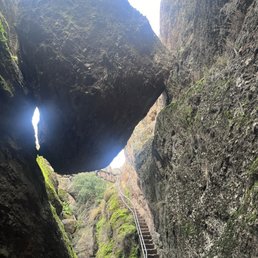
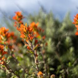
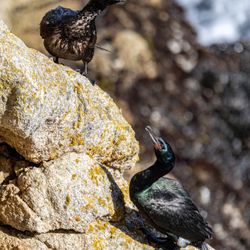
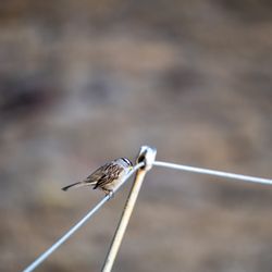
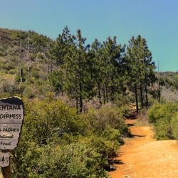
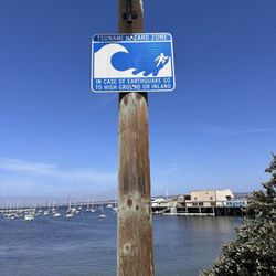
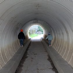
Pinnacles National Park Photos


You might also consider
More like Pinnacles National Park
Recommended Reviews - Pinnacles National Park
Start your review...


17 days ago
This was such a fun park. A little out of the way but way worth the trip! A small fee to enter. It's worth it because it goes to take care of upkeep and in the summer, there's a lot of people so this little bit helps. You will want to have a flashlight on hand to go through the caves here as there are long spots you are in the dark climbing up and down stairs or down or up through boulders. Headlamps are best but a flashlight will work too. I started out day 1 on one side and had so much fun hiking through the park and crawling through the rock caves. I spent a little time talking to the Park Rangers to find the best place for me to hike that wasn't too long. Reaching the top of the mountain and walking back down with the amazing views, all the Turkey Vultures and other birds and wildlife was spectacular. The trails, though not necessarily well marked which way is which were well traveled so you knew you weren't going to get lost going off trail. The second day I hit the other side of the park to do Bear Gulch Caves. Excellent cave! Parking at the foot is limited even about 1/4 mile down next to info shop and restrooms is limited so be patient. You may have to park further down as summer comes. This is the only bathroom but very well maintained. There is water running down through this cave and when you reach the top, there a tight squeeze through the rocks and then an amazing payoff with the reservoir. Great spot to watch the birds, Dragon Flies, walk around some of the reservoir before hiking back out down along the very well traveled path past rock climbers to the parking lot again. I highly recommend this fantastic park not just for the excellent caves but for all the good hiking trails. There is some camping and even a pool further down towards the entrance on one side. The Rangers here are full of knowledge and very friendly and professional. Excellent experience!! read more


For the first time, we were able to hike at Pinnacles National Park--specifically the Bear Gulch area--and it was truly an amazing experience, definitely one for the books! We absolutely loved the variety this hike offers. The caves were such a fun and unique highlight, and the reservoir added a peaceful, scenic touch to the whole trail. The views of the rock walls and dramatic formations were stunning from start to finish. It felt like a perfect mix of adventure and nature. What made it even more special is that we did it together with our 3-year-old, and he absolutely loved it too! It's such a memorable family-friendly experience, though of course some parts require a bit of extra attention with little ones. One thing to keep in mind--parking can be quite challenging. During our visit on April 2, it was very hard to find a spot. We ended up parking quite far and had to walk about a mile just to reach the entrance to the Sycamore Trail. Next time, we'll definitely plan to arrive as early as possible to avoid that hassle. Overall, it was an unforgettable hike, and we're already looking forward to coming back and exploring more trails in the area! read more


4 months ago
Amazing spot. Best time to hike is early in the morning or late afternoon during the summer but if you're like me, and love the heat, prepare to bring plenty of water and snacks and some block and of course a hat pets are not allowed on the trails. Better yet if you do a sunset hike it is gorgeous and you can see the Moon Rising and the stars shining bright read more


7 hours ago
It's Friday before the Memorial Day weekend and decide to take a day trip to Pinnacles National Park. The drive was scenic, no traffic and the East Side park was empty. Although people were beginning to check in for camping. I'm sorry to say we were unable to hike and explore as we wanted because the Bear Gulch Caves were closed due to bat population and the Visitor/Education center was closed as well due to short volunteer staffing. Maybe next time. read more


Cheers to 2026, and my 1st review of the year! One of the newest National Parks (Est. 2013) So many views to witness with your own eyes. Drive to the park, you will encounter so many beautiful views and scenary. First entering the national park, you will need to scan a QR code, and purchase a park pass for parking, either 7 days or annual (Your preference). Driving to the campsites, you first see the check in office, and a store. The office closes around 5, so if you come in after no worries, your campsite will be readily available for you still. All staff encountered during my 1st trip here were friendly and hopeful. Plenty of campsites to choose from, whether you're using an RV, vehicle camper, or tent only. They even have bungalows you can reserve as well. Campgrounds offer Plenty of restrooms, throughout the site. They have 1 site for showers scenery. Plenty of recycle bins and trash bins throughout the site as well, so please be mindful and clean your sites before checking out. Enjoy the trails and the views. And remember to clean up after yourselves, and leave no trash behind. Parking: in regards to the sites, Plenty of spots throughout the campsites, if you plan on hiking, parking is limited and Rangers will close roads once capacity is met. Recommended: absolutely, I definitely will be coming back in the future. read more


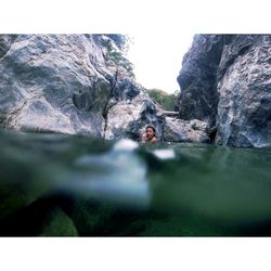
Everyone else has said all of the great things about the park. I agree on most points. What could be better is the very limited parking at one of their more populated sites - Bear Gulch. We got there around 10:20am on a Saturday (thanksgiving weekend) and the road that leads to Bear Gulch is blocked off. There's no visible information on when it reopens. This forced us to park near the campground store which is about 3 miles to Bear Gulch. Long story short, we huffed it only to realize that it opened back up as soon as we got there. If we knew ahead of time, we could've waited it out. The walk there and back was an additional 2-3 hours. It wasn't a scenic hike so not worth the aching feet and 2+ hours. The Bear Gulch cave trail is a shorter hike than our expedition to reach the trailhead. Its caves and the reservoir was a sight for sore eyes. The cave was somewhat crowded and some areas are pretty tight. The reservoir view is a nice payoff after all of that walking. But since we expended much of our time to get there, we had to start heading back before it got dark. Although we started at 10:45am, we made it back just before dark. read more


Hidden among the hills of central coast you can find the remnants of old time volcano. Nice place for hiking, birding, and catching beautiful colors in the morning and at sunset. We came in through the less entered West side. We visited the visitor center, and then parked at the Chaparral trailhead. We opted for the high peak trail. It was nice. Next time, I would come earlier in the day. Or stick around for after the sun breaks. Also, best season might be in the winter. It's a bit dryer and warmer in the summer months. We enjoyed the experience. read more


1 year ago
What a great place to hike, there are many attractions- caves to walk through, several trails, rock climbing, reservoirs, picnic areas, boulders, groomed trails. This is a beautiful NP: birds, rivers, scenery, caves, variety of trails - with flat easy trails and steeper rugged trails too. We met so many nice people and families. There are several parking lots, get there early to park in the furthest lot from the entrance which is closest to the most popular trail head. Water filtration systems - are in the parking lots, Make Sure you bring a refillable bottle! AND carry water on hikes. Flashlights needed in caves. Near Entrance: Picnic benches and a small general store with food, snacks, treats, books and gifts. Large lawn with huge shade trees. The caves and steeper trails may be difficult for kids, make sure to stick to the trail, pull to the side to let others pass. Poison oak is next to many trails (it's GREEN in the spring, and easier to spot in the summers-it's Green & red!) read more


Pinnacles National Park was one of our few remaining NPs for California, so we finally made the drive up. A was a little hesitant to visit this park so soon because it was just made into a national park in 2013, and I feel like it might not be as established as it will be in 10 more years. That being said, we decided to visit, and Pinnacles is more unique and (similar to Saguaro National Park), the park is divided between the east and the west side. Plan ahead - depending on what you want to do in the park will determine which side you go to, and they are about an hour drive apart from each other. We spent a day in Pinnacles and decided to focus on the east side. Their east side visitor center is within a mile of entering the park and is definitely small and shares a building with the local camp store. But it is still a nice little visitor center with a nice bookstore and friendly staff ready to help you plan your visit. They also have potable water here, so we filled up our bottles for our hikes. 100% recommend adding the Bear Gulch Cave Trail to your visit. Beautiful hike with some cave exploration ending at the Bear Gulch Reservoir. You'll have to squeeze through some tight, dark places, and you should have a flashlight to help you out. But it's a unique, fun, and worthy hike. Pinnacles is also known for its condor sightings. So great if you're looking for the chance to spot one of these rare birds. Overall, we really enjoyed our hike. But unless you're looking to spot some condors or visit all the national parks, I wouldn't make this one a priority. Fun if you live nearby - it is a wonderful piece of nature - but it's not one of the top national parks on my list. read more


Cave New World Pinnacles is perhaps one of the most underrated--and newest!--National Parks in the country, and is one of NorCal's best kept secrets. Despite being a National Monument since 1908, Pinnacles finally achieved National Park status back in 2013, and hasn't looked back since. The Park is pretty massive (±27k-acres); sports two entrances (á la the Grand Canyon); and is centered around an extinct volcano. If that doesn't get your nature juices flowing, then it's time to check your pulse. The Good: *Campgrounds (East entrance only) *They have a Visitor Center at both entrances, but the East one might be a little nicer, if memory serves. *Trails are (at least in the west side) in good shape. It's been a few years since we've been to the east side, so I can't speak for them. *The Balconies Trail loop (west side) is amazing and takes hikers high up for great views and down thru the Balconies Cave. The best part is that it's only a little over three-miles (±5k) and a svelte ±500' elevation gain. *Flushable restrooms *Balconies Cave is really where it's at! I guess you can access it from the east entrance but so much easier from the west side. Just be careful when traversing thru the Cave, especially if it's rained recently, as the rocks can be very slippery as it is. Also, be sure to pack at least a few bright flashlights (bonus points for a headlamp)--and check the batteries! It's a little challenging, but if my old, fat ass can do it, then you can, too! *One of the few places you can see California Condors out in the wild (west side is better for this, as well fwiw). *Rock climbing (check website and signage for rules) The Meh: *$30 entrance fee (free with NPS National Park pass [$80/year]) *If you're in the South Bay it's 1.5hrs to the East entrance and ±2hrs to the West entrance. *Can get ridiculously hot in the summer, so bring plenty of hydration. *Good park to pack a lunch, as it's a long drive to get there and there ain't much around either entrance for food. Altho, the west entrance is kinda close to the City of Soledad which has some (mostly Mexican) restaurants. The Ugly: *Despite it being under the radar, it can still get very busy here, as there's not a whole lot of parking spaces near the trail entrances. Conclusion: Epic Park with epic views and a fun cave to go spelunking in. read more


6 months ago
1 year ago
I don't think I could ever give anything less than 5 stars to a national park but regardless of that, Pinnacles is amazing! We have been to both sides of the park--the east entrance was several years ago. And the west entrance was just recently. We decided to check out the balconies cave trail. What an adventure that was! Lots of climbing through dark caves and exploring. We saw a condor flying! That was a cool moment. After our hike, we had a picnic in the picnic area. We knew there wouldn't be a lot of food options around so we brought a cooler to make sandwiches. Tips: *Make sure to bring a flashlight or headlamp. *And wear shoes with good traction. *Bring food and have a picnic after. *We always buy the annual pass ($80) every year because most parks cost $30 and we go to several parks. It definitely adds up. It's worth it if you go to several parks in a year like we do. read more


Pinnacles is huge and we got to explore a portion of it on a gloomy Saturday, but the weather was great as it was not hot at all. What an adventure! We got to do a hike that allowed us to witness beautiful rock formations, go through caves, and view a beautiful reservoir that has so many photographic points. It's an approximate 3 mile hike that anyone can do Beautiful views and wonderful adventure. Shuttle service available when parking is filled up at the trailhead. We were at the east side of Pinnacles and there is the West side to explore in the future. Parking was $30. Campgrounds provided with bathrooms and showers. A general store is also onsite and well stocked. Please come and creat your own adventure. read more


1 year ago
Small national park, just two hours away from Bay Area. We arrived at Saturday early morning 8am ish. Parking lot at bear gulch trail was almost full. Easy trail except the creeks along the way which you have to step on the rocks to cross the creek. It's kind of a good balancing act or you slip into the shallow water and get your shoes wet. Having a head lamp helps when you're in the talus cave. End of the trail is the beautiful reservoir. The old pinnacle trail was abit tricky, there is lack of signs and you may lost your way. It's a long trail. The balconies cave at the end of the trail is pretty hard to get through with lot of creeks in it. read more


Pinnacles National Park is the newest national park in the US and it is well worth a visit! We stayed in Soledad and visited the west side the first evening. We did part of the cave trail at around sunset and thought us was great. We saw so many bats flitting around and many deer and birds. Amazing boulders and views. We enjoyed the sunset in the way out and the great horned owls hooting and the common poorwill sitting in the road on the way out! Watch out for these little rocks with eyes in the road collecting heat at night. Also watch your drive in on the west side, very narrow most of the way and it can get bumpy. We visited the east side the next morning and did the Bear Gulch Trail. It was around 2 miles up through the reservoir and not very difficult (but being flashlights or headlamps for a portion of it). We also visited the nature center and visitor center/camp store. All are small but have good info and items to purchase. This NP is probably best visited in winter or spring. It gets hot quickly in the summer, but at least it is nearly empty of visitors! Their resident CA condors are more difficult to see this time of year also. read more


1 year ago
A beautiful park; off the beaten path so you have to really want to get here. Adding a bit more complication, there are 2 separate entrances with no road attaching the two. Come here in hopes of seeing a Condor - you are so lucky if you do! We didn't have time to do much hiking here; it was just a drive in and take pictures stop for us, but I am so glad we got to see it. As you can tell in the photos, this is a dry environment, so plan accordingly and bring more than ample water. read more


1 year ago
We entered from the west and consulted with a very helpful ranger on which hikes we should do. We did a cave hike--so thrilling but totally doable. You can purchase headlamps from the ranger station. We picnicked at a covered picnic table. Then we went on a strenuous hike (again, doable even for our 10 and 13 year olds) that climbed to a peak with beautiful views. It was a lovely visit with clean facilities. If your knees are good and you can handle some cardio, you can do this! read more


Wow! Exploring the Pinnacles was an incredible experience. We camped at the campground on the east side. Also 5 stars. We woke up early to get a parking spot in the very small usually full parking lot at Moses Spring trail. Our plan was to hike to bear gulch caves and then the reservoir. Hopefully spot and photograph a condor. Deer greeted us at the trailhead and off we went! We were alone in the wilderness most of the morning. Walking felt like meditation. Talk about peaceful! We hiked through all different landscapes. The caves were so neat. Dark and wet and amazing. We had the reservoir all to ourselves. Just sat there and pondered for a long while. It was all so magical we just kept going and going. Up and Up. Switchback after switchback. Before we knew it we had reached the high peaks trail and then the STEEP and Narrow. That it what it is called! Now I had you tubed this hike before we came. There was no way I would even want to do this but here I was. CRAZY! Go ahead look it up! My husband gently encouraged me and I put on my big girl you can do this panties and I DID It!! I cried part of the time but still. I did it! Am I still afraid of heights? Yes. Am I glad I did it? Also, yes. Will I do it again? I think so. At the end of the day we covered a little over 9 very memorable miles. Every step we took had something of beauty and wonder to offer. The entire park! We ended up seeing so many condors we stopped taking pictures of them. I absolutely recommend you visit! We bought the annual pass and are already planning to come back for the Super bloom! read more


Absolutely stunning! Very helpful staff/rangers. Heads up though, the "moderate" hike is pretty intense. Especially if you're claustrophobic. Highly recommend bringing flashlights! Also a pro tip is getting there early, especially on weekends. It takes time to get inside to park! There are shuttle busses to get to the hiking spots. Super nice! read more


5 months ago
Beautiful park. The least visited park in the US, I'm told. Be warned: the trails aren't really maintained and there isn't enough traffic to keep them nice. Perhaps because of all the Federal defunding? They are pretty treacherous. Lots of loose rock and difficult walking with few handholds and narrow conditions. While we were there, someone hurt their leg and needed to be airlifted out. Even the emergency response was slow because conditions were dangerous. Bring a flashlight AND a headlamp for the caves. They are dark and slippery and require some big, reaching steps up and down. Also---National Parks are now $$. $30 entry fee!!!!! Just FYI read more


1 year ago
We came to Pinnacle on purpose after seeing some pictures go viral on the internet which shows the narrow stairs right underneath the big rock ; locates in "Bear Gulch Cave". By mistakes, we started the trail in opposite side. All the way too far to reach to Bear Gulch Cave. It took us more than 5 hours from Condor Trail to High Peak Trails - Rim Trail and finally made to Bear Gulch Cave. Actually it's not a bad mistake. We glad that we did it anyway. The trails are so fun to complete. Some easy some really challenging. If you come here just to see the amazing stairs step big rock. You must stop and park at Moses Springs Parking area. From there you can follow the Moses Springs Trails to Bear Gulch Cave takes about 30 mins to one hour. Make sure you have on hand the flashlight to pass through very dark cave. The rest will be very easy and wonderful. Compare to Yosemite Park - Pinnacle itself so beautiful in different way with unique caves and a lot of trails to go through. Some maybe black and headlight /flashlights are mandatory required. There are not so many parking. Prefer to come here early to have enough time to make the long trail. Also there are many kinds of bird live here as you can see them flying everywhere very close to the trails. Especially condors, eagles and falcons. The park entrance fee for one day $30/ car or $80 / car ( annual fee for all national parks around USA) read more


It was a great day trip from the Bay Area. Easy drive in general. Nice short and kids friendly hikes to one of the caves. It was nice and cool ac in February. Parking available, but it fills up fast by the time we left. Make sure to pack your lunch and plenty of water. No food available in the visitor center/giftshop. Nice restrooms with showers available by the giftshop. Outdoor swimming pool noted but it was closed down for construction. 4th graders get in feee with America Beautiful pass! read more


6 months ago
If Castle Rock is paradise, then Pinnacles National Park is the cosmic afterparty. I don't know what tectonic drama happened here millions of years ago, but it looks like the planet sneezed out a fantasy landscape and said, "Yep, that's art." The Rocks: The pinnacles themselves? Absolute units. Towering, jagged, and dramatically photogenic -- like nature hired a personal stylist. You'll stare at them and think, "Yeah, I could totally live here and start a small wizard commune." Every rock looks like it could be a final boss arena. Geologists say it's volcanic; I say it's volcanic chic. The Caves: The talus caves are stunning. You'll walk through them with a headlamp, dodging boulders like Indiana Jones on a yoga retreat. Sometimes you'll see bats hanging out like goth teenagers avoiding sunlight. Rumor has it one of them speaks fluent Spanish and gives relationship advice. The Trails: Every trail here feels like a test from Mother Nature to see if you're worthy of enlightenment. I took the High Peaks Trail and found enlightenment halfway up -- it told me to invest in better socks. The views from the top? So unreal I thought I accidentally wandered into a Windows desktop background from another dimension. The Condors: The California Condors here are majestic, ancient, and probably plotting something. Wingspans wider than your student debt. One glided past me, locked eyes, and I'm pretty sure we shared a telepathic conversation about snack distribution. Fun fact: condors can spot fear, but they respect confidence and granola. The Lore: Some hikers say there's a hidden portal behind Bear Gulch Cave that leads straight to 1997. Local legend insists a fire wizard lives atop the pinnacles, keeping the rocks spicy and the sunsets dramatic. The park's chipmunks once overthrew a squirrel monarchy (unverified but inspiring). Final Verdict: Pinnacles isn't just a park -- it's a mood. It's where geology meets mythology and nature flexes its abs. You'll sweat, you'll ascend, you'll question reality, and by the end, you'll want to build a summer home in a crater. read more


2 years ago
Went camping here over the weekend. It is a really nice place, the shower provides shampoo, liquid soap and conditioner. Wildlife are active specially the raccoons, they are not really scared of people, if you don't shoo them away... they will be in front of you grabbing your food. We would be chatting and get jumpscare because a raccoon is trying to get close to us. We saw a lot of bluejay, quails, deers and wild rabbits. Hiked the Bear Gulch Cave and Reservoir and it was really beautiful. I can say my pictures did not do justice. If not for the abundant presence of the raccoons, I would have given it 5 stars. read more


2 years ago
Second time coming to Pinnacles National Park this year and both times have been awesome. We did the High Peaks Trail the first time and there was so much water. It was so green and cool. This time around it was drier and warmer, we got to go inside the caves. I highly recommend coming during fall if you'd like to explore the caves, definitely worth it. There's a little souvenir shop with cute stickers and shirts! read more


2 months ago


Extremely underrated National park! It's fun and rewarding! Take a lot of water and start at the east entrance, where you'd go from Hollister and not Soledad! It's not an easy hike but a fun moderately difficult climb. If you take it slow and steady it's fine but just be forewarned if you are afraid of heights, be prepared. The caves are well maintained and you'll want a flashlight or a headlamp. They have bathrooms scattered through the park. The parking is the worst part, if you come early before 9am you will be golden. Just know it's very limited parking spots. Have snacks and plenty of water! It's $30 bucks per car. Look for the condors and the woodpeckers! read more


Nice park with a large variety of trails. We went to the East entrance on a weekend in November and arrived too late to park close to the Reservoir trail area so parked in the small Manzanita lot and did a circle hike along the Blue oak - Condor Gulch - Sycamore trails and took the quick and modern shuttle back to our car. If you have time for only one moderate hike, do the Condor Gulch up and back to see a large variety of geological features and views. We also enjoyed the fall color along the Sycamore trail and views of the Pinnacles at the intersection of Blue Oak and Condor. read more


We came here for a day trip on a Saturday in March since we live in San Jose and it was only about a 1.5 hour drive for us. We purchased a $30 parking pass online (or you can also pay upon entry when you get there). Pinnacles became a national park in 2013 so it's a more-recent national park that is less crowded than Yosemite or other popular national parks. I recommend coming in the morning if you're coming on a weekend to avoid a possible wait which can happen if you're coming towards noon/afternoon (the park can hit capacity and they form a car line outside of the park for one car out, one car in). We came around 1pm and had to wait for about an hour to get into the park, but we're really glad we waited it out because the park was well worth it. We did the Moses spring rim trail and it exceeded my expectations. It was a moderate ~2 mile hike where you get access to the Bear Gulch caves which was one of the most amazing caves I've experienced. There was a running waterfall in the cave since we've gotten quite a bit of rain in 2024, but I've heard in previous years it's been dry. Bring a flashlight for the caves (we forgot our flashlights and had to use our phone flashlight which wasn't ideal. Smart and prepared people had lights strapped to their heads and waterproof hiking shoes) After the Bear Gulch Cave, I thought it couldn't get better but later in the path we also came across the Bear Gulch Reservoir up close. It looked like a beautiful dreamy lake in the forest. This hike was extremely rewarding in terms of scenery and adventure. Although we didn't camp, there is a campground that can be reserved for tents online. There were a lot of campers that were there for the weekend and from someone we talked to, they were really enjoying the longer, more adventurous hikes as well. I absolutely hope to return again soon for another hike route or even would love to do the Moses spring rim trail again because of how beautiful it was. I highly recommend this national park if you're looking for a less crowded alternative to Yosemite. Keep in mind that pinnacles is not as staffed or built out on amenities as Yosemite, but it's great if you're looking for beautiful hikes and less crowds. read more


Beautiful to walk or hike through. Came through the east entrance and hiked up to the bear gulch. Parking was a bit of a nightmare, but not impossible Very clean! Lots of hookups, electric charging stations, And glamping sites. We'll be back soon! read more


This is by far one of the most underrated National Parks in California! It's totally overshadowed by the bigger names National Parks, but it's a true hidden gem. The park is so much larger than anticipated, there's a West and an East entrance. Definitely get side has it's unique experiences and great hikes along the way. I really thought it was cool seeing the caves, definitely bring a headlamp and watch your head! The best part was seeing all the animals being so active! The trails are relatively easy paced and it's a great park to just leisurely enjoy all the sights. read more


Yosemite's lesser-known cousin which is spectacular. This is such an incredible spot and I am surprised that not enough people talk about it in the Bay Area especially considering that it's half the distance to Yosemite from the Bay Area. We had a fantastic visit today! The hiking, the views, the caves, the streams...just incredible. I will be back soon. read more


I've personally enjoyed this one every time I've been there but I know not everybody is a fan of the heat. We have been on three different trails here - Condor gulch - Pretty short straightforward set of switchbacks to a nice view at the viewpoint which is about a mile in. Pretty much uphill the whole way so prepare to climb. Bear gulch reservoir (loop through caves and rim trail) Surprisingly challenging terrain when wet - we were here on a mist-turned -rain. There's some narrow low clearance areas leading down to the reservoir and in the caves but both are interesting And worth the visit. The reservoir area is gorgeous and so peaceful. Lots of rock scrambling leading up to the reservoir. Wear hiking boots as the whole trail is rocky. Caves will have wet ground to cross in parts. High peaks - Great views and a breathtaking climb with railing using footholds. Definitely exciting but very exposed, probably one of the hottest hikes I've done in springtime. Other notes: Has actual bathrooms with toilets and sinks. Parking can be limited in the lot closest to the trailheads, was already filling up by 730 am. read more


Page 1 of 12
More info about Pinnacles National Park
5000 Hwy 146
Paicines, CA 95043
Directions
(831) 389-4485
Call Now
Visit Website
https://www.nps.gov/pinn/index.htm
Hours
Indoor Amenities
Outdoor Amenities
Ask the Community - Pinnacles National Park
It's 30$ for a week of Parking but is there a cheaper option for just one day of parking?
No, this is the only option.
Are the trails well marked? Or can you easily get lost. Debating on going solo
Example of a POORLY MARKED TRAIL. When you hike up the north half of High Peaks Trail, you get to area where you need to walk over a narrow shelf of stone, where iron bars are available for holding. Once beyond this scary part, you need to look for… Read more
During covid times, can we park at the east or west entrance to start hiking?
We parked at the west entrance two weeks ago. No problems
What's an average time that the hike takes?
It's about 2.5 to 3 hours.... depending on how many times you stop to take pictures or to enjoy the views.
What is the exact address of the Eastern Visitor's Center? I understand the main one on the west side is closed.
The address for Pinnacles National Park is 5000 Highway 146, Paicines, CA. Not exactly sure if this is the actual address for the east Visitors Center or the Park Headquarters a few miles farther up the highway. The east Visitors Center is on… Read more
What time of day is best to visit the park? I saw on the website the parking lots fill up by 10 am. Is it best to go earlier in the morning? Do crowds clear out in the afternoon?
Yes, the parking lots on both the east and west sides of the park can fill up by 10:00 AM, especially during the popular visitation months which is usually between November and early June. Getting at the park after about 2:00 PM is an option when… Read more
What time of day is best to visit the park? I saw the parking lots fill up by 10 am. Is it better to go later in the afternoon then or get up early?
I live on Alameda Island. Usually, I wake at three o'clock in the morning, and am on the road within 20 minutes, with a cup of Peet's in the cup holder. Then, I arrive at Pinnacles east gate at six in the morning. At 6 am the sun is bright enough… Read more
Hi Can you do this in a day trip from San Jose? Google maps says 1.5 hours but my coworker said 2.5 hours drive for a regular weekend day trip…
Day trip works fine. Google map travel times are correct but do not allow for heavy traffic. It’s usually not bad on weekends. I did a day trip last week from Santa Cruz. Left about 6am, hiked in the park about 3 hours (balcony cave) and home 2p
Can 5 year old kids hike here? So not hike, more like do a 1-2 hour walk? Or wait & come when they are older?
Yes, kids that are only five years old can hike here. I see no reason why a five year old cannot hike all the way up CONDOR GULCH TRAIL. This particular hike starts from the visitor center on BEAR GULCH ROAD. On the other hand, I would not… Read more
Can you hike it in December? (I have heard the water can get deep in the caves...)
The reservoir can flood the caves after lots of rain but it is very unlikely that would happen in December. We were there on December 28, and the water was down at least 10 feet from the overflow. The caves are more likely to be flooded in the… Read more
Are dogs allowed on hikes?
No, generally no pets are allowed on trails in all National Parks,especially in a Wilderness area, which most of the trail at Pinnacles are in. There are some exceptions. Go to the Visitor Center to inquire. Service animals are allowed.
Review Highlights - Pinnacles National Park


Why does Yelp recommend reviews?
10 reviews that are not currently recommended
The reviews below are not factored into the business's overall star rating.
11 months ago
12 years ago
9 years ago
1 year ago
3 years ago
12 years ago
6 years ago
13 years ago
14 years ago
5 years ago