Cancel

    Open app

    Search

    River Campground

    4.9 (8 reviews)
    Closed 8:00 am - 11:00 pm

    River Campground Photos

    You might also consider

    Recommended Reviews - River Campground

    Your trust is our priority, so businesses can't pay to alter or remove their reviews. Learn more about reviews.
    Yelp app icon
    Browse more easily on the app
    Review Feed Illustration

    Reviews With Photos

    Jennifer P.

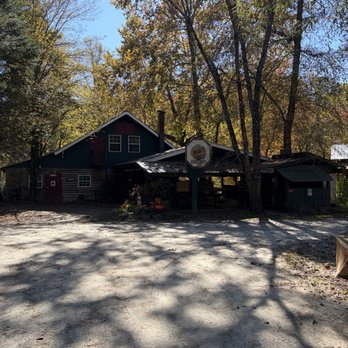
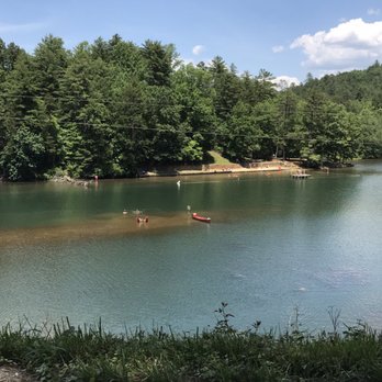
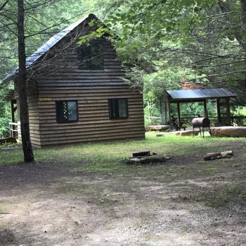
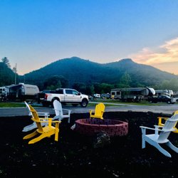
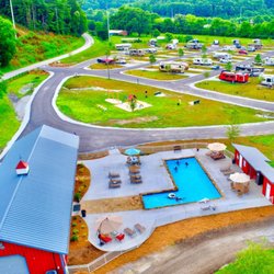
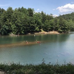
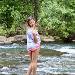
    This campground is right in the middle of all the attractions Rabun County has to offer without the hustle and bustle of the overcrowded on sight campgrounds at the parks. Tallulah Gorge and State Park is only a 3 minute drive away! This charming campground has a campsite for every kind of camper, RV, Cabin, Tents, etc. We car camped at space 15 right on the river and it was great, we were able to drop our Kayaks right in the water from our sight. The campground is clean and well taken care of. We will definitely be back, and we can't wait!
    See all

    10 months ago

    Helpful 0
    Thanks 0
    Love this 0
    Oh no 0

    3 years ago

    Helpful 0
    Thanks 1
    Love this 0
    Oh no 0

    7 years ago

    Helpful 0
    Thanks 0
    Love this 0
    Oh no 0

    9 years ago

    Helpful 0
    Thanks 0
    Love this 1
    Oh no 0

    9 years ago

    Helpful 0
    Thanks 0
    Love this 0
    Oh no 0

    8 years ago

    Helpful 0
    Thanks 0
    Love this 0
    Oh no 0
    Photo of Audi B.
    423
    2
    0

    8 years ago

    Love love love this place and amazing owners!!! Our band Soul Casserole will be playing there Labor Day Weekend 2018 we cant wait!!!

    Helpful 0
    Thanks 0
    Love this 0
    Oh no 0

    9 years ago

    Helpful 0
    Thanks 0
    Love this 0
    Oh no 0

    Ask the Community - River Campground
    Verify this business for free

    People searched for Campgrounds 206 times last month within 15 miles of this business.

    Verify this business

    Tallulah Gorge State Park

    Tallulah Gorge State Park

    4.5(210 reviews)
    2.4 mi

    I came here on a very hot summer day with the plans to see some waterfalls. We got here around…read more8:30am which I believe is when the park opens. We took the South Rim (At least I think it was the South Rim) and went to all 5 viewing points which is a flat walk and a round trip of about 1.5 miles. Then we went down into the Gorge which includes 1,099 steps (actual staircase) to the bottom and of course that many steps back up. You can't go all the way to the Gorge floor without a permit but that just means you can only walk down 1,089 steps to a platform. There are plenty of places to stop including a very cool suspension bridge that overlooks Hurricane Falls. This was pretty tough for a 50-year-old fat boy like me but it's doable if you can simply climb stairs. The views are amazing and worth the quads burning for the next 3 days. The visitor's center is really nice. There is of course a gift shop. a huge display of taxidermy of all the local wildlife and a very nice museum that goes through the history of the region. The most important part is they have air conditioning. Suck it up, take the stairs and buy the t-shirt saying you did it when you are done.

    The visitor center is phenomenal! Movie was down for some reason. The gift shop has loads to choose…read morefrom and the rest rooms were clean and there were many stalls available. There is almost a museum quality to the taxidermy animal scene they have in the middle of the room and along the walls. Truly a special visit! The hike to see the inspirational point and the swinging bridge wasn't too strenuous for my 4 or 5 year old for people's reference when considering it. We are an active family who hikes etc. There were a lot of warnings but we found it wasn't as bad as it seemed.

    Photos
    Tallulah Gorge State Park - Part of the 1,099 steps to bottom of Hurricane Falls

    Part of the 1,099 steps to bottom of Hurricane Falls

    Tallulah Gorge State Park
    Tallulah Gorge State Park - 10.22 towards the S Rim 568 stairs up

    See all

    10.22 towards the S Rim 568 stairs up

    Panther Creek Recreation Area - Trail could use a little TLC

    Panther Creek Recreation Area

    4.6(37 reviews)
    5.5 mi

    Overall great hike. A few steep sections but nothing too crazy. Beautiful scenery the whole way…read more Would recommend for anyone looking for a solid outdoor experience.

    My partner and I recently visited Clarksville for a spontaneous hiking trip. Panther Creek Trail…read morewas at the very top of our list and we were not disappointed. At first we were worried that the trail would be closed due to the storm damage that occurred during the prior year but we drove by and there were multiple parties going in and out of the trail so we figured we would go for it! This trail is long and arduous, so be prepared! Us Floridians definitely overestimated our hiking abilities but we still got it done (thankfully). Bring around 2L per person or more if it's a hot day. We started on a Friday around 2pm and finished by 6:30pm and clocked in a total of 8 miles round trip. If you can go earlier, I highly recommend doing so to have plenty of light. There's two main parts of the trail where the bridges were damaged and removed. In one section, there's several logs that lay across the stream. Find a big stick, and scramble across. In the second section, the water is shallow enough to walk across without the possibility of getting your legs wet. But even if you get wet, both sections are not deeper than your ankle. I don't know if I'd recommend this for children as there are multiple sudden drop offs but more power to you if your family can do this! If you are a hiker, this does not disappoint!

    Photos
    Panther Creek Recreation Area - Good hike today. Simple, relaxing, and Fun.

    Good hike today. Simple, relaxing, and Fun.

    Panther Creek Recreation Area - OTG Hiker's Club Hike #3

    OTG Hiker's Club Hike #3

    Panther Creek Recreation Area - Christina & boyfriend

    See all

    Christina & boyfriend

    Stonewall Creek Falls - Great mountain biking

    Stonewall Creek Falls

    4.5(2 reviews)
    3.9 mi

    Stonewall Creek Falls is located on the trail known as Stonewall Falls & White Twister Mountain…read moreBike Trail. It's an 11.5 mile trail used most often by mountain bikes (as the name would imply) and has multiple wet creek crossings. The parking area & trailhead are off Stonewall Creek Road, also known as Crooked Oak Road on one end and Carleton English Road on the other. Three names in less than 3 miles of road, but you would only know this if you are looking at Google Maps. [ DIRECTIONS ] The trailhead is approx. 1.3 miles from paved South Main Street in Tiger, GA. The road is gravel with no signage, but a small utility building with two power boxes surrounded by a chain link fence sits right on the corner. The road is a touch bumpy and is best for trucks, Jeeps, SUV's and vehicles with more clearance, but a car COULD make it through. [ THE TRAIL ] You'll know you've arrived when you reach a small forest service gate with a niche large enough for about 3 cars. There is also sufficient room for several more cars to park roadside. The Mountain Bike Trail has a 1492 foot elevation change and encompasses some of the roadway past the parking area. However, to get to the waterfall, go through the gate, cross the small creek and continue left downhill for about 1/2 mile. The waterfall will come into view near a large open camping area. [ THE FALLS ] The easiest waterfall to reach is the one at the camping area. It's approximately 20 feet tall. HOWEVER, there is another waterfalls upstream of the main falls, but it is difficult to reach. Scouting reports I have read say to use a steep side trail 100 yards or so further uptrail past the falls. You will see two faint trails and I've been told the first of the two is the better option, but be careful, BOTH are STEEP. I tried the second trail (didn't know the first trail was the better option at the time) and only made it halfway before turning back. It felt against my better judgement to try this alone with my tiny little dog. So I plan to come back on another day when I have another crazy adventurer with me for support (and possibly a 911 call). Just slightly upstream from the main falls is an easier path to Stonewall Creek. My thought is to try to wade through the river to the upper falls, which are far prettier according to some of the pics I've witnesses on hiking trail galleries: https://mtnimages.smugmug.com/Hiking-With-Mtnimages/Hike-to-Stonewall-Creek/i-bdsqddz/A TIP - If you hike upstream looking for the side trail to the upper falls and make it to a creek crossing, you've gone too far! There is also another waterfall downstream of the main falls, but requires some mountain goat skills and bushwacking, which I'm hoping to get into this summer as I want to trailblaze to more remote waterfalls. [ THINGS TO KNOW ] Hiking Distance: 1 miles (round trip to main falls) Difficulty: Easy & family friendly (main waterfall) Difficulty: Strenuous & dangerous (upper and lower falls) Creek Crossings: YES (1) small stream at the beginning Elevation Gain: n/a Waterfall Height: Approx 18-20 feet (main) Access to top of falls: NO Access to base of falls: YES Pool of water @ base of Falls: YES Sitting areas @ base: YES + camping area RESTROOMS: NO PARKING: YES (3+ cars) [ FINAL THOUGHTS ] I enjoy hiking very much! The beauty, serenity and adventure calls to me and the peace that comes from such adventures is simply unmatched. The only thing that disturbs my hiking serenity is when I can't reach my destination. I'm stubborn and bullheaded like that! The first waterfall was nice, but my mission was to see all three, or at the very least the main falls AND the upper falls.... so I left disappointed. Still, it was one of several waterfalls I toured today as I scouted new trails for my hiking groups 2020 expeditions. This is a great short hike to add to other longer hikes when looking to fill up a day. NOTE TO SELF: Be better prepared next time with trail map downloads and GPS trackers that work even offline to better navigate to falls that are off-trail. Also, bring a machete just in case some light bushwacking is required. 2020 / 9

    I love this places, beautiful, relaxing. I love to end here after mountain biking trails. Is not…read morecrowded place

    Photos
    Stonewall Creek Falls - 15Apr2020

    15Apr2020

    Stonewall Creek Falls - 2 of 4 - Main waterfall

    2 of 4 - Main waterfall

    Stonewall Creek Falls

    See all

    Angel Falls & Panther Falls - Panther Falls | Instagram: @telephonesmoothie

    Angel Falls & Panther Falls

    4.6(11 reviews)
    4.2 mi

    This is a beautiful trail that leads to two stunning waterfalls. The trail can be challenging in…read moresome areas due to rocky terrain and roots on the path. However, overall it's a pleasant trail with several creek crossings and rhododendron tunnels. The first falls, Panther Falls, is a sight to behold and you can even walk in the pool at the base of the falls. As you proceed from Panther Falls, the trail becomes harder as you go up the side of the falls, and there are handrails due to steep drop-offs. The trail is an in and out and takes you through lush rhododendron forests, alongside a scenic Creek. The effort is well worth it, though, as the falls themselves are magnificent, with cascading waters that make for an incredible photo opportunity. Angel Falls at the end of the trail can be harder to see due to plants growing over it partially. The Angel Fall Trailhead is located in Loop 2, area 2 of the Rabun Beach Campground. This is mostly an easy trail with a couple of short, steep runs. The payoff is reaching the observation deck where you can enjoy Angel Falls. Here you will see dogs on leash, kid-friendly, forests, rivers, and hiking. Great, short, easy "Moderate" hike. Parking is enough for a few cars only, but nearby there is a campground with a lot of parking. The hike itself is pretty easy. The peaceful surroundings and the sound of rushing water create a serene atmosphere, making it a must-visit for nature enthusiasts.

    Angel Falls was tough to find with Google providing the wrong location, but the trailhead is off…read moreRabun Rd. about 4 miles down from where Google says it is! Happy we continued the beautiful drive around the lake to find it. The parking area is small, but we also were the only car there for our visit. It's a short, easy walk (just watch out for the roots!) to the falls, but it was a little more advanced after the bridge at the falls. We had lots of rain so the mud was slippery. Must-do hike if you're near!

    Photos
    Angel Falls & Panther Falls - Angel Falls | Instagram: @telephonesmoothie

    Angel Falls | Instagram: @telephonesmoothie

    Angel Falls & Panther Falls - Panther Falls | Instagram: @telephonesmoothie

    Panther Falls | Instagram: @telephonesmoothie

    Angel Falls & Panther Falls - Instagram: @telephonesmoothie

    See all

    Instagram: @telephonesmoothie

    River Campground - campgrounds - Updated August 2026
    Loading...
    Loading...
    Loading...