1. Ramona Oaks Shade Trail

0

Ramona, CA

Cancel

Open app

Search

Ramona Oaks Shade Trail

5.0 (1 review)

Ramona Oaks Shade Trail Photos

You might also consider

More like Ramona Oaks Shade Trail

Recommended Reviews - Ramona Oaks Shade Trail

Your trust is our priority, so businesses can't pay to alter or remove their reviews. Learn more about reviews.
Yelp app icon
Browse more easily on the app
Review Feed Illustration

3 years ago

Helpful 17
Thanks 3
Love this 14
Oh no 0

You might also consider

Verify this business for free

People searched for Hiking 614 times last month within 15 miles of this business.

Verify this business

Cedar Creek Falls - Cedar Creek Falls

Cedar Creek Falls

4.4(358 reviews)
4.4 mi

Having lived in San Diego for so long, I honestly don't know why it took me this long to do this…read morehike. I finally got the permit online (definitely download it before you arrive since service can be spotty) and decided to go for it. I went in early May and started the trail around 8am, which turned out to be a great decision. The trail was practically empty at that time, and the downhill views were absolutely beautiful. I even saw two rattlesnakes before 9am, so definitely stay alert while hiking. At several points I had to remind myself I was still in San Diego and not somewhere in a huge national park. Once I got near the bottom, I did lose track of the trail a little and it was SOS, so having the AllTrails map downloaded beforehand was really helpful. It took me a little over an hour to reach the waterfall, and there were only two other people there at the time, which made it feel really peaceful and private. The water felt AMAZING after the hike down. There were so many fish in the water, and the whole area was honestly so pretty. By the time I started heading back around 10am, I noticed a lot more people arriving at the falls. The hike back up wasn't terrible, but the sun definitely makes it much harder on the return. I was very happy to make it back to the parking lot by around 11:30am. I would definitely bring lots of water, sunscreen, and some snacks.

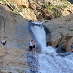
If you are a San Diego hiker and haven't done this hike- WHAT ARE YOU WAITING FOR???…read more And for those of you who see these photos and think damn I need to go do that, please be aware of the temperature because it is dangerously hot down there at lower temperatures than in other areas. The hike goes down into a canyon and the heat settles down there. Even if it's not as hot as you think coming up can be extremely dangerous. Every year I hear about somebody dying from heat stroke on that hike so don't take it lightly. I always check the weather on the actual trail using the AllTrails app. I saw that the weather out there was max 65° that day and I was like hell yeah. The hike really isn't that difficult, 3 miles down and then 3 miles back up. Lots of nice switchbacks, and there are a few sun shelters for shade. The views are gorgeous all along the trail. I've done this hike, probably 20 times over the years. It's the best in the spring and in the fall. In the winter it's way too cold. The reward for this hike is the gorgeous rock bowl and waterfall that the locals call Devils Punchbowl. This past Thursday when we did this hike, there were a lot of young folks at the Punchbowl when we got there. Some of the guys were climbing up and jumping into the water. I would not recommend it, even if the waterfall is still flowing that water is not safe to swim in. In the fall, the waterfall doesn't flow anymore after being dried out over the brutal summer, but the trees at the bottom of the canyon turn a beautiful gold color. One of the few places in San Diego you can actually experience fall.

Photos
Cedar Creek Falls - Cloud porn in the beginning of our hike!

Cloud porn in the beginning of our hike!

Cedar Creek Falls - Awesome day with one of my best girlfriends

Awesome day with one of my best girlfriends

Cedar Creek Falls - Morning frost

See all

Morning frost

Ramona Grasslands Preserve

Ramona Grasslands Preserve

4.4(20 reviews)
10.5 mi

Enjoyed a really nice hike/walk here this morning. They have a .8 mile meadow loop, and a 2-mil…read morewildflower loop, with a .2 mile connector trail between the two. I did some of all three. It was August, so definitely drier, and no wildflowers, but still some really pretty trees, green grass, and beautiful views. I saw a few groups of horseback riders, a coyote, some butterflies, birds and hawks, and tons of lizards and ground squirrels. It's a 3,521 acre preserve, some of which is not open to the public, although there is a 6-mile trail that is open 3 months a year by reservation. They have 408 plant species, 23 butterfly species, 21 reptile species, 6 types of amphibians, 37 mammals and over a hundred types of birds. Not crowded at all; other than the horseback riders, only encountered a few hikers the whole time. There's free parking and a portable toilet by the trailhead. Would love to come back in spring to see the wild flowers.

Fun little place to go for a hike or take pictures…read more There are plenty of trails, loop trails, signs. Some are shorter, some longer. Some easier, some harder. Only about 35 - 40 minutes E of Oceanside, so not too bad. There are plenty of animals to see the 3 or 4 times that I have been there. Including ground squirrels, rabbits, snakes, cows, coyotes, birds of all kinds such as woodpeckers, meadow larks, hawks, vulture or condors, etc. Pretty much dirt, so if it rains, mud. During the spring bloom there are some pretty flowers. There is 1 trail that leads to a pond, with some ducks, etc. There may be people riding horses, make sure you yield to them, whether walking, walking your dog, riding a bike, etc. There is a porta-potty at the beginning of the trail in the parking lot. Make sure you lock the gate when you enter the trails.

Photos
Ramona Grasslands Preserve

See all

Barnett Ranch County Preserve

Barnett Ranch County Preserve

4.0(6 reviews)
3.0 mi

I was here May 14 2019,…read more Park is nice and not very crowded. There was a lot of greenery and quite a few flowers since the recent rains. The trail is old ranch road and fairly flat with some minor elevation changes. If you walk the loop trail there is a nice bench in a grove of oaks about halfway around the trail and a bench by the pond. The park is serene and the traffic noise from San Vicente Rd dies off fairly quickly as you get further into the preserve and soon all you hear is the sound of nature and the occasional airplane from Ramona. The only bathroom is a porta potty at the parking lot. I originally had some trouble finding the park and nothing online was helpful, so here's how to find it. If you come off Main Street in Ramona and drive south on San Vicente Rd (like you're headed toward California Estates) you will pass Ramona High and then continue about 2 miles. You will see a brown Barrett Ranch county park sign on the right as you crest the hill. The turnoff is well marked and easy to see about 1/4 mile after the sign on the right. Look for the large gate to keep the public from driving down Delviney Ln and the parking lot is right in front of the gate. The no trespassing sign looks like it was put up before the gate was installed to keep cars from driving down Delviney Ln. Walk down the south side of Delviney about 1/4 mile (go past the small trail on your left) until you get to the trailhead where you will find a large sign and a trash can. Take that left and walk until you get to a Y in the road with a bench and a split rail/log fence. Take a right at the fence and that will start you on the loop trail.
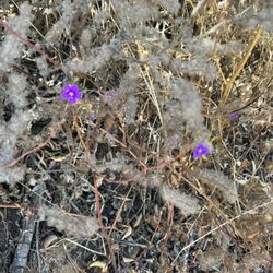
What a gorgeous area to hike. It is so beautiful, and you see cows, horses, and other animals along…read morethe way. The trail is very popular and often busy but worth the visit. Parking is available on site, as is a portable restroom at the trailhead. We visited this site almost every day as it's a good way to start the day. Highly recommended.

Photos
Barnett Ranch County Preserve

See all

Kumeyaay Trail

Kumeyaay Trail

4.0(1 review)
17.6 mi

The Kumeyaay Trail is a trail that hugs Lake Wohlford's North shore…read more Parking is free at the Lake Wohlford Ranger Station so just park and walk East to find the trail entrance. Note that the trail isn't marked very well, and you'll have to use trail intuition to find your way in the overgrown areas. The trail is mostly dirt, small boulders, and large flat smooth rocks. Expect mud and sand in some areas next to the lake. Not the best hike if you have bad knees. The actual hike was fun ( early spring after many large rainstorms). You'll walk by several Oak Trees and many wildflowers blooming. This is a birders paradise as many waterfowl make their homes here. It's about 4.5 miles there and back unless you are foolish and decided to walk around the ENTIRE LAKE.. That will make your hike 5.5 total. Note there is NO TRAIL to connect Kumeyaay to the South trails on the other side of the lake. Foolishness - So, once you walk to the end of the Kumeyaay Trail ( there is a private property gate) you might get the harebrained idea to cut through the swamp to get to the south side of the lake.. Okay, we did it ( with three kids).. There are a few things to know before deciding to cut across the mash to the other side.. Much of your hike will be through a large stinging nettle forest. If you're wearing shorts forget about going to the other side of the lake. If you have long pants / jeans you should be okay. Next you'll have to go through various reeds and muck. Then you'll have to cross a small stream about ten feet wide, a few feet deep.. You're going to get your shoes wet unless you're one hell of a long jumper. Finally, you'll have to ascend up a vertical cliff to get up to a road..One you're on the South Side of Lake Wohlford you still have a long way to hike to get back to your car. There is no shortcut and you'll have to walk along the busy Lake Wholford Rd for over a mile. Worth it?? Yeah it was pretty adventurous. - Tips I wouldn't kike this trail in the summer. There are soooo many places for rattlesnakes to hide.

Photos
Kumeyaay Trail - River to cross if you want to get to the other side of lake.

River to cross if you want to get to the other side of lake.

Kumeyaay Trail
Kumeyaay Trail

See all

Ramona Oaks Shade Trail - hiking - Updated October 2026

Loading...
Loading...
Loading...