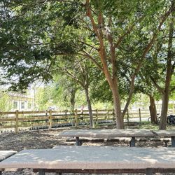
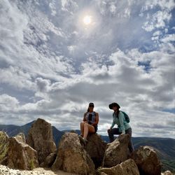
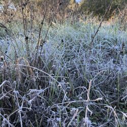
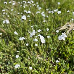
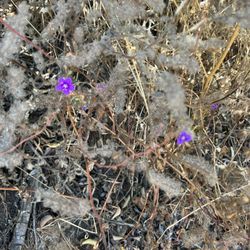
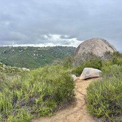
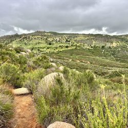
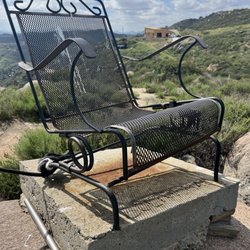
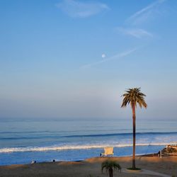
Cancel

    Open app

    Search

    Black Canyon

    4.5 (4 reviews)

    Black Canyon Photos

    You might also consider

    Recommended Reviews - Black Canyon

    Your trust is our priority, so businesses can't pay to alter or remove their reviews. Learn more about reviews.
    Yelp app icon
    Browse more easily on the app
    Review Feed Illustration

    4 years ago

    Helpful 1
    Thanks 0
    Love this 0
    Oh no 0

    5 years ago

    Helpful 0
    Thanks 0
    Love this 2
    Oh no 1

    6 years ago

    Helpful 3
    Thanks 0
    Love this 0
    Oh no 0
    Photo of Miles S.
    236
    40
    18

    10 years ago

    Helpful 6
    Thanks 0
    Love this 7
    Oh no 0

    You might also consider

    Verify this business for free

    People searched for Hiking 1,019 times last month within 15 miles of this business.

    Verify this business

    Cedar Creek Falls - Cedar Creek Falls

    Cedar Creek Falls

    4.4(358 reviews)
    10.1 mi

    If you are a San Diego hiker and haven't done this hike- WHAT ARE YOU WAITING FOR???…read more And for those of you who see these photos and think damn I need to go do that, please be aware of the temperature because it is dangerously hot down there at lower temperatures than in other areas. The hike goes down into a canyon and the heat settles down there. Even if it's not as hot as you think coming up can be extremely dangerous. Every year I hear about somebody dying from heat stroke on that hike so don't take it lightly. I always check the weather on the actual trail using the AllTrails app. I saw that the weather out there was max 65° that day and I was like hell yeah. The hike really isn't that difficult, 3 miles down and then 3 miles back up. Lots of nice switchbacks, and there are a few sun shelters for shade. The views are gorgeous all along the trail. I've done this hike, probably 20 times over the years. It's the best in the spring and in the fall. In the winter it's way too cold. The reward for this hike is the gorgeous rock bowl and waterfall that the locals call Devils Punchbowl. This past Thursday when we did this hike, there were a lot of young folks at the Punchbowl when we got there. Some of the guys were climbing up and jumping into the water. I would not recommend it, even if the waterfall is still flowing that water is not safe to swim in. In the fall, the waterfall doesn't flow anymore after being dried out over the brutal summer, but the trees at the bottom of the canyon turn a beautiful gold color. One of the few places in San Diego you can actually experience fall.

    Having lived in San Diego for so long, I honestly don't know why it took me this long to do this…read morehike. I finally got the permit online (definitely download it before you arrive since service can be spotty) and decided to go for it. I went in early May and started the trail around 8am, which turned out to be a great decision. The trail was practically empty at that time, and the downhill views were absolutely beautiful. I even saw two rattlesnakes before 9am, so definitely stay alert while hiking. At several points I had to remind myself I was still in San Diego and not somewhere in a huge national park. Once I got near the bottom, I did lose track of the trail a little and it was SOS, so having the AllTrails map downloaded beforehand was really helpful. It took me a little over an hour to reach the waterfall, and there were only two other people there at the time, which made it feel really peaceful and private. The water felt AMAZING after the hike down. There were so many fish in the water, and the whole area was honestly so pretty. By the time I started heading back around 10am, I noticed a lot more people arriving at the falls. The hike back up wasn't terrible, but the sun definitely makes it much harder on the return. I was very happy to make it back to the parking lot by around 11:30am. I would definitely bring lots of water, sunscreen, and some snacks.

    Photos
    Cedar Creek Falls - Cloud porn in the beginning of our hike!

    Cloud porn in the beginning of our hike!

    Cedar Creek Falls - Awesome day with one of my best girlfriends

    Awesome day with one of my best girlfriends

    Cedar Creek Falls - Morning frost

    See all

    Morning frost

    Inaja Memorial Park

    Inaja Memorial Park

    4.3(9 reviews)
    8.1 mi

    I was curious to see this trail-park, but didn't know the history till I read the board, (which I…read moreterribly forgot to take a full photo of). It memorializes 11 men that died while digging a fire line on steep canyon - three Forest Service firefighters, seven inmates firefighters & their correctional officer (from the Viejas Honor Camp (prison camp), died at approximately 8:00 PM (part of the blaze looped below their position and overran the crew) The fire, (which was started by arson on November 24, 1956), burned 43,611 acres before containment on the evening of November 28. This is from the National Forest Service Library website. It's has quite a few picnic tables, a couple grills by them but I personally wouldn't want to bbq out there. There are restrooms that are like porta pottys and a short trail (trails) but I didn't walk too far because of my knee. It's a beautiful, peaceful & scenic spot to go to if you live in the area or if you want to add to a pit stop while venturing out here. Main Street in Julian is down from here where you can grab a bite to eat at anyone of the restaurants/cafes.

    A small picnic stop on the way up to Julian. We stopped by…read moreto check out the nature trail and its viewpoint of the Santa Ysabel valley. The small loop trail is only .5 miles and about 15 minutes of hiking. This is a great place to stop and stretch your legs, go to the restroom, and maybe have a picnic before heading up to Julian.. - Restrooms - Views - Parking lot

    Photos
    Inaja Memorial Park
    Inaja Memorial Park
    Inaja Memorial Park

    See all

    Eagle Rock Hike - The Beautiful Eagle Rock

    Eagle Rock Hike

    4.7(55 reviews)
    14.2 mi

    Did a little hike since my knee replacement surgery (3 months & counting), what an amazing trail,…read moreespecially since it's part of the Pacific Crest hiking trail, traveled by hikers from allover. I didn't get far enough to see the sculptured eagle rock, but will get there soon and post pictures soon! A gem in the back country of San Diego.

    I had read about this random rock formation shaped like the profile of an eagle when I first…read morestarted doing San Diego County hikes. We tackled this 6.4 mile out-and-back trail in Warner Springs on a recent weekend. It seemed like most of the hikers were completing the journey when we arrived after lunch as they were returning towards the trailhead off Highway 79. You can park along both sides of the road on the shoulder, but don't pull into the fire station lot adjacent to the trailhead. The Eagle Rock Hike is actually a segment of the larger Pacific Crest National Scenic Trail (PCT). The PCT spans over 2,500 miles and runs through California, Oregon, and Washington from the Mexican border to the Canadian border. The first half of the outbound portion was rather flat and ran next to a creek that was still flowing with a good amount of water from the March rainfall. There was plenty of shade from the trees in that area. Once you emerged from that section, the path veered into a valley with a few curves and gentle slopes. The landscape looked nothing like what you would expect in San Diego. It resembled the Great Plains with grasses and weeds along with hills and mountains off in the distance. This continued until you could see a set of rocks appearing what seemed to be the middle of nowhere. The approach was from the south side which was the rear of the formation. The view from the north definitely resembled an eagle about to spread its wings. Only one other group of hikers was present when we reached Eagle Rock. You can climb up the back side to the top where you end up next to the eagle's head. Think of photo opportunities like at Potato Chip Rock but without the wait. According to a hiking app, there was an elevation change of several hundred feet. It wasn't noticeable because of the gradual sloping. The round trip took just under three hours. The only real drawback was the lack of shade in the meadows. It was windy during our visit which dropped the temperature by at least 10 degrees in that portion. At the peak of summer, the heat and dry air can make this five-star inland trek less comfortable. PS: Not only is this trail not crowded, but it's very kid and pet friendly.

    Photos
    Eagle Rock Hike - Fly like an eagle?

    Fly like an eagle?

    Eagle Rock Hike - 05-29-22

    05-29-22

    Eagle Rock Hike - Pacific Crest Trail sign.

    See all

    Pacific Crest Trail sign.

    Hellhole Canyon County Preserve - Flowers are just starting to come out along the sides of the trail

    Hellhole Canyon County Preserve

    4.5(22 reviews)
    10.8 mi

    One of my favorite late winter early spring hikes in San Diego. If you time it just right, you will…read moresee the most gorgeous flowers all over the trail. I was a little bit early this spring, the flowers are just starting to come out! My guess is two weeks from now it's going to pop. You do not want to come out here and hike in the summer, it's got the name Hellhole Canyon for a reason. It gets dangerously hot and there is no guarantee that anyone's going to rescue you. You can put together a monster hike in this canyon. I've done it twice over 10 miles with an ass blaster of a climb. But today I did the shorter loop which is 5.25 miles. It's got everything, views, climbing and descending and varied terrain! We rarely see anybody out here but today we actually passed three small groups on the trail. You can tell that a lot of people use the trails also with horses because we saw some horse poop and in the distance we could hear horse whinnies- so cute!!! Another bonus is at this trailhead. There are two pit toilets that are the nicest pit toilets I have ever been in. The people that maintain this canyon do an excellent job. They are always clean, stocked with toilet paper and have hand sanitizer. I will 100% be back to this trail, possibly in two weeks! If you're going to do it, I highly recommend downloading the AllTrails app and following the trail as marked. No way you'll get lost.

    Super sweet hike for me and my pups. Pretty steep but gorgeous when the weather is right!read more

    Photos
    Hellhole Canyon County Preserve - The smells so good and is starting to bloom all along the trail

    The smells so good and is starting to bloom all along the trail

    Hellhole Canyon County Preserve - It's hiking season in San Diego!

    It's hiking season in San Diego!

    Hellhole Canyon County Preserve - Have you ever seen a tree potato???

    See all

    Have you ever seen a tree potato???

    Santa Ysabel Nature Center - Information on the trail

    Santa Ysabel Nature Center

    4.7(3 reviews)
    7.6 mi

    My friends and I weren't planning to come here but the mission we drove out here to see was…read moreunexpectedly closed today so we stopped by the nature center after a slice of pie. The facility is very clean and seems to be on the newer side, with lots of large windows and central A/C. There's a room with some taxidermy wildlife and informational boards to read about the various types of wildlife and plants in the area. There's a room with a projector and a ton of chairs that is probably used for teaching, but today they were just showing shots of a mountain Lion caught walking by a camera. Out on the patio there are seats and tables, as well as interactive gold panning and archeology installations. We spent some time at them and thought it was cool (as adults) so I'm sure kids love them. Then there's a short nature path you can walk down to get to a limited playground, and there is also stadium-like seating off to the side so maybe they do some sort of show here? Not sure. But that's pretty much it. Less one star because there's not much to see, but everything that is there is nice. There were only three other families we ran into while exploring, so not sure if it was an off hour or if this is typical.

    Great place to visit. The center is full of information and exhibits showing the local plants and…read more wildlife. There are 12 miles of trails with different degrees of difficulty. Some of thrails are very step with long downhills, not good for people with bad knees. Hours of operation are from 8:00am to sunset.

    Photos
    Santa Ysabel Nature Center - View of the parking lot from the center

    View of the parking lot from the center

    Santa Ysabel Nature Center - Caterpillar on the trail

    Caterpillar on the trail

    Santa Ysabel Nature Center - Flowers on the trail

    See all

    Flowers on the trail

    Black Canyon - hiking - Updated May 2026

    Loading...
    Loading...
    Loading...