Rainforest Tour Photos


You might also consider
More like Rainforest Tour
Recommended Reviews - Rainforest Tour
Start your review...

2 years ago
Eric was a great guide! It's definitely worth paying for the guided tour through this magical place. read more


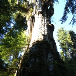
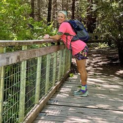
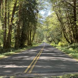
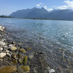
Went on this tour when visiting Olympic National Park. Who knew there were rainforests in the US!! This is a 4 hour tour lead by a National Park guide so not only is it informative, it is affordable! $35 for a 4 hour tour, not a bad deal! It's also the only tour of it's type in the area. You can bring snacks and drinks on the tour van so it's very relaxing. Anyways, this tour starts at Lake Quinault Lodge. On our tour, there were only 6 people, so it was like a private tour! The rainforest is beautiful and being driving around in AC beats driving your own car on the rough road. The guide stops at lots of waterfalls and sights and that you would not know to stop at otherwise. There is also a bathroom break and we stopped at one of the homesteads to explore. I would recommend this tour to anyone visiting Olympic National Park. It's a great and easy way to see the rainforest. Be aware that there are bugs in the rainforest and you can get bitten like me! Bring your bug spray! read more

7 years ago
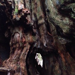
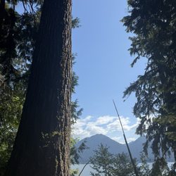
There were 4 people signed up for this tour on our day, 2 of them were us and the other 2 cancelled so we got a private tour with Paul. Check in for the tour is in the little shop of the lodge and goes around the lake. There is no really great views or stopping points, besides the giant spruce which we saw a few days prior so we didn't want to stop for that again. But it was very nice to hear some history and have local knowledge of the area. The homestead was a quiet nice area we stopped at and there was no one else there when we were there. Would recommend bringing $ if you'd like to tip your guide and there is a donation box by the Bigfoot if you'd like to help support that as well. Overall very happy with our guide and the trip around the lake. read more


9 years ago
9 years ago
More info about Rainforest Tour
Lake Quinault Lodge 345 S Shore Rd
Quinault, WA 98575
Directions
Hours
Outdoor Amenities
Other Amenities


Rainforest Tour - hiking - Updated July 2026
Best of Quinault
People found Rainforest Tour by searching for…
Things to Do in Quinault, Washington
Whale Watching Tours in Quinault, Washington
Waterfalls in Quinault, Washington
Hiking Trails With Waterfalls in Quinault, Washington
Photo Spots in Quinault, Washington
Lodging in Quinault, Washington
View Points in Quinault, Washington
Hotels & Travel in Quinault, Washington
Attractions in Quinault, Washington
Off Road Trails in Quinault, Washington
Scenic Drive in Quinault, Washington
Day Trips in Quinault, Washington
Waterfalls and Swimming Holes in Quinault, Washington
Running Trails in Quinault, Washington
Easy Hiking Trails in Quinault, Washington
Rental Car in Quinault, Washington
Beautiful Views in Quinault, Washington
Tourist Attractions in Quinault, Washington
Zip Line in Quinault, Washington
Stuff to Do in Quinault, Washington
Transportation in Quinault, Washington
Browse Nearby
BEST of Quinault, Washington Things to Do near Rainforest Tour
BEST of Quinault, Washington Coffee near Rainforest Tour
BEST of Quinault, Washington Lakes near Rainforest Tour
BEST of Quinault, Washington Restaurants near Rainforest Tour
BEST of Quinault, Washington Hot Springs near Rainforest Tour
BEST of Quinault, Washington Beaches near Rainforest Tour
BEST of Quinault, Washington Breakfast near Rainforest Tour
BEST of Quinault, Washington Campgrounds near Rainforest Tour