Spoon Creek Falls Photos


More like Spoon Creek Falls
Recommended Reviews - Spoon Creek Falls
Start your review...

11 years ago
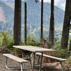
This place is a hidden gem! It has a very isolated feeling to it. The falls flow steadily into a beautiful oasis of crystal clear water that outlets into a peaceful creek. The hike to the falls is less than a mile from the trailhead with a 200ft elevation gain. Bringing your whole family to appreciate its beauty shouldn't be much of an issue. I'm almost hesitant to write this review based on some of the disrespect I've seen for the nature in surrounding areas ie; Trash left behind by visitors and people engraving their Initials and other things on the trees/earth. Im hoping my review brings people to want to visit this great spot that our national parks/Forests have to offer! Map: Green Trails Grisdale No. 198 GPS GRID: N 47 21.227 W 123 33.912 Directions: - travel north on Forrest Road 22 "Wynoochee Road" -Turn right on Forrest Road 23 and take for 17 miles - the trailhead sign "spoon creek falls" will be on your right. PLEASE Practice "LEAVE NO TRACE" read more


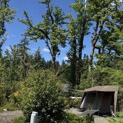
Great place to clear your mind with all the beautiful natural landscape. I would recommend wearing a long sleeve/pants while doing the hike down due to overgrown bushes and maybe water shoes. Today I didn't get my feet wet but previously we went during rainy times and we had to cross path in water to reach the waterfall. Kinda hard to find since not a lot of signs but my phone navigation got me there. Not much or no cell service. So if needed print it out. Just past the entrance to the waterfall is a fire pit area for possible day camp. Today someone had a tent in this location.Beautiful waterfall with such clear water. Very peaceful and quite. read more
5 years ago
8 years ago
More info about Spoon Creek Falls
Montesano, WA 98563
Directions
Visit Website
http://www.fs.usda.gov
Hours
Outdoor Amenities


Spoon Creek Falls - hiking - Updated May 2026
Best of Montesano
Browse Brands
Related Searches in Montesano, WA
Best Crabbing Locations to Visit in Montesano, Washington
Best Fishing Locations and Guides in Montesano, Washington
Best Nature Trails for Hiking in Montesano, Washington
Best Places for Horseback Riding in Montesano, Washington
Best Places for Stunning Views in Montesano, Washington
Check Out Off Road Trails in Montesano, Washington
Discover Baseball Fields Around Montesano, Washington
Discover Dog Friendly Trails to Explore in Montesano, Washington
Discover Popular Bike Trails in Montesano, Washington
Discover Popular Photo Spots in Montesano, Washington
Discover Top Boat Tours in Montesano, Washington for All Ages
Discover a Hiking Trail in Montesano, Washington
Discover the Best Night Hike Trails in Montesano, Washington
Dog-Friendly Hikes With Dogs in Montesano, Washington
Enjoy Camping Adventures Around Montesano, Washington
Enjoy Tent Camping Spots Around Montesano, Washington
Enjoy the Best Walking Trails in Montesano, Washington
Experience Stunning Sunset Views in Montesano, Washington
Explore Beautiful Parks and Green Spaces in Montesano, Washington
Explore Bike Rentals Throughout Montesano, Washington
Explore Easy Hikes Perfect for All in Montesano, Washington
Explore Popular Campgrounds Near Montesano, Washington
Explore Popular RV Parks Around Montesano, Washington
Explore Popular Scenic Overlook Points in Montesano, Washington
Explore Scenic Lakes to Visit in Montesano, Washington
Explore Secret Spots Worth Visiting in Montesano, Washington
Explore Top Dog Parks in Montesano, Washington Near You
Explore Top Water Parks in Montesano, Washington Today
Explore the Best Swimming Holes Around Montesano, Washington
Family Friendly Hiking With Kids in Montesano, Washington
Find Top Dog Swimming Spots in Montesano, Washington
Find Top Skate Parks in Montesano, Washington for All Skill Levels
Find Top-Rated Disc Golf in Montesano, Washington
Find the Best Parks for Picnics in Montesano, Washington
Find the Best Playgrounds to Visit in Montesano, Washington
Find the Best Swimming Pools in Montesano, Washington Today
Hiking Trails With Waterfalls in Montesano, Washington
Off Leash Dog Hiking Trails in Montesano, Washington
Perfect Spots to Watch Sunset in Montesano, Washington
Popular Kids Activities in Montesano, Washington
Popular Picnic Spots to Visit in Montesano, Washington
Popular Places to Take Pictures in Montesano, Washington
Popular Things to Do in Montesano, Washington
Relax at Natural Hot Springs Near Montesano, Washington
Safe River Swimming Areas in Montesano, Washington
See Top Fireworks Events in Montesano, Washington
Top Fishing Charter Experiences in Montesano, Washington
Top Running Trails to Explore in Montesano, Washington
People found Spoon Creek Falls by searching for…
Hiking Trails With Waterfalls in Montesano, WA
Swimming Lakes in Montesano, WA
Waterfalls and Swimming Holes in Montesano, WA
Running Trails in Montesano, WA
Dog Friendly Trails in Montesano, WA
Walking Trails in Montesano, WA
Places to Take Pictures in Montesano, WA
Lakes & Ponds in Montesano, WA
Secluded Spots in Montesano, WA
Off Road Trails in Montesano, WA
Scenic Overlook in Montesano, WA
Things to Do on a Rainy Day in Montesano, WA
Bird Sanctuary in Montesano, WA
Trending Searches in Montesano, WA
Baseball Fields near Spoon Creek Falls
Boat Rental near Spoon Creek Falls
Bounce House Rentals near Spoon Creek Falls
Campgrounds near Spoon Creek Falls
Floral Designers near Spoon Creek Falls
Garage Sales near Spoon Creek Falls
Nurseries & Gardening near Spoon Creek Falls
Party Equipment Rentals near Spoon Creek Falls
Pedicure near Spoon Creek Falls
Photo Spots near Spoon Creek Falls
Picnic Areas near Spoon Creek Falls
Places To Take Pictures near Spoon Creek Falls
Running Trails near Spoon Creek Falls
Swimming Holes near Spoon Creek Falls
Table And Chair Rentals near Spoon Creek Falls