
Pincushion Mountain Photos


You might also consider

More like Pincushion Mountain
Recommended Reviews - Pincushion Mountain
Start your review...


Reviews With Photos


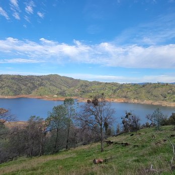
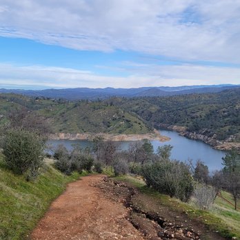
This review is for Pincushion Mountain Peak which was a ~2.4 miles round trip that took ~2 hours to complete. Pincushion Mountain Peak was a popular and crowded hike; located ~35 minutes north of Fresno, California. Trail was mostly an incline on a dirt path towards the peak. In addition, a few of the inclines were extremely steep! A little bit of rock scrambling near the top with rewarding views of Millerton Lake and the surroundings! Parking was on the side of the street, outside of the recreational area. There was a ~3 minute walk from the parking to the trailhead. Restrooms available at the trailhead. Short video of the hike for those interested! https://youtu.be/jvMj8y1Ades


First off, here are some tips on how to get there: Once you turn left on Sky Harbour Rd (where Table Mountain is) just keep going all the way. You may feel lost at some point but you're not! I made that mistake last weekend and just found another random trail. Anywho, once you get to the South Finegold parking area you will see the beginning of the trail directly across from the restrooms. It's an immediate and gradual incline; your gluteus maximus will be burning. You may find yourself huffin' and puffin'. Keep in mind, this incline goes for about 1/3 of the hike. Then you will see a trail split. Left is a little bit longer to reach your destination, right is quicker but more strenuous(very steep incline). Today I chose left, although not as steep, still exerting. Every step you take is a beautiful photo op. Especially right now with the temperate weather, greenery and flowers blossoming all around. I guess the only gripe is the lack of signage once you're trekking. The trail not only diverges once, but several times, it would be nice to know which trail goes where. But I suppose the sense of mystery is kind of cool. Overall, no matter which way you decide to take at the trail splits will be gorgeous. Springtime is the best time to hike-now is the time to go!


Quite a windy road from the casino to get to. Drive slowly and enjoy the road for 14 min from new casino. The parking is street and be good not to block the neighbor driveways. Walk to the signage and bear right into the round about (closed) parking lot with restrooms. Bear right sharply up the tight trail. 50 minutes up to the main peak to see around the mtn. It is very worth it to Boulder up extra 200 feet up pin cushion and see a very good 300 degree view The trails are mainly steep, rocky, and very good shoes or boots is needed. My avid runner with running shoes slipped and cut their wrist. Min age is 9-10 years age with good shoes. About 5 miles round trip, very steep in many places, about 2.15 hrs rt based on the incline and trying not to return down the steep but shorter path. The easier path does 4-5x the distance. Suggest going up the steep way and return the long way down. Fall and 11am hike worked very well. Windy at top not along the trail


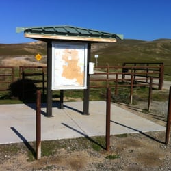
Woo babaaay! This hike up to Pincushion Mountain is short by mighty. We were not ready! Oh, but we got ready after making it up those steep ass hills to the top. After doing a 7 mile hike at Sequoia National Park, we decided to get a few more miles in here while we were in the area. Yeah... I don't know what the hell we were thinking, but it was an adrenaline rush for sure. I blame it on peer pressure! We looked up hikes in the Fresno area, and this was popped up. But be forewarned; this isn't located in Fresno. It's in the cuts of a small town called Friant. Driving here from Fresno kind of felt like a journey. A couple times we thought we were lost. The address on Yelp is completely wrong by the way! Just keep on Driving past Table Mountain Casino until you reach a dead end. The road is windy and narrow with a few one way streets. Once you make it to the end, you'll see a sign that says "Millerton Lake South Finegold Day Use Area". You can either park at the lake if it's open and a pay a fee, or park on the street next to this sign. We just parked on the street since the lake parking was closed. There a little trail next to the sign that will take you into the parking lot and a small recreation area with picnic tables, restrooms, and full access to the lake. The trail starts directly across from the restrooms. You'll see a big sign that says "San Joaquin River Trail" and will list a few different destinations with the mileage next to them. You could actually take this trail all the way down to the San Joaquin River Gorge Recreation area which is about 13 miles one way. This is also a popular trail for mountain bikers, so completing the entire trail roundtrip on a bike could be a great workout. Since we had already hiked 7 miles, we decided to do the short 3 mile hike to the top of the mountain and back. The start of this hike had us fooled. Once you pass the gate, the trail starts at a gradual incline. It's an all dirt trail that inclines for a good amount of the hike. A little over a half mile in, you'll come to a trail split. You can either go left or right, but both ways will take you to the mountain. Going left will take a bit more time, but the inclines are mild. Going right will take you up some super steep hills. We took a right and assumed that this would be the best way to get to the top of the mountain. It was seriously an ass kicker! There were two hills that were basically just straight up. It was a bit slippery due to the sand and rocks. The last stretch was the hardest but also the most rewarding. You'll be rewarded with 360 degree views of Millerton Lake and Fresno Valley! We actually got to see the sunset while we hiked up the hill, but we didn't time our hike right. We Started the hike around 6 thinking that we'd be done in an hour or so. We didn't realize that the sun would be down on our way back, so we ended up having to hike back down all of those steep slippery hills in the dark. YIKES! This trail is known to have rattlesnakes, and while we didn't see any of them on the trail, we could hear them once it got dark. We also saw field mice, beetles, and a tarantula on the trail. Since we weren't prepared, we didn't have any flashlights or headlamps and ended up having to use our cell phones for light. We definitely did NOT time it right, but that was our mistake. Other than the mistiming, we really enjoyed this hike! It's a great short workout with beautiful views. Next time, I would come earlier in the day and would do this before doing any other hikes, not after. Although its's a bit further out from Fresno, it's a a gem of a hike and I'm glad that we went.


This trail is great for intermediate hikers. A steep incline at one point but well worth the views at the top!


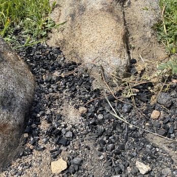
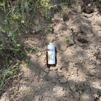
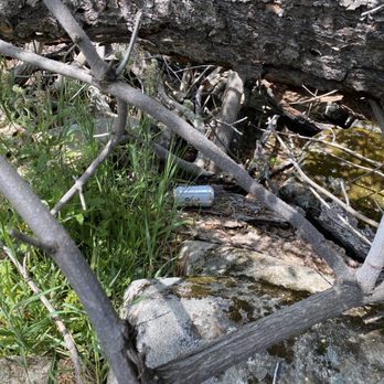
The trail is really beautiful but the people trashing it is not. There was an abundant of trash laying around the trails. And now there's an uproar of people hiking there in the past few days. This means more trash to be seen. There's cans of beers to plastic bottles to plastic wraps and even burnt charcoal. It's really sad how people don't respect nature. Next time, I am going to bring a trash bag and I'm picking up after people's mess the whole day. People that trash nature should be ashamed of themselves. Such a disgrace to human kind and should rethink their life choices. Instead all they care about is hanging out with their bros drinking cans of beer and smoking weed on the trails because it's the "vibe". Pathetic.


Perfect weather on Thanksgiving Eve. The hill to reach the top was definitely a steep climb and burns the calves but sooo worth the peaceful view. Dress in layers bcuz the top was windy.
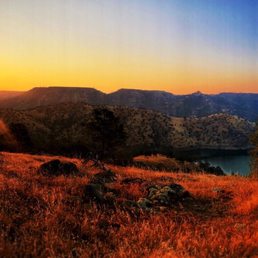

Got in to my head Saturday night to see the sunrise and do a little hike . Woke up at 3 am and drove to Millerton lake . I'm so glad I did it . This simple adventure was one of the most spiritual and relaxing things I ever done . Doing a little cardio and watching this beautiful view first thing in the morning was amazing . I recommend everybody to do something like this . Just change your way of seeing life . Pincushion trail it's a must go . Will recommend to go in the morning and see the sunrise it's beautiful ..


I truly love this trail. To get up top is hard for beginners but it is so worth it. The view and big blue sky makes it all worth it. The hardest part gets steep to reach the top of the pincushion, just take it nice and slow. Take breaks along the way, and you'll be able to cruise. Best local trail in my opinion.
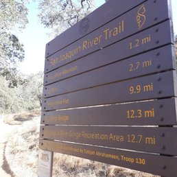

Very beautiful hike especially in the spring if you come in the summer bring lots of water bring your hiking boots have a great time !!!.
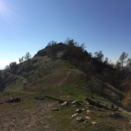

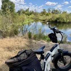
This is a really great hiking and mountain biking trail in close proximity to Fresno. It's located at the end of sky harbour road, just off Table mountain casino. There is no visible signage whatsoever until you reach it and the trails are also not very well marked. Overall this is a moderately difficult trail, as rated online and as someone who also does mountain biking, I would definitely stay away from it if you are a beginner mountain biker. It has steep portions that are can be slippery as well. However if you are a hiker with any decent endurance this can be quite easily accomplished and the views are worth it. The entire trail is just over 11 miles long but getting to the peak is just over a mile (a steep mile). I would probably avoid it in the summer as it might get way too hot and dry here


7 months ago
Have been doing this hike for YEARS! At least once a year and I have 3 young boys who love it as well. It gets a little intense but go at your own pace and all will be good. If you have asthma def bring your inhaler! Lol Also, came across a POISON OAK plant near the top/edge so BE CAREFUL! read more


10 months ago
I hiked Pincushion on New Year's Day. I start the hike at the Finegold recreation area, I recently learned this is the true trail head. It's about 3 miles round trip. It's not too hard, I would rate it moderate, but you should be in decent shape to attempt this hike. It is all uphill, it's moderate uphill. The last section right before you get to the peak is more of an intense uphill climb. The intense part doesn't last too long though. This hike offers beautiful views of the lake and Table mountains. Hiking the peak can be a bit tricky. Rocks are slippery, so wear good shoes with grip and ankle protection. This hike is unbearable in the summer, it's too hot. Winter months and early spring are my fave times to hike it. Parking is free if you park along the road. If you park in the parking lot day use area, I think it's $5. There is a public restroom, sometimes it's closed and a portopotty is available. read more
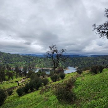


For my 200th Yelp Review, I chose this hiking experience! This is my second time hiking up Pin Cushion Mountain. Last time I went in the middle of summer and it was not pleasant at all. This time it was nice and cool, especially in the morning where it's not too sunny and busy. I went with a couple of my coworkers and I wanted to challenge myself to see if my knees can still handle the incline going up. It took about three hours round-trip to get to the top of the mountain. There are no bathrooms going up so make sure you bring some emergency wipes. I made it up and down without twisting an ankle or hurting my knees so I was happy that I made it to the top. I would say this is a moderate hike but definitely doable. It wasn't easy and it wasn't too hard but I was huffing and puffing as I went uphill, lol. Definitely recommend this hike since it's right next to Table Mountain Casino, that could be the reward after the hike!! read more

This review is for Pincushion Mountain Peak which was a ~2.4 miles round trip that took ~2 hours to complete. Pincushion Mountain Peak was a popular and crowded hike; located ~35 minutes north of Fresno, California. Trail was mostly an incline on a dirt path towards the peak. In addition, a few of the inclines were extremely steep! A little bit of rock scrambling near the top with rewarding views of Millerton Lake and the surroundings! Parking was on the side of the street, outside of the recreational area. There was a ~3 minute walk from the parking to the trailhead. Restrooms available at the trailhead. Short video of the hike for those interested! https://youtu.be/jvMj8y1Ades read more





2 years ago

First off, here are some tips on how to get there: Once you turn left on Sky Harbour Rd (where Table Mountain is) just keep going all the way. You may feel lost at some point but you're not! I made that mistake last weekend and just found another random trail. Anywho, once you get to the South Finegold parking area you will see the beginning of the trail directly across from the restrooms. It's an immediate and gradual incline; your gluteus maximus will be burning. You may find yourself huffin' and puffin'. Keep in mind, this incline goes for about 1/3 of the hike. Then you will see a trail split. Left is a little bit longer to reach your destination, right is quicker but more strenuous(very steep incline). Today I chose left, although not as steep, still exerting. Every step you take is a beautiful photo op. Especially right now with the temperate weather, greenery and flowers blossoming all around. I guess the only gripe is the lack of signage once you're trekking. The trail not only diverges once, but several times, it would be nice to know which trail goes where. But I suppose the sense of mystery is kind of cool. Overall, no matter which way you decide to take at the trail splits will be gorgeous. Springtime is the best time to hike-now is the time to go! read more


2 years ago

6 years ago
Quite a windy road from the casino to get to. Drive slowly and enjoy the road for 14 min from new casino. The parking is street and be good not to block the neighbor driveways. Walk to the signage and bear right into the round about (closed) parking lot with restrooms. Bear right sharply up the tight trail. 50 minutes up to the main peak to see around the mtn. It is very worth it to Boulder up extra 200 feet up pin cushion and see a very good 300 degree view The trails are mainly steep, rocky, and very good shoes or boots is needed. My avid runner with running shoes slipped and cut their wrist. Min age is 9-10 years age with good shoes. About 5 miles round trip, very steep in many places, about 2.15 hrs rt based on the incline and trying not to return down the steep but shorter path. The easier path does 4-5x the distance. Suggest going up the steep way and return the long way down. Fall and 11am hike worked very well. Windy at top not along the trail read more


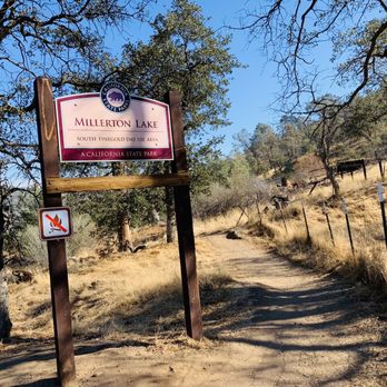


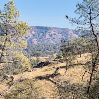
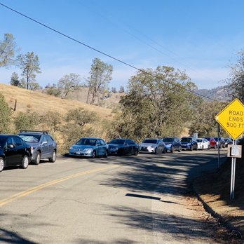


Woo babaaay! This hike up to Pincushion Mountain is short by mighty. We were not ready! Oh, but we got ready after making it up those steep ass hills to the top. After doing a 7 mile hike at Sequoia National Park, we decided to get a few more miles in here while we were in the area. Yeah... I don't know what the hell we were thinking, but it was an adrenaline rush for sure. I blame it on peer pressure! We looked up hikes in the Fresno area, and this was popped up. But be forewarned; this isn't located in Fresno. It's in the cuts of a small town called Friant. Driving here from Fresno kind of felt like a journey. A couple times we thought we were lost. The address on Yelp is completely wrong by the way! Just keep on Driving past Table Mountain Casino until you reach a dead end. The road is windy and narrow with a few one way streets. Once you make it to the end, you'll see a sign that says "Millerton Lake South Finegold Day Use Area". You can either park at the lake if it's open and a pay a fee, or park on the street next to this sign. We just parked on the street since the lake parking was closed. There a little trail next to the sign that will take you into the parking lot and a small recreation area with picnic tables, restrooms, and full access to the lake. The trail starts directly across from the restrooms. You'll see a big sign that says "San Joaquin River Trail" and will list a few different destinations with the mileage next to them. You could actually take this trail all the way down to the San Joaquin River Gorge Recreation area which is about 13 miles one way. This is also a popular trail for mountain bikers, so completing the entire trail roundtrip on a bike could be a great workout. Since we had already hiked 7 miles, we decided to do the short 3 mile hike to the top of the mountain and back. The start of this hike had us fooled. Once you pass the gate, the trail starts at a gradual incline. It's an all dirt trail that inclines for a good amount of the hike. A little over a half mile in, you'll come to a trail split. You can either go left or right, but both ways will take you to the mountain. Going left will take a bit more time, but the inclines are mild. Going right will take you up some super steep hills. We took a right and assumed that this would be the best way to get to the top of the mountain. It was seriously an ass kicker! There were two hills that were basically just straight up. It was a bit slippery due to the sand and rocks. The last stretch was the hardest but also the most rewarding. You'll be rewarded with 360 degree views of Millerton Lake and Fresno Valley! We actually got to see the sunset while we hiked up the hill, but we didn't time our hike right. We Started the hike around 6 thinking that we'd be done in an hour or so. We didn't realize that the sun would be down on our way back, so we ended up having to hike back down all of those steep slippery hills in the dark. YIKES! This trail is known to have rattlesnakes, and while we didn't see any of them on the trail, we could hear them once it got dark. We also saw field mice, beetles, and a tarantula on the trail. Since we weren't prepared, we didn't have any flashlights or headlamps and ended up having to use our cell phones for light. We definitely did NOT time it right, but that was our mistake. Other than the mistiming, we really enjoyed this hike! It's a great short workout with beautiful views. Next time, I would come earlier in the day and would do this before doing any other hikes, not after. Although its's a bit further out from Fresno, it's a a gem of a hike and I'm glad that we went. read more


2 years ago

9 years ago

4 years ago


7 years ago
The trail is really beautiful but the people trashing it is not. There was an abundant of trash laying around the trails. And now there's an uproar of people hiking there in the past few days. This means more trash to be seen. There's cans of beers to plastic bottles to plastic wraps and even burnt charcoal. It's really sad how people don't respect nature. Next time, I am going to bring a trash bag and I'm picking up after people's mess the whole day. People that trash nature should be ashamed of themselves. Such a disgrace to human kind and should rethink their life choices. Instead all they care about is hanging out with their bros drinking cans of beer and smoking weed on the trails because it's the "vibe". Pathetic. read more






7 years ago
Perfect weather on Thanksgiving Eve. The hill to reach the top was definitely a steep climb and burns the calves but sooo worth the peaceful view. Dress in layers bcuz the top was windy. read more


9 years ago
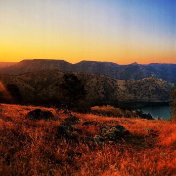
Got in to my head Saturday night to see the sunrise and do a little hike . Woke up at 3 am and drove to Millerton lake . I'm so glad I did it . This simple adventure was one of the most spiritual and relaxing things I ever done . Doing a little cardio and watching this beautiful view first thing in the morning was amazing . I recommend everybody to do something like this . Just change your way of seeing life . Pincushion trail it's a must go . Will recommend to go in the morning and see the sunrise it's beautiful .. read more


6 years ago
I truly love this trail. To get up top is hard for beginners but it is so worth it. The view and big blue sky makes it all worth it. The hardest part gets steep to reach the top of the pincushion, just take it nice and slow. Take breaks along the way, and you'll be able to cruise. Best local trail in my opinion. read more


3 years ago

7 years ago
Very beautiful hike especially in the spring if you come in the summer bring lots of water bring your hiking boots have a great time !!!. read more


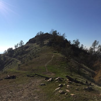
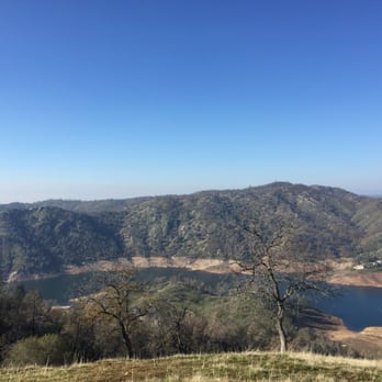
This is a really great hiking and mountain biking trail in close proximity to Fresno. It's located at the end of sky harbour road, just off Table mountain casino. There is no visible signage whatsoever until you reach it and the trails are also not very well marked. Overall this is a moderately difficult trail, as rated online and as someone who also does mountain biking, I would definitely stay away from it if you are a beginner mountain biker. It has steep portions that are can be slippery as well. However if you are a hiker with any decent endurance this can be quite easily accomplished and the views are worth it. The entire trail is just over 11 miles long but getting to the peak is just over a mile (a steep mile). I would probably avoid it in the summer as it might get way too hot and dry here read more



7 years ago
I love this place I hiked it with my 7 and 8 year olds they loved it, and I hiked it with my buddy from work after we showed the pics with everyone else at work they all wanted to go read more



8 years ago

7 years ago
I've been wanting to do this hike for quite some time. It's a pretty easy drive, right before Table Mountain. Only a 30 minute drive away from Fresno. The last time I hiked was when I accidentally parked at the bottom of the hill from Griffith Observatory in LA and I honestly think that hike was harder. This hike is moderate. The incline is steep and there is barely shade or signage. It took us 55 minutes to go up because we kept having to stop in the shaded areas. Coming down only took 20 minutes. The view at the top is neat, mostly dry grass, but you see all the hills, the table mountain skyline, a great view of millerton and all the trees at 1000 ft in elevation. I wish I would have seen it when it was green. I honestly would do this hike at least once a month, but I am on a search for different hiking trails around California because I would like to explore more of this gorgeous Golden State. read more


I went on February 26, 2017. This was my first hike with my hiking group and I was so nervous about the hike itself ( if I could do it or not ) and also meeting a group of new people. Everyone in the group was nice , friendly and welcoming. Phew !!! The hike to top of the Table Top was relatively easy but steep climb on a single track trail to top of the Pincushion was really scary . In fact , I froze up in middle of the single track on the way up but one of the members helped me thru it by holding my hands and encouraging me. The view from the top was absolutely amazing!!!!! It was well worth it. The climb down was a bit scary too because of the rocky part but it was manageable. read more


7 years ago

10 years ago
Well wanted to go and spend the day with the family. Nice day, great weather, good trails, and backpacked a lunch at Milerton Lake. This place is a must to go spend some time with the family... read more


7 years ago

8 years ago

8 years ago
5 years ago

7 years ago

8 years ago
6 years ago

10 years ago
7 years ago

10 years ago
More info about Pincushion Mountain
Sky Harbour Rd
Friant, CA 93626
Directions
Visit Website
http://www.everytrail.com
Hours
Outdoor Amenities
Ask the Community - Pincushion Mountain
Review Highlights - Pincushion Mountain














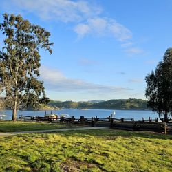
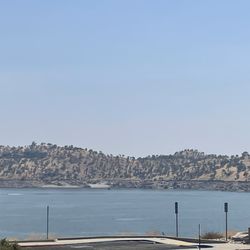

Pincushion Mountain - hiking - Updated October 2026
Best of Friant
People found Pincushion Mountain by searching for…
Trending Searches in Friant, CA
Apple Orchards near Pincushion Mountain
Apple Picking near Pincushion Mountain
Beautiful Views near Pincushion Mountain
Bird Sanctuary near Pincushion Mountain
Corn Maze near Pincushion Mountain
Costume Store near Pincushion Mountain
Craft Fairs near Pincushion Mountain
Dog Friendly Trails near Pincushion Mountain
Dog Parks near Pincushion Mountain
Hair Stylists near Pincushion Mountain
Halloween Events near Pincushion Mountain
Haunted Houses near Pincushion Mountain
Hiking near Pincushion Mountain
Hiking Trails near Pincushion Mountain
Men's Clothing near Pincushion Mountain
Nature Trails near Pincushion Mountain
Night Hike near Pincushion Mountain
Off Road Trails near Pincushion Mountain
Outdoor Activities near Pincushion Mountain
Parks near Pincushion Mountain
Photo Spots near Pincushion Mountain
Pick Your Own Farms near Pincushion Mountain
Picnic Spots near Pincushion Mountain
Places To Take Pictures near Pincushion Mountain
Pumpkin Patches near Pincushion Mountain
River Swimming near Pincushion Mountain
Rock Quarry near Pincushion Mountain
Scenic Overlook near Pincushion Mountain
Shoe Stores near Pincushion Mountain
State Parks near Pincushion Mountain
Sunrise View near Pincushion Mountain
Venues & Event Spaces near Pincushion Mountain
Browse Nearby
BEST of Friant, California Restaurants near Pincushion Mountain
BEST of Friant, California Things to Do near Pincushion Mountain
BEST of Friant, California Coffee near Pincushion Mountain
BEST of Friant, California Breakfast near Pincushion Mountain
BEST of Friant, California Horseback Riding near Pincushion Mountain
Browse Brands
Related Searches in Friant, CA
Affordable Bike Repair Services in Friant, California
Affordable Bike Tune Up Services in Friant, California
Affordable Kayak Rental Services in Friant, California
Best Dirt Bike Riding Spots in Friant, California
Best Dog Hiking Trails Around Friant, California
Best Electric Bike Rental Services in Friant, California
Best Fishing Locations and Guides in Friant, California
Best Nature Trails for Hiking in Friant, California
Best Places for Horseback Riding in Friant, California
Best Sightseeing Experiences Available in Friant, California
Best Sledding Spots and Fun in Friant, California
Best Waterfalls and Swimming Holes in Friant, California
Check Out Off Road Trails in Friant, California
Convenient Bike Sharing Programs in Friant, California
Discover Dog Friendly Trails to Explore in Friant, California
Discover Kid Friendly Hiking Trails in Friant, California
Discover Lakes & Ponds to Explore in Friant, California
Discover Popular Bike Tours in Friant, California
Discover Popular Bike Trails in Friant, California
Discover Scenic Mountain Bike Trails Near Friant, California
Discover a Hiking Trail in Friant, California
Discover the Best Fishing Lake in Friant, California
Discover the Best Night Hike Trails in Friant, California
Dog-Friendly Hikes With Dogs in Friant, California
Enjoy Camping Adventures Around Friant, California
Enjoy Hiking Adventures in Friant, California
Enjoy Kayaking Adventures in Friant, California
Enjoy Off Leash Dog Hikes in Friant, California
Enjoy Scenic Dirt Bike Trails Around Friant, California
Enjoy Scenic Places to Walk in Friant, California
Enjoy Tent Camping Spots Around Friant, California
Enjoy a Beautiful Waterfall Hike in Friant, California
Enjoy the Best Tubing Experiences in Friant, California
Enjoy the Best Walking Trails in Friant, California
Exciting Snow Tubing Experiences in Friant, California
Experience Thrilling White Water Rafting in Friant, California
Explore BMX Bike Shops Near Friant, California
Explore Beautiful Parks and Green Spaces in Friant, California
Explore Bike Rentals Throughout Friant, California
Explore Easy Hikes Perfect for All in Friant, California
Explore Electric Bikes Available in Friant, California
Explore Fun Activities to Do in Friant, California
Explore Popular Campgrounds Near Friant, California
Explore Popular Scenic Views Near Friant, California
Explore Top Dog Parks in Friant, California Near You


