Nevada Falls Hiking Photos


You might also consider

More like Nevada Falls
Recommended Reviews - Nevada Falls
Start your review...


Reviews With Photos
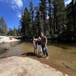

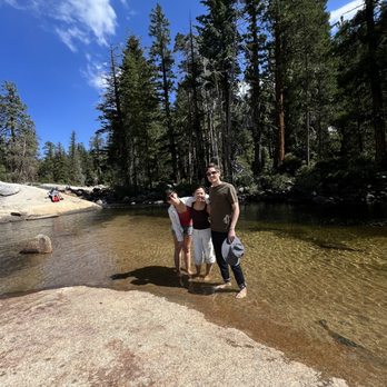
We hiked here from curry village. Started at 9 am and came back at 4:30 pm, we did take many mini breaks during the ascension. The first mile was all paved along the mountains. Steep slope. After the first mile, there's a bridge where you can see the Nevada Fall in the distance. There's a giant water fountain where you can refill water and go to the bathroom. Real bathroom with soap and hand sanitizer. Take a pee break here if you can cause there's none until you get to the top of the fall. After a couples of ascensions, there's a split where you can take the mist trail or winter route. The mist trail was close for us so we have to take the winter route. The next couples of miles on this route are full of switch backs and hiking on granite rocks. Very strenuous. Make sure you have good hiking boots or shoes. You'll eventually get to this point called Clark's Point. It's a giant rock where you can rest, go see Verna Fall if you want to stay there. Or you can continue climbing up to Nevada Fall. At this point, there's 2 ways to get the Nevada Fall, John Muir Trail or the second half Mist Trail. The Mist trail was hard. Full of switchbacks, it was like a step master, but on granite rocks. However, the views were amazing cause we were night next to the fall. At the top, there's porta-potty. There's a small water area where you can take your shoes off and enjoy the water! It was nice chilling there. Then, we came down via John Muir Trail, basically did a big loop. It was all down hills. Going down hills were rough on my knees and sheen toward the end. The views were magnificent! It was worth it, but this is not a beginner hike. And go early if you can! Highly recommend good hiking boots or shoes. A walking stick is definitely helpful on this hike!


In Yellowstone I hiked a long way to see wimpy little Fairy Falls, a supposedly major attraction which could be spotted only moments before landing in front of it. The beauty of Yosemite is that our falls aren't a mystery; they're pretty much on view early and (unlike Yellowstone) there's really no duds. Nevada Falls is certainly no dud. The route to the top of Nevada Falls is filled with variety and the route I'd recommend is like three separate hikes: * Beginning at Happy Isles (Yosemite shuttle stop #16), walk the steep, well-trod path to the base of Vernal Falls. * From the bridge at Vernal's base, head up again via the Mist Trail, on what's basically a steep, wet, granite staircase of more than 600 steps, to the top of Vernal Falls. You'll be happy you brought a hiking pole. * Walk behind Vernal Falls (near the restroom) to locate the continuation of the Mist Trail and head up again to get to Nevada Falls. Where the John Muir Trail intersects, follow it upward. Nevada Falls is on view for most of this final 1/3 of the hike up and even in late August it was flowing beautifully. It's difficult to get up this way without stopping for majestic photos every few minutes and reaching the top is both awe-inspiring and aaah-inspiring. For your descent, follow the John Muir Trail all the way down to the Vernal Falls bridge. You'll quickly realize that it's that very first section which is the steepest and hardest on the calves. With a 2,000 foot elevation gain in the 5.4 mile round-trip hike to Nevada Falls the National Park Service describes this hike as "strenuous". Though accurate, they also describe the hike to Upper Yosemite Falls in the same way. Trust me on this: Upper Yosemite Falls is a far more punishing hike (the downhill will just about kill you). NPS estimates 5-6 hours total for this hike though I did it in a bit less time. Unlike the hike to Upper Yosemite Falls, the hike to Nevada Falls is one I can easily envision doing again because of the stunning beauty, the lesser investment of time, and the fact that it didn't ruin me for the days which followed. The opportunity to hike to the top of 2 waterfalls in one hike is a gift that Yosemite gives us, and not one you find in just any National Park. While you still can, I suggest you do.
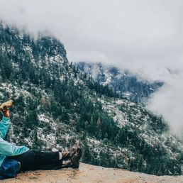

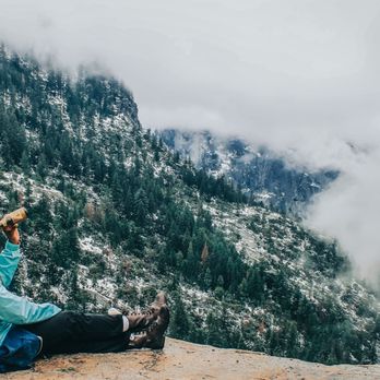
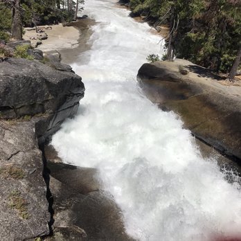
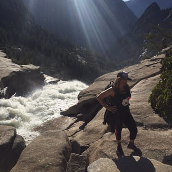
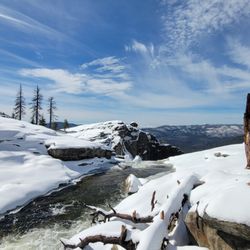
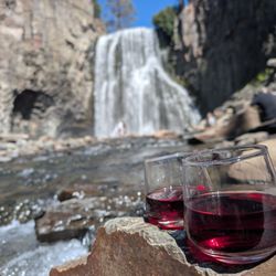
*Visited location before COVID-19; appreciation post* Getting there: This is 1 of 2 waterfalls to hike up along the Half Dome Trail. To be honest I was so tired I didn't remember much of the details about the trail. At this point, as long as you stay on the trail you will run into Nevada Falls. Experience: The hike was well worth it. It's not for the weak hearted. It's mostly at inclined (as you're hiking up a waterfall), and can be slippery in the colder months. This was the first time I had been on a hike longer than 2 miles and let me tell you...I was in no way shape or form prepared for this. It was mid-April so it was still some snow on the ground, but not too cold. I didn't have proper shoes, we hike up with water, a 6-pack of beer, and not enough snacks so needless to say it was very tiring. Each time we reached a high point we would sit down, open a cold one and enjoy the view (which is what I was doing in the picture I added). We hiked until we reached the bridge, took some amazing photos and then hiked back. Tips: - Hiking sticks, hiking boots (not the fake hiking boots I had on), and proper clothing is recommended. If hiking in the winter time I would recommend traction grips. They can be found at any sporting store, but I got ours from Big 5. - Beer is great and all, but make sure you have lots of water and some snacks along the way. I would even recommend bringing lunch and stopping at the top of one of the waterfalls to eat and enjoy the view.


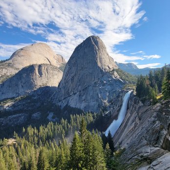
I have a love hate relationship with this hike. Our overall hike was taking the Mist Trail past Vernal Falls, to the top of Nevada Falls, and then taking the John Muir Trail on the way back down. It's about 6.7 miles round trip this way. The beginning of the hike is the worst part in my opinion. It starts with a relentlessly steep climb to get to Vernal Falls. Then, you stop to enjoy the falls. But don't get excited because there's about a million steps to get to the top of Vernal Falls. I was happy to not have to go down all of the stairs since we took the John Muir Trail back. Once you get to the top of Vernal Falls, it gets significantly easier in my opinion. There's a flat portion and then more stairs to get to the top of Nevada Falls, but not as many. Now for the views. Vernal Falls was beautiful. The best views are closer to the end of the stairs where you can see the pool at the bottom. The views of Nevada Falls were ok from the Mist Trail, but not great. It's kind of an awkward angle. There's great views of the surrounding area at the top of Nevada Falls. Probably my favorite view was of the back side of Nevada Falls with the domes next to it from the John Muir Trail on the way back down. It's a popular trail so it was kind of crowded. It seems like a lot of people only do the Vernal Falls portion because the beginning of it is definitely more crowded. The hike is pretty long and definitely challenging, but totally worth it. We were there in October when there wasn't as much water flowing and we still loved it.


When I searched Yelp for Nevada Falls, I was so surprised to see so few reviews. But after hiking up the treacherous rocks to the top, I can totally understand why. Many people will not make it up to the top. I saw it with my own two eyes; so many people turned around because they just simply couldn't do it. I consider myself an intermediate hiker, but this hike to Nevada Falls really pushed my body to the max. The rocky steps up to the top are like the steps from hell. If you've hiked the Mist Trail up to Vernal Falls and thought that was difficult; the hike up to Nevada Falls is ten times worse. The total elevation gain from the start of the Mist Trail to the top of Nevada Falls is 2,000 feet. Yes... 2,000 FEET! When I say that this hike is STEEP, I am not exaggerating. I feel weird even calling it a "hike" because you will basically be climbing up rocks for most of the way. Three tips that I usually stress for any hike, but especially for this one: *Wear the proper shoes and attire. It's so easy to sprain your ankle or to fall on a rock if you do not have the proper shoes. Your feet will be burning and blistering in pain after the hike, but it won't be so bad if you are wearing hiking boots or shoes. The Mist Trail gets very wet and you might end up soaked, so be prepared. *Bring plenty of water! One bottle is not enough! I went through 2 bottles just going up to to Nevada Falls, and drank over a gallon of water in my one day of hiking. The worst situation is being dehydrated and passing out up there on the rocks. Don't let that be you! Come prepared with water and food also because you might get hungry along the way. *Most importantly, pace yourself! It's not a race. You will be challenged and you will be sore. Take breaks along the way to get your wind back and take sips of water throughout the journey. This hike is said to be one of the most strenuous hikes in Yosemite, right behind Half Dome. It took me 5 hours to complete the entire hike with rest breaks, and a few longer breaks at each waterfall and to eat lunch. The average time it takes to finish this hike round trip is between 5-6 hours, and it's considered a day hike. Nevada Falls can me accessed taking the Mist Trail up from Vernal Falls or by taking the John Muir trail. My group took the Mist Trail to Vernal Falls up and then came back down the John Muir trail. If you aren't up for the rock climbing, I would suggest that you take the John Muir trail up and back, but it will add about 2 more miles to your trip. After all of that being said, this hike was probably the most challenging that I've ever done, but also the most rewarding! Nevada Falls is absolutely beautiful! It's worth all of the sore muscles and the journey up. It's a breath of fresh air! I'm so grateful to have experienced something so beautiful. If you're up for it, I would absolutely recommend it because it's an amazing experience!
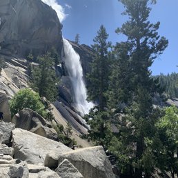

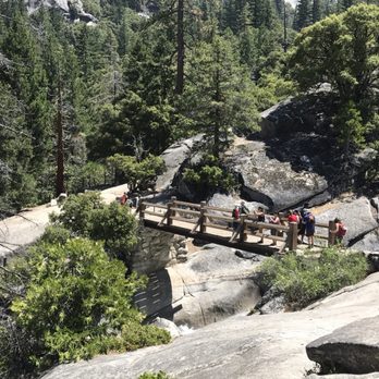
I had written a longer review under the Mist Trail listing of my entire hike which included Vernal Falls, Nevada Falls and the John Muir trail. Nevada Falls does certainly deserve its own listing given its majesty and the effort it takes to make it to the top. If you want to get a glimpse of the falls but not climb all the way up, you can can hike about a quarter of a mile past the top of Vernal Falls and see Nevada falls in the distance. However, if you're a strong hiker and prepared (water, hiking boots, ideally hiking poles) then head on up the steep switch backs of rocky stairs and the view of a lifetime waits for you at the top! Keep your eyes sharp-hikers behind us spotted a rattlesnake on the trail and there are also some steep drop offs in places on the way up. Magnificent view of the valley at the top. When I made it to the footbridge over the falls I nearly wanted to cry (mixture of joy and exhaustion.) The trail was moderately trafficked on a week day but since it's a slog to the top, every hiker group was well spaced out. Heads up that during COVID-19 restrictions you can't go back down the Mist Trail directly. With the steep stairs it's better to go down the John Muir trail which is longer but a more moderate grade. Look right, after crossing the footbridge and you'll see the small brown sign saying it's 4 miles back down to the valley . Those going to Half Doom will take the left hand trail. Overall a beautiful, but tough journey to see the falls up close.


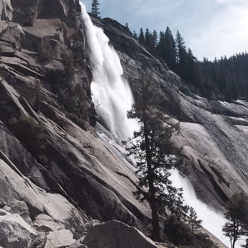
I climbed the mist trail about 5 times as a kid. All grown up, I decided to switch it up and break on through - from the other side. I started in Tuolumne Meadows and hiked to the Valley floor via the John Muir trail. The entire 30 mile hike was breathtaking, but the grand finale of the valley view and Nevada Falls was my favorite part. The 3,000+ foot descent couldn't even dampen my mood. I remember as a child, wondering if the switchbacks would ever end. As an adult, I savored the cool mist and was fascinated by how wonderful valley people smelled as I passed them by. After 4 days of hiking without a shower, you notice these things. People say they see God here. I feel God here. He wraps your soul in a blanket of endless beauty. It's tough not to feel enlightened and at home.


1. For those people who want more of a challenge than doing the Mist trail up to the top of Vernal Falls, there is the hike to the top of Nevada Falls. 2. My wife and I did this hike, as an extension of the Mist trail hike. For preparation, we carried at least 40 ounces of Gatorade, plenty of sunscreen, a hat to shield us from the sun, and oranges. No need for waterproof clothes, as the mist from Vernal Falls does not soak you. 3. We each wore full fledged hiking boots with hiking poles. You don't want to slip on the wet trail soaked by the Merced River. 4. We reach the trailhead at Happy Isles with the free valley shuttle. There is a parking lot a quarter mile down the Happy Isles road, and Curry Village is only 15 minutes walk. 5. There are bathrooms at the Happy Isles trailhead, at the Vernal Fall Footbridge, and behind Emerald Lake at the top of Vernal Falls. However, these last two were closed for the winter season. So the wife brought along toilet paper. 6. The hike to the Vernal Fall footbridge is 0.7 miles with a 400 foot elevation gain, along a paved trail with stone guardrails preventing people from falling over the cliff into the river 100 feet below. Shaded area with lots of trees for cover. This is merely a warmup for the Mist trail . 7. The upper Mist trail runs from the bridge to the top of Vernal Falls, and is closed in winter due to ice. It is only another 3/4 of a mile, but with 700+ granite rock stairs soaked wet by the next door Merced River. 8. If the Mist trail is closed, you have to use the John Muir trail to reach Vernal Falls. This is a long trail with a lot of switchbacks which go above Vernal Falls. 9. At the top of Vernal Falls, people go above or even beyond the railing to get that perfect selfie. On occasion, someone slips and falls into the water, and goes over the 317' falls, turning that Kodak moment into an Hasta La Vista moment, to quote our ex- governor. 10. Before you cross the Merced river, you come to Emerald Lake. On the near side of the Lake are bathrooms with pit toilets, often closed except during the summer. Plenty of trees here for the wife to go into the bushes, just like the four legged locals! 11. You cross the Merced River by way of a foot bridge. 2 miles and 900 feet elevation gain to Nevada Falls, over a trail carved into the granite walls. No cover here, just straight up the trail, with the Merced river running alongside. Only ground squirrels to keep the wife and I company. 12. We reach 594' Nevada Falls, huffing and puffing like Darth Vader in the 6000 foot elevation, with a tall tower like granite rock overshadowing the falls. 13. If you are going to the top of Half Dome, you are only part way there, with another 5 miles and 2000' elevation gain to go. We didn't see such people as Half Dome is only open in the summer, and any such hikers would have started off before sunrise. 14. The wife's knees are hurting, and we take the John Muir trail down to the Vernal footbridge, bypassing the 700 stairs of the Mist trail. We get an aerial view of Vernal Falls on the way back. 15. It takes a good 8 hours of hiking to complete the loop, but that's why you come to Yosemite - to enjoy the experience and views of hiking to nature's wonders.


Favorite Falls In Yosemite! Almost No People! Journey about 6 miles past The Mist trail to Vernal Falls for a nice less crowded spot that is great for a picnic and some peaceful time in the trees! We saw a grizzly bear cub and crowds of people chasing after it to take pictures which is insane! You need lots of water and really good footwear. This is a strenuous hike. Definitely a must see!


To get here is about 6 miles round trip. Not many people go past Vernal Falls. It was nice not being around all the crowds. You have to pass Vernal Falls to get here. It was a great hike to do if you have experience hiking! I wouldn't recommend hiking here if you don't hike much. There were a good amount of people who clearly were not ready for this hike. They were going up and down so slow that it was just ridiculous. There are lots of stairs to go up and they are not all the same height. The rock can be slippery from the mist of the waterfalls. If you have hiking boots or sandals you shouldn't have any issues. But Nike shoes, Vans etc. You'll have a hard time.


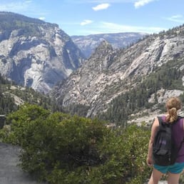
You finally made it to the top! Pat yourself on the back! Nevada Falls is at the top of a mountain. It is 5.4 miles long and takes about 5 to 6 hours with a 2000 feet elevation gain. You start at shuttle #16. This hike has excellent views of Vernal Falls which are visible from the foot bridge. This is a strenuous hike and you definitely want to come prepared for any kind of weather so make sure to dress appropriately. Be prepared for slippery footing and tremendous amount of waterfall spray in the spring and early summer. To get to this hike you will need to hike Vernal Falls. The Vernal Falls trail includes a long slippery staircase. Nevada Falls is different because it has lots of stairs as well, but they are less slippery and less steep. Once you get to the top you will be rewarded by enjoying the scenery. Many people lay out, picnic, and enjoy the waterfall. Make sure you stay behind the area that has been blocked off for your safety. Several people have died not following the parks rules and going past their barriers. There are rules in place to protect us! Nevada Falls is definitely worth hiking when you visit Yosemite!


2 years ago
When you reach Nevada Falls, you'll realize that the rocky, slippery, and steep hiking path was completely worth it. This hike was about 7 miles round trip. This isn't counting the walk from the parking lot. We parked by the camp grounds. That added about 1 extra mile. My feet were tired by the end of this hike. I think mainly because on the way back down, you apply more pressure on our feet and knees. I recommend you wear comfortable hiking shoes/ boots. If you can, take some hiking sticks, they will help you keep your balance when you reach the mist trail stairs, they are steep and slippery. We also wore ponchos, it helped us keep dry. I also recommend you bring water and snacks/ lunch so that you can enjoy this at the top of the falls. This is by far my favorite trail at Yosemite. read more


This review is for the Vernal And Nevada Falls Via Mist Trail was a ~8.75 mile round trip (starting from Yosemite Valley Trailhead Parking) that took ~4.5 hours to complete. Extremely crowded and popular hike. Mist Trail was closed between 7am - 3:30pm from Mondays - Thursdays. Poncho highly recommended when attempting the Mist Trail! Beautiful views throughout the hike! Steep inclines especially at Nevada Falls. Limited parking that fills up fast in the morning. Short video of the hike for those interested: https://youtu.be/fmsgeGWhebk read more




We hiked here from curry village. Started at 9 am and came back at 4:30 pm, we did take many mini breaks during the ascension. The first mile was all paved along the mountains. Steep slope. After the first mile, there's a bridge where you can see the Nevada Fall in the distance. There's a giant water fountain where you can refill water and go to the bathroom. Real bathroom with soap and hand sanitizer. Take a pee break here if you can cause there's none until you get to the top of the fall. After a couples of ascensions, there's a split where you can take the mist trail or winter route. The mist trail was close for us so we have to take the winter route. The next couples of miles on this route are full of switch backs and hiking on granite rocks. Very strenuous. Make sure you have good hiking boots or shoes. You'll eventually get to this point called Clark's Point. It's a giant rock where you can rest, go see Verna Fall if you want to stay there. Or you can continue climbing up to Nevada Fall. At this point, there's 2 ways to get the Nevada Fall, John Muir Trail or the second half Mist Trail. The Mist trail was hard. Full of switchbacks, it was like a step master, but on granite rocks. However, the views were amazing cause we were night next to the fall. At the top, there's porta-potty. There's a small water area where you can take your shoes off and enjoy the water! It was nice chilling there. Then, we came down via John Muir Trail, basically did a big loop. It was all down hills. Going down hills were rough on my knees and sheen toward the end. The views were magnificent! It was worth it, but this is not a beginner hike. And go early if you can! Highly recommend good hiking boots or shoes. A walking stick is definitely helpful on this hike! read more

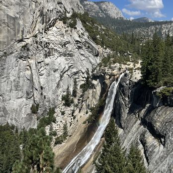


In Yellowstone I hiked a long way to see wimpy little Fairy Falls, a supposedly major attraction which could be spotted only moments before landing in front of it. The beauty of Yosemite is that our falls aren't a mystery; they're pretty much on view early and (unlike Yellowstone) there's really no duds. Nevada Falls is certainly no dud. The route to the top of Nevada Falls is filled with variety and the route I'd recommend is like three separate hikes: * Beginning at Happy Isles (Yosemite shuttle stop #16), walk the steep, well-trod path to the base of Vernal Falls. * From the bridge at Vernal's base, head up again via the Mist Trail, on what's basically a steep, wet, granite staircase of more than 600 steps, to the top of Vernal Falls. You'll be happy you brought a hiking pole. * Walk behind Vernal Falls (near the restroom) to locate the continuation of the Mist Trail and head up again to get to Nevada Falls. Where the John Muir Trail intersects, follow it upward. Nevada Falls is on view for most of this final 1/3 of the hike up and even in late August it was flowing beautifully. It's difficult to get up this way without stopping for majestic photos every few minutes and reaching the top is both awe-inspiring and aaah-inspiring. For your descent, follow the John Muir Trail all the way down to the Vernal Falls bridge. You'll quickly realize that it's that very first section which is the steepest and hardest on the calves. With a 2,000 foot elevation gain in the 5.4 mile round-trip hike to Nevada Falls the National Park Service describes this hike as "strenuous". Though accurate, they also describe the hike to Upper Yosemite Falls in the same way. Trust me on this: Upper Yosemite Falls is a far more punishing hike (the downhill will just about kill you). NPS estimates 5-6 hours total for this hike though I did it in a bit less time. Unlike the hike to Upper Yosemite Falls, the hike to Nevada Falls is one I can easily envision doing again because of the stunning beauty, the lesser investment of time, and the fact that it didn't ruin me for the days which followed. The opportunity to hike to the top of 2 waterfalls in one hike is a gift that Yosemite gives us, and not one you find in just any National Park. While you still can, I suggest you do. read more


5 years ago
*Visited location before COVID-19; appreciation post* Getting there: This is 1 of 2 waterfalls to hike up along the Half Dome Trail. To be honest I was so tired I didn't remember much of the details about the trail. At this point, as long as you stay on the trail you will run into Nevada Falls. Experience: The hike was well worth it. It's not for the weak hearted. It's mostly at inclined (as you're hiking up a waterfall), and can be slippery in the colder months. This was the first time I had been on a hike longer than 2 miles and let me tell you...I was in no way shape or form prepared for this. It was mid-April so it was still some snow on the ground, but not too cold. I didn't have proper shoes, we hike up with water, a 6-pack of beer, and not enough snacks so needless to say it was very tiring. Each time we reached a high point we would sit down, open a cold one and enjoy the view (which is what I was doing in the picture I added). We hiked until we reached the bridge, took some amazing photos and then hiked back. Tips: - Hiking sticks, hiking boots (not the fake hiking boots I had on), and proper clothing is recommended. If hiking in the winter time I would recommend traction grips. They can be found at any sporting store, but I got ours from Big 5. - Beer is great and all, but make sure you have lots of water and some snacks along the way. I would even recommend bringing lunch and stopping at the top of one of the waterfalls to eat and enjoy the view. read more

7 years ago
I have a love hate relationship with this hike. Our overall hike was taking the Mist Trail past Vernal Falls, to the top of Nevada Falls, and then taking the John Muir Trail on the way back down. It's about 6.7 miles round trip this way. The beginning of the hike is the worst part in my opinion. It starts with a relentlessly steep climb to get to Vernal Falls. Then, you stop to enjoy the falls. But don't get excited because there's about a million steps to get to the top of Vernal Falls. I was happy to not have to go down all of the stairs since we took the John Muir Trail back. Once you get to the top of Vernal Falls, it gets significantly easier in my opinion. There's a flat portion and then more stairs to get to the top of Nevada Falls, but not as many. Now for the views. Vernal Falls was beautiful. The best views are closer to the end of the stairs where you can see the pool at the bottom. The views of Nevada Falls were ok from the Mist Trail, but not great. It's kind of an awkward angle. There's great views of the surrounding area at the top of Nevada Falls. Probably my favorite view was of the back side of Nevada Falls with the domes next to it from the John Muir Trail on the way back down. It's a popular trail so it was kind of crowded. It seems like a lot of people only do the Vernal Falls portion because the beginning of it is definitely more crowded. The hike is pretty long and definitely challenging, but totally worth it. We were there in October when there wasn't as much water flowing and we still loved it. read more


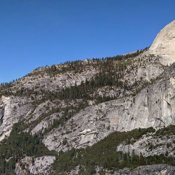


When I searched Yelp for Nevada Falls, I was so surprised to see so few reviews. But after hiking up the treacherous rocks to the top, I can totally understand why. Many people will not make it up to the top. I saw it with my own two eyes; so many people turned around because they just simply couldn't do it. I consider myself an intermediate hiker, but this hike to Nevada Falls really pushed my body to the max. The rocky steps up to the top are like the steps from hell. If you've hiked the Mist Trail up to Vernal Falls and thought that was difficult; the hike up to Nevada Falls is ten times worse. The total elevation gain from the start of the Mist Trail to the top of Nevada Falls is 2,000 feet. Yes... 2,000 FEET! When I say that this hike is STEEP, I am not exaggerating. I feel weird even calling it a "hike" because you will basically be climbing up rocks for most of the way. Three tips that I usually stress for any hike, but especially for this one: *Wear the proper shoes and attire. It's so easy to sprain your ankle or to fall on a rock if you do not have the proper shoes. Your feet will be burning and blistering in pain after the hike, but it won't be so bad if you are wearing hiking boots or shoes. The Mist Trail gets very wet and you might end up soaked, so be prepared. *Bring plenty of water! One bottle is not enough! I went through 2 bottles just going up to to Nevada Falls, and drank over a gallon of water in my one day of hiking. The worst situation is being dehydrated and passing out up there on the rocks. Don't let that be you! Come prepared with water and food also because you might get hungry along the way. *Most importantly, pace yourself! It's not a race. You will be challenged and you will be sore. Take breaks along the way to get your wind back and take sips of water throughout the journey. This hike is said to be one of the most strenuous hikes in Yosemite, right behind Half Dome. It took me 5 hours to complete the entire hike with rest breaks, and a few longer breaks at each waterfall and to eat lunch. The average time it takes to finish this hike round trip is between 5-6 hours, and it's considered a day hike. Nevada Falls can me accessed taking the Mist Trail up from Vernal Falls or by taking the John Muir trail. My group took the Mist Trail to Vernal Falls up and then came back down the John Muir trail. If you aren't up for the rock climbing, I would suggest that you take the John Muir trail up and back, but it will add about 2 more miles to your trip. After all of that being said, this hike was probably the most challenging that I've ever done, but also the most rewarding! Nevada Falls is absolutely beautiful! It's worth all of the sore muscles and the journey up. It's a breath of fresh air! I'm so grateful to have experienced something so beautiful. If you're up for it, I would absolutely recommend it because it's an amazing experience! read more



6 years ago
I had written a longer review under the Mist Trail listing of my entire hike which included Vernal Falls, Nevada Falls and the John Muir trail. Nevada Falls does certainly deserve its own listing given its majesty and the effort it takes to make it to the top. If you want to get a glimpse of the falls but not climb all the way up, you can can hike about a quarter of a mile past the top of Vernal Falls and see Nevada falls in the distance. However, if you're a strong hiker and prepared (water, hiking boots, ideally hiking poles) then head on up the steep switch backs of rocky stairs and the view of a lifetime waits for you at the top! Keep your eyes sharp-hikers behind us spotted a rattlesnake on the trail and there are also some steep drop offs in places on the way up. Magnificent view of the valley at the top. When I made it to the footbridge over the falls I nearly wanted to cry (mixture of joy and exhaustion.) The trail was moderately trafficked on a week day but since it's a slog to the top, every hiker group was well spaced out. Heads up that during COVID-19 restrictions you can't go back down the Mist Trail directly. With the steep stairs it's better to go down the John Muir trail which is longer but a more moderate grade. Look right, after crossing the footbridge and you'll see the small brown sign saying it's 4 miles back down to the valley . Those going to Half Doom will take the left hand trail. Overall a beautiful, but tough journey to see the falls up close. read more


I climbed the mist trail about 5 times as a kid. All grown up, I decided to switch it up and break on through - from the other side. I started in Tuolumne Meadows and hiked to the Valley floor via the John Muir trail. The entire 30 mile hike was breathtaking, but the grand finale of the valley view and Nevada Falls was my favorite part. The 3,000+ foot descent couldn't even dampen my mood. I remember as a child, wondering if the switchbacks would ever end. As an adult, I savored the cool mist and was fascinated by how wonderful valley people smelled as I passed them by. After 4 days of hiking without a shower, you notice these things. People say they see God here. I feel God here. He wraps your soul in a blanket of endless beauty. It's tough not to feel enlightened and at home. read more


1. For those people who want more of a challenge than doing the Mist trail up to the top of Vernal Falls, there is the hike to the top of Nevada Falls. 2. My wife and I did this hike, as an extension of the Mist trail hike. For preparation, we carried at least 40 ounces of Gatorade, plenty of sunscreen, a hat to shield us from the sun, and oranges. No need for waterproof clothes, as the mist from Vernal Falls does not soak you. 3. We each wore full fledged hiking boots with hiking poles. You don't want to slip on the wet trail soaked by the Merced River. 4. We reach the trailhead at Happy Isles with the free valley shuttle. There is a parking lot a quarter mile down the Happy Isles road, and Curry Village is only 15 minutes walk. 5. There are bathrooms at the Happy Isles trailhead, at the Vernal Fall Footbridge, and behind Emerald Lake at the top of Vernal Falls. However, these last two were closed for the winter season. So the wife brought along toilet paper. 6. The hike to the Vernal Fall footbridge is 0.7 miles with a 400 foot elevation gain, along a paved trail with stone guardrails preventing people from falling over the cliff into the river 100 feet below. Shaded area with lots of trees for cover. This is merely a warmup for the Mist trail . 7. The upper Mist trail runs from the bridge to the top of Vernal Falls, and is closed in winter due to ice. It is only another 3/4 of a mile, but with 700+ granite rock stairs soaked wet by the next door Merced River. 8. If the Mist trail is closed, you have to use the John Muir trail to reach Vernal Falls. This is a long trail with a lot of switchbacks which go above Vernal Falls. 9. At the top of Vernal Falls, people go above or even beyond the railing to get that perfect selfie. On occasion, someone slips and falls into the water, and goes over the 317' falls, turning that Kodak moment into an Hasta La Vista moment, to quote our ex- governor. 10. Before you cross the Merced river, you come to Emerald Lake. On the near side of the Lake are bathrooms with pit toilets, often closed except during the summer. Plenty of trees here for the wife to go into the bushes, just like the four legged locals! 11. You cross the Merced River by way of a foot bridge. 2 miles and 900 feet elevation gain to Nevada Falls, over a trail carved into the granite walls. No cover here, just straight up the trail, with the Merced river running alongside. Only ground squirrels to keep the wife and I company. 12. We reach 594' Nevada Falls, huffing and puffing like Darth Vader in the 6000 foot elevation, with a tall tower like granite rock overshadowing the falls. 13. If you are going to the top of Half Dome, you are only part way there, with another 5 miles and 2000' elevation gain to go. We didn't see such people as Half Dome is only open in the summer, and any such hikers would have started off before sunrise. 14. The wife's knees are hurting, and we take the John Muir trail down to the Vernal footbridge, bypassing the 700 stairs of the Mist trail. We get an aerial view of Vernal Falls on the way back. 15. It takes a good 8 hours of hiking to complete the loop, but that's why you come to Yosemite - to enjoy the experience and views of hiking to nature's wonders. read more


5 years ago
Great hike and views. Also you get a chance to see Half Dome closer up. Less crowded than Vernal Falls. read more


9 years ago
Favorite Falls In Yosemite! Almost No People! Journey about 6 miles past The Mist trail to Vernal Falls for a nice less crowded spot that is great for a picnic and some peaceful time in the trees! We saw a grizzly bear cub and crowds of people chasing after it to take pictures which is insane! You need lots of water and really good footwear. This is a strenuous hike. Definitely a must see! read more


3 years ago

To get here is about 6 miles round trip. Not many people go past Vernal Falls. It was nice not being around all the crowds. You have to pass Vernal Falls to get here. It was a great hike to do if you have experience hiking! I wouldn't recommend hiking here if you don't hike much. There were a good amount of people who clearly were not ready for this hike. They were going up and down so slow that it was just ridiculous. There are lots of stairs to go up and they are not all the same height. The rock can be slippery from the mist of the waterfalls. If you have hiking boots or sandals you shouldn't have any issues. But Nike shoes, Vans etc. You'll have a hard time. read more


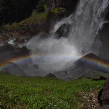


You finally made it to the top! Pat yourself on the back! Nevada Falls is at the top of a mountain. It is 5.4 miles long and takes about 5 to 6 hours with a 2000 feet elevation gain. You start at shuttle #16. This hike has excellent views of Vernal Falls which are visible from the foot bridge. This is a strenuous hike and you definitely want to come prepared for any kind of weather so make sure to dress appropriately. Be prepared for slippery footing and tremendous amount of waterfall spray in the spring and early summer. To get to this hike you will need to hike Vernal Falls. The Vernal Falls trail includes a long slippery staircase. Nevada Falls is different because it has lots of stairs as well, but they are less slippery and less steep. Once you get to the top you will be rewarded by enjoying the scenery. Many people lay out, picnic, and enjoy the waterfall. Make sure you stay behind the area that has been blocked off for your safety. Several people have died not following the parks rules and going past their barriers. There are rules in place to protect us! Nevada Falls is definitely worth hiking when you visit Yosemite! read more





10 years ago
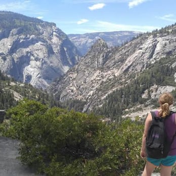
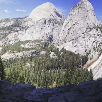
This hike was very intense and crowded. To be honest, it seemed like forever until we reached the top. This trail had a million stairs but breathtaking views. This hike was definitely challenging and time consuming. In addition, heading back down was a challenge. There are many rocks and it is easy to slip and fall. I was so pleased to see several restrooms available throughout the hike. I would recommend getting in shape before tackling this strenuous hike! read more


4 years ago


9 years ago
Steep climb on Mist Trail is a bit dangerous, with the combination of wet rocks and people. However, the trail was challenging with a huge reward. Would NOT recommend bringing children on Mist Trail. Rather, stick to John Muir Trail when with children. The rewarding view was absolutely stunning, and worth every bit of the hike! read more


9 years ago
7 years ago
9 years ago
10 years ago
8 years ago
More info about Nevada Falls
Yosemite National Park, CA 95389
Directions
Hours
Outdoor Amenities
Ask the Community - Nevada Falls
Review Highlights - Nevada Falls



















Why does Yelp recommend reviews?
2 reviews that are not currently recommended
The reviews below are not factored into the business's overall star rating.

16 days ago

10 years ago
Nevada Falls - hiking - Updated May 2026
Best of Yosemite National Park
People found Nevada Falls by searching for…
Swimming Holes in Yosemite National Park, CA
Hiking Trails With Waterfalls in Yosemite National Park, CA
Rock Climbing in Yosemite National Park, CA
Parks in Yosemite National Park, CA
Scenic View in Yosemite National Park, CA
Off Road Trails in Yosemite National Park, CA
Stairs Workout in Yosemite National Park, CA
Sunrise View in Yosemite National Park, CA
Things to Do in Yosemite National Park, CA
View Points in Yosemite National Park, CA
Picnic Areas in Yosemite National Park, CA
Camping With Showers in Yosemite National Park, CA
Bike Path in Yosemite National Park, CA
River Access in Yosemite National Park, CA
Scenic Overlook in Yosemite National Park, CA
Fishing Spots in Yosemite National Park, CA
Waterfalls in Yosemite National Park, CA
Water Parks for Kids in Yosemite National Park, CA
Walking Trails in Yosemite National Park, CA
Bridge in Yosemite National Park, CA
Attraction in Yosemite National Park, CA
Lookout Points in Yosemite National Park, CA


