Mist Trail Hiking Photos


You might also consider

More like Mist Trail
Recommended Reviews - Mist Trail
Start your review...


Reviews With Photos


What a gorgeous hike. Would 100% do this hike again. It was absolutely breathtaking. Took a few breaks throughout this hike and honestly wasn't too hard. The main hard part was walking up the stairs where it was wet and many people stopping every few steps to admire the view. I wish they would step to the side because it affected my momentum going up the stairs. There are many points in the hike where you can stop and view the hike without being in the way of the hikers! Definitely would recommend this hike! I didn't get super wet, like others mentioned. But definitely was very misty and got sprinkled on here and there. The floor is quite slippery though.


The Mist trail is a great choice for a hike if you have 1-2 days in the valley. The first day we walked around the valley floor and around mirror lake. The second day we did the most trail up to vernal falls and took the John Muir trail back down to the valley. The mist trail was steep and ALL STEPS. There wasn't much water in the falls but it was misty-rainy on our late September day which created the misty atmosphere anyways! I always take the John Muir trail back so you don't have to fight the pit of breath hikers coming up and avoid slipping on the big steps down. The John Muir trail gives great views of the valley walls when it's not cloudy out and is a fun alternative route back.


Great hike with amazing views. Make sure yall get there before 6AM to beat the heat and crowd, and to find a good parking spot. Also bring snacks and at least 3 liters of water. The path is steep and lots of stairs. Also wear good hiking boots or trail running shoes with a great grip. The overall hike took about five hours round trip, to include breaks and capturing the scenery.


The Mist Trail is challenging, but don't keep it from discouraging you; the waterfalls and views are completely worth it! The trail starts steep and continues for the most part. I recommend you wear hiking shoes/boots with good grip and hiking sticks to help you navigate the slippery stairs. I suggest you park in Curry Village if you can find parking. There's also campground parking nearby. I recommend you arrive early because it does get crowded early. It's a popular trail that takes you to Vernal and Nevada Falls. I went in late June, and the waterfalls were raging, so you will get wet if you go in late spring or early summer. We wore ponchos because we were carrying cameras and did not want to risk getting them wet. Pack a waterproof backpack with water, snacks, and sunscreen. Restrooms are available halfway to Vernal Falls and were decent. There were kids and families on this trail. It's a 3-mile round trip to Vernal Fall and a 7-mile round trip to Nevada Fall. Make sure you do this hike, even if it's only to Vernal Falls; it's such a beautiful place!


Search and rescue had 6 people carrying a body bag out of this trail as we approached the mist trail entrance. Many people die on this trial for several different reasons please be careful. If you are careful and the people around you are careful too you can make it to the top of this beautiful sight. Currently, the mist Trail is closed for repairs on certain days and certain times. So you will have to take the John Muir Trail. Enjoy with respect. The last pictures are me at 10 years old and me today!! How cute ! Ps my number one pet peeve is watching parents take their kids up this trail with water-shoes or crocs while the parents wear trail shoes or hiking shoes and then yell at their children for having tired feet. if you can't buy your child proper shoes for this trail do not take your child on this trail.


To get to this hike you can either park in Curry Village, though parking is tough to find or take the shuttle which is highly recommended. Depending on the distance you go or which trail you follow it can be a 2.5 mile to a 7 mile hike round trip. This was absolutely a beautiful and yet very challenging hike for myself. I've had two back surgeries and I have knee issues but I wanted to say I did it. Throughout the hike I saw people running, pushing strollers, carrying kids, ect so depending on yourself it's a doable hike but you're mostly going up hill and some areas are steeper than others so keep that in mind. There are some shaded areas to rest and some rocks to sit on here and there. There's 3 sections of this hike, to the foot bridge, halfway up the waterfall and then to the top. I only made it to the second one but I'm proud. I recommend plenty of water, good shoes (I saw people hiking in heeled dress boots and uggs, though I wouldn't recommend it. If that works for you, then I guess go for it) as well as sunscreen and a snack. As of my review the bathrooms are closed near the footbridge. There's bathrooms at the bottom before the hike so I recommend going before. I didn't get to the very top of the falls but I heard there's bathrooms there too but can't confirm or deny if they're opened. If you go past the footbridge to the second or third part of this hike, be warned there are steps and they are wet and slippery so be very cautious! I saw multiple people who were bleeding from having fallen. Be careful, take your time, and enjoy the views!


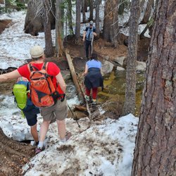
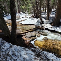
I was here the first weekend of May 2023. It was still snowy! Only a week before, part of Yosemite was flooded due to melting ice. I think this trail is doable for people without injuries. You just need to take your time with it. The view of the waterfall is worth it. There are some parts that may be scary for people afraid of heights. There are stone steps that just keep going up, so it gives a good leg work out. The area by the falls is very wet, slippery, and muddy. Recommend bringing water, packed lunch, sunscreen, and waterproof hat/jacket. The waterfall is so powerful that you will get soaked! At the top of the falls, there is an area to rest and eat lunch. I believe Vernal Falls was first. If you choose to end your hike here, you just go back down the way you came up. If you choose to continue, you can see Nevada Falls.


Once you've committed, there's no turning back! Due to COVID-19, the Mist trail is one way up (think stairmaster on steroids) to Vernal falls, then up to Clark point (think of the sun beating down on you in the middle of summer with little shade) and finally, down through the John Muir trail (think never ending switchbacks). You're looking at 4.2 miles and over a 1500 foot elevation gain. On top of that: no shuttle service. The closest parking is Happy Isles, which will tack on another 3 miles round trip. Pro-tip: bike from the parking lot to the trailhead. You'll be happy you did on the way back! Rated difficult on Alltrails, this hike is not for sissies. I was hating life from Vernal Falls to Clark point. Despite all my moaning and groaning, was it worth it? YEAH! It's a unique trail not to be missed when in Yosemite. Start early and bring lots of water, sunscreen and a hat!


Was it 7 miles round trip? 8 miles? I don't know and it doesn't matter now. It was spectacular and I needed and deserved (and consumed) at least one or more adult beverages afterward. This is no sissy hike but it is, truly, beautiful. You've got the raging Merced near you for much of the path and then there are the Vernal Falls, of course. Plus, gorgeous mountains all around. There are also many, many steps in the long stone staircase near the top which will test your fortitude. Reaching the top is obviously an achievement but the view on the way up is far better than at the top, for what that's worth. Depending on the season, you may get wet as you get closer to the top. So, watch your step and dress accordingly. We didn't continue on up to Nevada Falls but that's an option if you'd like. Simply a terrific hike.
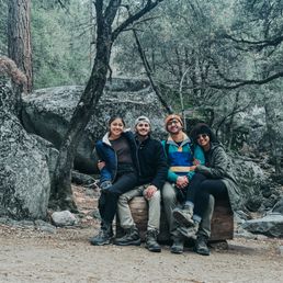

Getting there: The start of the Mist Trail is on the valley floor. If you follow the signs for Curry Village you'll come to a stop sign where you can either go straight towards the trailhead or turn left and cross the bridge towards Yosemite Falls. Follow the trailhead and park in the parking lot (if there's room). From there follow the blocked off road to the trail. Experience: This was my 3rd time going up the Mist Trail, and it was just as beautiful if not more. It was pretty cold so we made sure to layer up. It's also mostly include on the way up so hiking sticks are highly recommended. I would also suggest bringing lots of water and some snacks, maybe even lunch (great to have at the top of the waterfall. If hiking during the winter months, I would recommend getting spikes for your shoes. They're cheap (we got ours for $20 at Big 5), and they will give you a lot of added grip if the trail is icy.


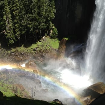
Waterfalls, rainbows, & amazing views!! I highly recommend you do the entire hike because the views only get better! This is definitely on the more strenuous side so be sure to pack lots of water, sunscreen, and snacks. There are 3 bathrooms on this hike too. In the spring, Vernal Fall is so strong that you will be SPRAYED with water! Be prepared to get soaked! There was still snow on the ground and the wet ground was pretty slippery so hiking shoes are a must. Definitely go back down on the John Muir trail instead of going back through Mist Trail since it is not as steep and it takes you back to the same spot. You can park at Curry Village and walk 1 mile to the trail head since there's no parking at the trail.


19 days ago


11 months ago
The most beautiful , challenging, worth it hike for me. I love this hike, It is a 7.4 mile hike (1,500 foot). we love to do this hike end of spring beginning of summer. Make sure to bring your water, snacks and energy. My kids love this trail/hike and look forward to getting to the Top of vernal falls for lunch and a dip in the water. There are 3 restrooms on this trail and 1 water fountain to fill up your water bottles. Take as many breaks that you need do not push yourself to much. Be very careful and watch your step. BIG TIP: If you have children please keep them close. i witnessed 2 small kids walking down the slippery wet stairs and almost lost their balance while the parents were nowhere near. My heart almost stopped. I highly recommend this trail. I LOVE THE MIST TRAIL. read more

19 days ago

What a gorgeous hike. Would 100% do this hike again. It was absolutely breathtaking. Took a few breaks throughout this hike and honestly wasn't too hard. The main hard part was walking up the stairs where it was wet and many people stopping every few steps to admire the view. I wish they would step to the side because it affected my momentum going up the stairs. There are many points in the hike where you can stop and view the hike without being in the way of the hikers! Definitely would recommend this hike! I didn't get super wet, like others mentioned. But definitely was very misty and got sprinkled on here and there. The floor is quite slippery though. read more


The Mist trail is a great choice for a hike if you have 1-2 days in the valley. The first day we walked around the valley floor and around mirror lake. The second day we did the most trail up to vernal falls and took the John Muir trail back down to the valley. The mist trail was steep and ALL STEPS. There wasn't much water in the falls but it was misty-rainy on our late September day which created the misty atmosphere anyways! I always take the John Muir trail back so you don't have to fight the pit of breath hikers coming up and avoid slipping on the big steps down. The John Muir trail gives great views of the valley walls when it's not cloudy out and is a fun alternative route back. read more


8 months ago
Great hike with amazing views. Make sure yall get there before 6AM to beat the heat and crowd, and to find a good parking spot. Also bring snacks and at least 3 liters of water. The path is steep and lots of stairs. Also wear good hiking boots or trail running shoes with a great grip. The overall hike took about five hours round trip, to include breaks and capturing the scenery. read more




2 years ago
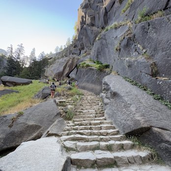
The Mist Trail is challenging, but don't keep it from discouraging you; the waterfalls and views are completely worth it! The trail starts steep and continues for the most part. I recommend you wear hiking shoes/boots with good grip and hiking sticks to help you navigate the slippery stairs. I suggest you park in Curry Village if you can find parking. There's also campground parking nearby. I recommend you arrive early because it does get crowded early. It's a popular trail that takes you to Vernal and Nevada Falls. I went in late June, and the waterfalls were raging, so you will get wet if you go in late spring or early summer. We wore ponchos because we were carrying cameras and did not want to risk getting them wet. Pack a waterproof backpack with water, snacks, and sunscreen. Restrooms are available halfway to Vernal Falls and were decent. There were kids and families on this trail. It's a 3-mile round trip to Vernal Fall and a 7-mile round trip to Nevada Fall. Make sure you do this hike, even if it's only to Vernal Falls; it's such a beautiful place! read more


2 years ago
Search and rescue had 6 people carrying a body bag out of this trail as we approached the mist trail entrance. Many people die on this trial for several different reasons please be careful. If you are careful and the people around you are careful too you can make it to the top of this beautiful sight. Currently, the mist Trail is closed for repairs on certain days and certain times. So you will have to take the John Muir Trail. Enjoy with respect. The last pictures are me at 10 years old and me today!! How cute ! Ps my number one pet peeve is watching parents take their kids up this trail with water-shoes or crocs while the parents wear trail shoes or hiking shoes and then yell at their children for having tired feet. if you can't buy your child proper shoes for this trail do not take your child on this trail. read more


To get to this hike you can either park in Curry Village, though parking is tough to find or take the shuttle which is highly recommended. Depending on the distance you go or which trail you follow it can be a 2.5 mile to a 7 mile hike round trip. This was absolutely a beautiful and yet very challenging hike for myself. I've had two back surgeries and I have knee issues but I wanted to say I did it. Throughout the hike I saw people running, pushing strollers, carrying kids, ect so depending on yourself it's a doable hike but you're mostly going up hill and some areas are steeper than others so keep that in mind. There are some shaded areas to rest and some rocks to sit on here and there. There's 3 sections of this hike, to the foot bridge, halfway up the waterfall and then to the top. I only made it to the second one but I'm proud. I recommend plenty of water, good shoes (I saw people hiking in heeled dress boots and uggs, though I wouldn't recommend it. If that works for you, then I guess go for it) as well as sunscreen and a snack. As of my review the bathrooms are closed near the footbridge. There's bathrooms at the bottom before the hike so I recommend going before. I didn't get to the very top of the falls but I heard there's bathrooms there too but can't confirm or deny if they're opened. If you go past the footbridge to the second or third part of this hike, be warned there are steps and they are wet and slippery so be very cautious! I saw multiple people who were bleeding from having fallen. Be careful, take your time, and enjoy the views! read more


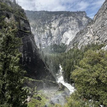
I was here the first weekend of May 2023. It was still snowy! Only a week before, part of Yosemite was flooded due to melting ice. I think this trail is doable for people without injuries. You just need to take your time with it. The view of the waterfall is worth it. There are some parts that may be scary for people afraid of heights. There are stone steps that just keep going up, so it gives a good leg work out. The area by the falls is very wet, slippery, and muddy. Recommend bringing water, packed lunch, sunscreen, and waterproof hat/jacket. The waterfall is so powerful that you will get soaked! At the top of the falls, there is an area to rest and eat lunch. I believe Vernal Falls was first. If you choose to end your hike here, you just go back down the way you came up. If you choose to continue, you can see Nevada Falls. read more




2 years ago
Just absolutely the best trail. fun in the mist and beautiful views on top of the two waterfalls. must check it out! read more
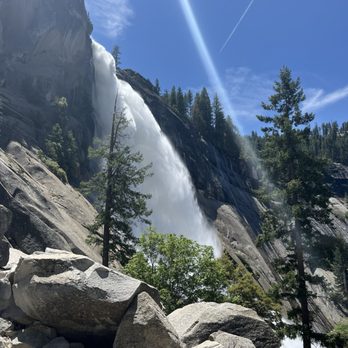


Once you've committed, there's no turning back! Due to COVID-19, the Mist trail is one way up (think stairmaster on steroids) to Vernal falls, then up to Clark point (think of the sun beating down on you in the middle of summer with little shade) and finally, down through the John Muir trail (think never ending switchbacks). You're looking at 4.2 miles and over a 1500 foot elevation gain. On top of that: no shuttle service. The closest parking is Happy Isles, which will tack on another 3 miles round trip. Pro-tip: bike from the parking lot to the trailhead. You'll be happy you did on the way back! Rated difficult on Alltrails, this hike is not for sissies. I was hating life from Vernal Falls to Clark point. Despite all my moaning and groaning, was it worth it? YEAH! It's a unique trail not to be missed when in Yosemite. Start early and bring lots of water, sunscreen and a hat! read more


Was it 7 miles round trip? 8 miles? I don't know and it doesn't matter now. It was spectacular and I needed and deserved (and consumed) at least one or more adult beverages afterward. This is no sissy hike but it is, truly, beautiful. You've got the raging Merced near you for much of the path and then there are the Vernal Falls, of course. Plus, gorgeous mountains all around. There are also many, many steps in the long stone staircase near the top which will test your fortitude. Reaching the top is obviously an achievement but the view on the way up is far better than at the top, for what that's worth. Depending on the season, you may get wet as you get closer to the top. So, watch your step and dress accordingly. We didn't continue on up to Nevada Falls but that's an option if you'd like. Simply a terrific hike. read more


5 years ago
Getting there: The start of the Mist Trail is on the valley floor. If you follow the signs for Curry Village you'll come to a stop sign where you can either go straight towards the trailhead or turn left and cross the bridge towards Yosemite Falls. Follow the trailhead and park in the parking lot (if there's room). From there follow the blocked off road to the trail. Experience: This was my 3rd time going up the Mist Trail, and it was just as beautiful if not more. It was pretty cold so we made sure to layer up. It's also mostly include on the way up so hiking sticks are highly recommended. I would also suggest bringing lots of water and some snacks, maybe even lunch (great to have at the top of the waterfall. If hiking during the winter months, I would recommend getting spikes for your shoes. They're cheap (we got ours for $20 at Big 5), and they will give you a lot of added grip if the trail is icy. read more
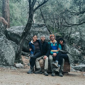


Waterfalls, rainbows, & amazing views!! I highly recommend you do the entire hike because the views only get better! This is definitely on the more strenuous side so be sure to pack lots of water, sunscreen, and snacks. There are 3 bathrooms on this hike too. In the spring, Vernal Fall is so strong that you will be SPRAYED with water! Be prepared to get soaked! There was still snow on the ground and the wet ground was pretty slippery so hiking shoes are a must. Definitely go back down on the John Muir trail instead of going back through Mist Trail since it is not as steep and it takes you back to the same spot. You can park at Curry Village and walk 1 mile to the trail head since there's no parking at the trail. read more


This trail is amazing, there is no doubt about that. However, it is HEAVILY trafficked on the weekend. My one suggestion would be to go on this trail during a weekday, if you can, because the line moves slowly and the trail gets very congested right up to Vernal Falls. Once you get to the top, it will thin out a little, as most people take the short loop back down to the Valley. Continuing via the John Muir Trail (6.5 mile round trip, roughly), it became significantly less congested but still a lot of people. My friend and I still had a great time, as this has been on our to-do list for a while. Things you'll need for the hike: - lots of water (at least 40 fl oz.) - rain jacket (you will get wet during multiple points on this trail) - waterproof hiking boots (semi-deep puddles) - extra socks (see above) - light snacks - hat/sunglasses It was a beautiful hike, and I'm so glad we went, but I definitely would have enjoyed it more on a weekday I think. Once you get to the top, all that hard work pays off and you are greeted with the most beautiful views and abundant waterfalls Yosemite has to offer. Not an easy hike -- my friend and I are pretty experienced with backpacking and we had to take a few breaks here and there, but it is very worth it! read more


6 years ago
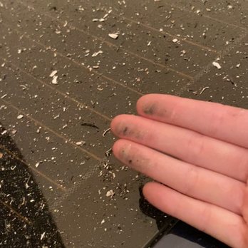
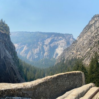
My first trip to Yosemite was this past Labor Day weekend (during COVID regulations) and I immediately hiked Mist Trail since it is THE signature trail for Yosemite. You can find more details of how I reserved tickets in my review under the "Yosemite National Park" page, I'm focusing on this particular hike for this review. I am writing this review during COVID regulations which differ from a typical season. For one, there are no shuttles in the park which means we had to walk from parking to the start of Mist Trail. The closest parking to Mist Trail is Trailhead parking but that fills up quickly (I recommend coming before 8AM on a busy weekend). The next closest parking is at Curry Village, which is a 1.5mi walk to the start of the trail. The Mist Trail hike includes Vernal Falls and Nevada Falls. The shorter hike is up to Vernal Falls and back (3mi round trip). It will be an uphill battle but it's not too strenuous and families can bring small children along. It was VERY CROWDED and hard to socially distance. Once you reach Vernal Falls you can choose to continue to Nevada Falls (7mi round trip and 2000 ft elevation from the start of the trail). This part of the journey has much fewer people because it's difficult and uphill the entire time. However, the views are GORGEOUS and you can see Liberty Cap and the back of Half Dome. The icy cold rivers along the way are great spots to rest and dip your feet into. There are bathrooms and water fountains along Mist Trail. Because of COVID regulations, the narrow trails are one-way only. So you must return via John Muir Trail. I have to take a star off because of the lax COVID regulations, confusing signage, and terrible smoke conditions. Even though there is a reservation restriction in place, Mist Trail is very popular so you will get most guests gathered here. Half of the hikers do not wear masks and it is impossible to socially distance with hikers stopping alongside trails. There are also hikers going down, passing you, even though the trails explicitly say one way only. The park rangers do not seem to enforce masks or social distancing. I will have to quarantine myself for two weeks because I have come into contact with so many maskless hikers breathing down my neck. The trail from Vernal Falls to Nevada falls is confusing at some points with roads that split off. I have been lost a few times and have run into other groups, who were also lost. The "mile marker" signs are also somewhat off in distance. Coming to Yosemite during California fire season (August/September) is a terrible idea. The smoke and air quality is unpredictable. In my case, the day started off fine but the smoke quickly descended around 1PM and darkened the sky (I have attached photos to this review). It felt like I was hiking during nighttime and it was raining ash the whole way. I could not turn back because I was almost at Nevada Falls and the trail was one way only; I hiked for 2 more hours in the smoke and my lungs hurt by the end. I wish park services was more clear about the health hazards of this. The entrance check-in can give guests the predicted air quality of the day, give refunds for at risk individuals (my boyfriend has asthma), or have more public safety signage indicating the health concerns of smoke inhalation. There was none of this at all and when we asked the entrance ranger about the predicted air quality she just said "oh it's probably worse than yesterday". I would give 3 stars for the Vernal Hike which has OK views, but the Nevada Hike is truly beautiful even though the entire view was covered by smoke. read more




7 years ago
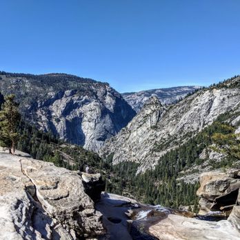
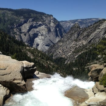
I have a love hate relationship with this hike. Our overall hike was taking the Mist Trail past Vernal Falls, to the top of Nevada Falls, and then taking the John Muir Trail on the way back down. It's about 6.7 miles round trip this way. The beginning of the hike is the worst part in my opinion. It starts with a relentlessly steep climb to get to Vernal Falls. Then, you stop to enjoy the falls. But don't get excited because there's about a million steps to get to the top of Vernal Falls. I was happy to not have to go down all of the stairs since we took the John Muir Trail back. Once you get to the top of Vernal Falls, it gets significantly easier in my opinion. There's a flat portion and then more stairs to get to the top of Nevada Falls, but not as many. Now for the views. Vernal Falls was beautiful. The best views are closer to the end of the stairs where you can see the pool at the bottom. The views of Nevada Falls were ok from the Mist Trail, but not great. It's kind of an awkward angle. There's great views of the surrounding area at the top of Nevada Falls. Probably my favorite view was of the back side of Nevada Falls with the domes next to it from the John Muir Trail on the way back down. It's a popular trail so it was kind of crowded. It seems like a lot of people only do the Vernal Falls portion because the beginning of it is definitely more crowded. The hike is pretty long and definitely challenging, but totally worth it. We were there in October when there wasn't as much water flowing and we still loved it. read more


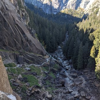
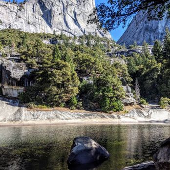


To get to the Mist Trail one must first get to the top of Vernal Fall Footbridge. This is what's known as "separating the wheat from the chaff". That is, if you can handle this first hike (.8 miles with a 400 foot elevation gain) you'll likely be able to handle what comes next, but if you can't... well, keep trying. What comes next is breathtaking. The trek to the Vernal Fall Footbridge is deceiving. It's short in distance but that elevation gain means it's steep. Many stop to catch their breath before reaching the footbridge. The Yosemite Valley Hiking Map (handed out in the park) describes the Mist Trail as "strenuous", "steep and long", having "slippery footing", and "a tremendous amount of waterfall spray in spring and early summer". Pick any: combined, they were the reasons I swore I wasn't going to hike the Mist Trail. Then I reached the Vernal Fall Footbridge and looked ahead. The Mist Trail begins almost immediately past the footbridge (.2 miles) and its call is like a siren's song. I changed my mind, uncertain about making it to the top of Vernal Fall but certain I could go further. News flash: I went to the top of Vernal Fall. The hiking map doesn't lie. The Mist Trail is short (.5 miles, 1,000 foot elevation gain) but wet and slippery and includes a steep granite stairway of over 600 steps. On their descent I saw people who inspired me to proceed. If THAT PERSON can do it, I can do it I reasoned (and hoped that people weren't thinking the same of me on my descent). The top of Vernal Fall is a perfect place to relax, dry off on the sun-kissed granite, pat yourself on the back, and worry about getting back down. There's a trail that you can loop around on (get information in advance of your hike as it wasn't obvious once you're up there) or you can go back the way you came which is both the quickest and scariest route out. If you have a hiking pole (recommended) it'll pay for itself on the downward trek. For those with more planning skills than I, the Mist Trail continues on all the way to Nevada Falls, a full-day hike with an elevation change of 2000 feet. Friends of mine have done it and said it's impossible to bring too much water with you, so be warned. The Mist Trail, at least the part I hiked, feels like the quintessential Yosemite hike. It's challenging without feeling impossible, doesn't take all day, gets you waterfall-wet, and fills you with a feeling of accomplishment. It's jaw-droppingly beautiful as well. If you have time for only one hike I'd recommend this one. read more
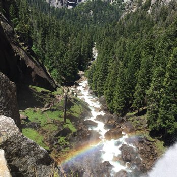


Went this past weekend to take advantage of not having to reserve ahead to enter Yosemite. We parked at Curry village and hiked from there. We had two kids under 5 and 4 seniors and made it to the stairs to see Vernal Falls. This is a popular hiking trail and I'm glad our family was able to enjoy it with us. It's definitely a good hiking trail with nice steep steps but well worth it. This is our 3rd time hiking this trail and we didn't get to go up to Nevada falls like we did last time because we had our family with us but the hike was still worthwhile. read more


6 years ago
This summer is my first visit to Yosemite and during the time of COVID-19, the park is open with some limitations. Day use passes in advance are required and shuttle buses are not operating in the 2020 season. This last part is important because normally you'd take the shuttle to the Happy Isles stop, which is the starting point of the Mist Trail. We had to park, instead, at Curry Village which adds 1 mile, each way to your hike. Also of note, this season has a one way restriction on the portion of the Mist Trail at the stairs up to Vernal Falls-once you commit, there's no going back down the way you came. For us, it didn't matter, since our plan was to hike to Nevada Falls and back down the John Muir trail. That loop is 7.8 miles and adding in the walk to and from parking, we did nearly 10 miles of hiking. As for the trail itself, the first part is a paved uphill until you get to the bridge with a view point of Vernal Falls. There is water there to fill or refill and trust me, you'll need more water than you think for this full journey. In late July Vernal Falls were still flowing but the stairs up weren't wet. There was a decent number of hikers on a Friday morning but it was definitely possible to social distance. At the top of Vernal Falls there are little boulders you can rest and have a snack before taking on the rest of the trail. As you follow the signs to Nevada Falls you will pass Emerald Pool, also a great spot to take relax before a pretty relentless upward climb. For me, the stairs to Vernal Falls were the easier uphill portion. The steady climb up to the top of Nevada falls seemed pretty grueling. It's endless switchbacks and stone stairs but along the way you can pause and take in views of the thundering Nevada Falls and sweeping views. It's a strenuous hike but I'm so glad I did it. At the top of Nevada Falls, you'll have up close views of Liberty Cap and a view of the back side of Half Dome. If you take the John Muir trail to the right, you'll loop back down to near the Vernal Falls Foot bridge. The John Muir trail has some good scenery and a different perspective of the way you came up for the first half. The second half is less scenic and to be honest at that point, I was so ready to be done. Don't get me wrong, it was an amazing hike but it's a tough one. I do wish I had hiking poles-many other hikers did. This hike definitely packed in a good amount of scenery and unique views. If you're up for a moderately strenuous hike and want to see two epic waterfalls, then this is a must do hike. read more


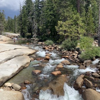


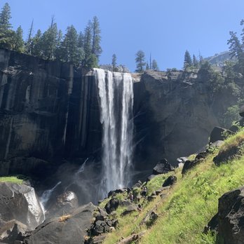


The Mist Trail..?! More like the "shower" trail! Oooohhh yes, you will get SOAKED! But, it will feel so good, especially after hiking up all of those rocky stairs! The Mist Trail is a popular hiking trail that will lead you to Vernal Falls and and Nevada Falls (if you're up for the challenge). The beginning of the trail starts at the Happy Isles Nature Center near shuttle 16 which can be accessed by their Yosemite trolley. The trail begins with a paved path that is all uphill but the incline is steady and gradual. About halfway through the trail, you will cross over a small bridge where you can see the beautiful water from Vernal Falls flowing. About a quarter mile after that, you will reach the wet steps that will lead you to the top of Vernal Falls. The steps are wet and there will be puddles that you will need to get through to get to the top! Be careful and watch your step! I saw a few people slip and almost tumble because they weren't paying attention. There's a small sections where the "mist" will shower you! So, if you don't shower before you take this trail, don't worry! You'll get one right before you reach the top! But really, I got soaked! This part of the trail is where you will get the best pictures of Vernal Falls, so be prepared to get wet! There's a narrow staircase that is guarded by a rail where you will have to squeeze by many other hikers. But after you conquer this, you will find yourself at the top of the beautiful Vernal Falls! There are restrooms available at the start of the trail, halfway through near the bridge, and at the top of Vernal Falls. The views at the top of Vernal Falls are beautiful but Nevada Falls about another mile and a half up is even more spectacular! I would only recommend Nevada Falls to those more experienced hikers as it is a tough and strenuous hike! However, hiking the Mist Trail to Vernal Falls is totally worth it! Soak up the amazing views of the gorgeous rock formations and the beautiful flowing water as you get soaked by Vernal Falls! read more


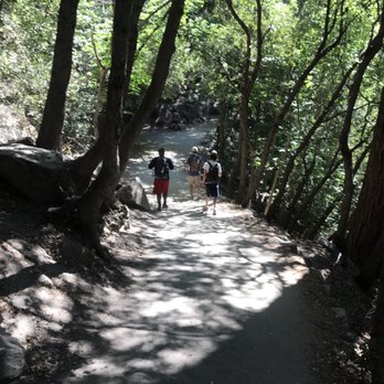


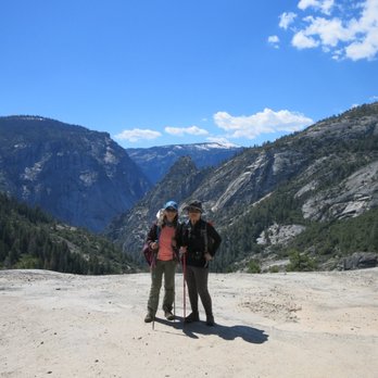
This is one of the best (and most popular) hikes in Yosemite. With the popularity comes some pros and cons. I've hiked the Mist Trail twice now (once in the Spring and once in the Summer) and had similar experiences both times. Pros: Drinkable water on the trail BEAUTIFUL scenery Bathrooms on the trail Clear signage Paved path (for the most part) Cons: Crowds... The steps are knee-killers on the way down ...Tourists I loved getting wet from the waterfalls in the Spring and loved the rainbows in the Summer. But the crowds of people walking around aimlessly is something I cannot deal with. We are hiking, people, not window shopping at the mall. Sure, stop and take pictures. But I beg of thee, go to the side of the trail and take the picture instead of standing in the middle of the trail! Ayyy caramba! My recommendation if you get up to Nevada Fall: take the John Muir Trail down rather than taking the Mist Trail back down. While the JMT adds a little bit of distance, it saves your knees and is comprised of completely different scenery for your eyes to behold. Enjoy! read more



6 years ago
Best hike ever. We only went to Vernal Falls and that was a good, moderate hike. The elevation change was 2,300 feet according to our app and it felt like it. Took about 2 hours to get there (with many stops for pics) and just under an hour to get back. Tip: once you to dead on with the waterfall, you'll see a small dirt path past the railing. Take it, you'll get within 30 feet of the waterfall, tons of mist in your face, and rainbows at the bottom. read more


4 years ago
Very straneous steep uphill hike but the views make it worth it. We were bummed to find out the mist trail on top was closed so we didn't get to see Ventura Falls. read more


I've hiked the Mist Trail several times now, but it never gets old. Simply stunning. If you're looking for a shorter hike (under 3 miles), then the hike to Vernal Falls is the one to do. Couple of pointers: This is a very popular hike (since it's so awe inspiring and majestic and fun). The crowds won't take much away from the experience if you start later in the day, but if you start early (around 6am in the busy summer months), you will have many views of the falls and wilderness unobstructed by people. The first part is along an asphalt trail up the Merced River. Once you reach the bridge, it turns to dirt, and then shortly after that, to steep granite steps the rest of the way. It's super fun for kids, but be mindful of their activity, since there is some pretty decent exposure to cliffs below. It's a wet trail. It takes you up through the mist of the falls, so you will most likely get wet. I always bring a rain jacket, but typically don't use it. It's feels good, especially on sunny days. The trail continues to Nevada falls, if you're looking for a longer hike, and from there picks up the John Muir Trail, which is much longer, and is the route to Half Dome (which requires permits to hike, as do overnight trips on the JMT). But the JMT can also take you to both Vernal Falls and Nevada Falls, so we like to hike up the Mist Trail and return on the JMT for a looped hike. I would recommend this, since the JMT back includes Clark Point, with a most stunning view of Vernal Falls. It's also new scenery (I love loops for this), and usually a little less crowded. Pack a picnic, soak in the sunny scenery, and enjoy this iconic California natural landscape. read more


I did this trail as part of hiking up to the half dome. This is a well traveled trail and it is easy to follow as it is marked plus you just have to follow the crowd. It is well maintained, but still slick in parts due to the water. Bring waterproof hiking shoes and water resistant or water proof clothing if you don't want to be soaked as the trail lives up to its name, especially at the first waterfall, vernal falls. There is quite a gain in elevation, about 2000 feet, so be sure to pace yourself and take in the scenery. It is about 7 miles long round trip. On a sunny day the mist from the falls creates magnificent rainbows that span the valley. The best views for the rainbows are from the stairs heading up to the top of vernal falls. Nevada falls is the second waterfall which is just as impressive in size, but you don't get soaked passing by it. The views from this trail are definitely worth the effort. I'd hike this trail again the next time I visit Yosemite. read more


We hiked the trail on October 8th, 2020, and at that time of the year, there was still quite a bit of smoke present from all the wildfires occurring then. However, we still had a great experience. According to my Garmin, this was a 9.22 mile hike round-trip for us, crossing Happy Isles Bridge, ascending up to Clark Point, then on to Nevada Fall, definitely nature's "giant staircase." Unfortunately there was construction on parts of the trail at the time of year we visited so we couldn't get up close to Vernal Fall, but could see it from a distance. If you want make the trek to Nevada Fall, I'd recommend planning to spend about 4.5-5 hours on the trail depending on your speed, how much time you need for breaks along the way, and how much time you want to spend at the top enjoying a snack and the views. I loved this hike and look forward visiting again when we get a clearer view of the Park itself without the smoke. read more


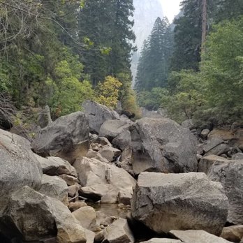


You will definitely get a work out from this hike. Starts off flat walking to the trail from the parking lot and then it's all uphill from there. Be prepared to go up a stair master for about 3hrs, there & back. Hike isn't that long about 1.5 miles to the top of Vernal Falls. Went on a hot day so the mist from the waterfall was refreshing. Warning: If you're scared of heights, going back down will make your legs shake. Go down slowly! Steps near the waterfall are slippery and wet. Parking: $30 to enter the park. I would invest in the annual pass for $80 if you're an avid park goer. I believe it's good for all national parks. I parked at the Half Dome Village. I believe it's the 2nd to last parking lot. There's another one closer to the trail if you drive further down. This parking lot was convenient with the shops and bathrooms. read more


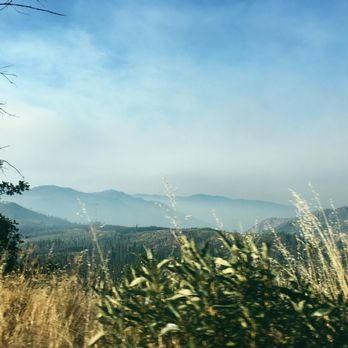

This is my 4th time hiking the Mist Trail, and I am still awed by it. We were camping at Upper Pines in early May for the weekend and our group decided to do a shorter hike as my friend's recovering from an injury and is set to go on a 2 week European trip soon. She needed to take it easy during the weekend. Not that the Mist Trail is an easy hike. But it is short, about 2.4 miles round trip. The National Park Service rates it as a strenuous hike as you gain about a 1000 ft elevation. If you only have time for short hike in Yosemite, this is the hike to do. Both the granite steps and falls are a site to behold! Plus, you'll get views of Yosemite Falls and Illilouette Falls from the Trail. Do pack a rain jacket or poncho with you, especially in early May. You will get drenched when you get to the granite steps. Careful going up and down the granite steps too as a false step can result in grave injury. The restroom by the footbridge is closed, so make sure to use the restrooms by Happy Isles. The trail was pretty crowded by the time we got there. We had a leisurely breakfast at our campsite and walked the 3/4 mile to the trailhead as we didn't want to wait for the shuttle bus, so we got there after 10 am. This is a super popular Trail, so the shuttle buses to and from the trailhead are always full of people. Bring a lunch and enjoy it when you get up to the top! read more


In short, my favorite hike, and the final destination would be the ideal place to scatter my ashes, though it would be strenuous to impossible to have people come visit my memorial. I've done the Mist Trail about seven or eight times from the 90s to July, 2018. I've done the trail bone dry. I've done the trail when it's misty, full of rainbows. I've done the trail completely soaked back when it used to rain in California. I even passed the warning sign and tried to do it in the snow, but smartly stopped after a few dozen steps. The reason I've stopped on May 13, 2011, is because my party was among the first five people to see the body of an esteemed professor lodged in the rocks of the raging river. While allowing passage to others, he had slipped on some wet grass, fell to the rocks where he suffered blunt trauma, and fell into the river. A friend of mine who I've known from high school also slipped from the same trail in the early 90s and had to be airlifted out. So, though I wouldn't consider the hike to be dangerous, I think it's important to know that the Mist Trail can be risky, no matter how careful you are. In other words, it's only dangerous if you think it isn't. The top has a railing (one of the few in the park), but you can get within three to the drop off. Unfortunately, in the super dry seasons, the pool of water upstream appears to be serene and still, and I've seen a swimmer ignore the signs and get a bit panicked as they try to get out. Others are foolish enough to go past the barricade. More people die on the Mist Trail than anywhere else in the valley, not because of the waterfall or cliffs but the strong current and the slippery granite. In the last ten years, 14 people have gone down Mist Trail the fast way, and 14 did not survive. That said, I say it's worth it. It's kinda like Willy Wonka's Chocolate Factory. Just be sure to be a Charlie, not an Augustus. By the way, also check reviews for Vernal Falls, which is the trail you must take to get to Mist Trail. PS. Another secret danger is feeding squirrels. It is bad for many reasons, and risky, but I usually bring peanuts for the squirrels at the top who beg from the people enjoying a snack or lunch. You will notice the more forward and bossy squirrels are super fat, obviously because they've gotten more food. And, I swear, when the camera comes out, they strike a pose. They vogue like Madonna. I guess they're a Material Squirrel. Like a Vermin. read more


6 years ago

Oh WOW. When we checked into Curry Village, the attendant highly recommended Vernal and Nevada falls. The mist trail begins right after the lower vernal falls viewing bridge. The trail becomes packed dirt here (before bridge it is a paved, .8 mile hike from the bus stop). This trail is spectacular. You get up close and personal to the falls. Be prepared to get wet and to walk on uneven wet terrain (the trail crews have made sure to keep it as safe and pristine as possible). I would not recommend this trail to inexperienced hikers or families with small children: in its entirety it hosts large elevation gain and steep/rocky terrain. Trust me when I say. Totally worth the effort. I was in awe the whole time. read more
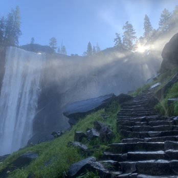


I've done this hike a few times and yet it never seems to get any easier. While the hike is challenging and fun, it can also be dangerous as well. When you're trying to hike up Vernal Falls, it can be a tad bit scary if you've got a fear of heights because there are times where you're just a step away from the ledge to the bottom of the mountain. The mist from the waterfall near Vernal makes the rock steps really slippery, so beware for that. What annoyed me the last time hiking here was when coming down after a long day of hiking and my legs were giving out on me were these inconsiderate hikers that just zoomed right past us while maneuvering off the side of the trail to pass us. Seriously, what's the rush? You're just causing me to be more nervous than I already am by zooming past me like it's nothing with your fancy ass hiking shoes. Jerks! read more



"Woohoo!" indeed. The Mist Trail (aka Vernal and Nevada Falls) is one of the iconic Yosemite hikes. This route will take you to Half Dome, the John Muir Trail, and the Panorama Trail up to Glacier Point. This is also the hike that tourists to the area most needlessly die on, so please don't be an idiot - realize that the river at the top is connected to the two waterfalls you passed on the way up. Hard core hikers will be annoyed by more novice hikers trying to squeeze in a view of the Falls while chafing in jean shorts and sandals. Avoid misery by wearing shoes with grip (you'll be thankful once you hit the mist) and dressing in layers if you're not sprinting up. There are excellent places at the top of both Falls to have a picnic, so bring snacks! Water is also a major must. Fortunately there are bathrooms and water fountains at the Vernal Footbridge. In the spring, the Mist Trail is more like the Shower Trail - you're gonna get soaked, so put a bag or t-shirt over that DLSR if you're trying to get some pictures. This hike is definitely a must if you're in the area for a few days, but could be traded for Glacier Point and Yosemite Falls if you need to prioritize your time. Go early to avoid the crowds, and feel proud if you even make it to the Footbridge - this is a hike to be reckoned with! read more


Page 1 of 3
More info about Mist Trail
Yosemite National Park, CA 95389
Directions
Hours
Outdoor Amenities
Ask the Community - Mist Trail
Review Highlights - Mist Trail










Why does Yelp recommend reviews?
2 reviews that are not currently recommended
The reviews below are not factored into the business's overall star rating.

5 years ago

13 years ago
Mist Trail - hiking - Updated May 2026
Best of Yosemite National Park
People found Mist Trail by searching for…
Hiking Trails With Waterfalls in Yosemite National Park, California
Things to Do in Yosemite National Park, California
Cliff Jumping in Yosemite National Park, California
Campgrounds in Yosemite National Park, California
River Swimming in Yosemite National Park, California
Picnic Areas in Yosemite National Park, California
Swimming in Yosemite National Park, California
Public Shower in Yosemite National Park, California
Scenic Drive in Yosemite National Park, California
Parks in Yosemite National Park, California
Camping With Showers in Yosemite National Park, California
Scenic View in Yosemite National Park, California
Off Road Trails in Yosemite National Park, California
Playgrounds in Yosemite National Park, California
Swimming Lakes in Yosemite National Park, California
Tours in Yosemite National Park, California
View Points in Yosemite National Park, California
Stairs Workout in Yosemite National Park, California
Fishing Spots in Yosemite National Park, California
Waterfalls and Swimming Holes in Yosemite National Park, California
Waterfalls in Yosemite National Park, California
Sunrise View in Yosemite National Park, California
Dog Friendly Hiking Trails in Yosemite National Park, California
Browse Nearby
BEST of Yosemite National Park, California Things to Do near Mist Trail
BEST of Yosemite National Park, California Restaurants near Mist Trail
BEST of Yosemite National Park, California Coffee near Mist Trail
BEST of Yosemite National Park, California Lakes near Mist Trail
BEST of Yosemite National Park, California Breakfast near Mist Trail
BEST of Yosemite National Park, California Horseback Riding near Mist Trail
BEST of Yosemite National Park, California Campgrounds near Mist Trail
BEST of Yosemite National Park, California Hotels near Mist Trail
BEST of Yosemite National Park, California Lodging near Mist Trail


