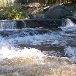
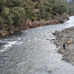
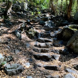
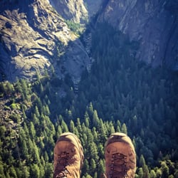
Cloud's Rest Photos


More like Cloud's Rest
Recommended Reviews - Cloud's Rest
Start your review...

Reviews With Photos

DO NOT take this hike lightly. This was a very strenuous and challenging hike. Remember if you're not use to the elevation the air is thinner. Don't be afraid to take breaks. We started right by Tenaya lake. We parked at the 'Sunrise' parking lot. Get there early When you cross the wooden bridge you will see signs for Cloud's (7.4 miles away) You will see two cross roads on the way there. One about 5..4 miles away and another 2.5 miles away before reaching the cloud's rest. Follow signs towards cloud's rest (stay to the right for both) When you see a lake you are half way there. The most difficult part of the hike I would say is The steep elevation gain on the switch backs about 1.5-2 miles in. GPS the directions before heading there. You will more likely lose reception on the way. Also if possible try to have some keep GPS on your next location. We had to drive into the valley to get reception. to figure out how to get to our hotel in maripost Parking - Sunrise Parking lot (navigate to Tenaya Lake) Preparation - Lots of water and snacks. duration- 8 hours total. 3.5h up and 3.5h down with a one hour break at the peak.

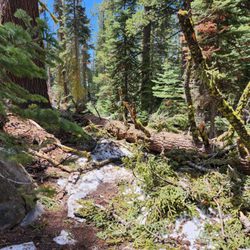
One of the most epic hikes in Yosemite with huge 360 panoramic views! This is a popular hike, but not as popular as the ones in Yosemite Valley since it's a further drive by around 30 - 45 minutes. It gives amazing views from a perspective that most people don't see which is from the Eastern side of Half Dome and you see into Yosemite Valley. You can even see people climbing up the chains on Half Dome if you look close enough! It's a long hike, but not as strenuous as some other ones. The elevation gain is modest and most of the path is shaded from the sun and flat. It does still take roughly 7 - 8 hours though to hike! Make sure to bring lots of water and snacks! It's not too busy while you hike, but once you get to the top there are a decent amount of people - you can also approach this from two directions, either from Yosemite Valley or Sunrise Lakes Trailhead. When we arrived at 8am the parking lot was full and there were already a decent number of cars parked on the side of the road (which is also open to parking). We were parked a couple minutes walk from the trailhead. You shouldn't have trouble finding parking because there's a lot, you just might have to walk a bit to the trailhead. The trailhead also has bathrooms, and food storage! I don't remember seeing any water refill stations or bathrooms on the hike so be prepared!

Activity Type: Hiking Nearby City: Curry Village Length: 12 total miles Elevation Gain: 1,800 feet Trail Type: Out-and-back Skill Level: Strenuous Duration: 7 hours or overnight Season: Late spring through fall Trailhead Elevation: 8,125 feet Top Elevation: 9,926 feet Local Contacts: Yosemite National Park **********Geographically CR sits in the middle of Yosemite*********** This summit not only has the loftiest name of the mountains that overlook Yosemite Valley, but it also has the most commanding view over the grandeur that is Yosemite. Half Dome sits well below the apex of Clouds Rest, and the jaw-dropping 360degree view encapsulates some of the finest vistas in the entire Sierra Nevada Range. Toward the trailhead, Tenaya Canyon adorns a tableau that resembles an ethereal painting more than reality. One might expect to see the colossal hand of god reaching down to create brushstrokes when staring into the east toward the canyon, the high Tuoloumne area, and Tenaya Lake.

Definitely a bucket list type of hike that can be done on multiple occasions because the elevation gain isn't as intense as Mt. Baldy (aka Mt. San Antonio in SoCal). No permit needed, but you can see Half Dome from the summit, so close enough? :P A great workout during the summer if you're up for it, and it can definitely be done in 6-8 hours depending on how much you stop for photos! We started our ascent around 8:15am and summited by 12pm, had a quick lunch before taking a bunch of photos. We started our descent around 12:50 and finished the hike by 3:40pm, so it's definitely manageable, even during summer heat. The descent felt more rocky than the ascent, which can be a bit rough on your feet without trekking poles. I'm still not quite as agile with my BD poles, and ended up having better footwork without them. The summit does get quite crowded during peak season, so it's best to start early and beat the heat too. The trail is quite shaded in multiple parts, which I appreciate! I wish I could round this up to a 4.5/5 rating because although the view is nice, it's not part of my top favorite hikes. I would recommend this as a repeat hike for the nice workout, or if anyone else is down for an easier hike compared to Half Dome. The view at Glacier Point is just as good if you're looking to drive to a somewhat similar viewpoint instead. For the same amount of time, I'd rather hike Hallasan (Jeju Island, South Korea) if I was abroad.

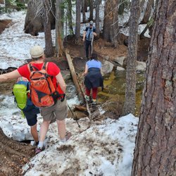
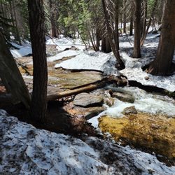
A group of us (ages 16-45 years) hiked to Clouds Rest from Tenaya Lake on 07/02/17. Definitely one of the best hikes I've done in a while. The only issue we had was occasionally going off course due to the snow. I'm thinking we added a mile to our hike due to getting lost (thank God for GPS haha). From the trailhead, we had to cross a stream which was waist deep. Embrace the cold water because there's no other way around it. Also, there's still quite a bit of snow up there so wear the right gear. Pack enough food and water. I had about 2.5 liters of water and a Gatorade, luckily I had just enough left to last me the whole hike. I need to invest in a water filter next time because my backpack was heavy. Overall, the views from the top was well worth the pain and headache of getting lost. I ate my Spam musubi, kicked off my shoes and took a nap. Note: We started our hike at 8:30 am and got back at 9:00 pm. We took our time to enjoy the scenery and took a bunch of photos.

I'm done with Half Dome. I've had enough of the crowds, the long lines, the hordes of out-of-shape people in tennis shoes who have no business attempting this hike (yeah, harsh, but just wait until you're stuck for 45 minutes halfway up the cables because you're behind someone who can't move because their frat boy boyfriend talked them into doing this, and now they're frozen in fear). I won't be doing Half Dome again unless I manage to get there on a day when the crowds are gone. Besides, there are SO many other parts of Yosemite to explore... Cloud's Rest is an excellent alternative. You start off near Tenaya Lake in Tuolumne at about 8,000 feet, and it's 7 miles to Cloud's Rest (yup, 14 miles round trip), gaining almost 2,000 feet along the way (Cloud's Rest itself is just under 10,000 feet). Lots of people backpack it, but it can be easily done as a day hike if you're fit and don't have a problem hiking at that altitude. I found the hike to be challenging, but nowhere near as hard as Half Dome. There are a few strenuous climbing parts, including some seemingly endless switchback sections in both directions, but long stretches of the trail are flat. The best part? It's not at all crowded, and when you get to the top, the views are incredible, and you're actually looking down on Half Dome. Bring binoculars and marvel at the line of people making their way painfully slowly up the cables. Warning: if you're afraid of heights, the last part is a little scary, as you're walking along these big boulders with loooong drops on either side of you. My advice for this part: just watch your feet, don't look to either side, breathe, and take it one step at a time. But even if you stop short of this point, you'll still get to take in some beautiful views. Bring lots of water - there's are a couple of streams along the way from which you can filter water, but it's mostly pretty dry. If you have trekking poles, bring 'em - your knees will thank you. Post-hike, I recommend a dip in Tenaya Lake. Yeah, the water's cold, but it feels great!

One of the best hikes of my life. It's a long 14 mile hike if you start at Tenaya Lake so make sure you start early. The trail starts at the West End of the lake so make sure you look for signs on your right side if you're coming from Yosemite Valley. We left curry village at 530 and started our hike roughly around 7. The hike is relatively flat the first 1.5 mile. After, you're going to be climbing a mountain of rocks or stairs (made of rocks). This is going to get your heart pumping. It's basically a mile to 1.5 mile 1000 ft incline, kinda like a stair master workout. It's gonna be hard for those that are novice hikers (such as me) so make sure you take breaks. Don't get discouraged though!! It's definitely doable. To note, the view from this area is beautiful. After this part, you're gonna have a slight descend to a beautiful meadow area. It's relatively flat at this area. Along with the meadow, you'll be crossing picturesque creeks, streams, lakes, flowers, etc. This part was probably about 2 miles. I thought this part of the hike was the most beautiful (besides getting to the top). However, make sure you bring mosquito repellent!! You'll be crossing a total of about 5-6 bodies of water and there WILL be mosquitos. Luckily for me, I went during the end of summer where most of the water was gone. To note, bring toilet paper since you will be needing to, uhh, do your business somewhere along the hike. Remember, you will be hiking 14 miles and you'll be downing water at the same time lol. After, it will another 2 miles of a gradual incline. This part was not as brutal as climbing the rocks I felt like. Good thing was that it was gradual. Bad thing was that it wasn't too shady and it was HOT!! Finally, you reach the Cloud's Rest foot trail. At this point, it's basically a 1/4 mile scramble to the summit. It's gonna be hard for those that have a fear of heights since on either side of those rocks is just a 9000 ft drop. But it's definitely doable. It's all about mentality. Just make sure you prepare yourself ahead of time. Initially, the foot trail is about 25 foot wide. It's a bunch of flat rocks. It gradually gets more narrower at parts that is probably about 5 ft in width. Just make sure you take your time and watch your footing. If you want to relive the moment, wear a GoPro!! I did that and I enjoyed watching the video over. After you reach the summit, it's a relatively flat area about 50 feet in width. And boy, the view here is magnificent. You see EVERYTHING. And you feel accomplished. It took us about 4 hours to the top. And 3.5 hours down. We spent an hour at the top eating lunch. Make sure you bring A LOT of water. The way down was kinda brutal on my knees. Especially when you reach the rocks. My knees started killing me. And I decided to wear my trail runners so my feet was dying from the jagged rocks. So make sure you wear hiking shoes that offer a lot of support. Overall, one of the best experiences of my life. Definitely enjoyable. And it's not crowded at all!!

I'm apprehensive to give such a great review of Clouds Rest because I don't want it turning into the zoo that Half Dome has become. I've done Half Dome 3 times, upper Yosemite Falls twice, and Eagles Peak. Clouds Rest via Sunrise Trail is by far the best because there is NO traffic and you're looking DOWN on all of the chumps waiting in line at Half Dome. I left from Tenaya Lake parking lot at 5:40am and thought I was lost by 5:45am. Why? I'll give you a hint... Hint: When you leave the parking lot you should wait to put your shoes/socks on after the 'treat'. Sunrise Trail has that 'treat' once you hit Tenaya and you'll have the options of: 1)Fording the River 2)Waiting for a ferry (kidding) 3)Inflating a raft and floating across (sort of kidding?) Seriously though, the water only goes up to your waist in the deep parts. **PENDING SNOW PACK*** if theres a lot of snow melting you're gonna have trouble. If the snow has melted you'll be fine and just have to duke it out with the africanized mosquitoes. It was really nice how the Sunrise Trailhead was at the parking lot. 7.5 miles up and 7.5 miles back, 15 miles round trip. I'm telling you it's worth every inch. The autonomy you get on the trail is incomparable. It was snowy (in July!) and I lost the trail a bunch of times. Take markers (stacked rocks) with a grain of salt because there were obviously people way more lost than I was. Just know your general direction (SW) and you'll do fine. I got up to CR in 3 hours and back down to Tenaya Lake in 2.5 hours. I'm in great condition and packed light. Hope you thought this review was helpful and good luck with your hike! Thanks for reading.

Just the highlights. Gorgeous Trail: The 14-15 mile round trip trek from Tenaya Lake to the top of Cloud's Rest was the longest hike I've ever done but I couldn't imagine more beautiful scenery than what I witnessed along every single mile. I finally understand why Yosemite draws people from all across the globe. People are awesome: Why can't all people be as friendly as the ones I met on the trail? I exchanged countless greetings, laughs, and encouragements from complete strangers along the entire hike. Maybe we were all delirious from the elevation gain but still .. this was pretty cool. I conquer all fears: I definitely had to stomach a few omg-I-might-fall-and-die feelings when I was hiking/crawling the last narrow rock ridge up to the end of the trail. It didn't help that there was a slight wind while I was making my way across. Getting over my fears and making it all the way was worth all the fears that ran through my brain =). Make sure you keep going even if you need to go super slow along this final stretch! Chillin' at the Top of the World: That is essentially what we did at the summit while checking out Half Dome and a 360 degree panorama of the Yosemite wilderness. We explored every nook and cranny while munching down our lunch of ham and turkey sandwiches. Unfortunately our only regret here was not taking a jumping picture before leaving but we decided we wanted to live to see dinner and our families back home. My mountain playground: After drinking all my water (3 water bottles and 2 sports drinks) and consuming my snacks (2 energy gels, 3 cliff bars, and 1 pack of sports beans) I did small stints of trail running along the way back which was ridiculously fun and energizing! I did kind of regret it though after I was struggling the last 2.5 miles (downhill switchbacks with a log of rocks) back to the parking lot. Nature Calls: Quoting my friend, "Taking [care of business] at the top of the world." after we drank too much water and didn't want to hike back to the treeline and come back. This involved finding a ledge on Cloud's Rest where people weren't looking and there wasn't much wind.

A hike I wanted to do since I first visited Yosemite last summer, I got to tick this off my list on June 26th. Touted as the premier viewing spot in the valley, this is a tough hike which we started at 10am from Tenaya Lake after passing Olmstead Point on the way (a great viewing spot in itself). The majority of the hike is through wooded areas, which is preferable on a hot day, and after a couple hours hiking you will start to see some fantastic views of Tenaya Canyon. We made it up in 3 and a half hours and came down in 2 and a half. I would rate it as strenuous on the way up and moderate on the way down. I wore running shoes which fared well on pretty even ground and took two canteens of water as well as 5 protein bars. The final ascent up the ridged spine to the summit gets quite hairy, being scared of heights I found myself getting lower and lower to the granite slabs beneath me, but it was worth every moment once I reached the summit and gazed upon the 360 degree view. Half Dome doesn't look too far away, yet the cable section and climbers are not nearly visible, while the view of Tenaya Lake in the opposite direction looks like a painting you just walked out of. I have included some pictures and would recommend this hike to anybody who is looking to do a day hike which provides uparalleled views of the valley and surrounding areas. I'll be hoping to do it again next year for sure!

A friend and I mustered up th to climb Cloud's Rest, a 14.5 round-trip hike, this past month. It's the beginning of July, we're 2 ladies in our 30's, I'm pretty fit and let's just say, my friend could have prepared a little better. We hike pretty much once a year when visiting National parks, so we're by no means avid hikers. This was the toughest hike we've done by far! We read reviews and watched YouTube videos to hype us up for the climb. After a morning of cold feet and indecision, we finally decided to go. It was late... around 1pm and people were coming down just as we were approaching the trailhead. Needless to say, we were very rushed. We climbed up, enjoyed the amazing view for a few short minutes and had to scramble down the mountain, racing the sun for daylight. The rush made hike 100x harder and definitely influenced the whole experience. It was long and hard, but I am so glad we did it!! I would love to do it again, but if I had the chance I would have done things very differently. I will include tips below so please read on. My friend, on the other hand, was so beat up by the end, that she pretty much wants to erase it from her memory. TIPS: - we had a hard time finding the trailhead from the parking. We parked in the Sunshine lot, but took a while looking around Lake Tenaya for the trailhead. Apparently, the trailhead begins about 1/2 a mile from the Lake. We couldn't find it on GPS and it wasn't marked on the NP map given at entrance. - leave early and don't get stuck racing back (I know it's a no brainer, but just saying) rushing caused a lot of hurt ankles and knees, especially with the switchbacks. - SWITCHBACKS FOR DAYS. There's a time at the beginning of a hike on pretty level ground through a forrest like setting. Then, the switchbacks start and don't end for a while. They are steep and mostly filled with gravel, which can be slippery. I like walking sticks to help take the weight off your knees, and help with balance, especially on the way down. - depending on what time of year your go, be mindful that you could possibly be hiking through streams and a lot of h2o. The melted snow from the mountains were pretty much dried up when we went in July, but YouTube videos taken just a few weeks prior showed hikers ankle deep in water. - you'll be hiking at pretty high altitudes. Keep in mind that any sudden change from low to high elevation could effect your overall health, making it difficult to breath, if your body hasn't already adjusted. We had just come from Death Valley, which in areas lies below sea level and, the next day, hiked at an altitude of over 10,000. Plus, we're from flat Florida. We felt it! - bring a lot of water (my friend and I both had 2L camel packs and 32oz sports bottles each. She drank it all and I had about I bottle left), energy bars, snacks and bug spray. I'm from Florida and I know mosquitos. These ones are killer! Be generous when spraying and keep on hand. There were times when all of a sudden, they're in kamikaze attack mode. Be prepared. - take your time and soak it all up at the summit. It's beautiful! Don't rush. Just breath it in. :)

I hate to write this about a Beloved Yosemite hike.But I have to clarify some of the reviews I read online prior to my trip. Here I go. Left Elk Grove at 2:00 am Arrived at Sunrise Trailhead at 5:20 - ate an organic banana and suited up for the hike. I drive with more comfortable attire and change onsite. Started hiking at 6:00 am (Sunrise) Arrived at Clouds Rest at 8:30 - took 40+ photos and 10+ videos on my way up At the summit I spent 30 min taking photos, videos, and ate my brunch.. Hiked from Clouds Rest at 9:00 am and arrived at my car at 11:15 This hike is moderate at best for the slightly above average hiker, but I would consider this hike strenuous for the average Joe. Bring sunblock and "sqeeto" spray to keep them at bay. The river at the start of the trail required me to take a shoe off and hop to the other side about midway. The rocks were underwater midway by about 4" and I didn't want to step in the water with my shoes. Much of the beginning of the hike is ups and downs. There is an spot about 2 miles into the hike that has alot of switchbacks and significant elevation gain. I timed my hike in this section (you'll see it and know when it's arrived) which is about 1 mile long and gains apx 1000' in elevation. It took me 25 minutes of non stop, one foot in front of the other hiking to get through this section. There are a couple other steep inclines on the way to the top, but nothing like I've read. Plus I didn't need 4 liters of water like some suggested to bring. I drank 0, yep 0 oz of water on my way to the top, and in total had just under 1 liter. If you're in good shape there will be no reason to stop on the way up other than to take some photos. Some sections are more challenging than others but they won't require you to take a break (if you're in above average shape). I had the top of Clouds Rest to myself for about 10 minutes. The views from the top are good, not great. There are other hikes with better views in my opinion in Yosemite. For starters, the Glen Aulin hike was much better in my opinion. Countless falls/cascades, winding river, scenery etc.Nonetheless if your into mountain tops and feeling tall you'll like the views from the peak. Upper Yosemite Falls has better views in my opinion too. The hike was a 3 out of 5 stars for difficultly, 3 being moderate. So moderate that after my hike I drove 10 miles on highway 120 to Lembert Dome and hiked to the top and then hiked to Dog Lake (See included photos of my 3 hikes). Lembert Dome's views provided amazing scenery and colors too, unlike the gray monotone view from Clouds Rest. It began to rain with thunder while on the summit so I didn't stay up there after hearing that! Rain and thunder in August?1 Yep in Yosemite! Pretty nice to have and feel on the body after some solid hikes. After Lembert Dome I hiked to Dog Lake and chilled at the beach section before heading back to my car. There's a small beach like area to the left of the lake apx .15 miles once you get to the lake. Hiking to Lembert Dome and Dog Lake is just over 5 miles roundtrip. This Yosemite Trifecta hike totaled 19.5 miles, 3005' elev gain. I would definitively hike Lembert Dome again for the views, but most likely not Clouds Rest. No blisters on this hike. If you want helpful some blister prevention tips that work for me let me know. Dinner meal consisted of a Freebirds Tempeh bowl. Ahhhhh. Check out my other Yelp reviews of Yosemite hikes :)

We came from Tenaya lake and it was my favorite hike in Yosemite. The trail and the rock formations were utterly stunning. Summit allows you to have an amazing view of Half Dome. Please come and create your own adventure. read more


6 years ago
My first hike in Yosemite, and it happened to be this one...I didn't know what I was getting myself into. Cloud's Rest is a strenuous and challenging hike that will exhaust you for a couple days or more! This hike isn't for beginners, if you want to attempt this, you will have to actually enjoy hiking. Cloud's Rest takes around 6-8 hours to complete and is a 14 miles hike with an elevation gain of 2,700 ft. Parking - We arrived around 9:30 AM and found parking at the Sunrise Lakes Trailhead. The earlier you arrive, the better, to avoid crowds and get a good spot to park. There is one pit toilet at the trailhead and would be my first stop after arriving because you're going to be consuming plenty of water during this hike, including many more bathroom breaks in nature. Don't be afraid to take plenty of breaks during the hike, rest stops are great to enjoy some snacks and water. After crossing the wooden bridge, follow the signs pointed towards Cloud's Rest and you'll be right on your way! What I like about this hike is the changes in scenery throughout the hike. It was like a different hike every couple of miles! The first part takes you through a forest-like scenery and then the incline switchbacks, which were extremely tiring and difficult. After conquering that part, the trail takes you through a well-deserved flat area with a nice view of a lake. The final stretch includes a steep, straight incline and then finally the granite steps, which requires a bit of climbing to reach the summit. The views are spectacular at the summit, you will be able to see Half Dome and the Yosemite Valley. We arrived at the top around 1 PM and took a lunch break as well as many pictures. The descent was just as challenging as the ascent, if not more, because you're already pretty tired. Take your time and pace yourself, I think we took ever longer breaks on the way down. Overall, if you're looking for a challenging hike in Yosemite, Cloud's Rest is that hike! Great views at the summit and changing sceneries makes this hike a great one to reflect back on and tell stories. read more


Category: strenuous AF Elev Gain : 3,166 ft Distance: 14.5 mile 1,000 ft gain in one mile switchbacks almost made me regret the decision to do this hike ... those switchbacks are brutal. 360 views of Yosemite from the top is well worth it. And the views of Half Dome. This hike is challenging for sure. I think it's a great prep hike for Whitney. We got rained on, hailed , sleet ... Most people were taking their boots off at the flooded trail near the Sunrise HSC but I was too worn out to take them off on the way back . We made it in 8 hours. read more


DO NOT take this hike lightly. This was a very strenuous and challenging hike. Remember if you're not use to the elevation the air is thinner. Don't be afraid to take breaks. We started right by Tenaya lake. We parked at the 'Sunrise' parking lot. Get there early When you cross the wooden bridge you will see signs for Cloud's (7.4 miles away) You will see two cross roads on the way there. One about 5..4 miles away and another 2.5 miles away before reaching the cloud's rest. Follow signs towards cloud's rest (stay to the right for both) When you see a lake you are half way there. The most difficult part of the hike I would say is The steep elevation gain on the switch backs about 1.5-2 miles in. GPS the directions before heading there. You will more likely lose reception on the way. Also if possible try to have some keep GPS on your next location. We had to drive into the valley to get reception. to figure out how to get to our hotel in maripost Parking - Sunrise Parking lot (navigate to Tenaya Lake) Preparation - Lots of water and snacks. duration- 8 hours total. 3.5h up and 3.5h down with a one hour break at the peak. read more


7 years ago
One of the most epic hikes in Yosemite with huge 360 panoramic views! This is a popular hike, but not as popular as the ones in Yosemite Valley since it's a further drive by around 30 - 45 minutes. It gives amazing views from a perspective that most people don't see which is from the Eastern side of Half Dome and you see into Yosemite Valley. You can even see people climbing up the chains on Half Dome if you look close enough! It's a long hike, but not as strenuous as some other ones. The elevation gain is modest and most of the path is shaded from the sun and flat. It does still take roughly 7 - 8 hours though to hike! Make sure to bring lots of water and snacks! It's not too busy while you hike, but once you get to the top there are a decent amount of people - you can also approach this from two directions, either from Yosemite Valley or Sunrise Lakes Trailhead. When we arrived at 8am the parking lot was full and there were already a decent number of cars parked on the side of the road (which is also open to parking). We were parked a couple minutes walk from the trailhead. You shouldn't have trouble finding parking because there's a lot, you just might have to walk a bit to the trailhead. The trailhead also has bathrooms, and food storage! I don't remember seeing any water refill stations or bathrooms on the hike so be prepared! read more


Activity Type: Hiking Nearby City: Curry Village Length: 12 total miles Elevation Gain: 1,800 feet Trail Type: Out-and-back Skill Level: Strenuous Duration: 7 hours or overnight Season: Late spring through fall Trailhead Elevation: 8,125 feet Top Elevation: 9,926 feet Local Contacts: Yosemite National Park **********Geographically CR sits in the middle of Yosemite*********** This summit not only has the loftiest name of the mountains that overlook Yosemite Valley, but it also has the most commanding view over the grandeur that is Yosemite. Half Dome sits well below the apex of Clouds Rest, and the jaw-dropping 360degree view encapsulates some of the finest vistas in the entire Sierra Nevada Range. Toward the trailhead, Tenaya Canyon adorns a tableau that resembles an ethereal painting more than reality. One might expect to see the colossal hand of god reaching down to create brushstrokes when staring into the east toward the canyon, the high Tuoloumne area, and Tenaya Lake. read more


 - Hiking Near Me - Yosemite, California")
8 years ago
Definitely a bucket list type of hike that can be done on multiple occasions because the elevation gain isn't as intense as Mt. Baldy (aka Mt. San Antonio in SoCal). No permit needed, but you can see Half Dome from the summit, so close enough? :P A great workout during the summer if you're up for it, and it can definitely be done in 6-8 hours depending on how much you stop for photos! We started our ascent around 8:15am and summited by 12pm, had a quick lunch before taking a bunch of photos. We started our descent around 12:50 and finished the hike by 3:40pm, so it's definitely manageable, even during summer heat. The descent felt more rocky than the ascent, which can be a bit rough on your feet without trekking poles. I'm still not quite as agile with my BD poles, and ended up having better footwork without them. The summit does get quite crowded during peak season, so it's best to start early and beat the heat too. The trail is quite shaded in multiple parts, which I appreciate! I wish I could round this up to a 4.5/5 rating because although the view is nice, it's not part of my top favorite hikes. I would recommend this as a repeat hike for the nice workout, or if anyone else is down for an easier hike compared to Half Dome. The view at Glacier Point is just as good if you're looking to drive to a somewhat similar viewpoint instead. For the same amount of time, I'd rather hike Hallasan (Jeju Island, South Korea) if I was abroad. read more


9 years ago
A group of us (ages 16-45 years) hiked to Clouds Rest from Tenaya Lake on 07/02/17. Definitely one of the best hikes I've done in a while. The only issue we had was occasionally going off course due to the snow. I'm thinking we added a mile to our hike due to getting lost (thank God for GPS haha). From the trailhead, we had to cross a stream which was waist deep. Embrace the cold water because there's no other way around it. Also, there's still quite a bit of snow up there so wear the right gear. Pack enough food and water. I had about 2.5 liters of water and a Gatorade, luckily I had just enough left to last me the whole hike. I need to invest in a water filter next time because my backpack was heavy. Overall, the views from the top was well worth the pain and headache of getting lost. I ate my Spam musubi, kicked off my shoes and took a nap. Note: We started our hike at 8:30 am and got back at 9:00 pm. We took our time to enjoy the scenery and took a bunch of photos. read more


I'm done with Half Dome. I've had enough of the crowds, the long lines, the hordes of out-of-shape people in tennis shoes who have no business attempting this hike (yeah, harsh, but just wait until you're stuck for 45 minutes halfway up the cables because you're behind someone who can't move because their frat boy boyfriend talked them into doing this, and now they're frozen in fear). I won't be doing Half Dome again unless I manage to get there on a day when the crowds are gone. Besides, there are SO many other parts of Yosemite to explore... Cloud's Rest is an excellent alternative. You start off near Tenaya Lake in Tuolumne at about 8,000 feet, and it's 7 miles to Cloud's Rest (yup, 14 miles round trip), gaining almost 2,000 feet along the way (Cloud's Rest itself is just under 10,000 feet). Lots of people backpack it, but it can be easily done as a day hike if you're fit and don't have a problem hiking at that altitude. I found the hike to be challenging, but nowhere near as hard as Half Dome. There are a few strenuous climbing parts, including some seemingly endless switchback sections in both directions, but long stretches of the trail are flat. The best part? It's not at all crowded, and when you get to the top, the views are incredible, and you're actually looking down on Half Dome. Bring binoculars and marvel at the line of people making their way painfully slowly up the cables. Warning: if you're afraid of heights, the last part is a little scary, as you're walking along these big boulders with loooong drops on either side of you. My advice for this part: just watch your feet, don't look to either side, breathe, and take it one step at a time. But even if you stop short of this point, you'll still get to take in some beautiful views. Bring lots of water - there's are a couple of streams along the way from which you can filter water, but it's mostly pretty dry. If you have trekking poles, bring 'em - your knees will thank you. Post-hike, I recommend a dip in Tenaya Lake. Yeah, the water's cold, but it feels great! read more

13 years ago
One of the best hikes of my life. It's a long 14 mile hike if you start at Tenaya Lake so make sure you start early. The trail starts at the West End of the lake so make sure you look for signs on your right side if you're coming from Yosemite Valley. We left curry village at 530 and started our hike roughly around 7. The hike is relatively flat the first 1.5 mile. After, you're going to be climbing a mountain of rocks or stairs (made of rocks). This is going to get your heart pumping. It's basically a mile to 1.5 mile 1000 ft incline, kinda like a stair master workout. It's gonna be hard for those that are novice hikers (such as me) so make sure you take breaks. Don't get discouraged though!! It's definitely doable. To note, the view from this area is beautiful. After this part, you're gonna have a slight descend to a beautiful meadow area. It's relatively flat at this area. Along with the meadow, you'll be crossing picturesque creeks, streams, lakes, flowers, etc. This part was probably about 2 miles. I thought this part of the hike was the most beautiful (besides getting to the top). However, make sure you bring mosquito repellent!! You'll be crossing a total of about 5-6 bodies of water and there WILL be mosquitos. Luckily for me, I went during the end of summer where most of the water was gone. To note, bring toilet paper since you will be needing to, uhh, do your business somewhere along the hike. Remember, you will be hiking 14 miles and you'll be downing water at the same time lol. After, it will another 2 miles of a gradual incline. This part was not as brutal as climbing the rocks I felt like. Good thing was that it was gradual. Bad thing was that it wasn't too shady and it was HOT!! Finally, you reach the Cloud's Rest foot trail. At this point, it's basically a 1/4 mile scramble to the summit. It's gonna be hard for those that have a fear of heights since on either side of those rocks is just a 9000 ft drop. But it's definitely doable. It's all about mentality. Just make sure you prepare yourself ahead of time. Initially, the foot trail is about 25 foot wide. It's a bunch of flat rocks. It gradually gets more narrower at parts that is probably about 5 ft in width. Just make sure you take your time and watch your footing. If you want to relive the moment, wear a GoPro!! I did that and I enjoyed watching the video over. After you reach the summit, it's a relatively flat area about 50 feet in width. And boy, the view here is magnificent. You see EVERYTHING. And you feel accomplished. It took us about 4 hours to the top. And 3.5 hours down. We spent an hour at the top eating lunch. Make sure you bring A LOT of water. The way down was kinda brutal on my knees. Especially when you reach the rocks. My knees started killing me. And I decided to wear my trail runners so my feet was dying from the jagged rocks. So make sure you wear hiking shoes that offer a lot of support. Overall, one of the best experiences of my life. Definitely enjoyable. And it's not crowded at all!! read more


16 years ago
I'm apprehensive to give such a great review of Clouds Rest because I don't want it turning into the zoo that Half Dome has become. I've done Half Dome 3 times, upper Yosemite Falls twice, and Eagles Peak. Clouds Rest via Sunrise Trail is by far the best because there is NO traffic and you're looking DOWN on all of the chumps waiting in line at Half Dome. I left from Tenaya Lake parking lot at 5:40am and thought I was lost by 5:45am. Why? I'll give you a hint... Hint: When you leave the parking lot you should wait to put your shoes/socks on after the 'treat'. Sunrise Trail has that 'treat' once you hit Tenaya and you'll have the options of: 1)Fording the River 2)Waiting for a ferry (kidding) 3)Inflating a raft and floating across (sort of kidding?) Seriously though, the water only goes up to your waist in the deep parts. **PENDING SNOW PACK*** if theres a lot of snow melting you're gonna have trouble. If the snow has melted you'll be fine and just have to duke it out with the africanized mosquitoes. It was really nice how the Sunrise Trailhead was at the parking lot. 7.5 miles up and 7.5 miles back, 15 miles round trip. I'm telling you it's worth every inch. The autonomy you get on the trail is incomparable. It was snowy (in July!) and I lost the trail a bunch of times. Take markers (stacked rocks) with a grain of salt because there were obviously people way more lost than I was. Just know your general direction (SW) and you'll do fine. I got up to CR in 3 hours and back down to Tenaya Lake in 2.5 hours. I'm in great condition and packed light. Hope you thought this review was helpful and good luck with your hike! Thanks for reading. read more


Just the highlights. Gorgeous Trail: The 14-15 mile round trip trek from Tenaya Lake to the top of Cloud's Rest was the longest hike I've ever done but I couldn't imagine more beautiful scenery than what I witnessed along every single mile. I finally understand why Yosemite draws people from all across the globe. People are awesome: Why can't all people be as friendly as the ones I met on the trail? I exchanged countless greetings, laughs, and encouragements from complete strangers along the entire hike. Maybe we were all delirious from the elevation gain but still .. this was pretty cool. I conquer all fears: I definitely had to stomach a few omg-I-might-fall-and-die feelings when I was hiking/crawling the last narrow rock ridge up to the end of the trail. It didn't help that there was a slight wind while I was making my way across. Getting over my fears and making it all the way was worth all the fears that ran through my brain =). Make sure you keep going even if you need to go super slow along this final stretch! Chillin' at the Top of the World: That is essentially what we did at the summit while checking out Half Dome and a 360 degree panorama of the Yosemite wilderness. We explored every nook and cranny while munching down our lunch of ham and turkey sandwiches. Unfortunately our only regret here was not taking a jumping picture before leaving but we decided we wanted to live to see dinner and our families back home. My mountain playground: After drinking all my water (3 water bottles and 2 sports drinks) and consuming my snacks (2 energy gels, 3 cliff bars, and 1 pack of sports beans) I did small stints of trail running along the way back which was ridiculously fun and energizing! I did kind of regret it though after I was struggling the last 2.5 miles (downhill switchbacks with a log of rocks) back to the parking lot. Nature Calls: Quoting my friend, "Taking [care of business] at the top of the world." after we drank too much water and didn't want to hike back to the treeline and come back. This involved finding a ledge on Cloud's Rest where people weren't looking and there wasn't much wind. read more

14 years ago
A hike I wanted to do since I first visited Yosemite last summer, I got to tick this off my list on June 26th. Touted as the premier viewing spot in the valley, this is a tough hike which we started at 10am from Tenaya Lake after passing Olmstead Point on the way (a great viewing spot in itself). The majority of the hike is through wooded areas, which is preferable on a hot day, and after a couple hours hiking you will start to see some fantastic views of Tenaya Canyon. We made it up in 3 and a half hours and came down in 2 and a half. I would rate it as strenuous on the way up and moderate on the way down. I wore running shoes which fared well on pretty even ground and took two canteens of water as well as 5 protein bars. The final ascent up the ridged spine to the summit gets quite hairy, being scared of heights I found myself getting lower and lower to the granite slabs beneath me, but it was worth every moment once I reached the summit and gazed upon the 360 degree view. Half Dome doesn't look too far away, yet the cable section and climbers are not nearly visible, while the view of Tenaya Lake in the opposite direction looks like a painting you just walked out of. I have included some pictures and would recommend this hike to anybody who is looking to do a day hike which provides uparalleled views of the valley and surrounding areas. I'll be hoping to do it again next year for sure! read more


A friend and I mustered up th to climb Cloud's Rest, a 14.5 round-trip hike, this past month. It's the beginning of July, we're 2 ladies in our 30's, I'm pretty fit and let's just say, my friend could have prepared a little better. We hike pretty much once a year when visiting National parks, so we're by no means avid hikers. This was the toughest hike we've done by far! We read reviews and watched YouTube videos to hype us up for the climb. After a morning of cold feet and indecision, we finally decided to go. It was late... around 1pm and people were coming down just as we were approaching the trailhead. Needless to say, we were very rushed. We climbed up, enjoyed the amazing view for a few short minutes and had to scramble down the mountain, racing the sun for daylight. The rush made hike 100x harder and definitely influenced the whole experience. It was long and hard, but I am so glad we did it!! I would love to do it again, but if I had the chance I would have done things very differently. I will include tips below so please read on. My friend, on the other hand, was so beat up by the end, that she pretty much wants to erase it from her memory. TIPS: - we had a hard time finding the trailhead from the parking. We parked in the Sunshine lot, but took a while looking around Lake Tenaya for the trailhead. Apparently, the trailhead begins about 1/2 a mile from the Lake. We couldn't find it on GPS and it wasn't marked on the NP map given at entrance. - leave early and don't get stuck racing back (I know it's a no brainer, but just saying) rushing caused a lot of hurt ankles and knees, especially with the switchbacks. - SWITCHBACKS FOR DAYS. There's a time at the beginning of a hike on pretty level ground through a forrest like setting. Then, the switchbacks start and don't end for a while. They are steep and mostly filled with gravel, which can be slippery. I like walking sticks to help take the weight off your knees, and help with balance, especially on the way down. - depending on what time of year your go, be mindful that you could possibly be hiking through streams and a lot of h2o. The melted snow from the mountains were pretty much dried up when we went in July, but YouTube videos taken just a few weeks prior showed hikers ankle deep in water. - you'll be hiking at pretty high altitudes. Keep in mind that any sudden change from low to high elevation could effect your overall health, making it difficult to breath, if your body hasn't already adjusted. We had just come from Death Valley, which in areas lies below sea level and, the next day, hiked at an altitude of over 10,000. Plus, we're from flat Florida. We felt it! - bring a lot of water (my friend and I both had 2L camel packs and 32oz sports bottles each. She drank it all and I had about I bottle left), energy bars, snacks and bug spray. I'm from Florida and I know mosquitos. These ones are killer! Be generous when spraying and keep on hand. There were times when all of a sudden, they're in kamikaze attack mode. Be prepared. - take your time and soak it all up at the summit. It's beautiful! Don't rush. Just breath it in. :) read more


9 years ago
I hate to write this about a Beloved Yosemite hike.But I have to clarify some of the reviews I read online prior to my trip. Here I go. Left Elk Grove at 2:00 am Arrived at Sunrise Trailhead at 5:20 - ate an organic banana and suited up for the hike. I drive with more comfortable attire and change onsite. Started hiking at 6:00 am (Sunrise) Arrived at Clouds Rest at 8:30 - took 40+ photos and 10+ videos on my way up At the summit I spent 30 min taking photos, videos, and ate my brunch.. Hiked from Clouds Rest at 9:00 am and arrived at my car at 11:15 This hike is moderate at best for the slightly above average hiker, but I would consider this hike strenuous for the average Joe. Bring sunblock and "sqeeto" spray to keep them at bay. The river at the start of the trail required me to take a shoe off and hop to the other side about midway. The rocks were underwater midway by about 4" and I didn't want to step in the water with my shoes. Much of the beginning of the hike is ups and downs. There is an spot about 2 miles into the hike that has alot of switchbacks and significant elevation gain. I timed my hike in this section (you'll see it and know when it's arrived) which is about 1 mile long and gains apx 1000' in elevation. It took me 25 minutes of non stop, one foot in front of the other hiking to get through this section. There are a couple other steep inclines on the way to the top, but nothing like I've read. Plus I didn't need 4 liters of water like some suggested to bring. I drank 0, yep 0 oz of water on my way to the top, and in total had just under 1 liter. If you're in good shape there will be no reason to stop on the way up other than to take some photos. Some sections are more challenging than others but they won't require you to take a break (if you're in above average shape). I had the top of Clouds Rest to myself for about 10 minutes. The views from the top are good, not great. There are other hikes with better views in my opinion in Yosemite. For starters, the Glen Aulin hike was much better in my opinion. Countless falls/cascades, winding river, scenery etc.Nonetheless if your into mountain tops and feeling tall you'll like the views from the peak. Upper Yosemite Falls has better views in my opinion too. The hike was a 3 out of 5 stars for difficultly, 3 being moderate. So moderate that after my hike I drove 10 miles on highway 120 to Lembert Dome and hiked to the top and then hiked to Dog Lake (See included photos of my 3 hikes). Lembert Dome's views provided amazing scenery and colors too, unlike the gray monotone view from Clouds Rest. It began to rain with thunder while on the summit so I didn't stay up there after hearing that! Rain and thunder in August?1 Yep in Yosemite! Pretty nice to have and feel on the body after some solid hikes. After Lembert Dome I hiked to Dog Lake and chilled at the beach section before heading back to my car. There's a small beach like area to the left of the lake apx .15 miles once you get to the lake. Hiking to Lembert Dome and Dog Lake is just over 5 miles roundtrip. This Yosemite Trifecta hike totaled 19.5 miles, 3005' elev gain. I would definitively hike Lembert Dome again for the views, but most likely not Clouds Rest. No blisters on this hike. If you want helpful some blister prevention tips that work for me let me know. Dinner meal consisted of a Freebirds Tempeh bowl. Ahhhhh. Check out my other Yelp reviews of Yosemite hikes :) read more


 sandwich. This powered me all day. - Hiking Near Me - Yosemite, California")


The 13 mile trip from Tenaya Lake to Cloud's Rest flew by. Awesome day hike alternative to half dome if you aren't successful in obtaining half dome permits. Just be sure you get an early start if making the trip in the summer. Highly recommend. read more


18 years ago
9 years ago
11 years ago
7 years ago
10 years ago
This review is from early June 2016 when we tried to hike Clouds rest. First things first and most reviews don't mention this: within 50 yards of the trailhead at the Sunrise trailhead, you must cross the stream from Tenaya Lake. For us, this was waist deep water for a good 50 yards. The trail continues after for a mile and a half until it starts going up and this is where the fun and confusion starts. There was lots of snow on the trail and soon, the trail disappears. There are zero markers. Everyone we ran into was thoroughly confused about where to go. We ended up just going straight up some really sketchy and melting snowfields until we reached the ridge at the top. Finally we found a sign that signified clouds rest was 4.5 miles away. Great. Except the trails disappears 20 yards past the sign. Luckily there was cell reception up there and we were able to download a GPS file or the trail. We made it another 3 miles or so, kind of following the trail, but not really since it's not marked at all. Finally the melting snow was starting to get really deep and we were very worried about falling through an 8 foot snow bank and decided to turn around. Everyone else we ran into made the same decision. Maybe it was possible to make the summit but it would have been really dangerous to risk falling through some of the huge melting snow banks. Not worth it. Getting back was a mixture of hiking down super steep snowy slopes and walking through snow melt waterfalls down the mountain. Beautiful but it was slow going. Beautiful trail and I wish we had a chance to do it again later in the summer when it was realistic to finish. Don't do it early in summer when the snowpack is still prevalent. And be aware of the deep crossing and poorly marked trail. I think if conditions were good, we could've made the summit in 3 hours pretty easy. read more


10 years ago
To me this hike was extremely intense. At times the hike was easy, other times it was difficult. Regardless of the long journey, the top was absolutely beautiful. Seeing all the mountains were breathtaking and gave me chills. I could not believe how amazing it was at the top. I think everyone should hike cloud's rest to see and experience the beauty. read more


11 years ago
14.5 mile roundtrip hike if starting from Tenaya Lake and a wonderful stroll througH the meadows. Pretty steady incline except for the initial switchback and the last 500-ft where you climb to the summit. You'll get a great view of Half Dome (8836 ft) and El Capitan (7573 ft) on the right side. Overall a great 360 view of the Yosemite Valley that stretches for hundreds of miles. A little tip is that coming here in June 2015, there were many mosquitoes, so be sure to pack some repellant! read more


13 years ago
I planned to hike Clouds Rest a month before actually doing the hike by taking a day off from work. Who would have thought that the weather would be cold, cloudy, and wet so late in June. But, I was not going to allow the weather to ruin my hike to the top of clouds rest as long as there were no thunderstorms in the forecast. My hiking partner (Nancy) and I arrived at the trail head at 9:13am and prepared for our hike by packing rain gear just in case it really rained. We arrived at the top of the hill at 10:46am after a very rocky trail hike. A sign there directed hikers to the clouds rest trail. The second and third markers did have a signs that directed hikers to the clouds rest trail (just take the trail to the right each time). At 12:11pm we arrived at the third marker and went right to continue to the clouds rest foot trail sign. We arrived there at 1:00pm, took some pictures and continued to the top. Because the weather was so bad we did not get to see any of the fantastic views that are described by other hikers. One positive thing from the weather was that we could not see how far down it was on both sides of the foot trail. Because of that we had no problems with fear of the trail being narrow. We headed back after a few minutes because we could not see anything; and stopped for lunch (mountain house) for 1/2 hour. We arrived back at the trail head at 5:00pm without any other problems on the trail. This hike is 14 miles and it is a good hike but it is not too difficult if your in good shape. If not you will struggle a bit going up the hill after the first 1.5 miles of a flat trail. Some things that are worth passing along are: 1) The water from Tenaya Lake is just low enough so that you can use the stepping stones to cross. Of course I slipped on a branch that moved just before getting to the other side and my left shoe submerged into the water. I had to hike with my shoe and sock being wet but it was not a real problem. 2) Mosquitoes will be an issues the first 1.5 miles up and back because of the water along the trail they will eat you alive if you are not prepared. Once you get to the top of the hill there is no water so no problems with mosquitoes. Be prepared!!! 3) You will cross water a total of six times on the way up and right now the final crossing is real muddy! 4) If you feel that the trail is not clear just look at the trees and you will see that the forest service has marked the trees showing you the trail up and back down. 5) The trail head parking area has a sign with the name (Sunrise). If you get to the lake about a 1/4 mile you have passed the trail head. 6) Enjoy you hike and hopefully the wonderful views that I did not get to see, but it only gives me a reason to come back again to Yosemite National Park. read more


9 years ago
14 years ago
10 years ago
Our group of eight just completed our hike to Clouds Rest 2 days ago. We ranged in age from 26 to 73 with three of us over 70. This was our third trip to this amazing lication on top of three trips up Half Dome in previous years. We spent two nights at the Tuolumne Meadows tent cabins. It's a very strenuous hike to attain the elevation of 9900 ft. but completely worth the struggle. I will say that previously we encountered few others but this time it was a busy trail. Get in shape and definitely you will be amazed as you stand atop Clouds Rest and take in the incredible view of Yosemite National Park. read more


11 years ago
The views are SPECTACULAR! I hiked Cloud's Rest as part of a 3 day hike. We started at Glacier Point and camped the 1st night at Buena Vista/Mono Meadows trail junction. We then camped 2 nights at Little Yosemete Valley making it a more managable 11 mile round trip. Backcountry permit for Little Yosemite Valley can be difficult to get during the peak of summer If you can't get overnight permits or only have a day, it's definitely worth it for the amazing views! read more

13 years ago
13 years ago
Out of all my mountain top hikes in Yosemite, I recommend this one for the ultimate 360 view of the high Sierra. It will leave you with your jaw wide open in awe of this beautiful land once you reach the rocky top. This is no exaggeration. Exquisite views of Half Dome. read more


6 years ago
11 years ago
10 years ago
Page 1 of 2
More info about Cloud's Rest
Yosemite National Park
Yosemite, CA 95389
Directions
(209) 372-0200
Call Now
Hours
Outdoor Amenities
Ask the Community - Cloud's Rest
Review Highlights - Cloud's Rest


Why does Yelp recommend reviews?
Cloud's Rest - hiking - Updated June 2026
Best of Yosemite
People found Cloud's Rest by searching for…
Snow Park in Yosemite, California
Beaches in Yosemite, California
Hiking Trails With Waterfalls in Yosemite, California
Tennis in Yosemite, California
Scenic Drive in Yosemite, California
Campgrounds in Yosemite, California
Star Gazing in Yosemite, California
Things to Do in Yosemite, California
Scenic View in Yosemite, California
Free Snow Play in Yosemite, California
Off Road Trails in Yosemite, California
Dog Friendly Hiking Trails in Yosemite, California
Waterfalls and Swimming Holes in Yosemite, California
Hikes With Dogs in Yosemite, California
Playgrounds in Yosemite, California
National Parks in Yosemite, California
Picnic Areas in Yosemite, California
Watch Sunset in Yosemite, California
Stairs Workout in Yosemite, California
Sunrise View in Yosemite, California
Lookout Points in Yosemite, California
State Park in Yosemite, California
Browse Nearby
BEST of Yosemite, California Things to Do near Cloud's Rest
BEST of Yosemite, California Restaurants near Cloud's Rest
BEST of Yosemite, California Coffee near Cloud's Rest
BEST of Yosemite, California Lakes near Cloud's Rest
BEST of Yosemite, California Breakfast near Cloud's Rest
BEST of Yosemite, California Horseback Riding near Cloud's Rest
BEST of Yosemite, California Hot Springs near Cloud's Rest