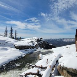
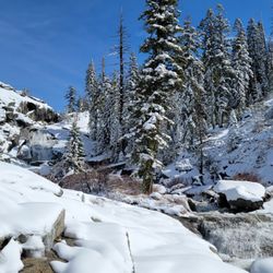
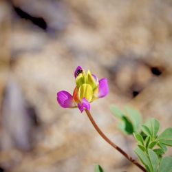
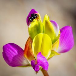
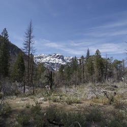
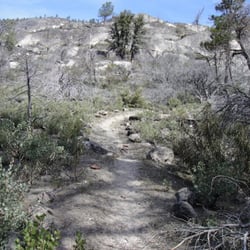
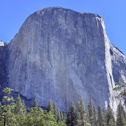
Meadow Loop Trail Photos


More like Meadow Loop Trail
Recommended Reviews - Meadow Loop Trail
Start your review...

8 years ago
11 years ago
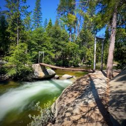
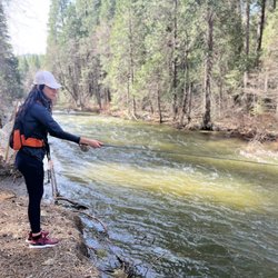
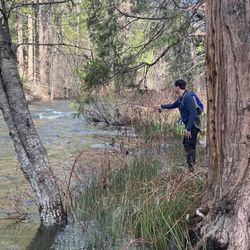
Begin at the Wawona Hotel. The is a circle hike so always bear to your left. Ignore other trails. Walk across the Wawona golf course on the paved road. Once across the golf course, take the first left onto the unpaved fire road that loops around the meadow. Great little hike if you are camping at The Wawona Campground nearby or of course the hotel. Grab your wine or brew and head out in the evening. 3.5 miles not ... more like 4 but easy mostly flat. Very pretty meadows no bear on our hike but I wouldn't be surprised to see one or maybe a deer grazing in the meadow. read more

8 years ago
8 years ago
More info about Meadow Loop Trail
41 Hwy
Wawona, CA 95389
Directions
Hours
Outdoor Amenities
Ask the Community - Meadow Loop Trail


Meadow Loop Trail - hiking - Updated July 2026
Best of Wawona
People found Meadow Loop Trail by searching for…
Trending Searches in Wawona, CA
Boating near Meadow Loop Trail
Cliff Jumping near Meadow Loop Trail
Dog Friendly Beaches near Meadow Loop Trail
Jet Skis near Meadow Loop Trail
Kayak Rental near Meadow Loop Trail
Off Road Trails near Meadow Loop Trail
Rainy Day Activities near Meadow Loop Trail
River Tubing near Meadow Loop Trail
Scenic Overlook near Meadow Loop Trail
Sunrise View near Meadow Loop Trail
Swimming Holes near Meadow Loop Trail
Things To Do On A Rainy Day near Meadow Loop Trail
U Pick Farms near Meadow Loop Trail
Water Parks near Meadow Loop Trail
Browse Articles
Browse Nearby
BEST of Wawona, California Restaurants near Meadow Loop Trail
BEST of Wawona, California Coffee near Meadow Loop Trail
BEST of Wawona, California Things to Do near Meadow Loop Trail
BEST of Wawona, California Breakfast near Meadow Loop Trail
BEST of Wawona, California Campgrounds near Meadow Loop Trail
BEST of Wawona, California Horseback Riding near Meadow Loop Trail
Browse Brands
Related Searches in Wawona, CA
Affordable Jet Ski Rental Options in Wawona, California
Affordable Kayak Rental Services in Wawona, California
Best Dog Hiking Trails Around Wawona, California
Best Fishing Locations and Guides in Wawona, California
Best Places for Horseback Riding in Wawona, California
Best Sightseeing Experiences Available in Wawona, California
Best Waterfalls and Swimming Holes in Wawona, California
Check Out Off Road Trails in Wawona, California
Discover Dog Friendly Trails to Explore in Wawona, California
Discover Kid Friendly Hiking Trails in Wawona, California
Discover Popular Bike Trails in Wawona, California
Discover Scenic Mountain Bike Trails Near Wawona, California
Discover a Hiking Trail in Wawona, California
Discover the Best Night Hike Trails in Wawona, California
Dog-Friendly Hikes With Dogs in Wawona, California
Enjoy Camping Adventures Around Wawona, California
Enjoy Kayaking Adventures in Wawona, California
Enjoy Off Leash Dog Hikes in Wawona, California
Enjoy Tent Camping Spots Around Wawona, California
Enjoy a Beautiful Waterfall Hike in Wawona, California
Enjoy the Best Walking Trails in Wawona, California
Experience Thrilling White Water Rafting in Wawona, California
Explore Beautiful Parks and Green Spaces in Wawona, California
Explore Easy Hikes Perfect for All in Wawona, California
Explore Fun Activities to Do in Wawona, California
Explore Popular Campgrounds Near Wawona, California
Explore Top Dog Parks in Wawona, California Near You
Explore Top Water Parks in Wawona, California Today
Explore the Best Beach Spots in Wawona, California
Explore the Best Boating Spots in Wawona, California
Explore the Best Swimming Holes Around Wawona, California
Family Friendly Hiking With Kids in Wawona, California
Find Top-Rated Waterfalls in Wawona, California Now
Find the Best Parks for Picnics in Wawona, California
Hiking Trails With Waterfalls in Wawona, California
Off Leash Dog Hiking Trails in Wawona, California
Plan a Scenic Drive Route Near Wawona, California
Popular Outdoor Activities to Try in Wawona, California
Safe River Swimming Areas in Wawona, California
Safe and Fun Parks for Kids in Wawona, California
Top Hiking Trails to Explore in Wawona, California
Top Paddleboarding Activities in Wawona, California
Top Running Trails to Explore in Wawona, California
Top Swimming Lakes to Enjoy in Wawona, California
Top Swimming Spots and Pools in Wawona, California