Mosquito Flat Trailhead Photos


You might also consider

More like Mosquito Flat Trailhead
Recommended Reviews - Mosquito Flat Trailhead
Start your review...


Reviews With Photos
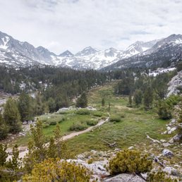

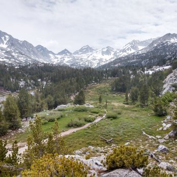
One of my absolute favorite hikes. The trail is BEAUTIFUL throughout and worth every step. If you are in decent shape, this hike will be no problem, and you'll love it. Just bring some good hiking shoes, especially for the muddier areas. And while it is not a "hard" hike, the high elevation and climb will make it something to consider for people, as some of my friends have had to sit this one out or stop part way. Be wary of elevation sickness. Also, it is called mosquito flat for a reason - prepare to be absolutely devoured by mosquitos! Many hikers cover their skin (including faces) before venturing here to help fend them off. If you use insect repellent, you'll need to reapply quite frequently, so covering your skin is a wise option. Despite those two warnings, you can tell how amazing this hike is simply by how busy this trail can get, especially during the summer. You have to try it at least once :)


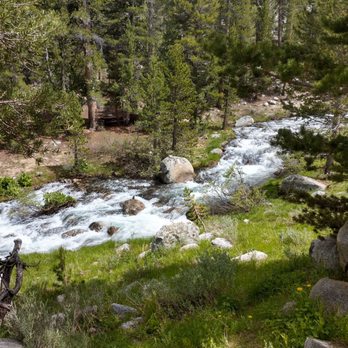
Love this trailhead! Leads to two of our favorite hikes in Mammoth. Mosquito flats to Gem lakes is maybe the most beautiful trail we've been on during summertime up here. It's green and lush, plenty and shade for the dogs and waters to fish and swim in. Last time we were up here we tried out Ruby Lake which was beautiful as well! Highly recommend this trailhead!


Wow! The Gem Lakes, at the end of the hike - that is if you head to Morgan Pass (as opposed to Mono Pass, well signed) - are worth going miles out of your way to see. Every year is different - in 2013 we were here July 3, and it was an easy hike with well maintained trails and gorgeous flowers. Ann L. says that in 2011 the last leg of the hike, to Gem Lakes, was totally snowed in. We also experienced a lot of mosquitoes in the early a.m. - but on the way back out a bit of a breeze had picked up and they had plenty of other humans to feast on so they were not a problem at all. GO EARLY!!! We started at around 7:30am and were the only ones on the trail on the way out - it was blissful, with only the sounds of birds calling, chipmunks chirping and rushing water - but on the way back the trail was crowded. At a leisurely pace, with plenty of photo ops and a picnic at Gem Lakes, it was about 5 hours. If you were moving quickly you could probably cut that in half. This is truly one of the most spectacular hikes I've ever done. Wish it was in my backyard!


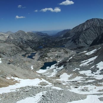
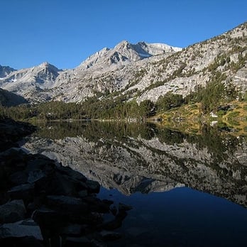
Mosquito Flat (a.k.a. Rock Creek or Little Lakes Valley) ranks among the top in my all-time favorite trailheads. It's high elevation (10,300 ft.) supports fine views of sparkling blue lakes and stark granite peaks with relatively little effort. As a result the trailhead is used heavily by fishermen, hikers, backcountry skiers, and climbers. That being said, if you're willing to walk a few miles (or go off-season) you'll be rewarded with solitude. There are bear boxes and restrooms at the trailhead as well as excellent pie at Rock Creek Lake Resort just down the road (go early for the best selection).


Disclaimer: I did this hike immediately after hiking to Ruby Lake (a 3 miles and 1000' of altitude hike) OK! To the point, THIS WAS NOT FLAT!! LOL It wasn't bad, but after doing Ruby Lake, it wasn't exactly easy either. There is a gradual incline and there are SMALL hills you walk over, but overall, definitely an easy hike with a beautiful scenic backdrop. Came here Labor Day weekend and it wasn't too hot and there weren't too many bugs... (THANK GOD!) Recommended to my fellow laid back hikers!


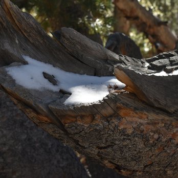
Such a beautiful hiking trail. I went on October and it was full of fall colored leaves, golden grasses with snow and clear water stream!!!!


One of the most beautiful hikes we've done up in the sierras. There was road construction and we had to wait about 20 min for an escort truck, but no worries-we're on vacation and in no hurry. We got to the parking lot around 930 on a weekday and there was plenty of parking. It was cooler up there so you may want to bring extra clothes just in case. WE took the trail to Morgan pass and it was just beautiful. Never saw so many lakes in such a short distance. We were in mammoth for a few days prior to hiking this lake but the altitude was still a killer. Definitely recommend this hike. Don't forget the bug repellant!


This review is for Little Lakes Valley To Gem Lakes which was a ~7.2 miles round trip that took ~4.5 hours to complete. Trail will take you to 6 different lakes (Mack, Marsh, Heart, Box, Long and Gem Lakes). With an optional detour to a 7th lake called Chickenfoot Lake (located after Long Lake). Trail was mostly a rocky incline towards Gem Lakes. There were some fall colors on the shrubs but not on the trees of this trail. Beware of altitude sickness! The worse symptom for us this time was shortness of breath. Decent sized parking area at the trailhead. However, it was almost full at sunrise. Restrooms are available within a short walk from the start of the trail. The drive towards the parking lot gets narrow and harder to fit two cars. Short video of the hike for those interested! https://youtu.be/lHZW-RvsUXk read more


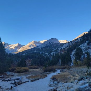


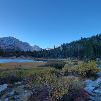

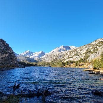

LITTLE LAKES VALLEY TRAIL - It's a very scenic and fun hike. If you're able, make sure you visit most of the lakes ( I think there are seven total). Reaching Long Lake (5th lake) is a good turnaround point for most people. Be prepared to get your feet wet as several portions of the trail were over a stream. TIPS: This trail is not ideal for those who have mobility issues. A lot of rocks, steps, gravel, and in some cases water and snow. Get to the parking lot by 8:30. The lot will fill up fast, and you'll have to drive down the road to find parking. There's a bathroom in the parking lot. read more


One of my absolute favorite hikes. The trail is BEAUTIFUL throughout and worth every step. If you are in decent shape, this hike will be no problem, and you'll love it. Just bring some good hiking shoes, especially for the muddier areas. And while it is not a "hard" hike, the high elevation and climb will make it something to consider for people, as some of my friends have had to sit this one out or stop part way. Be wary of elevation sickness. Also, it is called mosquito flat for a reason - prepare to be absolutely devoured by mosquitos! Many hikers cover their skin (including faces) before venturing here to help fend them off. If you use insect repellent, you'll need to reapply quite frequently, so covering your skin is a wise option. Despite those two warnings, you can tell how amazing this hike is simply by how busy this trail can get, especially during the summer. You have to try it at least once :) read more



7 years ago

Love this trailhead! Leads to two of our favorite hikes in Mammoth. Mosquito flats to Gem lakes is maybe the most beautiful trail we've been on during summertime up here. It's green and lush, plenty and shade for the dogs and waters to fish and swim in. Last time we were up here we tried out Ruby Lake which was beautiful as well! Highly recommend this trailhead! read more


13 years ago
Wow! The Gem Lakes, at the end of the hike - that is if you head to Morgan Pass (as opposed to Mono Pass, well signed) - are worth going miles out of your way to see. Every year is different - in 2013 we were here July 3, and it was an easy hike with well maintained trails and gorgeous flowers. Ann L. says that in 2011 the last leg of the hike, to Gem Lakes, was totally snowed in. We also experienced a lot of mosquitoes in the early a.m. - but on the way back out a bit of a breeze had picked up and they had plenty of other humans to feast on so they were not a problem at all. GO EARLY!!! We started at around 7:30am and were the only ones on the trail on the way out - it was blissful, with only the sounds of birds calling, chipmunks chirping and rushing water - but on the way back the trail was crowded. At a leisurely pace, with plenty of photo ops and a picnic at Gem Lakes, it was about 5 hours. If you were moving quickly you could probably cut that in half. This is truly one of the most spectacular hikes I've ever done. Wish it was in my backyard! read more


16 years ago
Mosquito Flat (a.k.a. Rock Creek or Little Lakes Valley) ranks among the top in my all-time favorite trailheads. It's high elevation (10,300 ft.) supports fine views of sparkling blue lakes and stark granite peaks with relatively little effort. As a result the trailhead is used heavily by fishermen, hikers, backcountry skiers, and climbers. That being said, if you're willing to walk a few miles (or go off-season) you'll be rewarded with solitude. There are bear boxes and restrooms at the trailhead as well as excellent pie at Rock Creek Lake Resort just down the road (go early for the best selection). read more



12 years ago
Disclaimer: I did this hike immediately after hiking to Ruby Lake (a 3 miles and 1000' of altitude hike) OK! To the point, THIS WAS NOT FLAT!! LOL It wasn't bad, but after doing Ruby Lake, it wasn't exactly easy either. There is a gradual incline and there are SMALL hills you walk over, but overall, definitely an easy hike with a beautiful scenic backdrop. Came here Labor Day weekend and it wasn't too hot and there weren't too many bugs... (THANK GOD!) Recommended to my fellow laid back hikers! read more


8 years ago
Such a beautiful hiking trail. I went on October and it was full of fall colored leaves, golden grasses with snow and clear water stream!!!! read more




11 years ago
One of the most beautiful hikes we've done up in the sierras. There was road construction and we had to wait about 20 min for an escort truck, but no worries-we're on vacation and in no hurry. We got to the parking lot around 930 on a weekday and there was plenty of parking. It was cooler up there so you may want to bring extra clothes just in case. WE took the trail to Morgan pass and it was just beautiful. Never saw so many lakes in such a short distance. We were in mammoth for a few days prior to hiking this lake but the altitude was still a killer. Definitely recommend this hike. Don't forget the bug repellant! read more


13 years ago

12 years ago
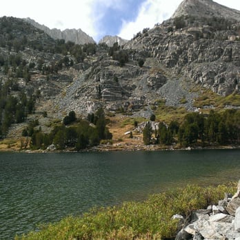
So beautiful, and worth the drive from the Bay Area! My boyfriend and I took our border collie, Riley, on a gorgeous 4 mile out-and-back hike through Little Lakes Valley to Chickenfoot Lake. We parked at the Mosquito Flat trailhead, and headed toward Morgan Pass. The first "official" detour we took was to check out Marsh Lake, just a quick offshoot from the main trail. A few minutes later, we were continuing toward Heart Lake, then passing Box Lake, crossing streams and marveling at the unreal views. There were plenty of friendly hikers and other dogs on the trail, but it didn't feel crowded. I was thrilled that I didn't see a single piece of trash on the ground the entire time. Must make time to go back there sometime soon and do the hike to Treasure Lakes. read more



7 years ago

8 years ago

10 years ago

12 years ago

9 years ago

7 years ago

11 years ago

16 years ago

13 years ago
10 years ago
10 years ago
More info about Mosquito Flat Trailhead
Mammoth Lakes, CA 93546
Directions
Hours
Indoor Amenities
Outdoor Amenities
Ask the Community - Mosquito Flat Trailhead
Review Highlights - Mosquito Flat Trailhead













Why does Yelp recommend reviews?
1 review that is not currently recommended
The reviews below are not factored into the business's overall star rating.

10 years ago


