12 MILES IN WITH NO POOP OUT BUS, LAST SIX MILES WERE PAINFUL…read more
BACKGROUND:
Located a few miles west of the bustling ski/vacation resort of Mammoth Lakes, the Agnew Meadows trailhead offers peace and quiet, quick access to some of the most beautiful scenery in the Sierra, as well as an easy approach to some of the range's most revered peaks. Banner Peak, Mt. Ritter, and the Minarets are all easily reached out of this trailhead via the River Trail/Shadow Lake trail/Pacific Crest Trail (south). San Joaquin Mountain and Mt. Davis can also be climbed from the same trailhead, via the Agnew Pass/Pacific Crest Trail (north).
STATS:
Shuttle hike ($7.00) http://www.nps.gov/depo/planyourvisit/reds-meadow-and-devils-postpile-shuttle-information.htm
Max 15 ppl can congregate
Distance: You decide. Our final count was just a smidge over 18 miles
Gain: 2500 ft (depending on what you decide to hike)
Starting Elevation: ~7500 Max Elevation ~9700
Know the signs of altitude sickness (headache, fatigue, stomach illness, dizziness, and sleep disturbance. Exertion aggravates the symptoms)
No lavatories of any sort along trail except for the outdoors
ESSENTIALS:
Know your limits
Experience with altitude (altitude sickness is deadly) -do the research
Comfortable hiking shoes with good lugs
Trekking poles
Layered Clothing
Rain gear (regardless of time of year)
Windbreaker
Hat (optional)
Sunscreen
High protein food/snacks
At least 5 liters of water/Electrolytes
Camera
OUR ROUTE:
We arrived at the Adventure Center at 7:30 and paid our $7.00 to board the Reds Meadow/Devil's Postpile shuttle. We offloaded the bus at the first stop, Agnew Meadows, to start our hike.
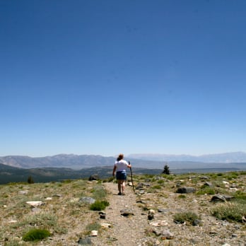
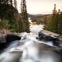
Starting out briefly on a portion of the PCT we headed towards Olaine Lake (2 miles, loss of 300 feet elevation). We crossed the Middle Fork San Joaquin River and that's where the fun started. An elevation gain of about 650 feet for the next mile until we reached Shadow Lake. Shadow lake is the largest of the many lakes we passed on our route. Continuing onto the west side of Shadow we joined the John Merrill Trail which led us to Devil's Postpile. What an amazing site.
From Wiki...
"The name "Devil's Postpile" refers to a dark cliff of columnar basalt. Radiometric dating indicates the formation was created by a lava flow at some time less than 100,000 years ago. The source of the lava is thought to have been somewhere near Upper Soda Springs campground at the north end of Pumice Flat on the floor of the Middle Fork of the San Joaquin River, from where it flowed to the site of the Postpile. Estimates of the formation thickness range from 400 feet (120 m) to 600 feet (180 m)."
A glacier later removed much of this mass of rock and left a polished surface on top of the columns with very noticeable glacial striations and glacial polish."
After Shadow we continued the second and larger elevation gain of about 700 feet over a mile long stretch as we approach Rosalie Lake. Our final ascent began just past Rosalie a climb of about 300 feet where we passed Gladys Lake. Alas, it was almost entirely downhill except for a few bumps along the way into Devil's Postpile."
Devil's Postpile was about mile 15 and decisions needed to be made.
-Check out the sites around the postpile and head back to shuttle pick up stop.
-Continue hiking to Rainbow Falls, which would add about 2.5-3 more miles.
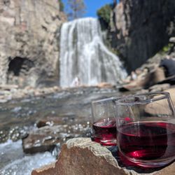
By this time we were all very tired and I had been hiking for several miles with what felt like blisters on my heels, and the pain was increasing rapidly. But when in Mammoth with The Crew... keep calm and hike on. A few of us continued on to Rainbow Falls. OMGoodness!!! Once we reached the falls.... pain? What pain? So amazingly beautiful. Water gushing down 102 feet, cascading off the rocks into a pool below where some brave souls were swimming around.
The trek back to the shuttle stop was a short three milers, but all uphill. Talk about pushing your limits. What a fantastic day on trail, so many lakes to see and greenery all around. Yeah, I'd do it again. Only next time, I'd like to take more time to "play".
DISCLAIMER:
Hiking is not something that can be taken lightly. It can be life-threatening as you see and hear on the news, people die or get lost all time. Please, if you are going to hike, never go alone and prepare for the worst, hope for the best. Remember when going for a hike, no matter how short you think it may be, always be prepared. Carry at least two liters of water for every five miles (more if the weather is warm), protein bar, nuts, and electrolytes. Wear sturdy lug sole shoes and protective clothing. Some areas the weather can change quicker than a fireman can put on his gear. It is also very important, always always always let a family member or friend know where you are going and when you expect to be back.
#HIKING #ADVANCEDHIKERS #KNOWYOURLIMITS #HIKINGMAMMOTH #MAMMOTH #AGNEWMEADOWS #DEVILSPOSTPILE #RAINBOWFALLS