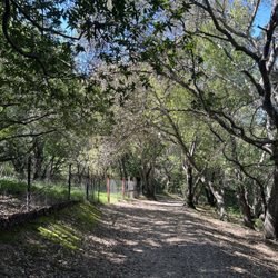
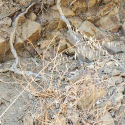
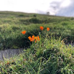
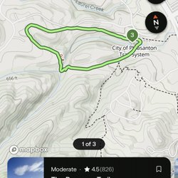
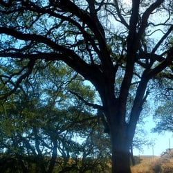
Moller Ranch Trails Photos


You might also consider
More like Moller Ranch Trails
Recommended Reviews - Moller Ranch Trails
Start your review...

2 years ago
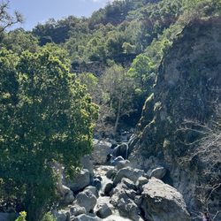
Lying stump shortcut trail is steep and slightly overgrown in spots. Posted as closed before you get to the falls. read more

More info about Moller Ranch Trails
8107 Moller Ranch Dr
Pleasanton, CA 94588
Directions
Hours
Outdoor Amenities
You might also consider


Moller Ranch Trails - hiking - Updated July 2026
Best of Pleasanton
People found Moller Ranch Trails by searching for…
Hiking Trails With Waterfalls in Pleasanton, CA
Secret Spots in Pleasanton, CA
Secluded Spots in Pleasanton, CA
Waterfalls and Swimming Holes in Pleasanton, CA
Free Things to Do in Pleasanton, CA
Walking Trails in Pleasanton, CA
Empty Parking Lot in Pleasanton, CA
Fall Foliage in Pleasanton, CA
Kid Friendly Hiking Trails in Pleasanton, CA
Fun Things to Do in Pleasanton, CA
Walking Groups in Pleasanton, CA
Things to Do Alone in Pleasanton, CA
Running Trails in Pleasanton, CA
Off Road Trails in Pleasanton, CA
Off Leash Dog Hikes in Pleasanton, CA
Trending Searches in Pleasanton, CA
Black Owned Nail Salons in Pleasanton, CA
Cliff Jumping in Pleasanton, CA
Jet Ski Rental in Pleasanton, CA
Kayak Rental in Pleasanton, CA
Lakes & Ponds in Pleasanton, CA
Off Road Trails in Pleasanton, CA
Outdoor Activities in Pleasanton, CA
Picnic Spots in Pleasanton, CA
Places To Swim in Pleasanton, CA
Places To Walk Around in Pleasanton, CA
Pool Day Pass in Pleasanton, CA
Public Pools in Pleasanton, CA
Public Shower in Pleasanton, CA
River Swimming in Pleasanton, CA
River Tubing in Pleasanton, CA
Running Trails in Pleasanton, CA
Scenic Night View in Pleasanton, CA
Scenic Overlook in Pleasanton, CA
Soccer Store in Pleasanton, CA
Sunrise View in Pleasanton, CA
Swimming Holes in Pleasanton, CA
Swimming Lakes in Pleasanton, CA
Browse Articles
Browse Nearby
BEST of Pleasanton, California Coffee near Moller Ranch Trails
BEST of Pleasanton, California Restaurants near Moller Ranch Trails
BEST of Pleasanton, California Things to Do near Moller Ranch Trails
BEST of Pleasanton, California Walking Trails near Moller Ranch Trails
BEST of Pleasanton, California Parks near Moller Ranch Trails
BEST of Pleasanton, California Breakfast near Moller Ranch Trails
BEST of Pleasanton, California Hot Springs near Moller Ranch Trails
BEST of Pleasanton, California Campgrounds near Moller Ranch Trails
BEST of Pleasanton, California Ski Resorts near Moller Ranch Trails
Browse Brands
Related Searches in Pleasanton, CA
Affordable Kayak Rental Services in Pleasanton, California
Best Fishing Locations and Guides in Pleasanton, California
Best Nature Trails for Hiking in Pleasanton, California
Best Places for Horseback Riding in Pleasanton, California
Check Out Off Road Trails in Pleasanton, California
Discover Dog Friendly Trails to Explore in Pleasanton, California
Discover Kid Friendly Hiking Trails in Pleasanton, California
Discover Scenic Hiking Trails in Pleasanton, California
Discover Scenic Mountain Bike Trails Near Pleasanton, California
Discover Scenic Waterfall Spots in Pleasanton, California
Discover Walking Parks in Pleasanton, California Near You
Discover a Hiking Trail in Pleasanton, California
Discover the Best Night Hike Trails in Pleasanton, California
Dog-Friendly Hikes With Dogs in Pleasanton, California
Enjoy Camping Adventures Around Pleasanton, California
Enjoy Exciting Mountain Biking Adventures in Pleasanton, California
Enjoy Kayaking Adventures in Pleasanton, California
Enjoy Tent Camping Spots Around Pleasanton, California
Enjoy a Beautiful Waterfall Hike in Pleasanton, California
Enjoy a Peaceful Nature Walk in Pleasanton, California
Enjoy the Best Picnic Spots and Ideas in Pleasanton, California
Enjoy the Best Walking Path in Pleasanton, California
Enjoy the Best Walking Trails in Pleasanton, California
Experience Thrilling White Water Rafting in Pleasanton, California
Explore Beautiful Parks and Green Spaces in Pleasanton, California
Explore Easy Hikes Perfect for All in Pleasanton, California
Explore Fun Activities to Do in Pleasanton, California
Explore Popular Campgrounds Near Pleasanton, California
Explore the Best Beach Spots in Pleasanton, California
Explore the Best Trail Options in Pleasanton, California
Family Friendly Hiking With Kids in Pleasanton, California
Find Beautiful Views in Pleasanton, California
Find the Best Parks for Picnics in Pleasanton, California
Find the Best Scenic View Locations in Pleasanton, California
Great Places to Walk in Pleasanton, California
Hike the Popular Waterfall Trail in Pleasanton, California
Hiking Trails With Waterfalls in Pleasanton, California
Off Leash Dog Hiking Trails in Pleasanton, California
Plan a Scenic Drive Route Near Pleasanton, California
Popular Outdoor Activities to Try in Pleasanton, California
Popular Picnic Spots to Visit in Pleasanton, California
Safe River Swimming Areas in Pleasanton, California
Safe and Fun Parks for Kids in Pleasanton, California
Top Climbing Spots and Gyms in Pleasanton, California
Top Paddleboarding Activities in Pleasanton, California
Top Running Trails to Explore in Pleasanton, California
Top Swimming Lakes to Enjoy in Pleasanton, California
Top Swimming Spots and Pools in Pleasanton, California
Walk Dog Friendly Hiking Trails in Pleasanton, California
Walk the Best Paved Walking Trails in Pleasanton, California
People who viewed Moller Ranch Trails also viewed
Martin Canyon Creek Trail
51 reviews
Preserve Trail
21 reviews
Summit View Trails
15 reviews
Sycamore Grove Park
92 reviews
Brushy Peak Regional Preserve
70 reviews
Oyster Point Trail
2 reviews
Tassajara Creek Regional Trail
4 reviews
Arroyo Del Valle Trail
2 reviews
Alamo Canal Regional Trail
2 reviews
Sycamore Valley Open Space Regional Preserve
2 reviews