Martin Canyon Creek Trail Photos


You might also consider


More like Martin Canyon Creek Trail
Recommended Reviews - Martin Canyon Creek Trail
Start your review...


Reviews With Photos


This was a nice trail that was short and somewhat hilly. Once we got to the end of the trail we were told that there is another route that goes up to a high hill, we opted to not go any further. The trail was paved on some parts but mostly rocky with dirt. The trail is nestled between housing communities, and luscious greenery and trees covered with moss. The entrance to the park is nestled in a residential area. We parked on the street, no designated parking for the trail.


We come here for a good hike workout with the kids and this trail never dissapoints! This trail does get a bit windy or chilly, so we carry a light jacket. The trail is beautiful with lots of greenery and tall trees. The trail elevation is really good for a workout! Upto the end it a good 2 hr hike with kids including a short snack break for the kiddos. It is definately on the narrower side, something to be aware of while hiking with kids. The end of the trail is lush green and gorgeous! Cows grazing and nice open greenery with sunlight! It is stroller accessible only for half the trail, up untill the narrow path begins. There are a couple of garbage bins along the trail. No restroom available. Lots of roadside parking.


What a great difficult short trail in a residential neighborhood!! I really really enjoyed the challenge. I would have never thought there was one there. The trail map on AllTrails says this was moderate three mile hike but for first timers, this would be a struggle for them. Good thing, I am a regular hiker. It's a back and forth trail but at the top, we rerouted to some smaller trails making it five miles then three. My friends and I enjoyed the views and the trail. Friendly folks on the trail. This trail is not for bikers. Will be back!! [80/100]


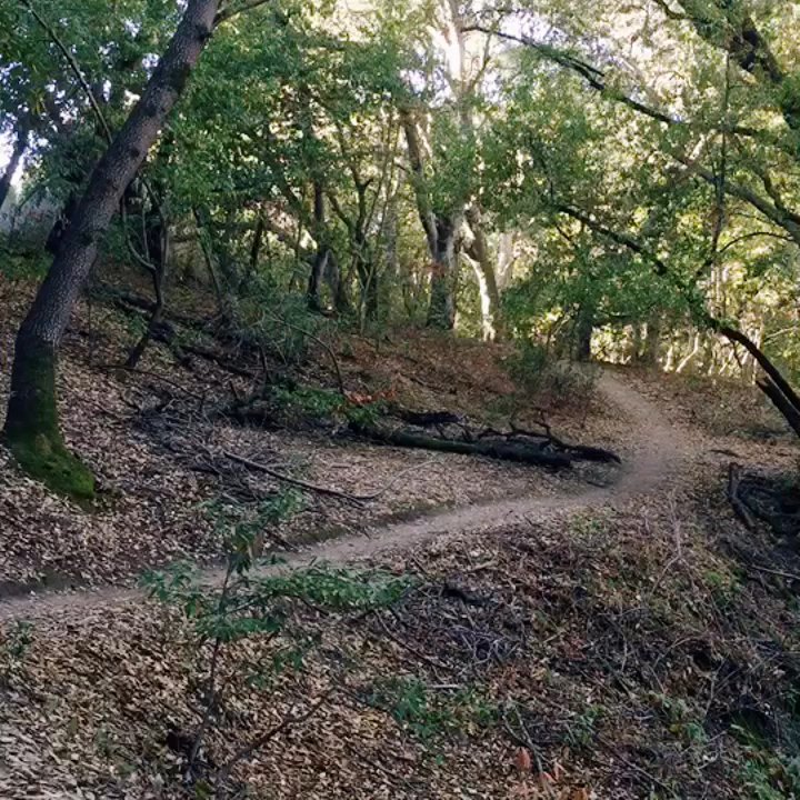
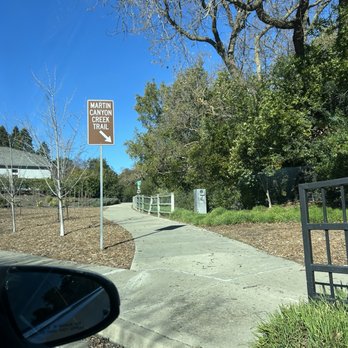
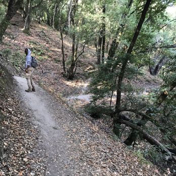
So there was a day that I was going to be working onsite at my job place in San Ramon last Tuesday so I decided to do some hiking at Martin Canyon Creek Trail since it's pretty nearby. I parked on the main street which was really easy, and I followed the sign that points me to Martin Canyon Creek Trail. The city trail was nice as it was spacious with a mix of good slight inclines and flats which was perfect for running. Then I reached the end of the city trail sign which has the gate for the "hikers only" trail. I was really excited and a bit anxious to do this trail because of the signage. Lol Upon walking a few steps after the gate, I felt like I was in a forest. It did feel a little eerie in there cause it's so shaded without much sunlight in. I like the shadedness since I'm not a fan of trails that don't have shade because I'm trying not get darker. Lol.. I had my earphones on so I was listening to my music at a low volume. The trail is very narrow with lots of up and downs and curves. I get why they put the "hikers only" sign there as if you're not careful -- you could fall down. I kept on walking until I saw a couple of people heading towards me so I decided to turn around. I must turn pretty fast as I felt I was losing my balance and almost fell which is not good, but luckily, I balanced myself quick. This is going to sound crazy, but I swore I saw something as I started walking back. I know there was a sign about watching out for coyotes, and I felt like I saw a brown animal from the corner of my eyes. I got scared so I freaking ran on that narrow pathway. Did I see an actual animal or was it just imagination? Hmm.. I'll never know. Lol Anywho, I felt relieved to be back on the city trail as I felt safer there versus being in the hikers only area of this trail. I definitely would love to come back again if only I had another person with me as I'm a little scared to do this hike alone again.


Hidden gem in Dublin! An in-and-out hiking trail minutes away from Dublin Blvd. Spacious city trail then leads to a hiker's only trail. Hiker's only trail is a bit steep and narrow, but I do see families and little kids (apparently much braver than I am) going through here. Have yet to make it to the end since I'm a hiking newbie and have a fear of falling. Good elevations on both to get a good workout in. Easy parking in the main street of the neighborhood - Silvergate Dr. I love stopping by here in the weekend mornings. Gets a little busy with families and kids around noontime, but not bad and not nearly as busy as Sycamore Canyon in Livermore. My go-to local spot for a good walk/jog. So glad I found this little Dublin gem!


About a 4 mile loop if you go all the way to the top of the hill and back. I started on Silvergate in the Briarhill neighborhood. It took about 1.5 hour to finish my loop with a stop at the top to enjoy the view. The trail starts with a very easy walk with the sides fenced off, making it pretty easy for anyone to walk the trail. Once you get to the sign "end of city trail" and "hikers only", the roads are not as well paved not fenced off. The incline is steeper and roads are much more narrow. Despite this, I saw groups of families and elderly + kids during my hike! Past the "hikers only" sign you'll be encompassed under a lot of trees and shade. The sight at the "end" is quite obvious, as it was well lit and opened up to a 360 degree view of a blue sky, white clouds, green hills, and a view of Dublin. I saw other hikers continuing to hike other hills/parts but I proceeded back the way I came to head back to where I parked. It would be nice to check out other parts, though. Compared other trails in Dublin, the view isn't nearly as pronounced but I really appreciated the steep/narrow trails for a good workout and how the hike ended with a "light at the end of tunnel" feel.


This trail is a hidden gem. You access the trail through a gate that say "end of city trail", which is a bit confusing, but open the gate and you enter a secluded path through a forest of shady trees. There's a bit of elevation to make things interesting, but nothing too difficult. It a good workout but won't kill you either.
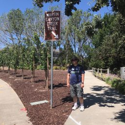

Martin Canyon Creek is located off a quiet residential area in Dublin. We drive by San Ramon Road nearly biweekly to access either 99 Ranch Dublin along with favorite lunch places (Pho Saigon, Tofu House), and did not even know this hiking trail existed! The trail comes in two parts. The first is the City Trail which has an entrance right off Bay Laurel Street on the residential area. Plenty of parking on both sides of the roads. The trail is mostly flat, and a straight shot of about 1.5 miles to the gate at the end. Decent amount of shade, decently-paved path, and views of the hills with houses high up. If you chose to proceed beyond the gate at the end of the City Trail, it becomes an entirely different hike! Narrow (single file), hilly, green and "foresty", and slippery from all those little leaves. I found this part challenging, and as a beginner hiker its probably less safe than other trails for those reasons. More experienced hikers with smaller feet may enjoy this more. On the plus side, there's a good amount of shade here. So for me, 3 stars overall. Note for both the City and the Regional Hill trails there are zero water and restrooms and limited signage available, so plan accordingly. They do have doggie bags available at the entrance and I seem to recall seeing a few garbage cans.
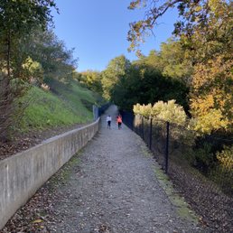
I didn't get to hike the full trail as I had little ones in tow. I'm really glad I found this local trail, it was sooo beautiful. The main part of the trail is wedged in between two residential plots - these residents are so lucky to basically have this as a backyard. Beautiful rocks paving the way, we saw a falcon, shaded trees, lush grass. Such a hidden gem, this was a beautiful hike.


5 months ago
This is truly a hidden gem in the Dublin neighborhood and a must! It's situated behind some residential properties in a beautiful trail. There's ample parking in the neighborhood and you'll follow the road til you see the gate and sign for the start of the trail. The beginning part has quite a bit of sun and then it's shady for most of the way. There's an option to extend the trail once you get the gate. Then you can hike all the way to the top and get rewarded with a beautiful view. It's really an enjoyable hike with greenery and beautiful nature. read more


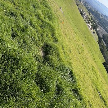


"I broke my foot here once, but I'm more careful now." This is a hidden gem on the west side of dublin. The trail is well maintained and there are often lots of hikers and runners. As you go along, the trail becomes tighter and steeper, about a mile in. That's where I broke my foot. So don't be like me and break bones. Watch your step and be careful. read more


1 year ago
This was a nice trail that was short and somewhat hilly. Once we got to the end of the trail we were told that there is another route that goes up to a high hill, we opted to not go any further. The trail was paved on some parts but mostly rocky with dirt. The trail is nestled between housing communities, and luscious greenery and trees covered with moss. The entrance to the park is nestled in a residential area. We parked on the street, no designated parking for the trail. read more




1 year ago
First time coming here. It doesn't look like a hiking place at first bit there is a small trail header. Beautiful hiking spot with creeks and easy to follow. read more


4 years ago
We come here for a good hike workout with the kids and this trail never dissapoints! This trail does get a bit windy or chilly, so we carry a light jacket. The trail is beautiful with lots of greenery and tall trees. The trail elevation is really good for a workout! Upto the end it a good 2 hr hike with kids including a short snack break for the kiddos. It is definately on the narrower side, something to be aware of while hiking with kids. The end of the trail is lush green and gorgeous! Cows grazing and nice open greenery with sunlight! It is stroller accessible only for half the trail, up untill the narrow path begins. There are a couple of garbage bins along the trail. No restroom available. Lots of roadside parking. read more


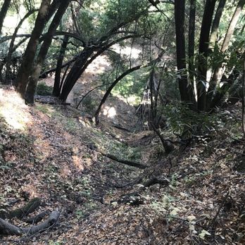
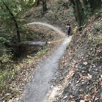
What a great difficult short trail in a residential neighborhood!! I really really enjoyed the challenge. I would have never thought there was one there. The trail map on AllTrails says this was moderate three mile hike but for first timers, this would be a struggle for them. Good thing, I am a regular hiker. It's a back and forth trail but at the top, we rerouted to some smaller trails making it five miles then three. My friends and I enjoyed the views and the trail. Friendly folks on the trail. This trail is not for bikers. Will be back!! [80/100] read more






3 years ago
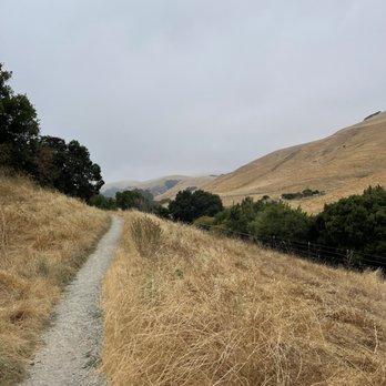
I found this trail and loved the challenge. I would walk it aging. This trail has some steep parts so I recommend shoes with good traction. read more



4 years ago
Fantastic shaded trail qith sweeping exposed views at the end. Great for hill training! Options to extend to Donlon Canyon and Loop Trails on more exposed but scenic paths. read more
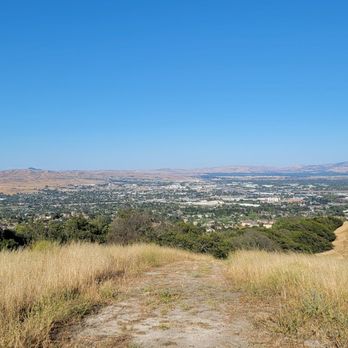

So there was a day that I was going to be working onsite at my job place in San Ramon last Tuesday so I decided to do some hiking at Martin Canyon Creek Trail since it's pretty nearby. I parked on the main street which was really easy, and I followed the sign that points me to Martin Canyon Creek Trail. The city trail was nice as it was spacious with a mix of good slight inclines and flats which was perfect for running. Then I reached the end of the city trail sign which has the gate for the "hikers only" trail. I was really excited and a bit anxious to do this trail because of the signage. Lol Upon walking a few steps after the gate, I felt like I was in a forest. It did feel a little eerie in there cause it's so shaded without much sunlight in. I like the shadedness since I'm not a fan of trails that don't have shade because I'm trying not get darker. Lol.. I had my earphones on so I was listening to my music at a low volume. The trail is very narrow with lots of up and downs and curves. I get why they put the "hikers only" sign there as if you're not careful -- you could fall down. I kept on walking until I saw a couple of people heading towards me so I decided to turn around. I must turn pretty fast as I felt I was losing my balance and almost fell which is not good, but luckily, I balanced myself quick. This is going to sound crazy, but I swore I saw something as I started walking back. I know there was a sign about watching out for coyotes, and I felt like I saw a brown animal from the corner of my eyes. I got scared so I freaking ran on that narrow pathway. Did I see an actual animal or was it just imagination? Hmm.. I'll never know. Lol Anywho, I felt relieved to be back on the city trail as I felt safer there versus being in the hikers only area of this trail. I definitely would love to come back again if only I had another person with me as I'm a little scared to do this hike alone again. read more


Hidden gem in Dublin! An in-and-out hiking trail minutes away from Dublin Blvd. Spacious city trail then leads to a hiker's only trail. Hiker's only trail is a bit steep and narrow, but I do see families and little kids (apparently much braver than I am) going through here. Have yet to make it to the end since I'm a hiking newbie and have a fear of falling. Good elevations on both to get a good workout in. Easy parking in the main street of the neighborhood - Silvergate Dr. I love stopping by here in the weekend mornings. Gets a little busy with families and kids around noontime, but not bad and not nearly as busy as Sycamore Canyon in Livermore. My go-to local spot for a good walk/jog. So glad I found this little Dublin gem! read more


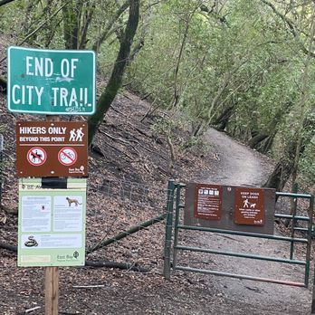

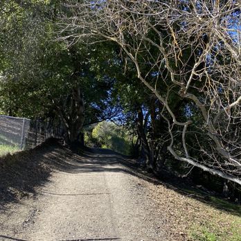


About a 4 mile loop if you go all the way to the top of the hill and back. I started on Silvergate in the Briarhill neighborhood. It took about 1.5 hour to finish my loop with a stop at the top to enjoy the view. The trail starts with a very easy walk with the sides fenced off, making it pretty easy for anyone to walk the trail. Once you get to the sign "end of city trail" and "hikers only", the roads are not as well paved not fenced off. The incline is steeper and roads are much more narrow. Despite this, I saw groups of families and elderly + kids during my hike! Past the "hikers only" sign you'll be encompassed under a lot of trees and shade. The sight at the "end" is quite obvious, as it was well lit and opened up to a 360 degree view of a blue sky, white clouds, green hills, and a view of Dublin. I saw other hikers continuing to hike other hills/parts but I proceeded back the way I came to head back to where I parked. It would be nice to check out other parts, though. Compared other trails in Dublin, the view isn't nearly as pronounced but I really appreciated the steep/narrow trails for a good workout and how the hike ended with a "light at the end of tunnel" feel. read more


This trail is a hidden gem. You access the trail through a gate that say "end of city trail", which is a bit confusing, but open the gate and you enter a secluded path through a forest of shady trees. There's a bit of elevation to make things interesting, but nothing too difficult. It a good workout but won't kill you either. read more


Martin Canyon Creek is located off a quiet residential area in Dublin. We drive by San Ramon Road nearly biweekly to access either 99 Ranch Dublin along with favorite lunch places (Pho Saigon, Tofu House), and did not even know this hiking trail existed! The trail comes in two parts. The first is the City Trail which has an entrance right off Bay Laurel Street on the residential area. Plenty of parking on both sides of the roads. The trail is mostly flat, and a straight shot of about 1.5 miles to the gate at the end. Decent amount of shade, decently-paved path, and views of the hills with houses high up. If you chose to proceed beyond the gate at the end of the City Trail, it becomes an entirely different hike! Narrow (single file), hilly, green and "foresty", and slippery from all those little leaves. I found this part challenging, and as a beginner hiker its probably less safe than other trails for those reasons. More experienced hikers with smaller feet may enjoy this more. On the plus side, there's a good amount of shade here. So for me, 3 stars overall. Note for both the City and the Regional Hill trails there are zero water and restrooms and limited signage available, so plan accordingly. They do have doggie bags available at the entrance and I seem to recall seeing a few garbage cans. read more
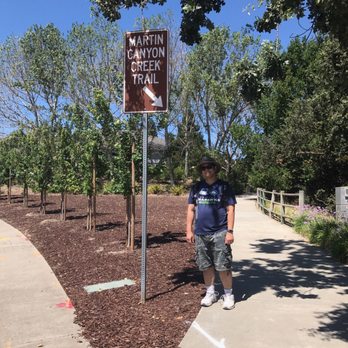


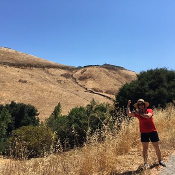


5 years ago
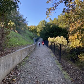
I didn't get to hike the full trail as I had little ones in tow. I'm really glad I found this local trail, it was sooo beautiful. The main part of the trail is wedged in between two residential plots - these residents are so lucky to basically have this as a backyard. Beautiful rocks paving the way, we saw a falcon, shaded trees, lush grass. Such a hidden gem, this was a beautiful hike. read more
4 years ago


6 years ago
Went on a lovely hike at Martin Canyon creek trail. This is a very convenient hike to get in a little bit of nature and exercise. The hike is roughly about 3 miles and took me under an hour to finish. It's not a loop and connects to further hiking. We did not take the additional route. The address listed on yelp will lead you right to the path. There is street parking in the neighborhood to park your car so it is very convenient. I liked that this hike isn't straight uphill/downhill. It's a bit like rolling hills with flat incline in between. This gives you a fair workout on both ends. I did get a bit of a workout but is definitely suitable for people who are beginners. When climbing the additional route there was a warning for wild animals but we didn't see anything. It's very serene and we saw horses from the hills read more


5 years ago
Nice place, shaded area, hidden gem... never knew this place before this year... keep going till you reach the top and wow... read more


The Martin Canyon Creek Trail head starts off at the Silvergate neighborhood. It's at the corner of Silvergate Drive and Bay Laurel Drives. I've never had any problems parking on the residential street. This is an easy trail that is out and back less than 2 miles round trip. If you want more of a challenge, cross the gate at the end of the trail that leads to the Dublin Hills. The East Bay Regional Park District extended the Martin Canyon Trail into Dublin Hills over a year ago. There is a single-track section of the trail with steep drop-offs. I don't recommend this hike for anyone who is afraid of heights or for young children. Once you pass the narrow, shady trail portion, you can continue up to the Calaveras Ridge Regional Trail to the end. It is about a 7 mile hike with hills round trip. It is strenuous! The hills kicked my behind! Once you reach the Dublin Hills side, it's wide open and no trees. It's not ideal for a very hot, sunny day. There are no restrooms or water at this trail, so be prepared. Bring water, spf, hat, sunglasses and possibly a small snack. Watch out for ticks and poison oak on this trail as well. We saw some lizards and a wild turkey during the hike. There are warning signs at the gate that states there are snakes and mountain lions in the regional park but we did not encounter any....thank goodness! The trail is relatively quiet....only saw a handful of hikers out there. Plan accordingly. read more


11 years ago
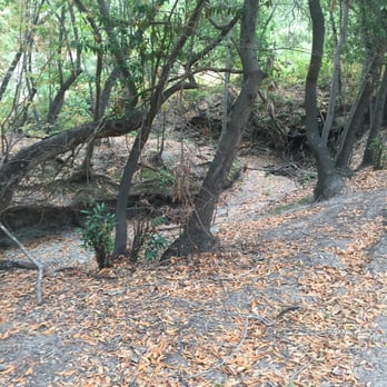
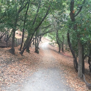
Did a quick hike here this morning and really enjoyed it. Reminds me of the fall season on the east coast with trees leaves and crisp weather (today hah) I only went a mile in so not sure how the whole trail was, but the beginning part is relatively easy. Not perfectly flat but no crazy hills either. Also saw quite a few dogs if you're scared of them. The only sad thing was seeing no water in the creek :( read more

11 years ago
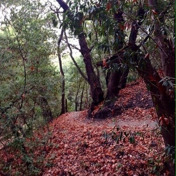
Gorgeous lush local hike starting in a residential neighborhood. It starts out pretty basic, and suddenly turns into a deep green forest with a pretty narrow winding trail. The second half emerges onto the tops of the Dublin hills. Great place to watch sunrises! read more


7 years ago
I absolutely loved how this hike has lots of inclines. The inclines are great for the heart! A few parts without the incline, but a ton of steep hills. It was better than the gym.My glutes, quads, hamstrings, and calves are burning today~a good kind of sore!! I would not go back without hiking shoes again. There is an area where you walk past a gate and it is nothing but narrow and steep and very scary. If you're looking for a quick, yet intense hike in a short amount of time, this is ideal! I wish there was a porta potty before starting, though. I have kids and so I wanted to make sure business is taken care of before hand, so we went to the nearest store development to take care of that. read more


13 years ago
Thi is a nice little unpaved trail behind some very nice houses in Dublin. It's close enough to the freeway that you can be here 2 minutes once you get off 580. You can not here the freeway but you can still here the garbage trucks, delivery trucks and sometimes vacuum cleaners from houses. But when the wind blows the shaking leaves drown all of that out. The trail zig zags a small creek and you are under the shade of trees most of the time. Its a nice place to get away with out going away if you live in Dublin or Pleasanton. read more


6 years ago

6 years ago

6 years ago
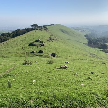
It was an amazing view! It was a tough hike up from this side of the hike. There is another way to get to the top that isn't such a hard hike. We got to see cattle aNd walk near them. read more



6 years ago

12 years ago

4 years ago
7 years ago

10 years ago
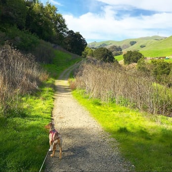
I really enjoyed this trail! So you park in the residential area and start your walk. There are dog bags for your dog as well. The first mile is out in the open and then you come to a gate... After that the path is very narrow. It feels like a Forrest! It's beautiful and quiet. I went alone on a Friday afternoon with my dog and we both loved it. Make sure you pay attention to where you are going because when you walk back you will notice that there are different trails that branch off that you might not have noticed before. read more



10 years ago
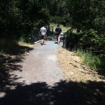
Such a cute, hidden trail! I love that it feels like you're in the middle of the forest within walking 50 feet into the path. The trail is mostly shaded, and the road is fairly easy to walk on. There's also dog bags and trash cans along the way. I'll definitely be back, along with food to have a little picnic! read more


8 years ago
Page 1 of 2
More info about Martin Canyon Creek Trail
11538-11574 Bay Laurel St
Dublin, CA 94568
Directions
Hours
Outdoor Amenities
Ask the Community - Martin Canyon Creek Trail
Review Highlights - Martin Canyon Creek Trail
You might also consider














Why does Yelp recommend reviews?
3 reviews that are not currently recommended
The reviews below are not factored into the business's overall star rating.
8 years ago

8 years ago
7 years ago
Martin Canyon Creek Trail - hiking - Updated May 2026
Best of Dublin
People found Martin Canyon Creek Trail by searching for…
Trending Searches in Dublin, CA
Boat Rental near Martin Canyon Creek Trail
Botanical Gardens near Martin Canyon Creek Trail
Bounce House Rentals near Martin Canyon Creek Trail
Campgrounds near Martin Canyon Creek Trail
Cliff Jumping near Martin Canyon Creek Trail
Dog Friendly Things To Do near Martin Canyon Creek Trail
Flower Fields near Martin Canyon Creek Trail
Flower Shop near Martin Canyon Creek Trail
Hair near Martin Canyon Creek Trail
Lakes & Ponds near Martin Canyon Creek Trail
Movie Theatre near Martin Canyon Creek Trail
Nurseries & Gardening near Martin Canyon Creek Trail
Outdoor Activities near Martin Canyon Creek Trail
Outdoor Furniture Stores near Martin Canyon Creek Trail
Party Equipment Rentals near Martin Canyon Creek Trail
Pedicure near Martin Canyon Creek Trail
Pick Your Own Farms near Martin Canyon Creek Trail
Picnic Areas near Martin Canyon Creek Trail
Places To Walk Around near Martin Canyon Creek Trail
Rainy Day Activities near Martin Canyon Creek Trail
Rock Quarry near Martin Canyon Creek Trail
Running Trails near Martin Canyon Creek Trail
Scenic Drive near Martin Canyon Creek Trail
Secret Spots near Martin Canyon Creek Trail
Strawberry Picking near Martin Canyon Creek Trail
Sunrise View near Martin Canyon Creek Trail
Swimming Holes near Martin Canyon Creek Trail
Things To Do On A Rainy Day near Martin Canyon Creek Trail
Browse Articles
Browse Nearby
BEST of Dublin, California Coffee near Martin Canyon Creek Trail
BEST of Dublin, California Restaurants near Martin Canyon Creek Trail
BEST of Dublin, California Things to Do near Martin Canyon Creek Trail
BEST of Dublin, California Walking Trails near Martin Canyon Creek Trail
BEST of Dublin, California Parks near Martin Canyon Creek Trail
BEST of Dublin, California Breakfast near Martin Canyon Creek Trail
BEST of Dublin, California Campgrounds near Martin Canyon Creek Trail
BEST of Dublin, California Hotels near Martin Canyon Creek Trail
BEST of Dublin, California Glamping near Martin Canyon Creek Trail
Browse Brands
Related Searches in Dublin, CA
Affordable Kayak Rental Services in Dublin, California
Best Fishing Locations and Guides in Dublin, California
Best Nature Trails for Hiking in Dublin, California
Best Places for Horseback Riding in Dublin, California
Check Out Off Road Trails in Dublin, California
Discover Dog Friendly Trails to Explore in Dublin, California
Discover Kid Friendly Hiking Trails in Dublin, California
Discover Scenic Hiking Trails in Dublin, California
Discover Scenic Mountain Bike Trails Near Dublin, California
Discover Scenic Waterfall Spots in Dublin, California
Discover Walking Parks in Dublin, California Near You
Discover a Hiking Trail in Dublin, California
Discover the Best Night Hike Trails in Dublin, California
Dog-Friendly Hikes With Dogs in Dublin, California
Enjoy Camping Adventures Around Dublin, California
Enjoy Exciting Mountain Biking Adventures in Dublin, California
Enjoy Kayaking Adventures in Dublin, California
Enjoy Tent Camping Spots Around Dublin, California
Enjoy a Beautiful Waterfall Hike in Dublin, California
Enjoy a Peaceful Nature Walk in Dublin, California
Enjoy the Best Picnic Spots and Ideas in Dublin, California
Enjoy the Best Walking Path in Dublin, California
Enjoy the Best Walking Trails in Dublin, California
Experience Thrilling White Water Rafting in Dublin, California
Explore Beautiful Parks and Green Spaces in Dublin, California
Explore Easy Hikes Perfect for All in Dublin, California
Explore Fun Activities to Do in Dublin, California
Explore Popular Campgrounds Near Dublin, California
Explore the Best Beach Spots in Dublin, California
Explore the Best Trail Options in Dublin, California
Family Friendly Hiking With Kids in Dublin, California
Find Beautiful Views in Dublin, California
Find the Best Parks for Picnics in Dublin, California
Find the Best Scenic View Locations in Dublin, California
Great Places to Walk in Dublin, California
Hike the Popular Waterfall Trail in Dublin, California
Hiking Trails With Waterfalls in Dublin, California
Off Leash Dog Hiking Trails in Dublin, California
Plan a Scenic Drive Route Near Dublin, California
Popular Outdoor Activities to Try in Dublin, California
Popular Picnic Spots to Visit in Dublin, California
Safe River Swimming Areas in Dublin, California
Safe and Fun Parks for Kids in Dublin, California
Top Climbing Spots and Gyms in Dublin, California
Top Paddleboarding Activities in Dublin, California
Top Running Trails to Explore in Dublin, California
Top Swimming Lakes to Enjoy in Dublin, California
Top Swimming Spots and Pools in Dublin, California
People who viewed Martin Canyon Creek Trail also viewed

Preserve Trail
21 reviews

Summit View Trails
15 reviews

Alamo Creek Trail
4 reviews

Centennial Trail
4 reviews

Moller Ranch Trails
3 reviews

Brushy Peak Regional Preserve
70 reviews

Tassajara Creek Regional Park
16 reviews

Callippe Preserve Trail
6 reviews

Tassajara Ridge Staging Area
17 reviews

Holdener Park
11 reviews