
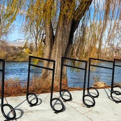
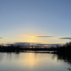
Lucky Peak Trail Photos


You might also consider
More like Lucky Peak Trail
Recommended Reviews - Lucky Peak Trail
Start your review...

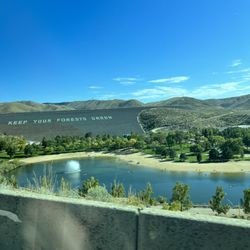
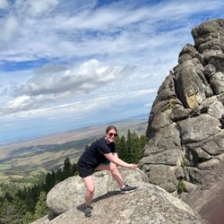
Beautiful trail! We hiked the Lucky Peak Trail via Homestead Trail that is accessible from S Council Spring Rd, off Warm Springs. We hiked it on Monday so the trail wasn't very busy. It took us 45 minutes to reach the Lucky Peak Trail going on the Homestead Trail. The total time going up was approximately 2.5 hours (walking, not running as we saw some people did- good for them!). Going down was about 1.5hrs. The summit is accessible by car from another side but difficult to get to from what I understand. BSU had some research camp set up there to study migratory birds. The views from the top are gorgeous- one can clearly see the top of Bogus Basin and all around Boise. read more


More info about Lucky Peak Trail
74 Arrowrock Rd
Boise, ID 83716
Directions
Hours
Outdoor Amenities


Lucky Peak Trail - hiking - Updated July 2026
Best of Boise
People found Lucky Peak Trail by searching for…
Trending Searches in Boise, ID
Blueberry Picking near Lucky Peak Trail
Cliff Jumping near Lucky Peak Trail
Day Trips near Lucky Peak Trail
Dog Friendly Things To Do near Lucky Peak Trail
Jet Skis near Lucky Peak Trail
Kayak Rental near Lucky Peak Trail
Kids Activities Indoor near Lucky Peak Trail
Lookout Points near Lucky Peak Trail
Off Road Trails near Lucky Peak Trail
Outdoor Activities near Lucky Peak Trail
Picnic Spots near Lucky Peak Trail
Public Pools near Lucky Peak Trail
Public Shower near Lucky Peak Trail
River Swimming near Lucky Peak Trail
Scenic Overlook near Lucky Peak Trail
Sunrise View near Lucky Peak Trail
Surf Shop near Lucky Peak Trail
Swimming Holes near Lucky Peak Trail
Swimming Lakes near Lucky Peak Trail
Things To Do On A Rainy Day near Lucky Peak Trail
U Pick Farms near Lucky Peak Trail
Watch Sunset near Lucky Peak Trail
Browse Articles
Browse Nearby
Browse Brands
Related Searches in Boise, ID
Affordable Kayak Rental Services in Boise, Idaho
Best Dog Hiking Trails Around Boise, Idaho
Best Fishing Locations and Guides in Boise, Idaho
Best Parks for Parties and Events in Boise, Idaho
Best Places for Horseback Riding in Boise, Idaho
Best Sightseeing Experiences Available in Boise, Idaho
Check Out Off Road Trails in Boise, Idaho
Discover Dog Friendly Trails to Explore in Boise, Idaho
Discover Popular Bike Trails in Boise, Idaho
Discover Scenic Mountain Bike Trails Near Boise, Idaho
Discover a Hiking Trail in Boise, Idaho
Discover the Best Night Hike Trails in Boise, Idaho
Dog-Friendly Hikes With Dogs in Boise, Idaho
Enjoy Camping Adventures Around Boise, Idaho
Enjoy Kayaking Adventures in Boise, Idaho
Enjoy Off Leash Dog Hikes in Boise, Idaho
Enjoy Tent Camping Spots Around Boise, Idaho
Enjoy a Beautiful Waterfall Hike in Boise, Idaho
Enjoy the Best Walking Trails in Boise, Idaho
Experience Thrilling White Water Rafting in Boise, Idaho
Explore Beautiful Parks and Green Spaces in Boise, Idaho
Explore Easy Hikes Perfect for All in Boise, Idaho
Explore Fun Activities to Do in Boise, Idaho
Explore Popular Campgrounds Near Boise, Idaho
Explore Popular State Park Destinations in Boise, Idaho
Explore Top Dog Parks in Boise, Idaho Near You
Explore the Best Beach Spots in Boise, Idaho
Explore the Best Swimming Holes Around Boise, Idaho
Family Friendly Hiking With Kids in Boise, Idaho
Find Popular Ziplining Spots Around Boise, Idaho
Find the Best Parks for Picnics in Boise, Idaho
Find the Best Playgrounds to Visit in Boise, Idaho
Hiking Trails With Waterfalls in Boise, Idaho
Off Leash Dog Hiking Trails in Boise, Idaho
Popular Dog Walking Areas in Boise, Idaho
Popular Fishing Spots to Explore in Boise, Idaho
Popular Outdoor Activities to Try in Boise, Idaho
Popular Picnic Spots to Visit in Boise, Idaho
Safe River Swimming Areas in Boise, Idaho
Safe and Fun Parks for Kids in Boise, Idaho
Top Dog Friendly Things to Do in Boise, Idaho
Top Hiking Trails to Explore in Boise, Idaho
Top Playgrounds for Kids to Enjoy in Boise, Idaho
Top Running Trails to Explore in Boise, Idaho
Top Swimming Lakes to Enjoy in Boise, Idaho
Top Swimming Spots and Pools in Boise, Idaho
Top Things to Do With Kids in Boise, Idaho


