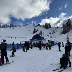
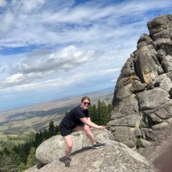
Hull's Gulch Interpretive Trail Photos


You might also consider
More like Hull's Gulch Interpretive Trail
Recommended Reviews - Hull's Gulch Interpretive Trail
Start your review...

4 years ago
Hull's Gulch is one of the many trails behind Camelback park and is one of the main reasons why living in Boise is so amazing. Proximity from downtown to this well-kept trail makes it fun for everyone and a great hike for visitors and locals. This trail starts a bit after the main parking lots and takes a dirt road- an SUV or truck type of car is probably best for this. I would say this is for the intermediate/expert hiker. It's around 7 miles and has some steep hills. So, hiking boots or athletic shoes are a must. It takes around 2.5-3 hours and there are tons of very picturesque places to stop along the creek (or crick, as many Idahoans say). During the summer months here in Boise, it stays light out until 9-10 pm. So I love starting this hike after work hours, without the worry of it getting too dark before getting back. You can see a lot of wildlife- birds, snakes, bugs, etc. There are usually a decent amount of people who walk their dog off-leash here. Hull's Gulch Interpretive Trail vs. the other foothill trails, there tend to be more bikers and fewer hikers. If you're into mountain biking, this would be a great trail for you! read more


11 years ago
Hull's Gulch Interpretive Trail is a roughly 7 mile (there and back) trail that meanders through the Boise foothills. It is uphill, though not steeply so (the elevation increase throughout the duration of the trail is roughly 1000 feet). We came midmorning on a Saturday and it took our party of 3 roughly 3 hours to complete (with some stopping for picture taking). The trail follows alongside a creek and so there are some picturesque spots. At the top of the trail there is a small waterfall (the amount of water depends on the time of year and snowmelt). There are informative and poetic signs (I'm not being sarcastic--truly--they have signs with poetry!) sprinkled throughout the trail and a few lovely (wide and sturdy) foot bridges along the path as well. The road to drive to the trail head isn't paved and though could be traversed by car, there were a couple of ruts that made me glad we drove our CRV and not our Accord, so something to think about if you have a low vehicle. Also, it is quite long, so I wouldn't recommend it for little ones and the path isn't wide enough in some areas for a jogger type stroller (and too rough for a conventional one). But, for older kids with stamina, it's great! Plus, given it's a there and back hike--you could always turn around at any point if it proves to much for some! The proximity to downtown is great and at the top where the waterfall is, there is also a gorgeous vantage, through a valley between the foothills, of the downtown skyline. Fresh air, gurgling creek, and nature poetry-- Get to it! read more


8 years ago
10 years ago
More info about Hull's Gulch Interpretive Trail
3001 N Sunset Peak Rd
Boise, ID 83702
Directions
Visit Website
http://www.ridgetorivers.org
Hours
Outdoor Amenities
Ask the Community - Hull's Gulch Interpretive Trail
You might also consider


Hull's Gulch Interpretive Trail - hiking - Updated July 2026
Best of Boise
People found Hull's Gulch Interpretive Trail by searching for…
Trending Searches in Boise, ID
Boat Rental near Hull's Gulch Interpretive Trail
Cliff Jumping near Hull's Gulch Interpretive Trail
Day Trips near Hull's Gulch Interpretive Trail
Dog Friendly Trails near Hull's Gulch Interpretive Trail
Fireworks near Hull's Gulch Interpretive Trail
Jet Ski Rental near Hull's Gulch Interpretive Trail
Kayak Rental near Hull's Gulch Interpretive Trail
Lakes & Ponds near Hull's Gulch Interpretive Trail
Lookout Points near Hull's Gulch Interpretive Trail
Mountain Biking near Hull's Gulch Interpretive Trail
Off Road Trails near Hull's Gulch Interpretive Trail
Outdoor Activities near Hull's Gulch Interpretive Trail
Parks near Hull's Gulch Interpretive Trail
Parks For Picnics near Hull's Gulch Interpretive Trail
Picnic Spots near Hull's Gulch Interpretive Trail
Public Pools near Hull's Gulch Interpretive Trail
Public Shower near Hull's Gulch Interpretive Trail
River Swimming near Hull's Gulch Interpretive Trail
Scenic Overlook near Hull's Gulch Interpretive Trail
Soccer Store near Hull's Gulch Interpretive Trail
Splash Pad near Hull's Gulch Interpretive Trail
Star Gazing near Hull's Gulch Interpretive Trail
Strawberry Picking near Hull's Gulch Interpretive Trail
Sunrise View near Hull's Gulch Interpretive Trail
Swimming Holes near Hull's Gulch Interpretive Trail
Swimming Lakes near Hull's Gulch Interpretive Trail
U Pick Farms near Hull's Gulch Interpretive Trail
Watch Sunset near Hull's Gulch Interpretive Trail
Browse Articles
Browse Nearby
BEST of Boise, Idaho Coffee near Hull's Gulch Interpretive Trail
BEST of Boise, Idaho Restaurants near Hull's Gulch Interpretive Trail
BEST of Boise, Idaho Things to Do near Hull's Gulch Interpretive Trail
BEST of Boise, Idaho Parks near Hull's Gulch Interpretive Trail
BEST of Boise, Idaho Breakfast near Hull's Gulch Interpretive Trail
BEST of Boise, Idaho Shopping near Hull's Gulch Interpretive Trail
Browse Brands
Related Searches in Boise, ID
Affordable Bike Repair Services in Boise, Idaho
Affordable Bike Tune Up Services in Boise, Idaho
Best Dirt Bike Riding Spots in Boise, Idaho
Best Dog Hiking Trails Around Boise, Idaho
Best Electric Bike Rental Services in Boise, Idaho
Best Fishing Locations and Guides in Boise, Idaho
Best Nature Trails for Hiking in Boise, Idaho
Best Places for Horseback Riding in Boise, Idaho
Best Places for Stunning Views in Boise, Idaho
Best Used Bikes for Sale Near Boise, Idaho
Check Out Off Road Trails in Boise, Idaho
Discover Dog Friendly Trails to Explore in Boise, Idaho
Discover Popular Bike Tours in Boise, Idaho
Discover Popular Bike Trails in Boise, Idaho
Discover Scenic Bike Paths in Boise, Idaho
Discover Scenic Waterfall Spots in Boise, Idaho
Discover the Best Night Hike Trails in Boise, Idaho
Discover the Best Running Track in Boise, Idaho
Dog-Friendly Hikes With Dogs in Boise, Idaho
Enjoy Camping Adventures Around Boise, Idaho
Enjoy Exciting Mountain Biking Adventures in Boise, Idaho
Enjoy Hiking Adventures in Boise, Idaho
Enjoy Kayaking Adventures in Boise, Idaho
Enjoy Tent Camping Spots Around Boise, Idaho
Enjoy the Best Tubing Experiences in Boise, Idaho
Enjoy the Best Walking Trails in Boise, Idaho
Experience Thrilling White Water Rafting in Boise, Idaho
Explore Beautiful Parks and Green Spaces in Boise, Idaho
Explore Bike Rentals Throughout Boise, Idaho
Explore Easy Hikes Perfect for All in Boise, Idaho
Explore Electric Bikes Available in Boise, Idaho
Explore Fun Activities to Do in Boise, Idaho
Explore Popular Campgrounds Near Boise, Idaho
Explore Popular RV Parks Around Boise, Idaho
Explore Popular Scenic Overlook Points in Boise, Idaho
Explore Popular View Points Around Boise, Idaho
Explore Scenic Lakes to Visit in Boise, Idaho
Explore Secret Spots Worth Visiting in Boise, Idaho
Explore Top Dog Parks in Boise, Idaho Near You
Explore the Best Beach Spots in Boise, Idaho
Explore the Best Boating Spots in Boise, Idaho
Explore the Best Swimming Holes Around Boise, Idaho
Explore the Best Trail Options in Boise, Idaho
Family Friendly Hiking With Kids in Boise, Idaho
Find Beautiful Views in Boise, Idaho
Find Parks and Recreation Activities in Boise, Idaho
Find Top Mountain Bike Rental Options in Boise, Idaho
Find Top-Rated Waterfalls in Boise, Idaho Now