Cancel

    Open app

    Search

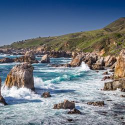
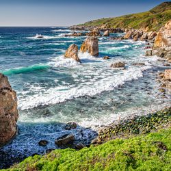
    Hurricane Point Vista Point

    4.0 (1 review)

    Hurricane Point Vista Point Photos

    You might also consider

    More like Hurricane Point Vista Point

    Recommended Reviews - Hurricane Point Vista Point

    Your trust is our priority, so businesses can't pay to alter or remove their reviews. Learn more about reviews.
    Yelp app icon
    Browse more easily on the app
    Review Feed Illustration

    2 months ago

    Helpful 4
    Thanks 0
    Love this 4
    Oh no 0

    You might also consider

    Verify this business for free

    People searched for Hiking 840 times last month within 15 miles of this business.

    Verify this business

    Pfeiffer Big Sur State Park

    Pfeiffer Big Sur State Park

    4.4(412 reviews)
    9.8 mi

    One of California's bigger and more popular state parks, rightfully so. Not as touristy as Yosemite…read morebut this is on a bigger scale than most other Cali State Parks. I ventured here once before in my early 20s back in my school boy days and felt it was time to see it again with decades worth of a wiser perspective. And I was rewarded in spades. This park is about 30 miles or so south of Carmel on Highway 1, which in my opinion is one of the most glorious stretch of road to drive. Even though it is only 30 miles or so, it still takes almost an hour to travel from Carmel. The road winds around through many curves and undulations so you simply cannot drive freeway speeds here, nor should you want to. Enjoy the views, roll down the window and take in that coastal air, play your favorite tunes and just soak in the moment. Once at the park there are campsites, as well as cabins and even a full service lodge for those that don't want to rough it at all. You are now in mountainous terrain so lots of trees, a big creek and lots of hiking trails. I did a 3 day camp stay and loved it. They keep the park clean, maintain the restrooms and patrol the grounds frequently. Even though they have almost 200 campsites available, they spread it out nice so not everyone is in the same area. I could sometimes hear my neighbors but they were never in my direct view. That is a big plus for me when rating camp sites. People can also just get a day pass and enjoy the trails and creek without having to stay. My camping pass also got me to see a couple other California State Parks nearby on the same trip, so well worth the price of admission. Very lively with animal life which are unfortunately very used to humans. Squirrels and blue jays will not be shy to investigate what they can scavenge so do not leave any food unattended. Upon setting up camp I had a ziplock bag of trail mix on the picnic bench along with the rest of my gear. While I was setting up the tent with me somewhat close by, a stellar jay swooped in and pecked at the bag. It didn't take it but ripped a good hole in the bag. So just a big fyi to keep your food on guard/lock. The big creek runs through many of the sites. Some parts are mellow whilst other parts the water rushes pretty good. I was about 50 yards from the creek so I couldn't see it but I could hear it rolling through the valley. It was very relaxing to hear the cool water rolling downstream, whether at night or waking up at sunrise. And a myriad of birds will contribute with their morning songs, which makes for the best alarm clock. TRUST A little too big for my preference but still beautiful enough that I can revisit every other year. And just outside the park are the California coastline with Highway 1 carving through it. Some of the most breathtaking views Cali has to offer. Pfeiffer thanks for the reacquaintance and the confirmation that you are still indeed one of California's top gems.

    Great Stop in Big Sur -- Beautiful Trails, Swimming Spots, & Scenic Views!…read moreThe drive along CA-1 to get here is reason enough to visit--absolutely stunning coastal views the entire way! Pfeiffer Big Sur State Park itself has a lot to offer. There are tons of trails to explore, though keep in mind that there isn't a whole lot of signage. The good news is that if you start from a central area, most paths naturally end up bringing you around in a loop at some point, so it's pretty easy to find your way back. A few takeaways from our visit: Water & Swimming: There are plenty of great spots along the rocks to dip in and swim, which is perfect on a warm day. Accommodations: Great setup whether you like roughing it or prefer comfort. Plenty of campsite options, plus the Lodge if you'd rather stay in a room. Pfeiffer Falls Trail: Honestly, this hike was pretty underwhelming. The falls were down to just a trickle when we went, but at least it was a decent walk to log some good steps! Overall, it's a lovely park with plenty to do. Just keep your expectations low for the waterfall if it hasn't rained recently, and enjoy the river, trees, and incredible coastal drive!

    Photos
    Pfeiffer Big Sur State Park - Family Camping September 12-14, 2025

    Family Camping September 12-14, 2025

    Pfeiffer Big Sur State Park - Family Camping September 12-14, 2025

    Family Camping September 12-14, 2025

    Pfeiffer Big Sur State Park - Family Camping September 12-14, 2025  THE JOY LUCK CLUB

    See all

    Family Camping September 12-14, 2025 THE JOY LUCK CLUB

    Point Lobos State Natural Reserve - Point Lobos State Natural Reserve

    Point Lobos State Natural Reserve

    4.9(1.1k reviews)
    13.7 mi

    One of our favorite places in the world and a place I'm certainly glad is in our proverbial…read more"backyard." Ok, so it's like 3-4 hours away, but wow, really pretty here. The natural landscape is just phenomenal. God's fingerprints all over this place. Pros: - not a bad drive down here from the touristy parts of Monterey and Seaside where we usually reside for the weekend - a bit windy, but a truly lovely and incredibly scenic twisty, turn-y road that keeps me on my toes - once you're here it's just breathtaking. - trail walk/stroll is pretty easy, nothing real rigorous as long as you're still in decent health. - more challenging "hikes" available for those who are looking for more, I've not stepped up to that (huffing and puffing doesn't sound fun), so I'm not sure where those trails are, but easy to find online. - so much fauna and flora to look at. - the coast here is just so rugged and ridiculously jawpdropping. - kids love this place too. There's a ranger station/little nature stop/house of sorts, not quite a "museum", but it's got the history, the nature, the strange facts you'd not otherwise know about unless you stopped by. - very kind and dedicated volunteers that will tell you all you want to know about Point Lobos - the nature, the creatures of sky, sea, and land, the past, present and future, whatever you want. - Plus they often have binoculars they will let you use to look out at the coast for seals and sealions and otters and more galore, oh my! Cons: - parking is the suck here. It's not too expensive to get in, but most people seem to park along the main road/highway that leads to Point Lobos which is kind of dangerous and a good trek to get to the State Reserve, so you've got your exercise before you even start exploring. That could be a plus? All in all, a magnificent and marvelous natural state reserve, well preserved, more than maintained, must see to appreciate.

    Views, trails, tide pools, ocean waves, shells, and lots of poison oak!…read more Parking is limited and we arrived later than we wanted. We were able to park on the side of the road like a lot of others, but other than that it's a worthwhile stop. Gorgeous state park, easy walking trails, there was even a park volunteer at the trailhead with maps answering questions and giving good advice (both when we got there and a different volunteer posted there when we left!)

    Photos
    Point Lobos State Natural Reserve - Point Lobos State Natural Reserve

    Point Lobos State Natural Reserve

    Point Lobos State Natural Reserve - Point Lobos State Natural Reserve

    Point Lobos State Natural Reserve

    Point Lobos State Natural Reserve - Point Lobos State Natural Reserve

    See all

    Point Lobos State Natural Reserve

    Sykes Hot Springs - Hot Spring

    Sykes Hot Springs

    5.0(1 review)
    8.5 mi

    At the end of Summer, my friend suggested a backpacking trip to Skyes Hot Springs - 20 miles out…read moreand back with 5380 ft elevation gain. (more challenging than Bright Angel Trail to bottom of Grand Canyon) Arrived at Big Sur Station at 9am. Paid $20 overnight parking fees, used toilet, snapped group photo then began hiking at 9:30. Half hour lunch break at 11:45 Terrace Creek Camp, and finally arrived to Skyes Camp by 3pm. In route to camp, we crossed 7 creeks each way. I was a bit anxious of slipping cuz I had less confidence than I used to. I think it would have been easier and more fun if I had power thr them with momentum. No mosquitoes sightings in mid Nov. Lots of poison oaks along the trail but not overgrown; I wore shorts with no problem, just clouds of dust from our own stompings. Our friend impaled a bunch of splinters from a burr plant. I visited many of our camp neighbors in search of a tweezer; fortunately, the last of the spikes expelled itself in the hot spring waters. Hiking downriver in search of the hot springs was not easy. When located at 5pm, the large tub was occupied, we tested all of the other 3 smaller tubs then settled in at the one on the river level, it was a tight squeeze for 4 people but we sardined to fit. Our inlet source was a water fall from the tub above which some of us used as a shower over our heads. It was a relaxing time with beautiful surroundings and good company. The water was lukewarm with lots of earthy debris, so it does not compare to the numerous fancy Onsens I have visited in Japan. But things are more valuable when it is earned by hard work - the miles, inclines, sun, sweat, dust, creek crossings, obstacles, and heavy pack; great feelings of accomplishment, and endorphins too. It was wise of us to leave the springs at 6pm since sunsets at 6:30. Due to the heavy forest, we were not able to sight the supermoon nor the comet in the night sky. Sleeping with the ripple sounds of the Big Sur River close by was soothing. Our return trip started at 9:30 and ended at the parking lot by 1pm, 4.5 hours was very fast pace. We were eager to celebrate our trip with a lunch in a sit down restaurant, Big Sur Roadhouse. Another great adventure with friends. Treasure memories.

    Photos
    Sykes Hot Springs - Creek crossing

    Creek crossing

    Sykes Hot Springs - Camp

    Camp

    Sykes Hot Springs - Big Sur River

    See all

    Big Sur River

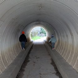
    McWay Falls - Tunnel that takes you underneath the highway to McWay Falls

    McWay Falls

    4.6(192 reviews)
    18.8 mi

    McWay Falls is one of the most iconic and photographed landmarks along the Big Sur coast, famous…read morefor its ethereal, postcard-perfect scenery. Located within Julia Pfeiffer Burns State Park, it is one of the few waterfalls in California that empties directly into the ocean. Unique Tide Falls: The stunning 80-foot waterfall flows year-round from McWay Creek, dropping over a jagged granite cliff directly onto the pristine sands of a picturesque, turquoise cove, or into the waves at high tide. Effortless Viewpoint Trail: The falls are reached via an exceptionally short and accessible 0.5-mile round-trip trail, making it a quick and highly rewarding stop right off Highway 1. This trail was unfortunately closed during my visit, but we could still see the falls

    Located within the Julia Pfeffer Burns State Park, the McWays Falls (named after an early settler…read moreof Big Sur) Vista Point was the fourteenth (09:53) and furthest south stop of our southbound scenic car tour through Big Sur. The trail down to get a close up view of the falls continues to be closed (there is no estimated reopen date). However there is a vista point off the highway that you can walk to (need to hop over a railing) from a safer parking spot, that provides a clear aerial view of the waterfall (one of the few in the world that dumps directly into the ocean...learned that those are called a tidefalls [another one in California is Alamere Falls near SF]).

    Photos
    McWay Falls - Parking is $10 at the trailhead across the highway

    Parking is $10 at the trailhead across the highway

    McWay Falls
    McWay Falls

    See all

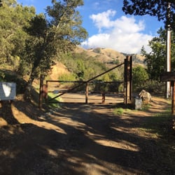
    Coast Ridge Road Hike - Don't be intimidated by the gate, pedestrians can walk around, it's a govt fire road.

    Coast Ridge Road Hike

    5.0(3 reviews)
    12.1 mi

    Stayed at the Alila Ventana Big Sur and this hike was one of the activities. We started off from…read morethe property onto a dirt road like path up the hills passing a few homes along the way. The first part of the hike is nice and shady with redwoods surrounding you. Eventually, you go beyond the redwoods where it's a little hotter but you get a beautiful view of the coast. This hike is relatively easy with a slight incline. Definitely recommend. Will need to go back next time to do the full hike.

    I'm a happily sedentary person, but Big Sur is so uniquely, astonishingly beautiful, I think it…read morewould've offended even my conscience to spend three days there without at least one good hike. We asked someone at our hotel to recommend an easy hike and he suggested Coast Ridge Road. It was a great recommendation, one I'll pass onto anyone else in pitiable physical condition who would nonetheless like to get outside, walk uphill, and drink in some views. I did make the mistake of underestimating either the hike's difficulty or my own decrepitude. It would've been fine if I'd just taken a bottle of water, but I didn't want to carry it and quickly regretted my decision. We walked from the Post Ranch Inn to the Ventana, where the hike begins, and I was already kind of tired by the time we reached the bottom of the trail. Going up a noticeable incline for several more minutes was just kind of a challenge, and I complained heartily and made a few stops before I got accustomed to the elevated activity level. Once I did, though, I really enjoyed the hike. The trail was, objectively, not hard, and it was lush and pretty the whole way through. We walked past tons of trees, which also afforded us cover from the son, and even a lovely waterfall. I don't know how far the trail went, but people were going up there with overnight camping gear. We stopped walking shortly after we lost tree cover and that felt like a good end point. We got to stand on the mountain and admire the endless sky and Big Sur laid out below us, the drama of all that coast and sparkling water. This was a lot of exercise for a lazy person, but it was definitely worthwhile. It was a great way to soak up the beauty of Big Sur.

    Photos
    Coast Ridge Road Hike - The trail head

    The trail head

    Coast Ridge Road Hike
    Coast Ridge Road Hike

    See all

    Garrapata State Park - Gorgeous mix of rocks, water, cliffs.

    Garrapata State Park

    4.7(138 reviews)
    5.8 mi

    Had been meaning to check out this park for a long time, but usually got pulled away to Point…read moreLobos. A few weekends ago we were down in Carmel for the long weekend with some friends and got a later start to the morning. Anticipating that Point Lobos would be super crowded, I picked out a few hikes at Garrapata State Park, just a few miles south. We parked near the Soberanes Canyon trailhead and hiked the Soberanes Point trail, first going north, then doubling back to take the loop around (and up) Whale Peak. I was worried about leading a group of 20 astray (with kids who had different tolerance levels for hikes), but my fears were immediately put to ease by the gorgeous oceanside views, full of greenery, wildflowers, and the powerful ocean waves hitting the rocks below. We even spotted a sea otter in the surf. Got some nice photos and everyone made it back. At this point our group split up. A few of us went down to Calla Lily Valley. The lilies were beautiful (though I heard they were cut down recently), but there were a ton of people, and the trail was quite muddy. The beach nearby was really nice - the kids spent some time playing there. Parking immediately near the valley is tight but there is parking at this beach and trails to both the beach and the valley from there. Will definitely be back, love that there's an alternative to Point Lobos so close by.

    This was the last stop as part of my Big Sur drive of the day. There are several state parks and…read morebeaches along CA 1 (from Carmel to Ragged Point) and I did not stop at any of them, so this somewhat made up for it. The great thing about this is you can park for free, simply off the 1. There are public restrooms at the entrance, and you can take a walkway to the beach. The beach was awesome, though I enjoyed it in the late afternoon as the sun was about to set. Swimming or water activities were not recommended due to the waves there, but it was great just watching the ocean go back and forth. The beach was very spacious. That's about all I did when I was there for about a half hour.

    Photos
    Garrapata State Park
    Garrapata State Park
    Garrapata State Park

    See all

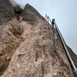
    High Peaks Trail - Going up the railing

    High Peaks Trail

    4.8(6 reviews)
    43.1 mi

    Absolutely amazing trail that I've done twice in 100° weather. The views are great, and the trail…read moreis well groomed. But, oh my god, it is straight uphill. With extreme heat I literally thought I was going to die. Do it in the winter.

    one of the many, many wonderful trails at pinnacles nat'l park. from the apex, you can see almost…read morethe entire park on a clear day, the beautiful balconies, ridges, forestry and wildlife that belongs to pinnacles. you can access this trail from: +west side: chaparral trailhead parking lot, 1.8mi hike to western trailhead of high peaks +east side: old pinnacles trailhead, 1.3mi hike to eastern trailhead of high peaks +east/south side: bear gulch parking lot, 0.5mi to southern trailhead of high peaks we chose to start from the east side, hike the old pinnacles trail to balconies, break at the chaparral trailhead for lunch, then return east via the high peaks trail. this was a TOUGH climb up, especially since it was only a little after noon, the sun was strong, and we'd already hiked 4+ miles from the east. many breaks were taken, call it "photo pace" hiking, and after some time, we finally reached the western side of the high peaks trail...more climbing awaited us, as did awesome views of this treasured park. there were many switchbacks, each turn offering a different view, so of course, i had to pause each time to snap a pic! there are no restrooms, water fountains, or other amenities here. due to the time of day we were here, there also wasn't much shade. definitely bring plenty of water, wear a hat, sunscreen, and light clothing if coming here during summer/autumn months.

    Photos
    High Peaks Trail - Top of High Peaks

    Top of High Peaks

    High Peaks Trail - Instagram: @telephonesmoothie

    Instagram: @telephonesmoothie

    High Peaks Trail - Instagram: @telephonesmoothie

    See all

    Instagram: @telephonesmoothie

    Limekiln State Park

    Limekiln State Park

    4.4(145 reviews)
    32.2 mi

    This place is terrible, stay away (so I will have less issues trying to book for next time)…read more Joking aside, this place is gorgeous. On the RV side they have two bathrooms and a shower, and it's a short walk to the ocean where a natural stream creates a lagoon on the sand before pouring out into the ocean. I would come here every year if I could get a spot!

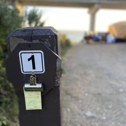
    I love camping here. It's been years and coming back recently was as magical as always…read more I've only camped in the ocean sites due to having a VW camper van. The other sites are tent camping only. I must say, the ocean sites are very snug and limited in space. If you're looking for a spacious camping site with privacy, you're not going to get here. And not all of the sites are the same size so if you have a trailer and a truck, you're gonna have to really be choosy at which is a site to book. This is right underneath the underpass so you're going to hear road noise. But to be honest, a lot of the sound was drowned out by the nearby stream and the ocean. It was walking distance to what felt like a private beach. Since the last time I've been here it looks like they made a mini dam with the running stream creating a mini swimming cove with crystal clear water. There are no electrical hook ups but the bathroom has running water and hot showers available. The bathrooms can get freaking disgusting from the day use visitors, but they do clean it every morning. And let's not forget the beautiful drive to get here. Magical.

    Photos
    Limekiln State Park
    Limekiln State Park
    Limekiln State Park - Flocks of birds and otters hang out just offshore

    See all

    Flocks of birds and otters hang out just offshore

    Hurricane Point Vista Point - hiking - Updated August 2026

    Loading...
    Loading...
    Loading...