Buzzard's Roost Trail Photos


You might also consider
More like Buzzard's Roost Trail
Recommended Reviews - Buzzard's Roost Trail
Start your review...

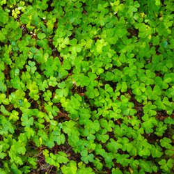
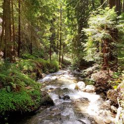
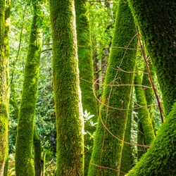
The hike itself says it's 1.8 miles, but truly feels longer. You have to pay $5 per person to enter the park, which isn't too bad. You can access the redwood decks and they're GORGEOUS. This hike feels longer because it's entirely uphill and very steep in some parts. It's a super fresh trail surrounded by lush greenery, trees, different Big Sur animal life and of course the Big Sur river. This being said it's beginner friendly. Take lots of stops, no one rushes you. Keep trudging, drink water. If you regularly do some stairs at the gym, you'll brush through pretty easily. Very worth it at the end (p.s. my 1 year old corgi made it & he has super short legs). read more


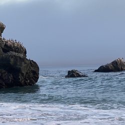
Trail access is from the Pfeiffer State Park campground (day use $10 for non-campers). This hike is around 4 miles in total and I'd classify it as moderate. Probably difficult for those that have never hiked before. Your reward will be seeing big views of the valley and of the ocean in the distance. TIPS - At the loop sign I'd recommend going right. - This hikes start under deep tree cover and is cool. Close to the top there is no shade and you're under direct sunlight. Dress appropriately. - There are a few downed trees along the path that you'll have to walk through. read more


More info about Buzzard's Roost Trail
Big Sur, CA 93920
Directions
Hours
Outdoor Amenities


Buzzard's Roost Trail - hiking - Updated June 2026
Best of Big Sur
People found Buzzard's Roost Trail by searching for…
Redwood Trees in Big Sur, California
Things to Do in Big Sur, California
National Parks in Big Sur, California
Hiking Trails in Big Sur, California
River Access in Big Sur, California
Off Road Trails in Big Sur, California
State Park in Big Sur, California
Easy Hikes in Big Sur, California
Waterfalls in Big Sur, California
Scenic View in Big Sur, California
Tent Camping in Big Sur, California
Toddler in Big Sur, California
Walking Trails in Big Sur, California
Browse Nearby
BEST of Big Sur, California Parks near Buzzard's Roost Trail
BEST of Big Sur, California Restaurants near Buzzard's Roost Trail
BEST of Big Sur, California Things to Do near Buzzard's Roost Trail
BEST of Big Sur, California Coffee near Buzzard's Roost Trail
BEST of Big Sur, California Beaches near Buzzard's Roost Trail
BEST of Big Sur, California Breakfast near Buzzard's Roost Trail
BEST of Big Sur, California Campgrounds near Buzzard's Roost Trail