Garrapata State Park Photos


More like Garrapata State Park
Recommended Reviews - Garrapata State Park
Start your review...


Reviews With Photos


My husband and I stopped here for the first time before hitting up Big Sur and I'm glad that we did. Parking is off the side of the road and there's easy trails to explore and just enjoy the scenic highway 1 coastline. Awesome place to take in the ocean air/breeze, great spot to take pictures, and just enjoy the ocean views!


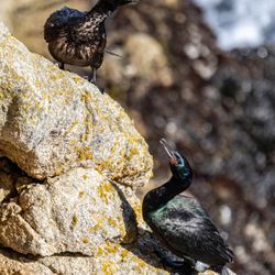
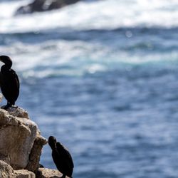
Gorgeous coastal views!!! While there isn't much of a trail it is worth getting out to take a look. For those who are a little more adventurous you can actually hike down to the coastal section, however, you will want some decent shoes with grip. Great little bluff to do some bird-watching/photography as the birds fly below you with the sea acting as a backdrop :)


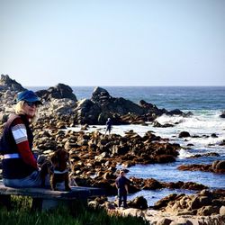
First time in Carmel with the wife and we decided to walk the area in the noon time . A nice stroll from the main downtown area. A nice trail to walk around. And views you can't miss. Definitely a spot worth hitting if you want to make your stay worth it. Even the dog got to enjoy some views and the walk!


This review is for Soberanes Point & Whale Peak which was a ~1.3 miles round trip that took ~1 hours to complete. This was another popular and crowded trail within 10 minute drive south of Point Lobos State Natural Preserve! Trail was mostly flat with a steady incline towards the peak. A decent amount of people were going off-trail towards the flowers and ocean. Furthermore, it was excessively windy at the peak. Stunning views of the coastline and wildflowers! Free parking on the side of the streets on Highway 1. There were 2 additional separate entrances to the trail just a little further south if there are no parking available. Restrooms available across the trailhead and highway. Short video of the hike for those interested! https://youtu.be/hVHdc29lrNw
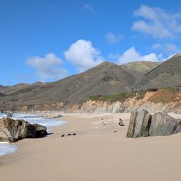

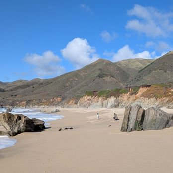
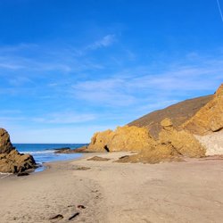
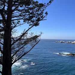
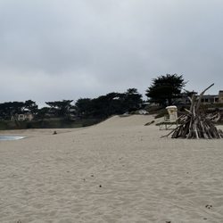
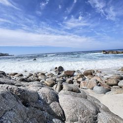
Review is for the beach, wanted a break to stretch our legs and pulled over just because we saw some other cars here. We didn't even know the name until we parked and couldn't see the ocean and were surprised to find a secluded and interesting beach to explore. It's located about 10 miles from Carmel and very close to Point Lobos, another favorite of ours. We did lose reception during our stop here so I would download a. Offline map or go paper if you are going to be proceeding further south toward Big Sur. There are a couple paths to get down to the beach. The left side stairs are currently under repair and roped off though we saw some people using them. The bottom of these stairs are missing and there is a section with planks missing so use at your own risk. The other side is safer but a longer loop around if you want to see the rocky enclaves. The ocean is a beautiful color here and I love nice rocks combined with the sea, this is a perfect place to get a glimpse of these kinds of features. We came around 3 pm on a Friday and it was not very crowded which we loved. Normally to get this small amount of people we go to beaches early in the morning.


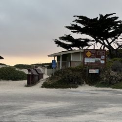
If you want to experience both the mountain trail and ocean trail then come to this state park. It has parking on the side of the road but be extra careful with crossing. Cars are very speedy here and make dangerous maneuvers trying to park. This park has 3 big porta potty but no running water so bring hand sanitizers. I quite enjoyed walking this trail especially the ocean side.
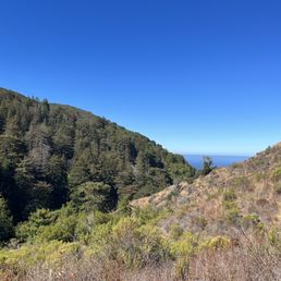

Second time doing this strenious hike ! Oh lala! Its tough! But worth all the effort if you can make it to the top and possibly loop around ! The hike is a million $ view and priceless! If you think you can do it ??? Give it a try ! Its amazing ! I love it ! We love it


Yellow fields, super bloom and beautiful weather and beautiful coastal hike Paved and walkable for a one year old! Lots of people Thank you!


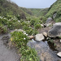
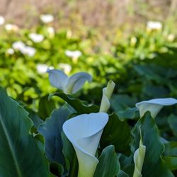
Went back again this year with family to see the calla lilies in bloom. The entire road was packed with cars and to my utter shock, I saw some people walking away with some fresh cut calla lilies!! We made our way down to the valley and it was packed with people. And to my disbelief, the number of lilies were less than 1/3rd of what I saw at around the same time last year. Most of the plants were trampled upon very badly as well. I was disappointed how social media could reduce such a beautiful place to this state, I doubt we will even have these many flowers next year.


This beach and view is gorgeous and there's a small hidden valley of lilies and omg breathtaking i'm at a loss for words. This was our fav stop along our coastal scenic drive


This review is for Soberanes Point Trail. I visited during a sunny summer weekday. The hike itself is about one and half miles of unpaved trail and just under three hundred feet in altitude gain. It's an easy trail for most people. There's zero canopy on entire trail. It is flat along the coast but a bit of an uphill with many steps and loose gravels towards the peak. At the top, Whale Peak, you are rewarded with breathtaking views of the coast...and super strong WINDS, like 50mph! I could barely stand and not straight... it's constant wind. There's a peaceful looking bench but you aren't likely to sit there, since there's no protection from winds. Loved the views and enjoyed small flowers and shrubbery along the trail. I do NOT recommend the hike to the peak for anyone with heart condition and kids as it's NOT safe with steep cliffs without barriers and STRONG WINDS. The trail along the coast though is okay for kids. Recommend sun screen, sunglasses, jacket, long pants, water and a good pair of hikers or trail runners. Clip your cap and tie down your hat. If not, you'll likely lose it to the winds. There's no markers and no service of any kind.


The Soberanes Point / Whales Peak Trail was one of the most beautiful hikes we did in the Big Sur area, and I highly highly recommend to anyone who is passing by Garrapata State Park along Highway 1! Parking is all along the side of the road as there's no actual parking lot for the Soberanes Point Trail in particular (not sure about other Garrapata trails), but the pro is that you don't have to pay any entrance fee unlike the other state parks in the area. Do make sure to take valuables with you though. This is a relatively easy hike that takes you right up along the coastline where you're faced with the immense beauty of the water meeting the rocks and cliffs. You are greeted with amazing views pretty much all throughout this hike (no shortage of photo ops for sure!), and we also did the additional trek up to Whales Peak which offers panoramic views up and down the coast. There weren't too many people around when we visited on a Friday afternoon, so it seriously felt like we were in some sort of paradise. Please take even 30 minutes to an hour to visit this spot as it seems like a hidden gem along Hwy 1; you won't be disappointed especially on a beautiful clear day!


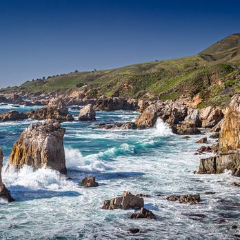
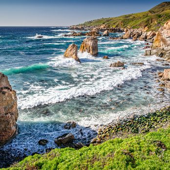
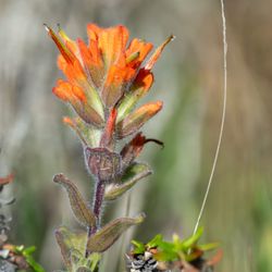
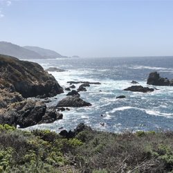
Something about being on the coast side just makes me all warm and fuzzy inside. It gives me this tingly feeling that I long for all of the time. Staring out into those stunning bluffs will leave you downright speechless, and Garrapata State Park has got me at a total loss for words. I've been dying to hike here for as long as I can remember. I've driven past this park several times on my way out to Big Sur, but never had a chance to actually stop through to explore. Welp, I finally got that chance. And let me tell you; it was everything that I could have imagined and more. Better than I imagined it to be. You just can't compete with those views... you really can't. You look out and just go numb. It's the craziest feeling. This park is located right off highway 1. You can literally just pull off to the side of the road, walk down to the many different trailhead entrances, and hike down to the bluffs. The. Views. Are. Insane. INSANE! Like, is this even real?! The bluest waters with white waves just crashing up against the coastline. Tide pools galore. Like what?! I can just live here. Seriously. It's so damn picturesque. The Bluff Trail is the most popular and also the most stunning as it basically follows the coastline. We love a good coastal trail! There are plenty of spots to stop and take in the views. It's family friendly and pretty flat minus a few gentle inclines on the way back up to the road. There's also the Soberanes Canyon trail that will take you up the mountain top with a gorgeous coastal view. I did the first 1.5 miles of the Soberanes Trail, but the rest of the trail was closed due to dangerous conditions. Saw a few people still going up there at their own risk. Looked extremely gnarly and narrow, so I didn't want to take my chances. But the short 3 mile stretch that I was able to do was really enjoyable. It starts off exposed and gently inclines through dry hills. And then all of a sudden, you end up in the most random Redwood Grove! I'm a Redwood junky, so this was such a lovely surprise. There's tons of beautiful plants throughout the trail ranging from wildflowers to cactus. It always amazes me how certain plants can grow even in the most driest conditions. It gets extremely hot during the afternoons on this trail. If you're planning on hiking the Soberanes trail, lather up on the sunscreen and bring a lot of water (especially if you plan to hike the entire loop). There are also said for be lots of ticks on this trail, but thankfully I didn't find any on myself. Might be best to wear long pants and/or socks, and to layer your shirts/sweaters for extra protection. Parking will be tough if you don't get here early in the morning. There's no real parking lot, and people start parking along the highway early. You could end up parking a mile out if you come in the afternoon. But, don't let this discourage you. With some easy planning, you'll be able to fully enjoy the beauty of Garrapata State Park. And trust; there's lots and lots of beauty to go around here.


Amazing scenic hike with stunning coastal ocean views. The trail offers a beautiful walk along the ocean, with an awesome panoramic view from the top of the mountain. The hike is enjoyable and manageable, even on the way to the summit. Whenever I'm passing through Carmel on Highway 1, I love stopping here for a hike. read more

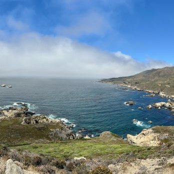


One of the most spectacular spots on the California coast, and my often backup plan as Point Lobos has become way too popular and parking fills up extremely early. One of the great things about Garrapata is that you can make your walk/hike as short or as long as you want. There are trails along the coast and inland, with the inland trails being much more strenuous than the coastal side. No matter which side you go, the views are spectacular. There's parking along the highway with a big section on the inland side right at the main entrance, and some further back on the coastal side. Luckily there are a handful of entry spots, so even if you don't get parking right up front, you'll likely be able to catch a coastal trail. Two things to note about the inland side, it's not too uncommon to see rattlesnakes if you're there in the warmer months, especially if it's a sunny day. And, the rock/dirt can be a little loose/slippery, so I have seen people slip and fall. I always come with a windbreaker and binoculars because it gets breezy as you get closer to the water, and you can often spot marine life like otters and seals! read more
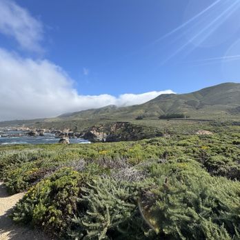


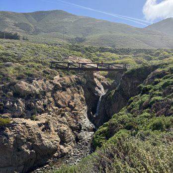
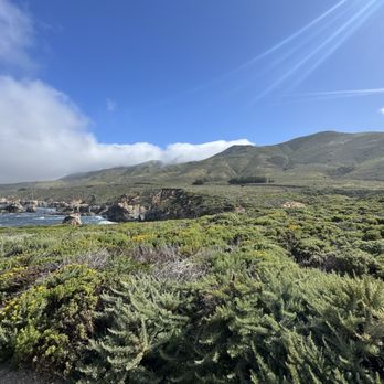

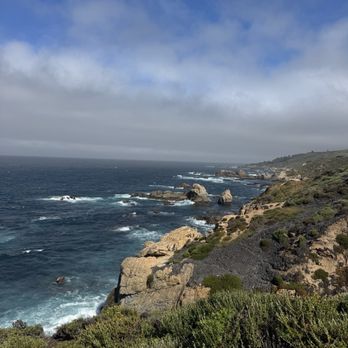


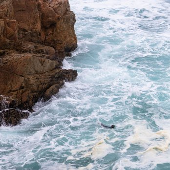
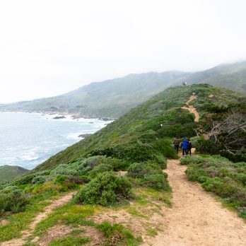
Had been meaning to check out this park for a long time, but usually got pulled away to Point Lobos. A few weekends ago we were down in Carmel for the long weekend with some friends and got a later start to the morning. Anticipating that Point Lobos would be super crowded, I picked out a few hikes at Garrapata State Park, just a few miles south. We parked near the Soberanes Canyon trailhead and hiked the Soberanes Point trail, first going north, then doubling back to take the loop around (and up) Whale Peak. I was worried about leading a group of 20 astray (with kids who had different tolerance levels for hikes), but my fears were immediately put to ease by the gorgeous oceanside views, full of greenery, wildflowers, and the powerful ocean waves hitting the rocks below. We even spotted a sea otter in the surf. Got some nice photos and everyone made it back. At this point our group split up. A few of us went down to Calla Lily Valley. The lilies were beautiful (though I heard they were cut down recently), but there were a ton of people, and the trail was quite muddy. The beach nearby was really nice - the kids spent some time playing there. Parking immediately near the valley is tight but there is parking at this beach and trails to both the beach and the valley from there. Will definitely be back, love that there's an alternative to Point Lobos so close by. read more






5 months ago
My husband and I stopped here for the first time before hitting up Big Sur and I'm glad that we did. Parking is off the side of the road and there's easy trails to explore and just enjoy the scenic highway 1 coastline. Awesome place to take in the ocean air/breeze, great spot to take pictures, and just enjoy the ocean views! read more


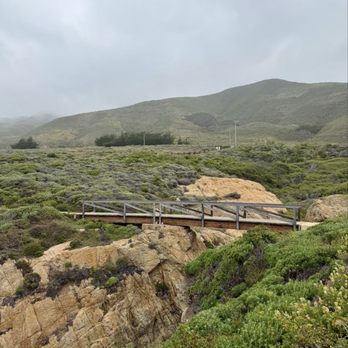


Gorgeous coastal views!!! While there isn't much of a trail it is worth getting out to take a look. For those who are a little more adventurous you can actually hike down to the coastal section, however, you will want some decent shoes with grip. Great little bluff to do some bird-watching/photography as the birds fly below you with the sea acting as a backdrop :) read more


3 months ago
First time in Carmel with the wife and we decided to walk the area in the noon time . A nice stroll from the main downtown area. A nice trail to walk around. And views you can't miss. Definitely a spot worth hitting if you want to make your stay worth it. Even the dog got to enjoy some views and the walk! read more
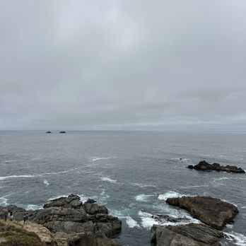


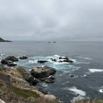


This review is for Soberanes Point & Whale Peak which was a ~1.3 miles round trip that took ~1 hours to complete. This was another popular and crowded trail within 10 minute drive south of Point Lobos State Natural Preserve! Trail was mostly flat with a steady incline towards the peak. A decent amount of people were going off-trail towards the flowers and ocean. Furthermore, it was excessively windy at the peak. Stunning views of the coastline and wildflowers! Free parking on the side of the streets on Highway 1. There were 2 additional separate entrances to the trail just a little further south if there are no parking available. Restrooms available across the trailhead and highway. Short video of the hike for those interested! https://youtu.be/hVHdc29lrNw read more

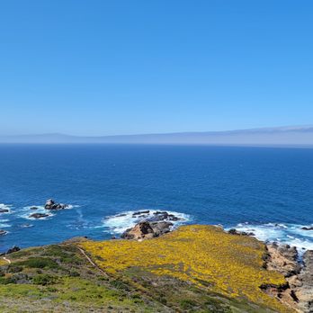


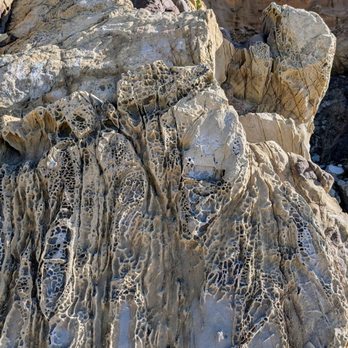
Review is for the beach, wanted a break to stretch our legs and pulled over just because we saw some other cars here. We didn't even know the name until we parked and couldn't see the ocean and were surprised to find a secluded and interesting beach to explore. It's located about 10 miles from Carmel and very close to Point Lobos, another favorite of ours. We did lose reception during our stop here so I would download a. Offline map or go paper if you are going to be proceeding further south toward Big Sur. There are a couple paths to get down to the beach. The left side stairs are currently under repair and roped off though we saw some people using them. The bottom of these stairs are missing and there is a section with planks missing so use at your own risk. The other side is safer but a longer loop around if you want to see the rocky enclaves. The ocean is a beautiful color here and I love nice rocks combined with the sea, this is a perfect place to get a glimpse of these kinds of features. We came around 3 pm on a Friday and it was not very crowded which we loved. Normally to get this small amount of people we go to beaches early in the morning. read more



1 year ago
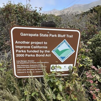
If you want to experience both the mountain trail and ocean trail then come to this state park. It has parking on the side of the road but be extra careful with crossing. Cars are very speedy here and make dangerous maneuvers trying to park. This park has 3 big porta potty but no running water so bring hand sanitizers. I quite enjoyed walking this trail especially the ocean side. read more




1 year ago
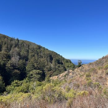
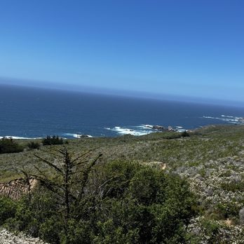
Second time doing this strenious hike ! Oh lala! Its tough! But worth all the effort if you can make it to the top and possibly loop around ! The hike is a million $ view and priceless! If you think you can do it ??? Give it a try ! Its amazing ! I love it ! We love it read more




2 years ago
Went back again this year with family to see the calla lilies in bloom. The entire road was packed with cars and to my utter shock, I saw some people walking away with some fresh cut calla lilies!! We made our way down to the valley and it was packed with people. And to my disbelief, the number of lilies were less than 1/3rd of what I saw at around the same time last year. Most of the plants were trampled upon very badly as well. I was disappointed how social media could reduce such a beautiful place to this state, I doubt we will even have these many flowers next year. read more


3 years ago
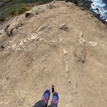
This review is for Soberanes Point Trail. I visited during a sunny summer weekday. The hike itself is about one and half miles of unpaved trail and just under three hundred feet in altitude gain. It's an easy trail for most people. There's zero canopy on entire trail. It is flat along the coast but a bit of an uphill with many steps and loose gravels towards the peak. At the top, Whale Peak, you are rewarded with breathtaking views of the coast...and super strong WINDS, like 50mph! I could barely stand and not straight... it's constant wind. There's a peaceful looking bench but you aren't likely to sit there, since there's no protection from winds. Loved the views and enjoyed small flowers and shrubbery along the trail. I do NOT recommend the hike to the peak for anyone with heart condition and kids as it's NOT safe with steep cliffs without barriers and STRONG WINDS. The trail along the coast though is okay for kids. Recommend sun screen, sunglasses, jacket, long pants, water and a good pair of hikers or trail runners. Clip your cap and tie down your hat. If not, you'll likely lose it to the winds. There's no markers and no service of any kind. read more



5 months ago

The Soberanes Point / Whales Peak Trail was one of the most beautiful hikes we did in the Big Sur area, and I highly highly recommend to anyone who is passing by Garrapata State Park along Highway 1! Parking is all along the side of the road as there's no actual parking lot for the Soberanes Point Trail in particular (not sure about other Garrapata trails), but the pro is that you don't have to pay any entrance fee unlike the other state parks in the area. Do make sure to take valuables with you though. This is a relatively easy hike that takes you right up along the coastline where you're faced with the immense beauty of the water meeting the rocks and cliffs. You are greeted with amazing views pretty much all throughout this hike (no shortage of photo ops for sure!), and we also did the additional trek up to Whales Peak which offers panoramic views up and down the coast. There weren't too many people around when we visited on a Friday afternoon, so it seriously felt like we were in some sort of paradise. Please take even 30 minutes to an hour to visit this spot as it seems like a hidden gem along Hwy 1; you won't be disappointed especially on a beautiful clear day! read more


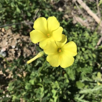
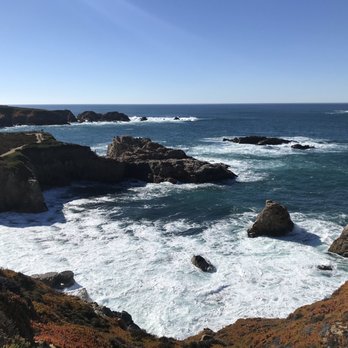
Something about being on the coast side just makes me all warm and fuzzy inside. It gives me this tingly feeling that I long for all of the time. Staring out into those stunning bluffs will leave you downright speechless, and Garrapata State Park has got me at a total loss for words. I've been dying to hike here for as long as I can remember. I've driven past this park several times on my way out to Big Sur, but never had a chance to actually stop through to explore. Welp, I finally got that chance. And let me tell you; it was everything that I could have imagined and more. Better than I imagined it to be. You just can't compete with those views... you really can't. You look out and just go numb. It's the craziest feeling. This park is located right off highway 1. You can literally just pull off to the side of the road, walk down to the many different trailhead entrances, and hike down to the bluffs. The. Views. Are. Insane. INSANE! Like, is this even real?! The bluest waters with white waves just crashing up against the coastline. Tide pools galore. Like what?! I can just live here. Seriously. It's so damn picturesque. The Bluff Trail is the most popular and also the most stunning as it basically follows the coastline. We love a good coastal trail! There are plenty of spots to stop and take in the views. It's family friendly and pretty flat minus a few gentle inclines on the way back up to the road. There's also the Soberanes Canyon trail that will take you up the mountain top with a gorgeous coastal view. I did the first 1.5 miles of the Soberanes Trail, but the rest of the trail was closed due to dangerous conditions. Saw a few people still going up there at their own risk. Looked extremely gnarly and narrow, so I didn't want to take my chances. But the short 3 mile stretch that I was able to do was really enjoyable. It starts off exposed and gently inclines through dry hills. And then all of a sudden, you end up in the most random Redwood Grove! I'm a Redwood junky, so this was such a lovely surprise. There's tons of beautiful plants throughout the trail ranging from wildflowers to cactus. It always amazes me how certain plants can grow even in the most driest conditions. It gets extremely hot during the afternoons on this trail. If you're planning on hiking the Soberanes trail, lather up on the sunscreen and bring a lot of water (especially if you plan to hike the entire loop). There are also said for be lots of ticks on this trail, but thankfully I didn't find any on myself. Might be best to wear long pants and/or socks, and to layer your shirts/sweaters for extra protection. Parking will be tough if you don't get here early in the morning. There's no real parking lot, and people start parking along the highway early. You could end up parking a mile out if you come in the afternoon. But, don't let this discourage you. With some easy planning, you'll be able to fully enjoy the beauty of Garrapata State Park. And trust; there's lots and lots of beauty to go around here. read more






6 years ago
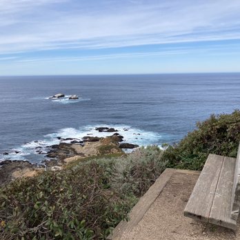
Garrapata State Park is gorgeous! It sits in between two other state parks, Point Lobos State Natural Reserve to the north, and Andrew Molera State Park to the south, with a lot of beautiful coastal viewpoints in between. My hubby and I were driving down to Big Sur on my birthday last week, and started our day-trip adventure here. On Yelp, some of these trails are reviewed under "California Sea Otter Game Refuge" which is how I found them. I initially thought these were trails that led you to an area on the coast where you can watch sea otters in the wild, and all I could think of was the scene in Disney's Finding Dory with the adorable otters..."Cuddle party!" I think it's listed incorrectly on Yelp, and if you look up "California Sea Otter Game Refuge" on Google maps, it gives you a location further south (see Google Maps screen shots I added to my review for California Sea Otter Game Refuge). So back to Garrapata. We hiked the Soberanes Point Trails, which are the trails that people see right off Hwy 1 overlooking the Pacific. Parking is just on the dirt patches on either side of the highway. You'll see that the trail has some wooden steps in addition to dirt walking paths, and you can hike/run a loop, or head up to the peaks and get some beautiful panoramic views of the coast! While Garrapata is a large state park extending from the coast into the mountains, Soberanes Point Trails are about 8.5 mile south of Carmel Beach. Well worth a quick stop or even a dedicated scenic hike or short trail run! read more



4 years ago
I'd highly recommend the Garrapata bluff trail which is a 0.6 mile hike with minimal elevation that provides stunning views of the ocean. Parking might be a little tricky as there's space for 4 cars right next to the trail on the left side of the road ( right next to the start of the trail). If you're unable to find parking there, you can potentially drive up a little ahead and walk back. The trail itself is an easy one but not wheelchair friendly as it involves some amount of minimal stairs. If you're with a group that doesn't need wheel chairs, I'd highly recommend this read more


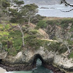
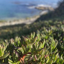
My family had a lot of fun in this area today. Very epic loop with rewarding views all around that can be done in about 1.5 hours at a slow pace and while checking out the beautiful jagged cliffs/ocean waves. A few recommendations: -Try to get here early. Parking can be kind of tough. You will need to either pull into the parking right into the center of the state park (always packed), or park on the shoulder along HWY 1. -Winds can pick up here. Bring a windbreaker and even a hat to avoid the discomfort of the strong winds and the "wind fatigue" (headache) after the hike here. Description: If you park on the Northernmost side, you will walk down a path that will take you across a bridge and to a stunning view of cliffs and rolling waves of the ocean. Afterwards you will then walk along the hillside to enjoy the lush vegetation (mostly succulents) with amazing blue backdrop. There is also a resting place to enjoy some hidden caves and pockets of exceptionally pristine water. The second half will then take you back to the parking area (with an additional juncture that can take you up a small mountain). Highly recommended for a half day trip. read more


There isn't an official entrance, just lookout for the trailheads. You can easily miss it, so GPS and look for the parked cars by the road. The Bluff trail is short and sweet. There are better viewing spots, but this one is free and right off of Hwy 1. The Canyon Trail is a great contrast to the ocean views. The trail is well wooded and the babbling brook will put you in meditative state. I hiked around 10 in the morning and the trail was 80 percent shaded. Mostly flat with some climbing towards the end. It is a 2.5 round trip as of the time of this writing the rest of the trail is closed due to fire damage. I can only imagine the radiant blooms in the spring. read more


It's a very beautiful and serene place to stroll around. You can enjoy a peaceful nature walk or sit and listen to the waves of the ocean crashing on the beach. If you go at the right time, you can see beautiful calla lillies. read more


6 years ago
Hmm, should I call this a hidden gem? It was a total accidental find and I'm so glad I found it! As with many stops along the Highway 1 drive, it can be so easy to miss. I was intending to visit Pfeiffer Beach but sadly due to recent wildfires they were closed to the public :( when turning back around, I randomly stopped at this park in hopes of finding access to the beach and discovered this awesome, somewhat private and small section of sand with very few people. It was perfect! It's a short walk/hike from the main road, down a very photogenic set of stairs and you have a secluded, sorta private oasis! There were only a few other people who had laid their blankets out and enjoying the sun and fresh ocean breeze. It was a perfect day out to just relax. Totally visit this spot, even if for a photo. Parking is kind of sketch because there is no parking, you basically park on the side of the road! I did see some broken glass along the parked cars so be careful as it seems opportunists might hit while people are out enjoying the park. read more


My family and I absolutely love this place. This is one of our favorite places to go whenever we are up in Carmel. It is unbelievably beautiful here. The trails west of highway 1 are all really easy and mellow. Whenever there is a steep climb there are usually steps. There are a bunch of short trails that connect together that you can finish in just one morning. There are two peaks where the views from the top are amazing. There are some great spots up there for some amazing photos. There are ways to get down to the small beaches, but the way down can be tricky What we usually do is pick up lunch on the way there, park on the side of the road, hike, tailgate it for lunch and hike some more. That is our favorite way to spend the day up there. read more


1 year ago

3 years ago
We made a quick stop here on the way to Bixby Bridge and it was very nice and relaxing. It's a quick walk down to the beach from where you park on the side of the road. Portable restrooms are available. read more


5 years ago
This was just off the road and it was quite a surprise to see the beautiful views around. I highly suggest taking a visit here. read more


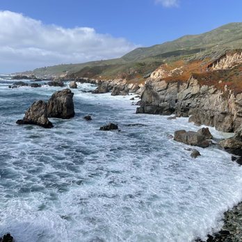
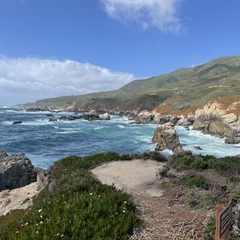
Words can't describe the beauty and wonder of one of California's most lovely nature spots. You can hike around for 30 minutes and admire the many enchanting views of the ocean, rocks, and cliffs, or you can spend hours here doing all the optional hiking trails. Either way, if you're cruising Highway 1 be sure to pull over and spent at least 10-15 minutes in this enchanting state park. read more





3 years ago

I feel as if Garrapata State Park is a hidden gem in the Carmel/Big Sur area. The park entrance is easy to miss as it is located right along Highway 1 and the only parking available is street parking. If you are driving to fast, you will miss the park entrance. My husband and I did a trail run/hike on the Soberanes Canyon Trail to the top of Doud Peak. The first half of this trail is pretty easy as it is mostly has no elevation and is well shaded under the trees. However, once you cross the creek is when the real climbing begins. There is a big step up and all of a sudden you are above the trees and trail gets really challenging. From here, it is at least 1-1.5 miles all the way to the peak. According to Strava, some of the sections of this part was a 30% incline, which is very steep; steeper than anything I have previously experienced before. My knees defiantly took a beating. I would defiantly recommend taking your time on this part and bringing plenty of water as it is all exposed trail at this point. Although, this 1 mile climb seems endless, once you reach the peak, it is really beautiful view. Nothing but gorgeous views of the Pacific Ocean and the Big Sur coast. The downhill is just as challenging as going up as it is very easy to slip. There was a porta potty at the beginning of the trail and is free to enter. I would defiantly recommend this park for anyone looking for a challenging hike with beautiful ocean views and wooded trails. read more


Came here to check out Cala lily valley 2 weekends ago. There's parking on the side of the highway (easy to miss and you would have to u turn) so we parked, followed the trail leading to the stairs that will take you down to Cala lily valley. We went later during the day to catch sunset which is a popular time. Observed others wearing masks and respecting each other during the trail down and back up. Nice place go catch sunset and enjoy the lilies when it's in full bloom. read more


6 years ago
Took to some of the Bluff trails in Garrapata this past weekend, and while the ones we took weren't challenging the views were beautiful. It's very breezy, so hold onto your hats folks. This is a great stop to get out of the car for some fresh air and steps. If for some reason you're looking for a restroom, we later spotted one across the road (not on the ocean side) not sure if they were open but they probably are and I know finding a restroom on this drive is as challenging as not oooing and awwwing at every turn. read more


4 years ago
So happy to finally have made it here to hike the notorious Garrapata path straight up the hill. Wow! There are other trails here but we decided to hike up into the Soberanes Canyon trail up to Doud Peak, and took the Rocky Ridge trail down. The trail lived up to its reputation in difficulty. The trail is uphill the entire way. Through the canyon are varying levels of steepness and the trail does wind down a few times before you begin to climb up. The climb up is no joke. Once you start climbing up, it is intensely challenging. For approximately a mile and a half straight up. In actuality, we didn't make the right at the top which takes you over to Doud Peak. Once at the top all I wanted was to start back down. The views were outstanding. From the canyon redwoods below with little creeks crossings and small waterfalls to the cactus blooms at the beginning. Once up above in the hills flowers were blooming. Lizards around every corner. Trust me, you will stop and catch your breath to survive the difficulty level in steepness. Heading downhill was also a challenge as the steep gravel trail was very slippery. Using all your muscles and focus to navigate the single lane trail. Parking is as described by other Yelp reviews, just off the highway. Be carefull! Folks are driving very fast on this stretch of Highway 1. There are some port a potties at the beginning of the trail head too. Bring water and a hat it is windy and sunny. And....stop and breathe. You will be forced to, lol. Because of the difficulty level, I am not in a hurry to hike this particular trail again but perhaps one of the others below. Cheers everyone! Happy hiking. read more


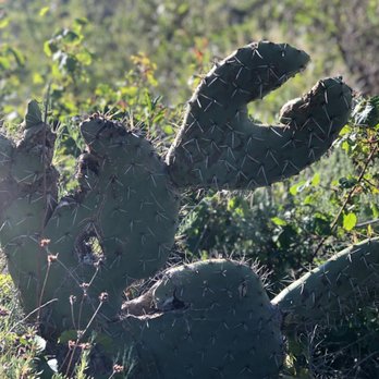


One of the most stunning hiking trails on the Central Coast. I've done the Soberanes loop trail as well as the western side near the ocean. Soberanes was really challenging for me but the changing beauty kept me going. Wildflowers, creeks crossings, redwoods, and a fantastic summit. A few times that side has been closed so I have wandered over to the ocean side and hiked north to the ravine with the gorgeous flowers. I usually go once a year. It changes each time and I usually discover a new trail. Only drawback is parking is by the side of the road but if you plan right you will get a spot. I always go early. read more


6 years ago
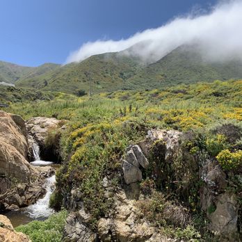
Great place to hike and beautiful views to take in. As most places along the coast to hike, you want to get here early as parking can be a challenge pending which day you choose to visit. I was able to find a waterfall to sit near and enjoy the scenery. read more



6 years ago
We went there during the sunset!!! It was windy. But sky colors at sunset were awesome. Waves were strong and water was cold, but pacific at this time of the year is cold ;( Would love to visit again during spring and summer to see the bloom. read more


Page 1 of 4
More info about Garrapata State Park
Carmel, CA 93923
Directions
(831) 624-4909
Call Now
Visit Website
http://www.parks.ca.gov/?page_id=579
Hours
Indoor Amenities
Outdoor Amenities
Ask the Community - Garrapata State Park
Are dogs allowed?
According to the CA State Park site, dogs are only allowed on the beach. They must be on leash at all times. They are not allowed on the hiking trails.
Review Highlights - Garrapata State Park














Why does Yelp recommend reviews?
5 reviews that are not currently recommended
The reviews below are not factored into the business's overall star rating.

9 years ago

11 years ago
17 years ago

3 years ago

8 years ago


