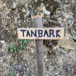
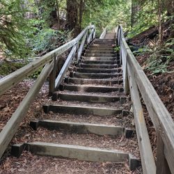
1. Coast Ridge Road Hike

0

Big Sur, CA

Cancel

Open app

Search

Coast Ridge Road Hike

5.0 (3 reviews)

Coast Ridge Road Hike Photos

You might also consider

Recommended Reviews - Coast Ridge Road Hike

Your trust is our priority, so businesses can't pay to alter or remove their reviews. Learn more about reviews.
Yelp app icon
Browse more easily on the app
Review Feed Illustration

5 months ago

Helpful 0
Thanks 0
Love this 0
Oh no 0

3 years ago

Helpful 5
Thanks 1
Love this 6
Oh no 1
Photo of Jeremy S.
4998
1416
2511

11 years ago

Helpful 36
Thanks 1
Love this 37
Oh no 0

You might also consider

Verify this business for free

People searched for Hiking 133 times last month within 15 miles of this business.

Verify this business

Pfeiffer Big Sur State Park

Pfeiffer Big Sur State Park

4.4(413 reviews)
2.2 mi

Pfeiffer Beach looks and feels magical and is one of our absolute favorite places to come every…read moreyear. It's where the forest meets the sea and the views are breathtaking Between the huge rock formations, purple sand, and the famous keyhole where you can see the ocean through the rock, it's such a beautiful place. There are also tide pools to explore and we've seen tons of starfish, sea urchins, and other little sea creatures. The everyone loves it :) The beach feels so different from your normal California beach it doesn't feel real.. it's so beautiful. It's definitely one of those places pictures don't do justice AT ALL !! If you're passing through Big Sur this is a MUST stop.. Trust me, you won't regret it Just be prepared for the drive down to the beach. The road is VERY narrow, almost one lane in some areas, and you'll have to move to the side to let other cars pass. There are some tight turns too, so just go slow and pay attention, especially with cars coming the opposite direction. It's a little adventure getting down there but completely worth it!

One of California's bigger and more popular state parks, rightfully so. Not as touristy as Yosemite…read morebut this is on a bigger scale than most other Cali State Parks. I ventured here once before in my early 20s back in my school boy days and felt it was time to see it again with decades worth of a wiser perspective. And I was rewarded in spades. This park is about 30 miles or so south of Carmel on Highway 1, which in my opinion is one of the most glorious stretch of road to drive. Even though it is only 30 miles or so, it still takes almost an hour to travel from Carmel. The road winds around through many curves and undulations so you simply cannot drive freeway speeds here, nor should you want to. Enjoy the views, roll down the window and take in that coastal air, play your favorite tunes and just soak in the moment. Once at the park there are campsites, as well as cabins and even a full service lodge for those that don't want to rough it at all. You are now in mountainous terrain so lots of trees, a big creek and lots of hiking trails. I did a 3 day camp stay and loved it. They keep the park clean, maintain the restrooms and patrol the grounds frequently. Even though they have almost 200 campsites available, they spread it out nice so not everyone is in the same area. I could sometimes hear my neighbors but they were never in my direct view. That is a big plus for me when rating camp sites. People can also just get a day pass and enjoy the trails and creek without having to stay. My camping pass also got me to see a couple other California State Parks nearby on the same trip, so well worth the price of admission. Very lively with animal life which are unfortunately very used to humans. Squirrels and blue jays will not be shy to investigate what they can scavenge so do not leave any food unattended. Upon setting up camp I had a ziplock bag of trail mix on the picnic bench along with the rest of my gear. While I was setting up the tent with me somewhat close by, a stellar jay swooped in and pecked at the bag. It didn't take it but ripped a good hole in the bag. So just a big fyi to keep your food on guard/lock. The big creek runs through many of the sites. Some parts are mellow whilst other parts the water rushes pretty good. I was about 50 yards from the creek so I couldn't see it but I could hear it rolling through the valley. It was very relaxing to hear the cool water rolling downstream, whether at night or waking up at sunrise. And a myriad of birds will contribute with their morning songs, which makes for the best alarm clock. TRUST A little too big for my preference but still beautiful enough that I can revisit every other year. And just outside the park are the California coastline with Highway 1 carving through it. Some of the most breathtaking views Cali has to offer. Pfeiffer thanks for the reacquaintance and the confirmation that you are still indeed one of California's top gems.

Photos
Pfeiffer Big Sur State Park - Family Camping September 12-14, 2025

Family Camping September 12-14, 2025

Pfeiffer Big Sur State Park - Family Camping September 12-14, 2025

Family Camping September 12-14, 2025

Pfeiffer Big Sur State Park - Family Camping September 12-14, 2025  THE JOY LUCK CLUB

See all

Family Camping September 12-14, 2025 THE JOY LUCK CLUB

Ewoldsen Trail

Ewoldsen Trail

4.7(29 reviews)
6.8 mi

The hike kicked our ass, a lot to adventure and see. I think in total we had almost 15,000 steps…read moreand climbed about 109 stairs.

Come here if you want to feel like katniss, the part before she volunteered as a tribute and spent…read moremost of her days hunting in the woods. This hike is no joke. Beware of bringing noobs on this hike because Ewoldsen will work you so hard and so good. In addition to being steep as hell, the trail is also narrow af. You have to basically hug the wall of the mountain to let the opposite traffic go. Sharing is caring! But be very careful because doing that stunt gets even scarier the higher you go up. The trail starts off only one path in the beginning. Right at the beginning, it's okay to take it a little bit easy. It's very chill at this point. And then suddenly, you face this "almost vertical looking" path and you're thinking to yourself "aw shit. What did I get myself into." But it's too late to turn back. I mean, you can but you traveled so far just to conquer this monster Ewoldsen. You might as well finish it and show off what you achieved! Anyway, somewhere along the trail, a wild fork appears. Which one to take? Left or right?? Choose wisely because one leads you to a never ending path! Just kidding. (Although, you may start thinking that about the entire hike). Per advice from people in the opposite traffic, My friends and I chose left. We really should have went right so that we went counter clockwise because then we would be climbing up less. I don't know if that made sense. We went left. And we ended up going up steep hills so if we had went right, we would be actually going down those hills instead of up. It's actually a loop so technically it doesn't matter if you choose left or right. You will end up at the same fork after completing the loop. The view on the top was stunning. Although, the McWay falls trail produced a prettier picture, you will feel more accomplished once you see the small waterfall from all the way on top of the ewoldsen loop.

Photos
Ewoldsen Trail
Ewoldsen Trail
Ewoldsen Trail

See all

Pfeiffer Beach - Outhouses

Pfeiffer Beach

4.5(345 reviews)
3.3 mi

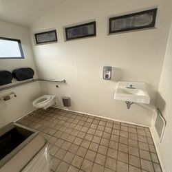
Pfeiffer Beach looks and feels magical and is one of our absolute favorite places to come every…read moreyear. It's where the forest meets the sea and the views are breathtaking Between the huge rock formations, purple sand, and the famous keyhole where you can see the ocean through the rock, it's such a beautiful place. There are also tide pools to explore and we've seen tons of starfish, sea urchins, and other little sea creatures. The everyone loves it :) The beach feels so different from your normal California beach it doesn't feel real.. it's so beautiful. It's definitely one of those places pictures don't do justice AT ALL !! If you're passing through Big Sur this is a MUST stop.. Trust me, you won't regret it Just be prepared for the drive down to the beach. The road is VERY narrow, almost one lane in some areas, and you'll have to move to the side to let other cars pass. There are some tight turns too, so just go slow and pay attention, especially with cars coming the opposite direction. It's a little adventure getting down there but completely worth it! Note: restrooms are not the best .. take wipes/toilet paper, sanitizer

The most famous beach with purple sand, Pfeiffer Beach is located in BIg Sur, requiring a 2 mile…read moredrive down a one-lane road to reach. It also costs $15 to park here. Our family thought it was worth it. Pfeiffer Beach was our eighth and longest stop during our southbound journey on the Cabrillo highway through Big Sur. Access is through Sycamore Canyon Road (one lane) which is extremely easy to miss from the highway. It is a one lane road but has many areas where one can turn off to let oncoming cars pass, though I can imagine when it gets busy how much more difficult it would become. We had left Carmel early in the morning, so it was about 07:48 when we reached the bottom. As we drove down, my wife noticed a lone, empty chair about halfway down. Later we realized that that is where a ranger would sit to tell cars to go back up, once the limited parking lot near the beach got full. The car entrance had yet to be manned, so we paid per vehicle fee via cash in an envelope deposited in a fee drop box. The tear off stub is then displayed on your dash. Later when we were leaving, there were employees manning the area, accepting payment, with credit cards being accepted. The parking is administered by a private company so our America the Beautiful National Park pass did not work here. We were the 2nd car in the lot. There are angled handicap spots, motorcycle parking, and bathrooms (outhouse style) in the parking area. There is definitely more beach space than there are parking spots, so if you are able to get to the beach, one can easily find a secluded spot. Though as the no refund sign warned, there is high winds and blowing sand on the beach so not the best place for a warm, sunny beach day. There are streaks of purple sand along the beach (learned that the purple is caused by garnet powder that washes down from surrounding areas). It made the white sand look like it had dirt spots. I did have time to walk to both ends of the beach, and discovered that at the north end, there are pockets of sand further away from the ocean where the garnet sand is a lot more prevalent. The beach is named after the pioneer, Michael Pfeiffer. Many other places in the area (Pfeiffer Big Sur State Park, Julia Pfeiffer Burns State Park) are named after his descendants. The beach is for day use only, and is open from sunrise to sunset. What's interesting about this is how many reviews are on Yelp for this beach, even though there was no cell service when we went. It clearly shows a lot of Yelpers are coming to this beach, and taking the effort to write about it once they get back to an area that has internet. But there are no reviews for any of the vista points in the surrounding areas. Maybe they aren't being approved by Yelp to be searchable?
Photos
Pfeiffer Beach - Velella velella

Velella velella

Pfeiffer Beach
Pfeiffer Beach

See all

Sykes Hot Springs - Hot Spring

Sykes Hot Springs

5.0(1 review)
3.5 mi

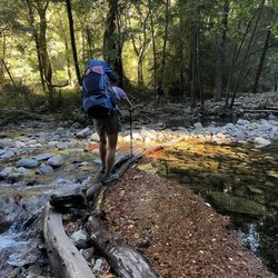
At the end of Summer, my friend suggested a backpacking trip to Skyes Hot Springs - 20 miles out…read moreand back with 5380 ft elevation gain. (more challenging than Bright Angel Trail to bottom of Grand Canyon) Arrived at Big Sur Station at 9am. Paid $20 overnight parking fees, used toilet, snapped group photo then began hiking at 9:30. Half hour lunch break at 11:45 Terrace Creek Camp, and finally arrived to Skyes Camp by 3pm. In route to camp, we crossed 7 creeks each way. I was a bit anxious of slipping cuz I had less confidence than I used to. I think it would have been easier and more fun if I had power thr them with momentum. No mosquitoes sightings in mid Nov. Lots of poison oaks along the trail but not overgrown; I wore shorts with no problem, just clouds of dust from our own stompings. Our friend impaled a bunch of splinters from a burr plant. I visited many of our camp neighbors in search of a tweezer; fortunately, the last of the spikes expelled itself in the hot spring waters. Hiking downriver in search of the hot springs was not easy. When located at 5pm, the large tub was occupied, we tested all of the other 3 smaller tubs then settled in at the one on the river level, it was a tight squeeze for 4 people but we sardined to fit. Our inlet source was a water fall from the tub above which some of us used as a shower over our heads. It was a relaxing time with beautiful surroundings and good company. The water was lukewarm with lots of earthy debris, so it does not compare to the numerous fancy Onsens I have visited in Japan. But things are more valuable when it is earned by hard work - the miles, inclines, sun, sweat, dust, creek crossings, obstacles, and heavy pack; great feelings of accomplishment, and endorphins too. It was wise of us to leave the springs at 6pm since sunsets at 6:30. Due to the heavy forest, we were not able to sight the supermoon nor the comet in the night sky. Sleeping with the ripple sounds of the Big Sur River close by was soothing. Our return trip started at 9:30 and ended at the parking lot by 1pm, 4.5 hours was very fast pace. We were eager to celebrate our trip with a lunch in a sit down restaurant, Big Sur Roadhouse. Another great adventure with friends. Treasure memories.

Photos
Sykes Hot Springs - Creek crossing

Creek crossing

Sykes Hot Springs - Camp

Camp

Sykes Hot Springs - Big Sur River

See all

Big Sur River

Coast Ridge Road Hike - hiking - Updated October 2026

Loading...
Loading...
Loading...