Valley View Trail Photos


More like Valley View Trail
Recommended Reviews - Valley View Trail
Start your review...

Reviews are reminders to myself Nice maintained trail Took this trail because Pfeiffer falls trail was closed. Pfeiffer falls was a bit disappointing because it's more of a man made outlet for some water and not really a natural falls read more


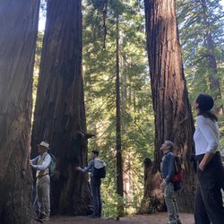
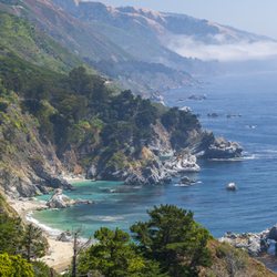
Located in the Pfeiffer Big Sur Campground, this is a 2 mile total hike to the Valley View overlook. It's a very picturesque experience as you start off walking through tall redwoods and end up walking past large areas of Oak trees. We came during sunset and it didn't disappoint. Notes: - Day Use Fee for non-campers. - I would consider this to be family-friendly, but there is a lot of uphill walking required. -Trailhead is across from the restaurant. - Not as aggressive as the Buzzard's Roost Trail. read more


More info about Valley View Trail
47225 Hwy 1
Sur Rd, CA 93920
Directions
Hours
Outdoor Amenities
Valley View Trail Reviews in Other Languages


Valley View Trail - hiking - Updated June 2026
Best of Sur Rd
People found Valley View Trail by searching for…
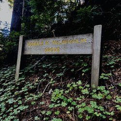
Redwood Trees in Sur Rd, California
Things to Do in Sur Rd, California
Hiking Trails in Sur Rd, California
Waterfall Hike in Sur Rd, California
Stroller Friendly Hikes in Sur Rd, California
Easy Hikes in Sur Rd, California
Walking Trails in Sur Rd, California
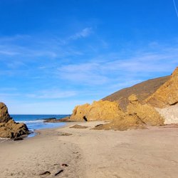
Waterfall in Sur Rd, California
Viewpoints in Sur Rd, California
Sunset View in Sur Rd, California
Swimming Holes in Sur Rd, California
Off Road Trails in Sur Rd, California
Running Trails in Sur Rd, California
Scenic View in Sur Rd, California
Tent Camping in Sur Rd, California
What to Do in Sur Rd, California
Fun Things to Do With Kids in Sur Rd, California
Must See in Sur Rd, California
Stuff to Do in Sur Rd, California
Browse Nearby
BEST of Sur Rd, California Restaurants near Valley View Trail
BEST of Sur Rd, California Coffee near Valley View Trail
BEST of Sur Rd, California Things to Do near Valley View Trail
BEST of Sur Rd, California Beaches near Valley View Trail
BEST of Sur Rd, California Breakfast near Valley View Trail
BEST of Sur Rd, California Horseback Riding near Valley View Trail
BEST of Sur Rd, California Campgrounds near Valley View Trail
BEST of Sur Rd, California Hot Springs near Valley View Trail